- Moggerhanger
-
Coordinates: 52°07′48″N 0°20′02″W / 52.130°N 0.334°W
Moggerhanger 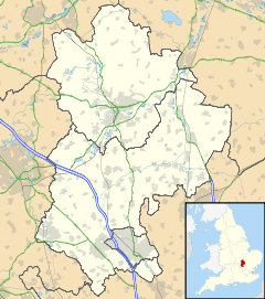
 Moggerhanger
Moggerhanger shown within BedfordshirePopulation 636 (2001) Parish Mogerhanger Unitary authority Central Bedfordshire Ceremonial county Bedfordshire Region East Country England Sovereign state United Kingdom Post town Bedford Postcode district MK44 Dialling code 01767 Police Bedfordshire Fire Bedfordshire and Luton Ambulance East of England EU Parliament East of England UK Parliament Mid Bedfordshire List of places: UK • England • Bedfordshire Moggerhanger is a village in the English county of Bedfordshire. It is west of Sandy on the road to Bedford. it has a population of 636.[1] In the twentieth century the village name was spelled variously as: Moggerhanger, Mogerhanger, Muggerhanger and Morehanger. Local pronunciation of the name is as Morhanger.[2]
History
The civil parish name is Mogerhanger. The parish includes the hamlet of Chalton which is mentioned in the Domesday Book where it is listed amongst the lands held by Adeliza, wife of Hugh de Grandmesnil, on behalf of the King. The land consisted of a mill, meadow for 10 ploughs and woodland for 16 pigs. This was said to be an outlying area of Potton which was held by the King's niece, Countess Judith.[3]
Notable buildings
The parish church is dedicated to St. John the Evangelist. It was built in 1860 when the village, with the hamlet of Chalton, became a separate ecclesiastical parish. Before that, they had been hamlets in the parish of Blunham.
Moggerhanger House, a Grade I listed building designed largely by John Soane, is situated in the village.
References
- ^ "Neighbourhood Statistics - Mogerhanger (CP) Parish". Office for National Statistics. http://neighbourhood.statistics.gov.uk/dissemination/LeadTableView.do;jsessionid=ac1f930dce628da247a59464594b63defc3d47c4c1e?a=6&b=791919&c=mogerhanger&d=16&e=15&g=423004&i=1001x1003x1004&o=1&m=0&r=1&s=1217600844512&enc=1&dsFamilyId=779. Retrieved 2008-09-01.
- ^ "Mogerhanger records". Bedfordshire Archives and Record Office. http://www.bedfordshire.gov.uk/CommunityAndLiving/ArchivesAndRecordOffice/CommunityArchives/Mogerhanger/Introduction.aspx. Retrieved 14 December 2009.
- ^ Williams, Ann & Martin, G. H., eds. (2002) Domesday Book: a complete translation. London: Penguin; p. 585 ISBN 0-14-143994-7
Categories:- Villages in Bedfordshire
- Civil parishes in Bedfordshire


Wikimedia Foundation. 2010.