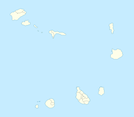
Monte Gordo, Cape Verde

Monte Gordo, Cape Verde
Monte Gordo
Monte Gordo is located in Cape Verde
Monte Gordo
western São Nicolau
Elevation 1,312 m (4,304 ft)
Listing List of mountains in Cape Verde
Location
Coordinates 16°37′15″N 24°21′15″W / 16.62083°N 24.35417°W / 16.62083; -24.35417Coordinates: 16°37′15″N 24°21′15″W / 16.62083°N 24.35417°W / 16.62083; -24.35417
Geology
Type Stratovolcano

Monte Gordo is São Nicolau's tallest mountain located in the westcentral part of the island in Cape Verde. Its height is 1,312 m, some calculates as high as 1,340 m. The mountain and its ranges is entirely of volcanic origin. Since 2005, the municipal boundary of Tarrafal de São Nicolau and Ribeira Brava (then by its island name) bounds at the mountaintop. The mountain is almost partly deforested, vegetations are mainly in valley areas and slopes and it contains trees and also features some areas with colorful ledges and a crater area. A communications tower serving radio and television to the island is near the mountaintop with the only road linking Monte Gordo, colorful green pine trees are in the higher elevations. The mountain can be seen from almost the whole island and also to the other two islands. The panorama offers a view to most of the whole western part and much of the eastern half of the island. Several mountains to the north and the south blocks the view of some coastal parts of the island.

See also


Wikimedia Foundation. 2010.

Игры ⚽ Нужна курсовая?

Look at other dictionaries:

  • Monte Gordo — may refer to: Contents 1 Places 1.1 Cape Verde 1.2 Portugal 2 See also Places …   Wikipedia

  • São Nicolau, Cape Verde — São Nicolau (Portuguese meaning Saint Nicholas) is one of the Barlavento (Windward) islands of Cape Verde. It is located between the islands of Santa Luzia and Sal. Its population is 12,864, with an area of 388 km². Its economy consists mainly of …   Wikipedia

  • List of mountains in Cape Verde — This article is a list of mountains in Cape Verde:*Pico do Alberto on São Nicolau *Pico da Antónia on Santiago Island *Monte Batalhas on Maio *Monte Bissau on São Nicolau *Monte Cara on São Vicente *Caixa on São Vicente *Topo de Coroa on Santo… …   Wikipedia

  • Cachaço, São Nicolau, Cape Verde — Cachaço (in Cape Verdean Creole, written in ALUPEC: Katxós ) is village on the island of São Nicolau.GeographyCachaço features farmlands in the valley areas, forests dominate the western part and the slopes of the valley with some grasslands and… …   Wikipedia

  • Campo, Cape Verde — Campo (Portuguese meaning fields, Capeverdean Crioulo, ALUPEC or ALUPEK: Kanpu , São Vicente Crioulo: Kamp ) is village on the island of São Nicolau.GeographyCampo features farmlands in the valley areas, forests dominate the western part and the… …   Wikipedia

  • Carvoeiro, Cape Verde — Carvoeiro or Carvoeiros (Portuguese meaning fields, Capeverdean Crioulo, ALUPEC or ALUPEK: Karvuéru , São Vicente Crioulo: Kamp ) is village in the north of the island of São Nicolau. Carvoeiro is connected with the road linking Tarrafal and… …   Wikipedia

  • São Nicolau (Cabo Verde) — Saltar a navegación, búsqueda São Nicolau Localización País Cabo Verde Localidad principal Ribeira Brava (Cabo Verde) Coordenadas 16° 29′ y 1 …   Wikipedia Español

  • Nossa Senhora do Rosário (Ribeira Brava) — For other uses, see Nossa Senhora do Rosário. Nossa Senhora do Rosário Statistics Island: São Nicolau Municipality: Ribeira Brava Nossa Senhora do Rosário is a parish that covers a part of the municipality of Ribeira Brava in the island of …   Wikipedia

  • Nossa Senhora da Lapa (Ribeira Brava) — For other uses, see Nossa Senhora da Lapa. Nossa Senhora da Lapa Statistics Island: São Nicolau Municipality: Ribeira Brava Altitude: Lowest: Centre: Highest …   Wikipedia

  • Mafra Municipality — Coordinates: 38°57′48.87″N 9°17′36.99″W / 38.963575°N 9.2936083°W / 38.963575; 9.2936083 …   Wikipedia

Share the article and excerpts

Direct link
Do a right-click on the link above
and select “Copy Link”