- Tschlin
-
Tschlin 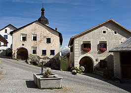
Country Switzerland 
Canton Graubünden District Inn 46°52′N 10°25′E / 46.867°N 10.417°ECoordinates: 46°52′N 10°25′E / 46.867°N 10.417°E Population 459 (Dec 2009)[1] - Density 6 /km2 (16 /sq mi) Area 75.08 km2 (28.99 sq mi) Elevation 1,553 m (5,095 ft) Postal code 7559 SFOS number 3753 Localities Tschlin, Martina (includes Vinadi) and Strada (includes Chaflur) Surrounded by Graun im Vinschgau (IT-BZ), Nauders (AT-7), Pfunds (AT-7), Ramosch, Samnaun, Spiss (AT-7) Website www.tschlin.ch
SFSO statistics
 Tschlin
View map of Tschlin Tschlin is a municipality in the district of Inn in the canton of Graubünden in the extreme east of Switzerland.
Contents
History
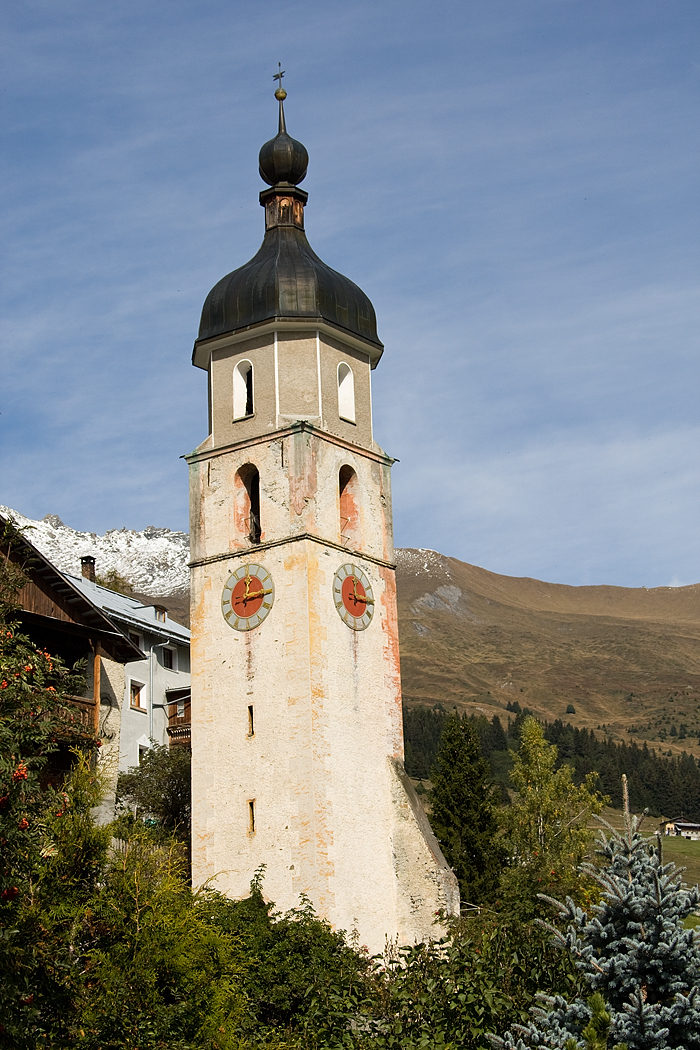
 Tower of the Church of St. John the Baptist
While Bronze and Iron Age items have been found in Tschlin, the first mention of the village is in the 10th Century. In the 10th Century, bishop Hildibald gave the chapterhouse in Chur a gift of a farm house in Tschlin. In the High Middle Ages Tschlin was under the authority of Ramosch. The village church of St. Blasius was built in 1515 in the gothic style. In 1545 the Protestant Reformation reached the village and in 1574-82 the reformer and historian Ulrich Campell worked in Tschlin. In 1856 a fire destroyed much of the village, including the Church of St. John the Baptist. The church was not rebuilt, but the church tower is still visible in the village.[2]
Geography
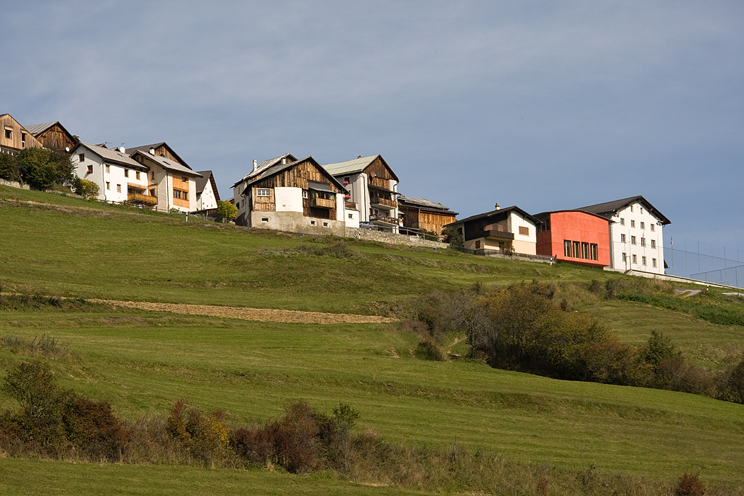
 Tschlin village
Tschlin has an area, as of 2006[update], of 75.1 km2 (29.0 sq mi). Of this area, 28.7% is used for agricultural purposes, while 34.7% is forested. Of the rest of the land, 1.3% is settled (buildings or roads) and the remainder (35.3%) is non-productive (rivers, glaciers or mountains).[3]
The municipality is located in the Ramosch sub-district of the Inn district. It consists of the village of Tschlin on a terrace above the left bank of the Inn, the sections of Strada and Martina and the hamlets of San Niclà, Chaflur, Sclamischot and Vinadi.
Until 1943 Tschlin was known as Schleins.[4] The municipalities of Ramosch and Tschlin are considering a merger for some time in the future, which will create a new municipality of Valsot.[4]
Demographics
Tschlin has a population (as of 31 December 2009) of 459.[1] As of 2008[update], 6.3% of the population was made up of foreign nationals.[5] Over the last 10 years the population has grown at a rate of 1.8%.[3]
As of 2000[update], the gender distribution of the population was 49.6% male and 50.4% female.[6] The age distribution, as of 2000[update], in Tschlin is; 39 children or 9.9% of the population are between 0 to 9 years old. 27 teenagers or 6.9% are 10 to 14, and 14 teenagers or 3.6% are 15 to 19. Of the adult population, 42 people or 10.7% of the population are between 20 to 29 years old. 59 people or 15.1% are 30 to 39, 54 people or 13.8% are 40 to 49, and 48 people or 12.2% are 50 to 59. The senior population distribution is 37 people or 9.4% of the population are between 60 to 69 years old, 55 people or 14.0% are 70 to 79, there are 16 people or 4.1% who are 80 to 89, and there are 1 people or 0.3% who are 90 to 99.[5]
In the 2007 federal election the most popular party was the SVP which received 48.9% of the vote. The next three most popular parties were the SPS (20.8%), the FDP (14.3%) and the CVP (13.6%).[3]
In Tschlin about 62.8% of the population (between age 25-64) have completed either non-mandatory upper secondary education or additional higher education (either university or a Fachhochschule).[3]
Tschlin has an unemployment rate of 0.81%. As of 2005[update], there were 62 people employed in the primary economic sector and about 24 businesses involved in this sector. 28 people are employed in the secondary sector and there are 8 businesses in this sector. 101 people are employed in the tertiary sector, with 21 businesses in this sector.[3]
The historical population is given in the following table:[2][6]
year population 1835 665 1850 571 1900 553 1930 648 1950 590 1960 553 1970 499 1980 431 1990 515 2000 392 Languages
Most of the population (as of 2000[update]) speaks Rhaeto-Romance (71.4%), with German being second most common (25.5%) and Serbo-Croatian being third ( 1.0%).[3]
Languages in Tschlin Languages Census 1980 Census 1990 Census 2000 Number Percent Number Percent Number Percent German 64 14.85 % 130 25.24 % 100 25.51 % Romanish 362 83.99 % 313 60.78 % 280 71.43 % Italian 4 0.93 % 33 6.41 % 3 0.77 % Population 431 100 % 515 100 % 392 100 % Heritage sites of national significance
The Museum Stamparia da Strada is listed as a Swiss heritage site of national significance.[7]
References
- ^ a b Swiss Federal Statistical Office, MS Excel document – Bilanz der ständigen Wohnbevölkerung nach Kantonen, Bezirken und Gemeinden (German) accessed 25 August 2010
- ^ a b Tschlin in German, French and Italian in the online Historical Dictionary of Switzerland.
- ^ a b c d e f Swiss Federal Statistical Office accessed 12-Oct-2009
- ^ a b Amtliches Gemeindeverzeichnis der Schweiz published by the Swiss Federal Statistical Office (German) accessed 23 September 2009
- ^ a b Graubunden Population Statistics (German) accessed 21 September 2009
- ^ a b Graubunden in Numbers (German) accessed 21 September 2009
- ^ Swiss inventory of cultural property of national and regional significance 21.11.2008 version, (German) accessed 12-Oct-2009
- This article incorporates information from the equivalent article on the German Wikipedia.
Maloja • Sils/Segl • Silvaplana • Champfèr • St. Moritz • Celerina/Schlarigna • Pontresina • Samedan • Bever • La Punt • Chamues-ch • Madulain • Zuoz • S-chanf • Zernez • Susch • Lavin • Guarda • Ardez • Tarasp-Vulpera • Ftan • Scuol • Sent • Ramosch • Tschlin • MartinaArdez | Ftan | Guarda | Lavin | Ramosch | Samnaun | Scuol | Sent | Susch | Tarasp | Tschlin | Val Müstair | Zernez
Canton of Graubünden | Districts of Canton Graubünden | Municipalities of the canton of Graubünden
 Categories:
- Municipalities of Graubünden
- Municipalities of Switzerland
- Engadin
- Cultural property of national significance in the canton of Graubünden


Wikimedia Foundation. 2010.