- Mill End
-
Coordinates: 51°33′34″N 0°52′03″W / 51.55931°N 0.867585°W
Mill End 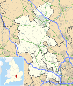
 Mill End
Mill End shown within BuckinghamshireOS grid reference SU786851 Parish Hambleden District Wycombe Shire county Buckinghamshire Region South East Country England Sovereign state United Kingdom Post town Henley-on-Thames Postcode district RG9 Dialling code 01491 Police Thames Valley Fire Buckinghamshire Ambulance South Central EU Parliament South East England UK Parliament Wycombe List of places: UK • England • Buckinghamshire Mill End is a small hamlet in the parish of Hambleden in the south of Buckinghamshire, England, on the main A4155 road between Henley-on-Thames and Marlow. It is on the River Thames. Mill End consists of about 30-50 houses, some on the river bank and others on the northern side of the main road. The name clearly comes from the mill that is situated near the lock. , Mill end Farm which has been run by the bowden family for over 45 years is situated opposite the lock and has farmed most of the land in and around the hambleden area. The scenery of both places is nice, the rolling hills of Hambleden compared to the peaceful waters of the River Thames alongside the lock. This part of the Thames is characterised by willow trees and a large biodiversity of wildlife including swans, grebes, ducks, herons, terns and kingfishers. The footpath next to Hambleden Lock is the main attraction for Mill End.
Anne Petrie, daughter of the famous Egyptian archaeologist Flinders Petrie lived in Mill End, she is buried in Hambleden church-yard.
 The River Thames at Mill End, with Hambleden Mill on the left. (photo Andrew Smith)
Watermill and lock
Within the village is the historic Hambleden Mill, which has been converted into flats. The village is next to Hambleden Lock.
Nearby places
The site of a Roman villa is close by. Henley Management College lies a kilometre to the west and is also on the River Thames.
Nearby villages: Aston, Greenlands, Hambleden, Medmenham
External links
Categories:- Villages in Buckinghamshire
- Populated places on the River Thames
- Buckinghamshire geography stubs


Wikimedia Foundation. 2010.