- Dhaulagiri
-
Dhaulagiri 
Elevation 8,167 m (26,795 ft)
Ranked 7thProminence 3,357 m (11,014 ft) [1] Parent peak K2 Listing Eight-thousander
UltraLocation 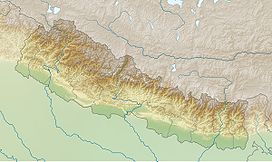
 Dhaulagiri
 Nepal
NepalRange Dhaulagiri Himal Coordinates 28°41′54″N 83°29′15″E / 28.69833°N 83.4875°ECoordinates: 28°41′54″N 83°29′15″E / 28.69833°N 83.4875°E Climbing First ascent May 13, 1960 by a Swiss/Austrian team Easiest route Northeast ridge Dhaulagiri is Earth's seventh highest mountain at 8,167 metres (26,795 ft); one of fourteen over eight thousand metres. Dhaulagiri was first climbed May 13, 1960 by a Swiss/Austrian expedition.
The mountain's name is धौलागिरी (dhaulāgirī) or धवलागिरी (dhawalāgirī) in Hindi and Nepali. This comes from Sanskrit where धवल (dhawala) means dazzling, white, beautiful[2] and गिरि (giri) means mountain.[3] It is often called Dhaulagiri I, denoting the highest summit in its massif called Dhaulagiri Range (Nepali: श्रृंखला, shrinkhalā), Dhaulagiri Himāl (Nepali: हिमाल) or The Dhaulagiris. This massif extends 120 km from the Kali Gandaki River west to the Bheri. Dhaulagiri I is the easternmost high peak.
Annapurna I (8,091m/26,545ft) is only 34 km. east of Dhaulagiri I. The Kaligandaki River flows between through its notable gorge, said to be the world's deepest. The town Pokhara is south of the Annapurnas, an important regional center and the gateway for climbers and trekkers visiting both ranges as well as a tourist destination in its own right.
 Dhaulagiri Range looking west from Poon Hill.
Contents
Geography
Geographic History
Looking north from the plains of India, most 8,000 metre peaks are obscured by nearer mountains, but in clear weather Dhaulagiri is conspicuous from northern Bihar[4] and as far south as Gorakhpur in Uttar Pradesh. In 1808 A.D. survey computations showed it to be the highest mountain yet surveyed.[5] This lasted until 1838 when Kangchenjunga took its place, followed by Mount Everest in 1858.
Dhaulagiri's sudden rise from lower terrain is almost unequaled. It rises 7,000 metres from the Kali Gandaki River 30 km to the southeast. The South and West faces rise precipitously over 4000 metres. The south face of Gurja Himal in the same massif is also notably immense.
Dhaulagiri I Climbing History
 Dhaulagiri I in October 2002. Northeast Ridge is the right skyline.
Most ascents have followed the Northeast Ridge route of the first ascent, but climbs have been made from most directions. As of 2007 there had been 358 successful ascents and 58 fatalities.[6] Between 1950 and 2006, 2.88% of 2,016 expedition members and staff going above base camp on Dhaulagiri I died. On all 8,000 metre peaks in Nepal the death rate was 1.63%, ranging from 0.65% on Cho Oyu to 4.04% on Annapurna I and 3.05% on Manaslu.[7]
Partial timeline
- 1950 – Dhaulagiri I reconnoitered by a French expedition led by Maurice Herzog. They did not see a feasible route and switched to Annapurna, where they made the first ascent of an 8000 m peak.
- 1953–1958 – Five expeditions attempt the North Face, or "Pear Buttress", route.
- 1959 – An Austrian expedition led by Fritz Moravec makes the first attempt on the Northeast Ridge.
- 1960 – Swiss-Austrian expedition led by Max Eiselin, successful ascent by K. Diemberger, P. Diener, E. Forrer, A. Schelbert, Nyima Dorje, Nawang Dorje on May 13. First Himalayan climb supported by a fixed-wing aircraft, which eventually crashed in Hidden Valley north of the mountain during an approach and was abandoned.[8]
- 1969 - Americans, led by Boyd Everett, attempt the Southeast Ridge; seven team members, including Everett, are killed in an avalanche.
- 1970 - second ascent, via the Northeast Ridge by a Japanese expedition led by Tokufu Ohta and Shoji Imanari. Tetsuji Kawada and sherpa Lhakpa Tenzing summit.[9]
- 1973 - American team led by James Morrissey makes third ascent via the Northeast Ridge. Summit team: John Roskelley, Louis Reichardt, sherpa Nawang Samden.
- 1975 - Japanese team led by Takashi Amemiya attempt Southwest Ridge (also known as the South Pillar). Six are killed in an avalanche.
- 1976 An Italian expedition makes the fourth ascent.
- 1977 An international team led by Reinhold Messner attempts the South Face.
- 1978, Spring: Amemiya returns with an expedition which puts five members on the summit via the Southwest Ridge—the first ascent not using the Northeast Ridge. One team member dies during the ascent.
- 1978, Autumn - Seiko Tanaka of Japan leads successful climb of the very difficult Southeast Ridge. Four are killed during the ascent. A French team attempts the Southwest Buttress (also called the "South Buttress"), only reaches 7,200 m.
- 1980 - A four-man team consisting of Polish climbers Voytek Kurtyka, Ludwik Wiczyczynski, Frenchman René Ghilini and Scotsman Alex MacIntyre climbs the east face, topping out at 7,500 m on the northeast ridge. After a bivouac they descended in a storm. One week later they climbed the mountain via the northeast ridge.[10]
- 1981 - Yugoslavian team reaches 7,950 m after putting up the first route on the true South Face of the mountain, on the right side, connecting with the Southeast Ridge. They climbed in alpine style but suffered four days of open bivouacs and six days without food before returning. Also, Hironobu Kamuro of Japan reaches the summit alone, via the normal route.
- 1984 - Three members of the Czechoslovakian expedition (J. Simon, K. Jakes, J. Stejskal) climb the West Face to the summit. J. Simon died during the descent.
- 1985 – A Polish expedition including Jerzy Kukuczka climbs Dhaulagiri in Winter via the standard route, summiting January 21.
- 1986 – A mostly Polish expedition puts up a second South Face route, on the left side of the face connecting with the Southwest Ridge route. They go above 7,500 m but do not summit.
- 1988 – Y. Moiseev and K. Valiev in cooperation with a Slovak Z. Demjan succeeded in climbing the south-west buttress. This 3,000-metre ascent with difficult technical climbing at 6,800–7,300 m was acknowledged as the year's best achievement at the UIAA Expedition Commission Conference.[citation needed]
- 1990 – Dhaulagiri becomes the first mountain higher than 8,000 m to be climbed by a Lithuanian. Dainius Makauskas disappears on the descent.
- 1993 – A Russian-British team puts up the Direct North Face Route.
- 1998 – French climber Chantal Mauduit dies in an avalanche on Dhaulagiri.
- 1999 – On October 24, British climber Ginette Harrison dies in an avalanche on Dhaulagiri. Days later, Slovenian Tomaz Humar climbs the South Face solo but does not reach the summit. His ascent ended at 7,300 m due to by a 300 m band of rotten rock. Humar traverses to the dangerous SE ridge, re-enters the face briefly and exits c. 8000 m for a descent on the NE ridge. Dhaulagiri has never been summited from the South Face, which remains one of the greatest remaining challenges in alpinism.
- 2007 – Eva Martínez becomes the first Mexican woman to ascend the Dhaulagiri, with a Spanish team in which two colleagues died.
Other peaks in the Dhaulagiri Himalaya
† Only peaks above 7,200 m with more than 500 m (1,640 ft) of topographic prominence are ranked.
‡ The status of Churen Himal's three peaks is unclear and sources differ on their heights.[11][12][13] The coordinates, heights and prominence values above are derived from the Finnmap.[13] The first ascent data is from Neate,[11] but it is unclear if the first ascent of Churen Himal East was actually an ascent of the highest of the three peaks, as Neate lists Churen Himal Central as a 7,320 m subpeak of Churen Himal East.Most of the named 7,000 metre peaks are on a ridge extending WNW, separated from Dhaulagiri I by 5,355m French Pass at 28°46'55"N, 83°31'54"E.[14] In order they are Dhaulagiri II, III, V, IV, Junction Peak, Churens East, Central and West, then Putha Hiunchuli. False Junction Peak, Dhaulagiri VI and Gurja are on a ridge extending south from Junction Peak.[15] The British Alpine Club's[16] Himalayan Index lists 37 more peaks over 6,000 m.[17]
Climbing History
- 1954 - J.O.M. Roberts and Sherpa Ang Nyima climb Putha Hiunchuli, first major summit ascent in the range.[18]
- 1955 - Dh.II attempted by J.O.M Roberts and others[19]
- 1959
- Pre-monsoon[20] and post-monsoon[21] reconnaissances of Dh.II by Japanese expeditions.
- Hangde 6556m in Mukut section attempted.[22]
- 1962
- Churen attempt from north by Japanese Nihon University expedition. Climbed Hangde (~6600m), Tongu (~6250m), P6265 during approach/acclimation through Hidden Valley; also Kantokal (~6500m) north of Putha Hiunchili.[23]
- Churen and Dh.VI attempt from south by J.O.M. Roberts, thinking he was on Dh.IV due to inaccurate maps. Climbed a lower peak (6,529m) near Gurja, naming it Ghustang after the stream draining the cirque they climbed in.[24]
- 1963
- 1965
- Japanese expedition to Dh.II delayed two months by heavy snow in approach passes. Lost two porters to avalanche, then another porter was injured in a fall and needed evacuation. This left too little food to continue.[27]
- J.O.M. Roberts leads British R.A.F. expedition to Dh.VI, still believing it was Dh.IV. Defeated by late monsoon, then early winter storms creating excessive avalanche risk..[28]
- 1969
- Dh.IV attempt by Austrian Alpine Club. Five Austrians and one Sherpa disappear, may have summited.[29]
- Gurja climbed by Japanese expedition..[30]
- First authorized ascents of Tukuche 6920m and Tukuche West 6800m.[31]
- 1970
- Japan's Kansai Mountaineering Club unsuccessful on Dh.IV in April but climbed Dh.VI[32] and False Junction Peak..[33]
- Korean expedition claims they summited Churen East on April 29. Questioned by same year Japanese expedition, see next.
- Japanese expedition climbs Churen Central and Churen West on Oct. 24..[34]
- 1971
- First ascent of Dh.II on May 18 by German expedition.[35]
- Dh.IV attempt[36]
- Dh.V attempted by pre- and post-monsoon Japanese expeditions. Both ended by fatal accidents.[37]
- 1972 - Dh.IV attempted twice by Japanese expeditions. First attempt abandoned when a climber fell ill and died at 6200m. Second expedition climbed via crest from west, found route too long at high elevation (7,000m+). Climbed Dh.VI and Junction Peak.[38]
- 1973
- first ascent of Dh.III on October 20 by German expedition.[39]
- Dh.IV attempted by Austrians who reached 7250m on N face, then by British who quit after two deaths.[40]
- 1974
- Dh.IV attempt by British R.A.F. expedition abandoned after three sherpas killed by falling ice.[41]
- In Mukut section: ascents of Parbat Rinchen 6200m, Parbat Talpari 6248m, West Himparkhal 6248m, East Himparkhal 6227m, Tashi Kang III 6157m[42]
- 1975
- Dh.IV climbed May 9 by S. Kawazu and E. Yusuda, who died on descent, bringing death toll on Dh.IV to 14. (Compared to 13 deaths on Mount Everest before it was successfully climbed in 1953.) Another Japanese expedition in October puts ten on summit without loss of life.[43]
- Dh.V climbed by M. Morioka and sherpa Pembu Tsering on Japanese expedition.[44]
- 1979 - Japanese traverse Dh.II, III and V along 7,150m+ crest. Expedition led by a woman.[45]
References
- ^ Greg Slayden. "Dhaulāgiri, Nepal". Peakbagger.com Peak Lists. http://www.peakbagger.com/peak.aspx?pid=10620.
- ^ Monier-Williams (1964) [1899]. A Sanskrit-English Dictionary. Oxford University Press. p. 513. http://www.sanskrit-lexicon.uni-koeln.de/scans/MWScan/index.php?sfx=pdf. Retrieved April 20, 2011.
- ^ Monier-Williams, op. cit.. p. 355. http://www.sanskrit-lexicon.uni-koeln.de/scans/MWScan/index.php?sfx=pdf.
- ^ "Valmiki National Park, Bihar". IndiaMike.com. http://www.indiamike.com/india/indian-wildlife-and-national-parks-f74/valmiki-national-park-bihar-t74555/. Retrieved April 21, 2011.
- ^ Waller, Derek John (2004). The Pundits: British Exploration of Tibet & Central Asia. Lexington, KY: University Press of Kentucky. ISBN 0-8131-9100-9.
- ^ 8000ers.com: Dhaulagiri
- ^ Richard Salisbury, Elizabeth Hawley (September 2007). "The Himalaya by the Numbers, a statistical analysis of mountaineering in the Nepal Himalaya". http://www.himalayandatabase.com/downloads/HimalayaByNbrs.pdf. Retrieved April 25, 2011.
- ^ D.F.O. Dangar (1984). "A Record of the First Ascents of the Fifty Highest Mountains". Alpine Journal (Alpine Club) 89: 184–7. http://www.alpinejournal.org.uk/Contents/Contents_1984_files/AJ%201984%20184-187%20Dangar%20Ascents.pdf. Retrieved April 24, 2011.
- ^ American Alpine Journal, 1971, p. 438.
- ^ Alex MacIntyre:Dhaulagiri's East Face. In: American Alpine Journal 1981, p. 45-50. (AAJO)
- ^ a b Jill Neate, High Asia: An Illustrated History of the 7,000 Metre Peaks, Mountaineers Books, 1990, ISBN 0-89886-238-8
- ^ H. Adams Carter (1985). "Classification of the Himalaya". American Alpine Journal (American Alpine Club) 27 (59): 109–141. http://c498469.r69.cf2.rackcdn.com/1985/109_carter_himalaya_aaj1985.pdf. Retrieved April 29, 2011.
- ^ a b Finnmap (topographic map) of Dhaulagiri Himal
- ^ "Terrain Map". Wikimapia. http://wikimapia.org/#lat=28.781878&lon=83.5316277&z=13&l=0&m=t. Retrieved April 21, 2011.
- ^ J.O.M. Roberts and M.J. Cheney (1971). "Climbs and Regional Notes: Asia, Nepal". Alpine Journal (London: Alpine Club) 76: 228. http://www.alpinejournal.org.uk/Contents/Contents_1971_files/AJ%201971%20210-233%20Asia.pdf\. Retrieved April 21, 2011.
- ^ "The Alpine Club". http://www.alpine-club.org.uk/. Retrieved April 21, 2011.
- ^ "Himalayan Index". U.K. Alpine Club. http://www.alpine-club.org.uk/hi/index.htm. Retrieved April 21, 2011.
- ^ J.O.M Roberts (1955-6). "Round about Dhaulagiri". Himalayan Journal (New Dehli: Himalayan Club) 19. http://www.himalayanclub.org/journal/round-about-dhaulagiri/. Retrieved April 21, 2011.
- ^ Egbert Eidher (1964). "The 1963 Austran Dhaula Himal expedition". Himalayan Journal (New Dehli: Himalayan Club) 25. http://www.himalayanclub.org/journal/the-1963-austrian-dhaula-himal-expedition/. Retrieved April 21, 2011.
- ^ Kiichiro Kato (1960). "Reconnaissance around Dhaulagiri II". American Alpine Journal (American Alpine Club) 12 (34): 67–72. http://c498469.r69.cf2.rackcdn.com/1960/66_kawakita_japaneseNepal_aaj1960.pdf. Retrieved April 21, 2011.
- ^ Jiro Yamada (1961). "Japanese Himalayan Expeditions". American Alpine Journal (American Alpine Club) 12 (35): 275. http://c498469.r69.cf2.rackcdn.com/1961/275_yamada_japanesehimalayan_aaj1961. Retrieved April 21, 2011.
- ^ John S. Humphreys (1961). "North of Dhaulagiri". American Alpine Journal (American Alpine Club) 12 (35): 249–62. http://c498469.r69.cf2.rackcdn.com/1961/249_humphreys_dhaulagiri_aaj1961.pdf. Retrieved April 21, 2011.
- ^ Shojiro Ishizaka (1963). "Mukut Himal and Churen Himal". American Alpine Journal (American Alpine Club) 13 (37): 520–1. http://c498469.r69.cf2.rackcdn.com/1963/517_asia_aaj1963.pdf. Retrieved April 21, 2011.
- ^ J.O.M. Roberts (1966). "Expeditions and Notes, a note on the Dhaula Himal of central Nepal". Himalayan Journal (New Dehli: Himalayan Club) 27. http://www.himalayanclub.org/journal/expeditions-and-notes-16/. Retrieved April 21, 2011.
- ^ Egbert Eidher, 1964 op. cit.. http://www.himalayanclub.org/journal/the-1963-austrian-dhaula-himal-expedition/.
- ^ American Alpine Journal (American Alpine Club) 14 (38): 227–8. 1963.
- ^ Hiroshi Sugita (1966). "Dhaulagiri II". Himalayan Journal (New Dehli: Himalayan Club) 27. http://www.himalayanclub.org/journal/dhaulagiri-ii/. Retrieved April 21, 2011.
- ^ J.O.M. Roberts (1966). "With the Royal Air Force on Dhaulagiri IV". Himalayan Journal (New Dehli: Himalayan Club) 27. http://www.himalayanclub.org/journal/with-the-royal-air-force-on-dhaulagiri-iv/. Retrieved April 21, 2011.
- ^ J.O.M Roberts (1970). "Climbs and Regional Notes". Alpine Journal (London: Alpine Club) 75: 196–8. http://www.alpinejournal.org.uk/Contents/Contents_1970_files/AJ%201970%20196-202%20Nepal.pdf. Retrieved April 21, 2011.
- ^ Yoshimi Yakushi (1970). "Gurja Himal: first ascent, 1969". Alpine Journal (London: Alpine Club) 75: 17–24. http://www.alpinejournal.org.uk/Contents/Contents_1970_files/AJ%201970%2017-24%20Yakushi%20Gurja.pdf. Retrieved April 21, 2011.
- ^ "Climbs and Expeditions, Nepal". American Alpine Journal (American Alpine Club) 17 (44): 181–2. 1970. http://c498469.r69.cf2.rackcdn.com/1970/nepal1970_180-183.pdf. Retrieved April 21, 2011.
- ^ D.F.O. Dangar (1979). "The highest mountains 1968-77". Alpine Journal (London: Alpine Club) 84: 29. http://www.alpinejournal.org.uk/Contents/Contents_1979_files/AJ%201979%2029-31%20Dangar%20Heights.pdf. Retrieved April 21, 2011.
- ^ J.O.M Roberts and M.J. Cheney (1971). "Climbs and Regional Notes - Nepal". Alpine Journal (London: Alpine Club) 76: 229. http://www.alpinejournal.org.uk/Contents/Contents_1971_files/AJ%201971%20210-233%20Asia.pdf. Retrieved April 21, 2011.
- ^ Ryozo Yamamoto (1972). "First ascent of Churen Himal". Alpine Journal (London: Alpine Club) 77: 105–9. http://www.alpinejournal.org.uk/Contents/Contents_1972_files/AJ%201972%20105-109%20Yamamoto%20Churen.pdf. Retrieved April 21, 2011.
- ^ Franz Huber (1972). "Dhaulagiri 2". Alpine Journal (London: Alpine Club) 77: 168–9. http://www.alpinejournal.org.uk/Contents/Contents_1972_files/AJ%201972%20168-169%20Huber%20Dhaulagiri2.pdf. Retrieved April 21, 2011.
- ^ Himalayan Journal (New Dehli: Himalayan Club) 31. 1971.
- ^ J.O.M Roberts and M.J. Cheney (1972). "Notes 1971 (Asia, Nepal)". Alpine Journal (London: Alpine Club) 78: 248–9. http://www.alpinejournal.org.uk/Contents/Contents_1972_files/AJ%201972%20245-249%20Lawford%20Asia.pdf\. Retrieved April 21, 2011.
- ^ Robert Lawford (1973). "Notes 1972 Asia". Alpine Journal (London: Alpine Club) 78: 241. http://www.alpinejournal.org.uk/Contents/Contents_1973_files/AJ%201973%20238-242%20Lawford%20Asia.pdf. Retrieved April 21, 2011.
- ^ Klaus Schreckenbach, Peter von Gizycki (1974). "Dhaulagiri III". Alpine Journal (London: Alpine Club) 79: 198–201. http://www.alpinejournal.org.uk/Contents/Contents_1975_files/AJ%201975%20198-201%20Schreckenbach%20Dhaul3.pdf. Retrieved April 21, 2011.
- ^ Robert Lawford (1974). "Notes 1973 Asia". Alpine Journal (London: Alpine Club) 79: 255. http://www.alpinejournal.org.uk/Contents/Contents_1974_files/AJ%201974%20254-256%20Notes%20Lawford%20Asia.pdf. Retrieved April 21, 2011.
- ^ Edward Pyatt (1975). "Notes 1974 Asia". Alpine Journal (London: Alpine Club) 80: 264. http://www.alpinejournal.org.uk/Contents/Contents_1975_files/AJ%201975%20262-266%20Pyatt%20Asia.pdf. Retrieved April 21, 2011.
- ^ Himalayan Club Newsletter (31): 3–4, 1976
- ^ Shiro Nishamae. "First ascent and tragedy on Dhaulagiri IV, 1975". Himalayan Journal (New Dehli: Himalayan Club) 34. http://www.himalayanclub.org/journal/first-ascent-and-tragedy-on-dhaulagiri-iv-1975/. Retrieved April 21, 2011.
- ^ T.M. Connor (1976). "Regional Notes 1975". Alpine Journal (London: Alpine Club) 81: 242. http://www.alpinejournal.org.uk/Contents/Contents_1976_files/AJ%201976%20238-242%20Connor%20Asia.pdf. Retrieved April 21, 2011.
- ^ Michiko Takahashi (1980). "Dhaulagiri II, III and V Traverse". American Alpine Journal (American Alpine Club) 22 (54): 630–1. http://c498469.r69.cf2.rackcdn.com/1980/616_nepal_2_aaj1980.pdf. Retrieved April 21, 2011.
Sources
- American Alpine Journal, 1974, 1976, 1977, 1979, 1986, 1987, 1994, 1999, 2000.
- Eiselin, Max, The Ascent of Dhaulagiri, OUP, 1961
- Ohmori, Koichiro, Over the Himalaya. Cloudcap/The Mountaineers, 1994.
- Himalayan Index
External links
- Dhaulagiri on Peakware
- Dhaulagiri on summitpost.org (Detailed description of trekking and of first ascent)
- Himalayan Index
Eight-thousanders Everest · K2 · Kangchenjunga · Lhotse · Makalu · Cho Oyu · Dhaulagiri · Manaslu · Nanga Parbat · Annapurna · Gasherbrum I · Broad Peak · Gasherbrum II · XixabangmaCategories:- Eight-thousanders
- Mountains of Nepal
- Mountain ranges of Nepal


Wikimedia Foundation. 2010.