- Oldtown, Dublin
-
Oldtown
An tSeanbhaile— Town — Location in Ireland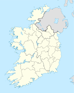
 Oldtown
Coordinates: 53°31′27″N 6°18′58″W / 53.5241°N 6.3160°WCoordinates: 53°31′27″N 6°18′58″W / 53.5241°N 6.3160°W Country Ireland Province Leinster County Fingal Elevation 63 m (207 ft) Population (est.) - Urban 300 Time zone WET (UTC+0) - Summer (DST) IST (WEST) (UTC-1) Irish Grid Reference O115540 Oldtown (Irish: An tSeanbhaile) is one of a network of rural villages in North Fingal, which function as local centres, servicing the agricultural hinterland within the County. The R122 runs through the village linking Naul to St. Margaret's and Dublin Airport.
Contents
Physical Features
Oldtown is a compact village with a distinct village identity, characterised by its narrow roads and village lanes around Oldtown House. The Daws River and stone bridge, together with the mature trees throughout the village form strong visual elements within the village core.
History
Oldtown is a good example of a ‘chapel village’ which lead to a widespread investment in chapel building following the re-emergence of institutional Catholicism in the late eighteenth century.
The original chapel, which was built in 1827, became the focal point of the village and attracted a range of other services such as the national school, community hall, priest’s house, shop, public house and forge. The term ‘chapel villages’ has been coined for settlements, which evolved in association with the growing social and cultural importance of the Catholic Church in Irish society.
 Commemoration plaque on the
bridge in OldtownThe Parliamentary Gazette of Ireland 1843–44 states that the population of Oldtown in 1841 was 156 and 27 houses were located within the village area of 10 acres (40,000 m2). After the Great Famine of 1848 the census of 1851 states the population of the village as recorded as 32 people.
Molly Weston a heroine of the 1798 rebellion was born near Oldtown. She fought alongside her three brothers at Tara. A memorial was erected to her memory at Oldtown during the 1798 Bi-Centennial in 1998.
Another local celebrity and honorary mascot is a donkey rumoured to be in excess of 80 years of age named Tu'pence. Now dead, his age is as yet unverified.
Oldtown was the first town in the State to benefit from the Rural Electrification Scheme, run by the Electricity Supply Board from 1946 to 1979. The first electricity pole was ceremoniously erected in November, 1946 at Kilsallaghan, and the first switch-on, was in Oldtown itself, in January 1947. The 50thanniversary of the event was commemorated in the village, by the ESB hosting a dinner, to which families living in the area since 1946, were invited.
More recently in the winter of 1981/1982 a large snowstorm cut off the village for 5 days, eventually the Air Corps had to fly in supplies such as food and medicine via helicopter to relieve the village.
Modern Development
The village core consists of a mix of two-storey nineteenth century stone built dwellings, single-storey cottages and bungalows. The new stone-built terraced dwellings within the core complement the scale and the vernacular architecture of the village.
The recently redeveloped thatched cottage and Oldtown Local Hall, a corrugated community hall recently restored, add to the unique identity of the village – however the small development of detached dormer bungalows located to the north of the village, contribute little to the streetscape and village character. The northern, western and southern approaches to the village are characterised mainly by low density ‘one-off’ dormers and bungalows with the exception of Shamrock Park, a small Council housing development to the south of the village.
The Catholic Church, Our Lady Queen of Peace, and presbytery are located south of the village core.
There is a significant level of undeveloped land within and close to the village core, which will serve to facilitate the augmentation and consolidation of the village.
Facilities
Currently there are limited commercial facilities in the village. These include a public house – The Oldtown House – and general grocer – Dave's Village Store – and a veterinary surgery.
Community facilities include the local primary school, the Catholic Church, the Oldtown Local Hall and a horse riding stable. The County Council’s mobile library service visits the village on a weekly basis. The Oldtown Health and Care Centre is a large Health Service Executive facility located to the south of the village which provides full time care for disabled people and a community Health Centre where a wide variety of health and related services are provided. A Citizens Information Centre is also available here a few days each month.
Oldtown has a large playing field, close to the centre of the village, which is home to the Wild Geese. First founded in 1888, it is said to be the oldest Gaelic Athletic Association club in Dublin. The club recently won the Junior 'E' Dublin football championship, beating Park Rangers in the final. The field is also the location of an indoor handball alley, which is still in regular use. Oldtown has a proud tradition in the sport and a number of former world champions are from the village. The alley is primarily used nowadays for racquetball.
Landscape
The village of Oldtown is situated within the Low-Lying Agricultural landscape character area indicated in the County Development Plan. This area generally contains mixed pasture and arable farming on low lands, consisting of large fields with few tree belts or large settlements with few panoramic views or prospects.
The village itself is situated in a shallow valley drained by a small river known locally as ‘The Daws River’ and is surrounded by lands zoned as agricultural in the 1999 Fingal County Development Plan. It is the policy of the Council to protect and provide for the development of agriculture and rural amenity within this zone.
See also
- List of towns in the Republic of Ireland
External links
Categories:- Untranslated Irish place names
- Towns and villages in Fingal


Wikimedia Foundation. 2010.