- Old Town Chinatown, Portland, Oregon
-
Old Town Chinatown, Portland, Oregon 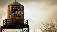
Neighborhood representation Association Old Town Chinatown Neighborhood Association Neighborhood geography Area 0.53[1] km² (PDF map) Location Interactive map Coordinates 45°31′31″N 122°40′21″W / 45.52528°N 122.67246°WCoordinates: 45°31′31″N 122°40′21″W / 45.52528°N 122.67246°W Old Town Chinatown is a neighborhood in the Northwest section of Portland, Oregon. The Willamette River forms its eastern boundary, separating it from the Lloyd District and the Kerns and Buckman neighborhoods. It includes the Portland Skidmore/Old Town Historic District and the Portland New Chinatown/Japantown Historic District, which are listed on the National Register of Historic Places.
In the Northwest section, NW Broadway forms the western boundary, separating it from the Pearl District, and W Burnside St. forms the southern boundary, separating it from Downtown Portland. In the Southwest section, the neighborhood extends from SW 3rd Ave. east to the river and from SW Stark St. north to W Burnside St. (with the exception of areas south of SW Pine St. and west of SW 2nd Ave, and south of SW Oak St. and west of SW 1st Ave., which are part of Downtown).
Contents
Transportation
The neighborhood is well-served by various modes of transportation. Amtrak's Union Station and the Greyhound bus station are located in the northwestern portion of the neighborhood. The Broadway Bridge marks the northern tip, and the ends of the Steel and Burnside bridges are along the area's eastern border.
The MAX Light Rail line turns south into the neighborhood from the Steel Bridge and stops at Old Town/Chinatown, Skidmore Fountain, and Oak Street/Southwest 1st Avenue; the system connects the neighborhood to Northeast and North Portland across the Willamette, and to Downtown Portland to the south and west. The Portland Mall begins at the Greyhound station, providing local bus and light rail service along 5th and 6th Avenues south into downtown.
Old Town
 The White Stag sign, a former advertising sign, greets those traveling into Old Town on the Burnside Bridge.
 Portland Skidmore/Old Town Historic District
 Skidmore Fountain, and the New Market Block in the background.
Location: Roughly bounded by Naito Parkway, Everett, 3rd, and Oak streets., Portland, Oregon Area: 440 acres (180 ha)[2] Built: Approx. 1871-1914 Architect: multiple Architectural style: Late 19th and Early 20th Century American Movements, Late Victorian, Italianate NRHP Reference#: 75001597 Significant dates Added to NRHP: December 6, 1975[3] Designated NHLD: May 5, 1977[4]
October 6, 2008 (additional NHL documentation approved)Old Town was the original urban core of Portland. It straddles West Burnside St and includes an area under the Burnside Bridge. The Portland Skidmore/Old Town Historic District, created in 1975 and roughly bounded by Naito Parkway, Everett Street, 3rd Avenue, and Oak Street, is an important part of Old Town Portland. Attractions include the Saturday Market; the Shanghai tunnels; and Ankeny Plaza, site of Portland's oldest public art work, the Skidmore Fountain (dedicated September 22, 1888). The fountain, designed by Olin L. Warner of New York, is named after pioneer druggist Stephen G. Skidmore. Naito Parkway (ex-Front Avenue) is named after the late Bill Naito, a longtime Old Town-based businessman and developer, who with his brother Sam Naito in the 1960s helped to halt the decline of the area—then known as Portland's "Skid Road"—by opening a retail store, buying and restoring old buildings in the area, and convincing others to invest in the district over the next several years.[5] Bill Naito died in 1996.
Businesses located in Old Town include Dan and Louis Oyster Bar (since 1907) and Voodoo Doughnut. The area is the site of the 24 Hour Church of Elvis and formerly of attractions such as the Satyricon nightclub and the X-Ray Cafe.
The Portland Skidmore/Old Town Historic District was declared a National Historic Landmark in 1977.[4][6]
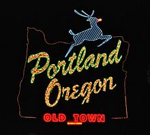
Chinatown
Portland New Chinatown/Japantown Historic District The Chinatown Gate over NW Fourth Avenue at W Burnside Street.
Location: Portland, Oregon Area: 174 acres (70 ha)[2] Built: Apx. 1880-1927 Architect: multiple Architectural style: Late Victorian, Modern Movement, Late 19th And Early 20th Century American Movements[2] NRHP Reference#: 89001957 Added to NRHP: 1989-11-21[3] The Chinatown portion of Old Town extends north from West Burnside St. to Union Station. The entrance is marked by a China gate (built in 1986),[7] complete with a pair of lions, at the corner of NW 4th Ave. and W Burnside St. The core of the area, from W Burnside St. to NW Glisan St. and from NW 5th Ave. to NW 3rd Ave., was designated in 1989 the New Chinatown/Japantown Historic District.
When compared to the more well-known Chinatowns of Oakland and San Francisco in California and Vancouver, British Columbia, Portland's Chinatown is smaller and less active. It has more than two dozen Chinese-owned businesses, including restaurants such as Good Taste which serves Cantonese noodle soups and barbecued meats, gift and import shops, club houses, an herbal medicine store and an Asian food market.
Other major organizations based in Chinatown include the Port of Portland, Oregon Department of Transportation's Portland offices and NW Natural Gas. There is also a parking structure with a helipad on top.
In a step towards revitalization of the area, the Portland Classical Chinese Garden opened September 14, 2000. The $12.8 million park covers an entire city block and was built by 65 artisans from Suzhou, China of imported materials (though all plants were grown locally). More recently, NW 3rd and 4th Avenues received streetscape improvements, including plaques describing historical features. Two block-long "festival streets" that can easily be used for street festivals were also created between these streets.[8] In 2008, Uwajimaya anchored a redevelopment proposal, similar to the Uwajimaya Village in Seattle's International District/Chinatown. It would host the store, an underground parking garage, mixed-income apartments, and other small retailers. This is hoped to revitalize the area and bring in more tourists.[9]
There are actually very few Chinese people living in Chinatown. A second Chinese area has sprung up around Southeast 82nd Avenue. The Southeast 82nd area has a large number of Asians, mainly Chinese and Vietnamese. There has recently emerged an ideological division separating the established social services and SRO residents from many of the new residents and businesses over how best to accommodate new investments and activities with minimal displacement of current services and residents.
See also
- List of Registered Historic Places in Multnomah County, Oregon
- List of National Historic Landmarks in Oregon
References
- ^ http://communique.portland.or.us/04/12/part_of_old_town_to_move_into_river_district_urban_renewal_area communique.portland.or.us
- ^ a b c "National Register of Historic Places.com". http://www.nationalregisterofhistoricplaces.com/. Retrieved 2008-05-11.
- ^ a b "National Register Information System". National Register of Historic Places. National Park Service. 2007-01-23. http://nrhp.focus.nps.gov/natreg/docs/All_Data.html.
- ^ a b "Skidmore/Old Town Historic District". National Historic Landmark summary listing. National Park Service. http://tps.cr.nps.gov/nhl/detail.cfm?ResourceId=1564&ResourceType=District. Retrieved 2007-11-19.
- ^ Orloff, Chet. "William Sumio Naito (1925–1996)". The Oregon Encyclopedia. http://www.oregonencyclopedia.org/entry/view/naito_william_sumio_1925_1996_/. Retrieved December 4, 2010.
- ^ Carolyn Pitts (February 19, 1977). National Register of Historic Places Inventory-Nomination: Skidmore/Old Town Historic DistrictPDF (648 KiB). National Park Service and Accompanying 13 photos, from 1960 and 1975.PDF (1.18 MiB)
- ^ Hottle, Molly (February 2, 2011). "Chinese New Year celebration at Portland Chinatown gate also will celebrate its 25th anniversary". The Oregonian. http://www.oregonlive.com/portland/index.ssf/2011/02/post_61.html. Retrieved February 13, 2011.
- ^ http://www.pdc.us/ura/dtwf/otctstreetscape.asp pdc.us
- ^ http://www.oregonlive.com/business/oregonian/index.ssf?/base/business/1214882720212460.xml&coll=7
External links
- Old Town/Chinatown information from Old Town Chinatown Neighborhood Association
- Self-Guided Walking Tour of Portland's Chinatown from Travel Portland
- National Historic Landmark Nomination for Skidmore/Old Town Historic District
- Portland's Chinatown History and Resources from Friends of Portland Chinatown
Chinatowns Africa South Africa: JohannesburgAsia India: Kolkata · Makum (closed) · Mumbai (closed), Indonesia: Jakarta, Iran: Mahale Chiniha, Japan: Kobe · Nagasaki · Yokohama, Malaysia: Kuala Lumpur, Myanmar: Yangon, Pakistan: Karachi, Philippines: Manila, Singapore Singapore, South Korea: Incheon, Thailand: Bangkok, United Arab Emirates: Dubai, Vietnam: Ho Chi Minh City (Saigon)Europe Latin America Argentina: Buenos Aires, Brazil: São Paulo, Costa Rica: San José, Cuba: Havana, Mexico: Mexicali · Mexico City, Peru: LimaNorth America Canada: Calgary · Edmonton · Lethbridge · Montreal · Ottawa · Toronto · Vancouver · Victoria · Winnipeg
United States: Boston · Brooklyn · Chicago · Cleveland · Flushing · Honolulu · Houston · Las Vegas · Los Angeles · Newark · New York · Oakland · Oklahoma City · Philadelphia · Portland · San Francisco · Seattle · Washington D.C.Oceania U.S. National Register of Historic Places Topics Lists by states Alabama • Alaska • Arizona • Arkansas • California • Colorado • Connecticut • Delaware • Florida • Georgia • Hawaii • Idaho • Illinois • Indiana • Iowa • Kansas • Kentucky • Louisiana • Maine • Maryland • Massachusetts • Michigan • Minnesota • Mississippi • Missouri • Montana • Nebraska • Nevada • New Hampshire • New Jersey • New Mexico • New York • North Carolina • North Dakota • Ohio • Oklahoma • Oregon • Pennsylvania • Rhode Island • South Carolina • South Dakota • Tennessee • Texas • Utah • Vermont • Virginia • Washington • West Virginia • Wisconsin • WyomingLists by territories Lists by associated states Other Categories:- Historic districts in Oregon
- Neighborhoods in Portland, Oregon
- National Historic Landmarks in Oregon
- Chinatowns in the United States
- National Register of Historic Places in Portland, Oregon
- Visitor attractions in Portland, Oregon


Wikimedia Foundation. 2010.