- Maryland Route 277
-
Maryland Route 277

Route information Maintained by MDSHA Length: 2.51 mi[1] (4.04 km) Major junctions West end: Elk Mills Road in Elk Mills  MD 316 in Elk Mills
East end:  MD 279 near Elkton
Location Counties: Cecil Highway system Maryland highway system
Interstate • US • State • Minor • Former • Turnpikes←  MD 276
MD 278  →
→Maryland Route 277 (MD 277) is a state highway in the U.S. state of Maryland. The state highway runs 2.51 miles (4.04 km) from Elk Mills east to MD 279 near Elkton in northeastern Cecil County. MD 277 was paved west of MD 316 by 1921 and was extended east to MD 279 in the mid 1980s.
Contents
Route description
MD 277 begins at an arbitrary point on Elk Mills Road in the community of Elk Mills about 250 feet (76 m) west of the entrance to Elk Mills Community Park. Elk Mills Road continues west as a county highway toward MD 213. MD 277 heads east through a residential area, crossing CSX's Philadelphia Subdivision at grade and then over Big Elk Creek. The state highway enters a forested area along the edge of a quarry before meeting Appleton Road, which heads south as MD 316. MD 277 continues east as Fletchwood Road past a distribution center and through a residential area before reaching its eastern terminus at MD 279 (Elkton Road) northeast of Elkton and just west of the Delaware state line.[1][2]
History
MD 277 was paved west of MD 316 by 1921.[3] The state highway was extended east to MD 279 around 1985.[4]
Junction list
The entire route is in Cecil County.
Location Mile[1] Destinations Notes Elk Mills 0.00 Elk Mills Road west Western terminus 1.19 MD 316 south (Appleton Road) / Appleton Road north – ElktonElkton 2.51 MD 279 (Elkton Road) – Newark, DEEastern terminus 1.000 mi = 1.609 km; 1.000 km = 0.621 mi References
- ^ a b c "Highway Location Reference: Cecil County" (PDF). Maryland State Highway Administration. 2009. http://www.marylandroads.com/Location/2009_CECIL.pdf. Retrieved 2010-10-14.
- ^ Google, Inc. Google Maps – Maryland Route 277 (Map). Cartography by Google, Inc. http://maps.google.com/maps?f=d&source=s_d&saddr=Elk+Mills+Rd&daddr=MD-277+E%2FFletchwood+Rd&hl=en&geocode=FU40XQIdj916-w%3BFUQRXQIdCIt7-w&mra=ls&sll=39.658185,-75.811765&sspn=0.03033,0.077162&ie=UTF8&t=h&z=14. Retrieved 2010-10-14.
- ^ Maryland Geological Survey. Map of Maryland: Showing State Road System and State Aid Roads (Map) (1921 ed.).
- ^ Maryland State Highway Administration. Maryland: Official Highway Map (Map) (1985-86 ed.).
External links
Roads in Cecil County, Maryland State highways 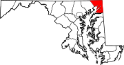
U.S. Highways Interstate Highways Categories:- State highways in Maryland
- Roads in Cecil County, Maryland


Wikimedia Foundation. 2010.