- Maryland Route 279
-
Maryland Route 279
Elkton Road, Newark Avenue 
Route information Maintained by MDSHA Length: 4.95 mi[1] (7.97 km) Major junctions South end:  US 40 in Elkton
 MD 545 in Elkton
 MD 213 in Elkton
 MD 268 in Elkton
 MD 316 in Elkton
 I-95 near Elkton
 MD 277 near Elkton
North end:  DE 2 near Elkton
Location Counties: Cecil Highway system Maryland highway system
Interstate • US • State • Minor • Former • Turnpikes←  MD 278
MD 280  →
→Maryland Route 279 (MD 279) is a state highway in the U.S. state of Maryland. Known as Elkton Road and Newark Avenue, the state highway runs 4.95 miles (7.97 km) from U.S. Route 40 (US 40) west of Elkton to the Delaware state line north of Elkton, where the highway continues as Delaware Route 2 (DE 2). MD 279 functions as a northern bypass of Elkton and is the primary highway to Newark, Delaware from Maryland. The state highway was constructed in the 1910s. The highway was realigned north of Elkton in the early 1960s when Interstate 95 (I-95) was constructed through eastern Cecil County. MD 279 bypassed Elkton with an extension to US 40 in the late 1960s; the old alignment to downtown Elkton was designated MD 268.
Contents
Route description
MD 279 begins at an intersection with US 40 (Pulaski Highway) west of Elkton, heading along Elkton Road. MD 7 (Philadelphia Road) heads south and west from the opposite side of the intersection. MD 279 heads northeast as a two-lane highway, passing the Elkton YMCA before crossing Little Elk Creek and entering the town limits of Elkton. The state highway intersects MD 545 (Blue Ball Road) and curves to the east ahead of the junction with MD 213 (Bridge Street), where the highway becomes Newark Avenue and expands to three lanes with a center turn lane. MD 279 goes through a residential area where the highway passes Gilpin Manor Elementary School and Elkton Middle School before the intersection with MD 268 (North Street). The state highway becomes Elkton Road again and crosses Big Elk Creek, leaving the town limits of Elkton and immediately meets the southern terminus of MD 316 (Appleton Road). MD 279 continues northeast as a four-lane divided highway. The state highway intersects Belle Hill Road in the midst of a commercial area catering to travellers before meeting I-95 (John F. Kennedy Memorial Highway) at a cloverleaf interchange. MD 279 intersects MD 277 (Fletchwood Road) immediately before reaching its northern terminus at the Delaware state line. The highway continues northeast as DE 2 (Elkton Road) toward Newark.[1][2]
History
MD 279 was paved as a state-aid road from the northern limit of Elkton to the Delaware state line by 1915.[3] The state highway was completed by 1921 when North Street within Elkton was surfaced.[4] Outside of Elkton, MD 279 followed present day MD 316 north from Big Elk Creek, veered east onto Belle Hill Road, then followed its present alignment northeast to the state line.[5] In 1963, the state highway moved to its present alignment between Big Elk Creek and I-95 in conjunction with the construction of the highway's interchange with I-95.[6] MD 279 was extended west on a new alignment to US 40 west of Elkton in 1967; North Street was redesignated MD 268.[7] The divided highway between MD 316 and the state line was completed around 1983.[8]
Junction list
The entire route is in Elkton in Cecil County.
Mile[1] Destinations Notes 0.00  MD 7 west (Philadelphia Road)
Southern terminus US 40 (Pulaski Highway) – North East, Perryville0.60 MD 545 (Blue Ball Road) – Childs1.18 MD 213 (Bridge Street) – Fair Hill, Chesapeake City1.70 MD 268 south (North Street)Old alignment of MD 279 1.80 MD 316 north (Appleton Road) – Elk MillsOld alignment of MD 279 3.37 Belle Hill Road south Old alignment of MD 279 3.81 I-95 (John F. Kennedy Memorial Highway) – Baltimore, New YorkI-95 Exit 109; Cloverleaf interchange 4.91 MD 277 west (Fletchwood Road) – Elk Mills4.95 DE 2 east (Elkton Road) – Newark, DENorthern terminus; Delaware state line 1.000 mi = 1.609 km; 1.000 km = 0.621 mi References
- ^ a b c "Highway Location Reference: Cecil County" (PDF). Maryland State Highway Administration. 2009. http://www.marylandroads.com/Location/2009_CECIL.pdf. Retrieved 2010-10-13.
- ^ Google, Inc. Google Maps – Maryland Route 279 (Map). Cartography by Google, Inc. http://maps.google.com/maps?f=d&source=s_d&saddr=MD-279+E%2FElkton+Rd&daddr=MD-279+E%2FElkton+Rd&hl=en&geocode=FShbXAIdmpB6-w%3BFSQSXQIdno17-w&mra=ls&sll=39.60706,-75.853815&sspn=0.001897,0.004823&ie=UTF8&t=h&z=13. Retrieved 2010-10-13.
- ^ Report of the State Roads Commission of Maryland. 1912-1915. Baltimore: Maryland State Roads Commission. May 1915. p. 124. http://www.archive.org/details/annualreportsofs1912mary. Retrieved 2010-10-13.
- ^ Maryland Geological Survey. Map of Maryland: Showing State Road System and State Aid Roads (Map) (1921 ed.).
- ^ United States Geological Survey. Elkton, MD quadrangle (Map). 1:48,000. 15 Minute Series (Topographic) (1942 ed.). http://historical.mytopo.com/quad.cfm?quadname=Elkton&state=MD&series=15. Retrieved 2010-10-13.
- ^ Maryland State Roads Commission. Maryland: Official Highway Map (Map) (1963 ed.).
- ^ Maryland State Roads Commission. Maryland: Official Highway Map (Map) (1967 ed.).
- ^ Maryland State Highway Administration. Maryland: Official Highway Map (Map) (1983-84 ed.).
External links
Roads in Cecil County, Maryland State highways 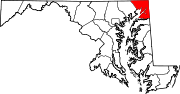
U.S. Highways Interstate Highways Categories:- State highways in Maryland
- Roads in Cecil County, Maryland


Wikimedia Foundation. 2010.