- Moonta, South Australia
-
Moonta
South Australia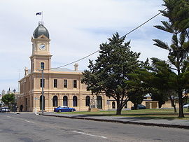
Moonta Town Hall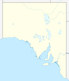
 Moonta
Population: 3,350[1] Established: 1863 Postcode: 5558 Coordinates: 34°06′S 137°32′E / 34.1°S 137.533°ECoordinates: 34°06′S 137°32′E / 34.1°S 137.533°E Elevation: 44 m (144 ft) Location: LGA: Copper Coast State District: Goyder Federal Division: Grey Mean max temp Mean min temp Annual rainfall 23.0 °C
73 °F10.8 °C
51 °F386.7 mm
15.2 inLocalities around Moonta: Wallaroo Kadina Moonta Bay Moonta Paskeville Balgowan Maitland Arthurton Moonta is a town located on the Yorke Peninsula of South Australia, 165 kilometres north-northwest of the state capital of Adelaide. It is one of three towns known as the Copper Coast or "Little Cornwall" for their shared copper mining history.
It is about 20 kilometres (12 mi) southwest of Kadina, site of the famous Wallaroo Mines, and 19 kilometres (12 mi) south of the port of Wallaroo. At the 2006 census, Moonta had a population of 3,350.[1] There are several distinct localities or hamlets surrounding Moonta, including Moonta Mines, Yelta, North Yelta, Moonta Bay, Port Hughes and Simms Cove.
It is thought that the name "Moonta" is derived from Moontera, an (Indigenous) Narungga word meaning 'impenetrable scrub'.[citation needed]
Contents
History
Prior to European settlement, the Moonta area was occupied by an indigenous community known as the Narungga. When Matthew Flinders was navigating the coastline of Southern Australia in 1802 he explored the coastline near Moonta. British settlers arrived in the Moonta area in the 1840's, as pastoralists, but there was no significant development until the 1860's, primarily because of the lack of water. The scrub in the area was difficult to penetrate (as testified by the town's name) so the first settlers had a hard time clearing the land.
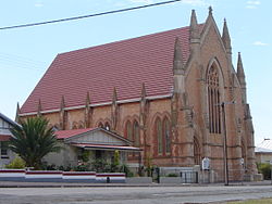 Church in Moonta
Large and rich deposits of copper were discovered at Moonta in 1861 by shepherds from Walter Watson Hughes' sheep farm. This became a prosperous mine, named Wheal Hughes, with other mines soon to follow. The town was laid out in 1863 and a horse drawn tramway to Wallaroo was established in 1863. Following advertising by the South Australian Government, Cornish miners arrived in Moonta soon afterward[2]. The mines at Moonta proved to be the richest mines in the whole of South Australia by 1917, exceeding the total wealth created by all other mines since 1836, the year of establishment of South Australia. The population of Moonta in 1875 was 12,000. The primary copper mining operations ceased in 1923, but smaller-scale operations recommenced in the area in the 1990s, and geological explorations continue.
Geography and climate
Moonta exists in a semi-arid location, above Goyder's Line. Moonta is surrounded by mallee scrub. The centre is located four kilometres inland and is 20 metres above sea level. Moonta has a dry Mediterranean climate with seasonal temperatures a few degrees above Adelaide's temperatures. The temperature ranges are similar to those of Kadina and the weather patterns are similar to those of both Kadina and Adelaide.
Following the demise of copper mining, the district successfully merged into dry-grain farming. Moonta's surrounds are used for growing barley, wheat and other crops such as legumes, canola, chickpeas and field peas. Barley from the region is considered to be some of the best in the world.
Economy
 Shops in Moonta
Moonta, the town centre, consists of old limestone miners' cottages and churches, giving the town a historical feel. There are several eateries in the town centre, as well as at Moonta Bay.
The nearby locations of Moonta Bay, Port Hughes and Sims Cove are on the foreshore and are rapidly developing. They are extremely popular locations for retirement. The beaches, with fine white sand, are popular with recreational anglers and sailboarders. The natural state of the coast has largely been retained.
Tourism is a significant local industry, focussing on the availability of beachside accommodation- including several caravan parks and a motel.
North Yelta is an old mining village just north of Moonta. Like Moonta, it has an historic ambience.
Moonta also contains the Wheal Hughes Tourist Mine at the site of Wheal Hughes, the Moonta Heritage Site, the Moonta School of Mines and a folk museum.
The popular three-day Kernewek Lowender Cornish festival is held every odd year in May in the Copper Triangle towns, where each of the three towns hosts the festival for one day.
Governance
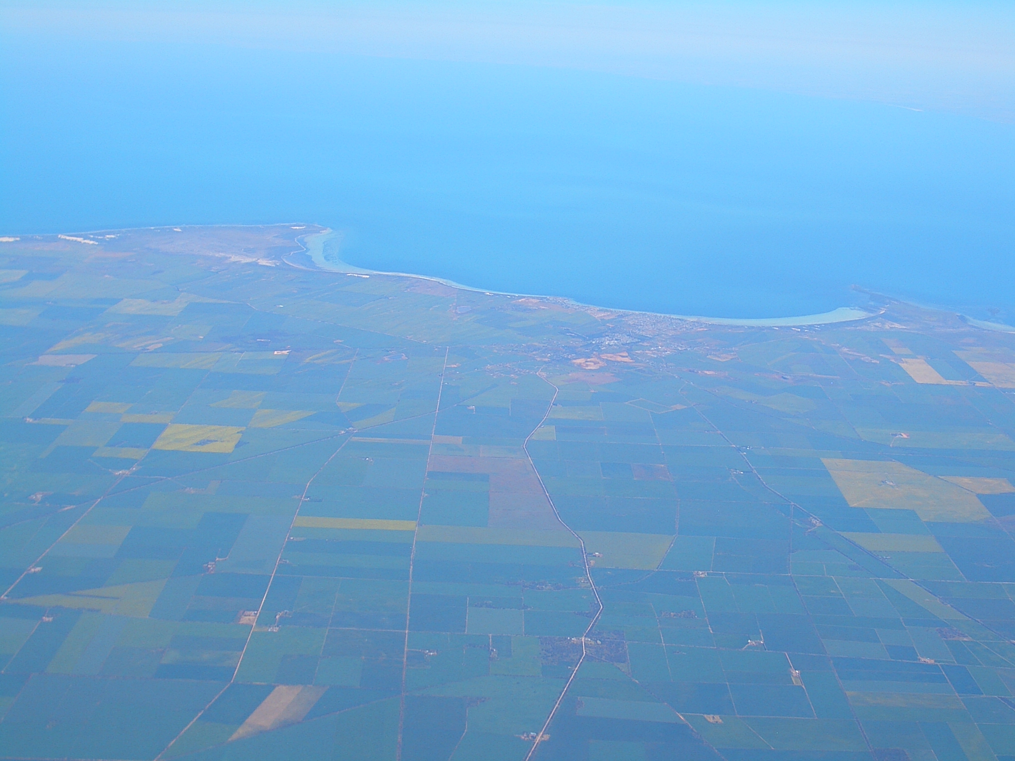
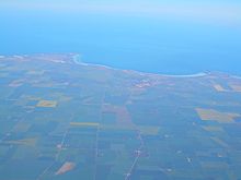 Aerial view of Moonta, looking west into Spencer Gulf
The District Council of the Copper Coast governs Moonta at the municipal level. Moonta lies in the state electoral district of Goyder and the federal electoral Division of Grey.
References
- ^ a b Australian Bureau of Statistics (25 October 2007). "Moonta (Urban Centre/Locality)". 2006 Census QuickStats. http://www.censusdata.abs.gov.au/ABSNavigation/prenav/LocationSearch?collection=Census&period=2006&areacode=UCL416400&producttype=QuickStats&breadcrumb=PL&action=401. Retrieved 11 October 2011.
- ^ For a discussion of the development of "Cornishness" see Philip Payton Making Moonta: The Invention of ‘Australia’s Little Cornwall, Exeter, University of Exeter Press, 2007 ISBN 978-085989-796-9 paperback ISBN 978-085989-795-2
See also
- Copper Coast
- Cornish emigration
- Wheal Hughes
- Kernewek Lowender
- Swanky beer
External links
- Yorke Peninsula website
- Yorke Peninsula: Moonta
- District of Copper Coast: Moonta
- Moonta and District Progress Association
- Postcards: Moonta
- Walkabout: Moonta
- Tourism facilities
Towns and localities of the District Council of the Copper Coast Boors Plain · Cross Roads · Cunliffe · East Moonta · Hamley · Jericho · Jerusalem · Kadina · Kooroona · Matta Flat · Moonta · Moonta Bay · Moonta Mines · Newtown · North Beach · North Moonta · North Yelta · Paramatta · Paskeville · Port Hughes · Thrington · Tickera · Wallaroo · Wallaroo Mines · Wallaroo Plain · Warburto · Willamulka · YeltaYorke Peninsula, South Australia Major Townships Ardrossan · Bute · Kadina · Maitland · Minlaton · Moonta · Paskeville · Port Broughton · Wallaroo · YorketownCouncils Islands Goose Island · Wardang IslandCategories:- Towns in South Australia
- Yorke Peninsula
- Visitor attractions in South Australia
- Mining towns in South Australia


Wikimedia Foundation. 2010.