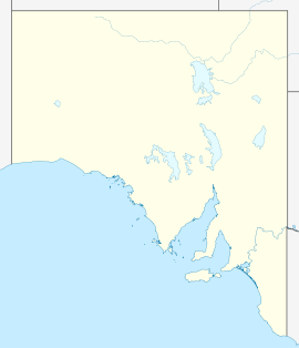
- Currency Creek, South Australia
-
Currency Creek
South AustraliaPostcode: 5214 Coordinates: 35°26′S 138°46′E / 35.433°S 138.767°ECoordinates: 35°26′S 138°46′E / 35.433°S 138.767°E Time zone: • Summer (DST)
ACST (UTC+9:30) ACDT (UTC+10:30)
Location: 8 km (5 mi) N of Goolwa LGA: Alexandrina Council State District: Finniss Federal Division: Mayo Currency Creek (postcode 5214) is a small town located on South Australia's Fleurieu Peninsula about 6 km north of Goolwa. The Currency Creek area was initially explored by Charles Sturt in the late 1820s, with the area being officially named in 1837 after the whaling boat Currency Lass.[1] The township was surveyed in the 'Currency Creek Special Survey' of 1840.
Contents
History
While exploring the Fleurieu Peninsula and Lake Alexandrina region and looking for other outlets to the sea, explorers Thomas Bewes Strangways, Young Bingham Hutchinson and party discovered the waterway in November 1837. Their bullock wagon was unable to proceed over the waterway and they decided to make the area their base for some time. They reported on the good grassland in the area and its potential for agriculture. The creek was named in honour of the whaling boat they used to explore the lake.
Wine industry
Currency Creek lends its name to a wine region that stretches from Port Elliot in the west, to Lake Alexandrina to the east, and includes Hindmarsh Island. The main grape varieties grown are Chardonnay, Sauvignon blanc, Cabernet Sauvignon and Shiraz. Vineyards were first established in the area in 1969, with the region producing its first vintage in 1972.
Currency Creek Arboretum
The Currency Creek Arboretum is named after the nearby geographical feature and town. It is being developed as a specialist eucalypt (Angophora, Eucalyptus and Corymbia) arboretum with its main purpose being research into Australia's most dominant natural group of plants, the eucalypts.[2]
See also
External links
- Headstones of the Currency Creek cemetery
- Currency Creek at Manning Index of South Australian history
- Currency Creek wine region at Wine Australia
References
Wine regions of South Australia Adelaide Hills · Adelaide Plains · Barossa Valley · Clare Valley · Coonawarra · Currency Creek · Eden Valley · Kangaroo Island · Langhorne Creek · McLaren Vale · Mount Benson · Padthaway · Riverland · Southern Fleurieu · Southern Flinders Ranges · The Peninsulas · Wrattonbully
Categories:- Towns in South Australia
- Wine regions of South Australia
- Arboreta in Australia
Wikimedia Foundation. 2010.

