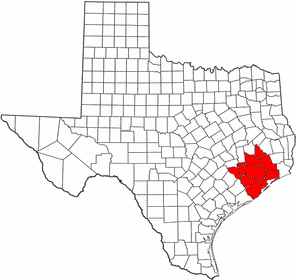
- Greater Houston
-
Houston–Sugar Land–Baytown — MSA — Country United States of America State Texas Principal cities – Houston
– Sugar Land
– Baytown
– Galveston
– ConroeArea - Urban 1,295.3 sq mi (3,354.7 km2) - Metro 10,062 sq mi (26,061 km2) Elevation 0–430 ft (0–131 m) Population (2010)[1] - Density 630.3/sq mi (243.4/km2) - Urban 3,822,509(6th) - MSA 5,946,800 (6th) - CSA 6,051,363 (9th) MSA/CSA = 2010, Urban = 2000 Time zone CST (UTC-6) - Summer (DST) CDT (UTC-5) Houston–Sugar Land–Baytown is a 10-county metropolitan area defined by the Office of Management and Budget. It is located along the Gulf Coast region in the U.S. state of Texas. The metropolitan area is colloquially referred to as "Greater Houston" and is situated in Southeast Texas, just west of the Golden Triangle.
Houston–Sugar Land–Baytown is the sixth-largest metropolitan area in the United States with a population of 5,946,800 as of the 2010 U.S. Census estimate.[1] The population of the metropolitan area is centered in the city of Houston—the largest economic and cultural center of the South Central United States with a population of 2.3 million.[2]
Houston is among the fastest-growing metropolitan areas in the United States. The area grew 25.2 percent between the 1990 and 2000 censuses—adding more than 950,000 people—while the nation's population increased 13.2 percent over the same period. From 2000 to 2007, the area grew by 912,994 people.[3] From 2000 to 2030, the metropolitan area is projected by Woods & Poole Economics [4] to rank fifth in the nation in population growth—adding 2.66 million people.[5] In 2009, Milken Institute/Greenstreet Real Estate Partners ranked Houston–Sugar Land–Baytown as the fifth-best performing metropolitan area; the Houston area had moved up 11 spaces from the previous year's ranking.[6]
Contents
Geography
 An image of the Greater Houston area taken from NASA's Space Shuttle during mission STS-55 (STS055-71-43) with Galveston Bay and Galveston Island visible towards the bottom of the picture.
According to the United States Census Bureau, the Houston–Sugar Land–Baytown metropolitan area has a total area of 10,062 square miles (26,060 km²), 8,929 sq mi (23,130 km2). is land area, while 1,133 sq mi (2,930 km2). is water area.; slightly smaller than Massachusetts and slightly larger than New Jersey.[7]
The metropolitan area is located in the gulf coastal plains biome, and its vegetation is classified as temperate grassland. Much of the metro area was built on forested land, marshes, swamp, or prairie—all of which can still be seen in surrounding areas.
Much of the Houston metropolitan area is very flat, making flooding a recurring problem for some areas.[citation needed]
Geology
Underpinning Houston's land surface are unconsolidated clays, clay shales, and poorly-cemented sands up to several miles deep. The region's geology developed from stream deposits formed from the erosion of the Rocky Mountains. These sediments consist of a series of sands and clays deposited on decaying organic matter that, over time, transformed into oil and natural gas. Beneath these tiers is a water-deposited layer of halite, a rock salt. The porous layers were compressed over time and forced upward. As it pushed upward, the salt dragged surrounding sediments into dome shapes, often trapping oil and gas that seeped from the surrounding porous sands. This thick rich soil also provides a good environment for rice farming in suburban outskirts that the city continues to grow into near Katy. Evidence of past rice farming is even still evident in developed areas as there is an abundance of rich dark loamy top soil.
The Houston region is generally earthquake-free. While the city of Houston contains over 150 active surface faults (some have estimated as many as 300 active faults)[8] with an aggregate length of up to 310 miles (500 km),[9][10] the clay below the surface precludes the buildup of friction that produces ground shaking in earthquakes. These faults generally move at a smooth rate in what is termed "fault creep."
Components of the metropolitan area
Counties
 Location of the Houston–Baytown–Huntsville CSA and its components:Houston–Sugar Land–Baytown Metropolitan Statistical AreaHuntsville Micropolitan Statistical AreaBay City Micropolitan Statistical Area
There are 10 counties in the Houston–Sugar Land–Baytown metropolitan statistical area (MSA) defined by the U.S. Census.[11] They are listed below with population figures as of the 2010 U.S. Census.[12][13]
- Harris County – 4,092,459
- Fort Bend County – 585,375
- Montgomery County – 455,746
- Brazoria County – 313,166
- Galveston County – 291,309
- Liberty County – 75,643
- Waller County – 43,205
- Chambers County – 35,096
- Austin County – 28,417
- San Jacinto County – 26,384
- Total Metropolitan Statistical Area – 5,946,800
Combined statistical area
In addition to the 10 counties in the Houston–Sugar Land–Baytown MSA, the U.S. Census Bureau defines a Combined Statistical Area, which adds two more counties to the area. These are:[13]
- Matagorda County – 36,702
- Walker County – 67,861
- Total Combined Statistical Area – 6,051,363
This Combined Statistical Area encompasses 12,475 sq mi (32,310 km2). of area. 10,830 sq mi (28,000 km2). is land while 1,645 sq mi (4,260 km2). is water.
Cities and towns
There are five "principal" cities defined by the U.S. Census as of 2009.[14] Population figures are within the city limits as of the 2008 U.S. Census estimates.[15]
- Houston – 2,242,193
- Sugar Land – 80,704
- Baytown – 70,330
- Galveston – 57,086
- Conroe – 55,429
Demographics
As of 2011 Greater Houston has four of Texas's ten wealthiest communities. They include the wealthiest community, Hunters Creek Village, the fourth wealthiest community, Bunker Hill Village, the fifth wealthiest community, West University Place, and the sixth wealthiest community, Piney Point Village.[16]
From 2001 to 2011, the number of people living in very poor Greater Houston areas almost doubled.[17]
Economy
Among the ten most populous metropolitan areas in the U.S., Houston ranked first in employment growth rate and second in nominal employment growth.[18] In 2006, the Houston metropolitan area ranked first in Texas and third in the U.S. within the category of "Best Places for Business and Careers" by Forbes.[19]
The Houston–Sugar Land–Baytown MSA's Gross Metropolitan Product (GMP) in 2005 was $308.7 billion, up 5.4 percent from 2004 in constant dollars—slightly larger than Austria's Gross Domestic Product (GDP). By 2010, the GMP rose to $384 billion, fifth in the nation.[20][21] Only 28 nations other than the United States have a GDP exceeding Houston's GAP.[5] Mining, which in Houston is almost entirely oil and gas exploration and production, accounts for 11 percent of Houston's GAP—down from 21 percent as recently as 1985. The reduced role of oil and gas in Houston's GAP reflects the rapid growth of other sectors—such as engineering services, health services, and manufacturing.[5]
The area's economic activity is centered in Houston, the county seat of Harris County. Houston is second to New York City in Fortune 500 headquarters. The city has attempted to build a banking industry, but the companies originally started in Houston have since merged with other companies nationwide. Banking, however, is still vital to the region.[citation needed]
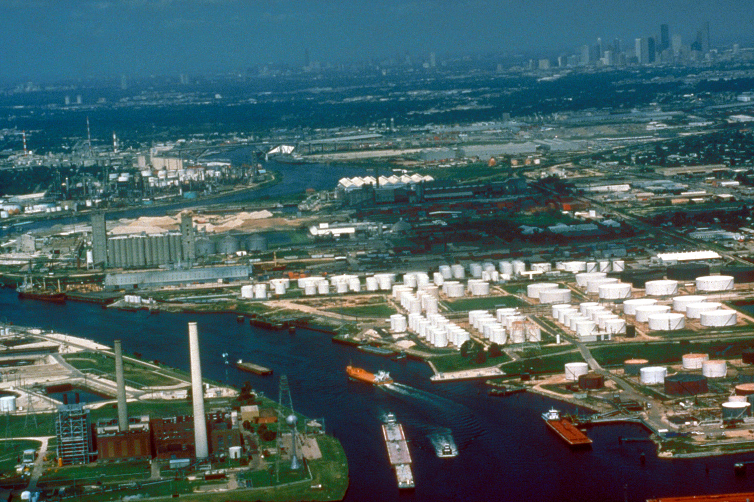
Galveston Bay and the Buffalo Bayou together form one of the most important shipping hubs in the world. The Port of Houston, the Port of Texas City, and the Port of Galveston are all major seaports located in this Greater Houston area.[22] The area is also one of the leading centers of the energy industry, particularly petroleum processing, and many companies have large operations in this region.[23] The metropolitan area also comprises the largest petrochemical manufacturing area in the world, including for synthetic rubber, insecticides, and fertilizers.[24] The area is also the world's leading center for building oilfield equipment. The region is also a major center of biomedical research, aeronautics, and high-technology.[25]
Much of metro area's success as a petrochemical complex is enabled by its busy man-made ship channel, the Houston Ship Channel.[26] Because of these economic trades, many residents have moved to the Houston area from other U.S. states, as well as hundreds of countries worldwide. Unlike most places, where high fuel prices are seen as harmful to the economy, they are generally seen as beneficial for Houston as many are employed in the energy industry. Baytown, Pasadena/La Porte, and Texas City have some of the area's largest petroleum/petrochemical plants though major operations can be found in Houston, Anahuac, Clute, and other communities. Galveston has the largest cruise ship terminal in Texas (and the 12th-largest in the world). The island as well the Clear Lake Area are major recreation and tourism areas in the region.[27]
Houston is home to the Texas Medical Center—the largest medical center in the world. The majority of Houston area Medicare recipients are members of Texan Plus, a Medicare approved Medicare Advantage plan that contracts with the federal government.[28] Galveston is home to one of only two national biocontainment laboratories in the United States.[29]
The University of Houston System's annual impact on the Houston-area's economy equates to that of a major corporation: $1.1 billion in new funds attracted annually to the Houston area, $3.13 billion in total economic benefit, and 24,000 local jobs generated.[30][31] This is in addition to the 12,500 new graduates the UH System produces every year who enter the workforce in Houston and throughout Texas. These degree-holders tend to stay in Houston. After five years, 80.5 percent of graduates are still living and working in the region.[31]
Sugar Land is home to the second-largest economic activities and third-largest city in the metropolitan area. Sugar Land has the most important economic center in Fort Bend County. The city holds the Imperial Sugar (its namesake), Nalco/Exxon and Western Airways headquarters. Engineering firms and other related industries have managed to take the place as an economic engine.[citation needed]
Culture
Houston's concentration of consular offices ranks third in the nation and first in the South, with 90 countries represented.[32] Houston has a sizable Hispanic community, with the third-largest Hispanic and third-largest Mexican-American populations in the United States, Hispanics also have large population bases in a number of suburbs, most notably Pasadena and Rosenberg, whose Hispanic populations make up the majority of these cities. Greater Houston is also home to a large and growing Asian-American population, including the third largest Vietnamese-American community in the U.S."Top Metropolitan Areas, Vietnamese Population, by Region". http://www.hmongstudies.org/VSPopCitiesbyRegion.html. Retrieved Nov 2, 2010. It also has a large Filipino-American community, the fifth largest in the nation.
CNN/Money and Money magazine have recognized cities in the Greater Houston area the past three years as part of its 100 Best Places to Live in the United States. In 2005, Sugar Land, southwest of Houston in northeast Fort Bend County, was ranked 46th in the nation, and one of only three Texas cities among the Top 100. In 2006, the magazine recognized Sugar Land again, this time as the third best city on its list. [1][33] Also making the 2006 list were League City (65th) in northern Galveston County and The Woodlands (73rd) in southern Montgomery County. In 2007, another Houston suburb, Friendswood made the list ranked 51st in the nation. It should be noted that the 2006 list only includes cities with at least 50,000 residents and that the 2007 list contains only cities with less than 50,000 residents.
Greater Houston is widely noted for its ethnic diversity and strong international community. In its 2010 publication "Urban Elite",[34] A.T. Kearney added the city to their list of the 65 most important world cities and ranks Houston 35th, as "...a magnet for a diverse population and business services...". The Globalization and World Cities Study Group and Network ranks Houston as a Beta- World City, "an important world city instrumental to linking their region or state to the world economy."[35]
Professional sports teams
Major Professional Sports Teams
Club Sport Founded League Venue Houston Astros Baseball 1962 MLB Minute Maid Park Houston Rockets Basketball 1967 NBA Toyota Center Houston Texans Football 2002 NFL Reliant Stadium Houston Dynamo Soccer 2005 MLS Robertson Stadium Other Professional Teams
Club Sport Founded League Venue Houston Aeros Hockey 1994 AHL Toyota Center Sugar Land Skeeters Baseball 2010 ALPB StarTex Power Field Houston Energy Football 2001 WPFL The Rig Houston Wranglers Tennis 2005 WTT Westside Tennis Club Houston Takers Basketball 2006 ABA John H. Reagan HS Bay Area Toros Baseball 2007 CBL Robinson Stadium Galveston Tidalwave Football 2008 IIFA Galveston Island Convention Center University sports
Houston is home to four NCAA Division I programs. The University of Houston and Rice University play in Division I-A and both belong to Conference USA. Both schools were also once part of the Southwest Conference. Texas Southern University, which is a member of the Southwestern Athletic Conference, plays in Division I-AA. Houston Baptist University currently plays in NCAA Division 1 as an independent in its first probationary year as part of their readmission into Division 1. Rice and Houston Baptist are widely noted for their student-athlete graduation rates, which number at 91% for Rice (tied for highest in the nation according to a 2002 Sports Illustrated issue on best college sports programs) and 80% for HBU.
NCAA Division I college athletics
School Founded Nickname Conference University of Houston 1927 Houston Cougars Conference USA Houston Baptist University 1960 Houston Baptist Huskies Great West Conference Prairie View A&M University 1876 Prairie View A&M Panthers Southwestern Athletic Conference Rice University 1912 Rice Owls Conference USA Texas Southern University 1947 Texas Southern Tigers Southwestern Athletic Conference Events
Houston is or has been home to various nationally known sporting events. The most notable is the Houston Livestock Show and Rodeo, which is the world's largest livestock exhibition and rodeo event. Other events of importance on greater Houston include the Shell Houston Open ( a (PGA Tour) event), the U.S. Men's Clay Court Championships (ATP tour) the Houston Marathon, and the Texas Bowl college football bowl game. Houston has also played host to two Super Bowls (VIII) and (XXXVIII), the 1968, 1986 2004 MLB All-Star Game, the 2005 World Series, and the 1989 2006 NBA All-Star Game. Houston has also played host to various high school and college sporting events, including the Big 12 Championship Game and will host the 2011 NCAA Men's Final Four, 2010 NCAA Men's Regional Finals, and 2010 MLS All-Star Game. Houston was also considered a candidate for the 2012 and 2016 Olympic Games and is currently a host candidate in the United States' bid for future FIFA World Cups.
Media
 Melcher Center for Public Broadcasting at the University of Houston
The Houston–Sugar Land–Baytown metropolitan area is served by a public television station and two public radio stations. KUHT (HoustonPBS) is a PBS member station and is the first public television station in the United States. Houston Public Radio is listener-funded radio and comprises two NPR member stations: KUHF (KUHF News) and KUHA (Classical 91.7). KUHF is news/talk radio and KUHA is a classical music station. The University of Houston System owns and holds broadcasting licenses to KUHT, KUHF, and KUHA. The stations broadcast from the Melcher Center for Public Broadcasting, located on the campus of the University of Houston.
The Houston area is served by the Houston Chronicle, its only major daily newspaper with wide distribution. The Hearst Corporation, which owns and operates the Houston Chronicle, bought the assets of the Houston Post—its long-time rival and main competition—when Houston Post ceased operations in 1995. The Houston Post was owned by the family of former Lieutenant Governor Bill Hobby of Houston. The only other major publication to serve the city is the Houston Press—a free alternative weekly with a weekly readership of more than 300,000.[36]
Education
Colleges and universities
Four distinct state universities are located in the Houston–Sugar Land–Baytown area. The University of Houston is a nationally recognized top-tier research university, and is the flagship institution of the University of Houston System.[37][38][39][40] The institution ranks among the Top 50 American Research Universities.[41] The third-largest university in Texas, UH has nearly 40,000 students on its 667-acre campus in southeast Houston.[42] The University of Houston–Clear Lake and the University of Houston–Downtown are stand-alone universities; they are not branch campuses of the University of Houston. Located in the historic community of Third Ward is Texas Southern University—one of the largest historically black colleges and universities in the United States.
Several private institutions of higher learning—ranging from liberal arts colleges to a nationally recognized research university—are located within the metropolitan area. Rice University is one of the leading teaching and research universities of the United States and ranked the nation's 17th best overall university by U.S. News & World Report.[43]
Three community college districts exist with campuses in and around Houston. The Houston Community College System serves most of Houston. The northwestern through northeastern parts of the metropolitan area are served by various campuses of the Lone Star College System, while the southeastern portion of the metropolitan is served by San Jacinto College. The Houston Community College and Lone Star College systems are within the 10 largest institutions of higher learning in the United States.
Transportation
Highways
Houston’s freeway system includes 575.5 miles (926.2 km) of freeways and expressways in the 10-county metro area.[5] The State of Texas plans to spend $65 billion on Houston area highways by 2025. Houston freeways are heavily traveled and often under construction to meet the demands of continuing growth.
The Greater Houston area has a hub-and-spoke freeway structure with multiple loops. The innermost is Interstate 610, forming approximately a 10-mile (20 km) diameter loop around downtown. The roughly square "Loop 610" is quartered into "North Loop," "South Loop," "West Loop," and "East Loop." The roads of Beltway 8 and their freeway core, the Sam Houston Tollway, are the next loop, at a diameter of roughly 25 miles (40 km). A proposed highway project, State Highway 99 (The Grand Parkway), would form a third loop outside of Houston. Currently, the completed portion of State Highway 99 runs from just north of Interstate 10, west of Houston, to U.S. Highway 59 in Sugar Land, southwest of Houston, and was completed in 1994. The next portion to be constructed is from the current terminus at U.S. Highway 59 to State Highway 288 in Brazoria County. Freeways also include the Westpark Tollway, which runs from U.S. Hwy 59 to Texas Hwy 99 and the Fort Bend Parkway, which runs from U.S. Hwy 90-A to Texas Hwy 6 in Missouri City.
Further information: List of highways in Houston–Sugar Land–Baytown MSAMass transit
The Metropolitan Transit Authority of Harris County, Texas, or METRO, provides public transportation in the form of buses, trolleys, and lift vans.
METRO began running light rail service (METRORail) on January 1, 2004. Currently the track is rather short—it runs about 8 miles (13 km) from Downtown Houston to the Texas Medical Center and Reliant Park. Still the Red Line is traveled by about 45,000 people daily, giving it the second highest ridership per track mile in the nation. METRO's various forms of public transportation still do not connect many of the suburbs to the greater city, causing Houstonians to rely on the automobile as a primary source of transportation. Prior to the opening of METRORail, Houston was the largest city in the United States devoid of a rail transit system by a very large margin.
Following a successful referendum held locally in 2004, METRO is currently in the beginning design phases of a 10-year expansion plan to add five more sections to connect to the current rail system. An 8.3-mile (13.4-km) expansion has been approved to run the service from Uptown through Texas Southern University, ending at the University of Houston campus.
Airports
Main article: Transportation in Houston#AirportsHouston's largest airport (and Texas's second-largest), George Bush Intercontinental Airport, is located in north Houston. Continental Airlines is headquartered in Downtown Houston. The southeast of Houston has William P. Hobby Airport, the second-largest commercial passenger airport. Houston's third-largest airport is Ellington Field, which houses several National Guard and Air National Guard units, as well as a United States Coast Guard air station and the Lyndon B. Johnson Space Center's fleet of jets that are used to train astronauts. Sugar Land, southwest of Houston, has the Sugar Land Regional Airport. Sugar Land Regional is the fourth-largest airport in the metropolitan area and the only general reliever airport in the southwest sector.
Intercity rail
Amtrak provides intercity rail service to the Houston station.
Intercity bus
Greyhound Bus Lines operates services from five bus stations in the City of Houston:
- Houston Greyhound Station at 2121 South Main Street[44]
- Coach USA Inc. Dept. Casin (Houston Crosstimbers) at 4001 North Freeway[45]
- The Box Store (Houston Northwest) at 1500 West Loop North Suite 117[46]
- Americanos U.S. L.L.C. (Houston Southeast) at 7000 Harrisburg Blvd.[47]
- Agencia Autobuses (Houston Southwest) at 6590 Southwest Freeway
In addition, Greyhound operates services from two stops[48]
Greyhound also operates services to stops within other cities in the Greater Houston area, including:
- Alvin (Yellow Jacket Grocery-Citgo)[49]
- Angleton (Ocampos Mexican Rest)[50]
- Baytown (Baytown Travel Express)[51]
- Conroe (Conroe Greyhound Station)[52]
- Galveston (Galveston Bus Station)[53]
- Katy (at Millers Exxon)[54]
- Prairie View (at Unco Food Store)[55]
- Rosenberg (at Shell-McDonalds)[56]
- Sealy (at Mazac Muffler City-AC)[57]
- Texas City (at McKown Air Conditioning, also serving La Marque)[58]
Politics
Politically, the Greater Houston area has historically been divided between areas of strength of the Republican and Democratic parties.[59]
The city of Houston itself has historically voted Democratic except for its affluent western and west-central portions, including the River Oaks, Westchase, Memorial and Uptown areas, as well as the Kingwood and Clear Lake City master-planned communities on Houston's far northeast and southeast sides, respectively. All these areas favor and are almost entirely represented both in Congress and in the Texas Legislature by Republicans. Democrats' strongest areas are within Loop 610, and also in the largely poor and minority northern, eastern and southern portions of Houston. Most of these areas have sizable Hispanic populations, though some northern and southern parts of the city have notable African-American communities. Democrats are also stronger in the more liberal Neartown area, which is home to a large artist and LGBT community, and Alief, which houses a sizable Asian American population. In 2008, almost every county in the region voted for Republican John McCain; only Harris County was won by Democratic candidate Barack Obama, by a small margin (51%–49%).[60] Galveston has long been a staunch Democratic stronghold, with the most active Democratic county establishment in the state.[61]
Houston's suburbs, are also politically divided. Such examples:
- Pasadena, which went for Barack Obama, is heavily Hispanic and lower-middle class on its north side, which favors Democrats, and slightly more affluent on its south side, which favors Republicans. A northwestern section of the city is represented by Democrat Ana Hernandez (District 143), while the city's central core, which contains most of its population, is represented by Republican Robert Talton (District 144). A small, largely unincorporated southeastern section of the city is represented by Republican John Davis (District 129), who also represents the NASA Johnson Space Center. Hernandez's district is also home to Galena Park and Jacinto City, which also have large Hispanic populations that favor Democrats.
- In Fort Bend County, southwest of Houston, Democrats are strongest in northern Missouri City and older sections of Rosenberg, which are home to large numbers of African-American and Hispanic voters, while more affluent areas of the county, such as Sugar Land, Katy, and Sienna Plantation, are heavily Republican. These areas house sizable Asian-American populations, many of whom are largely pro-business and generally favor Republicans, though a sizable community of Democratic business owners does exist among the area's Asian caucuses. In the 2008 election, John McCain won the county by 51% to 49%. Republicans control every county-wide elected office.
- Montgomery County, north of Houston, is a Republican stronghold, supported by voters in affluent communities on Lake Conroe and in The Woodlands. Rural residents of the county, though primarily lower- and middle-class, tend to be very socially conservative and also have a substantial Republican following. However, the city of Conroe proper, the county seat, tends to lean Democratic. Although The Woodlands is home to many corporate transplants from Europe, Japan, Canada, and Australia, who tend to be of a more liberal persuasion, most of these people are not U.S. citizens and thus have little impact on the voting trends of the county.[citation needed]
- The mainland areas of Galveston County, north of Galveston Island, have also become increasingly divided on political issues. Democrats have a presence in La Marque and Texas City, both of which are home to large numbers of unionized refinery workers and African Americans, a traditionally Democratic voting bloc. However, Democrats' strength in this area is increasingly being superseded by newer developments in the northern areas of the county around Friendswood and League City that favor Republicans.
- Brazoria County, south of Houston, is heavily Republican, especially in rural areas and in central portions of the county, such as Manvel, Alvin, and Angleton. However, Democrats perform strongly in southern portions of the county such as Lake Jackson, Clute, and Freeport due to its large Hispanic population as well as its large base of unionized refinery workers. Additionally, the northern areas of the county around fast-growing Pearland have recently become more moderate and even Democratic compared to the rest of the county due to its ethnic diversity as well as large numbers of Northern and West Coast transplants.
- In Liberty County, east of Houston, Republicans are represented at the state and federal levels, and the county went strongly for John McCain in 2008. However, Democrats hold a near-monopoly in county politics, though in 2006 it elected a countywide Republican (the County Treasurer position) for the first time since Reconstruction.
United States Congress
Senators Name Party First Elected Level Senate Class 1 Kay Bailey Hutchison Republican 1993 Senior Senator Senate Class 2 John Cornyn Republican 2002 Junior Senator Representatives Name Party First Elected Area(s) of Greater Houston Represented District 2 Ted Poe Republican 2004 Kingwood portion of Houston, Spring, northeast Harris County (including Baytown, Humble and La Porte), western and southern Liberty County District 7 John Culberson Republican 2000 West Houston, Memorial Villages, Bellaire, West University Place, west and northwest Harris County District 8 Kevin Brady Republican 1996 Montgomery and San Jacinto counties; northern Liberty County District 9 Al Green Democrat 2004 Alief, Southwest Houston, Houston’s Southside, portions of Fort Bend County (Mission Bend, eastern portion of Stafford, northern and eastern portions of Missouri City, county’s entire share of Houston) District 10 Michael McCaul Republican 2004 Northwest Harris County; Austin and Waller counties; most of the Greater Katy area District 14 Ron Paul Republican 1996 (also served 1976–1977 and 1979–1985) Galveston, most of Brazoria County (except Pearland), far northern and western Fort Bend County (including the Greater Katy portion in Fort Bend), Chambers County, portions of Galveston County (League City, most of Texas City), Wharton County, and Matagorda County District 18 Sheila Jackson Lee Democrat 1994 Downtown Houston, Bush IAH, northwest and northeast Houston, inner portions of Houston’s Southside District 22 Pete Olson Republican 2008 most of Fort Bend County (Sugar Land, Rosenberg, western and southern portions of Missouri City), northern Brazoria County (including Pearland), portions of Galveston County (La Marque), southeastern Harris County (Clear Lake City Area, NASA Johnson Space Center, Ellington Field, southern and central Pasadena, Deer Park) District 29 Gene Green Democrat 1992 East Houston, northern Pasadena, Galena Park, Channelview (all Harris County) Texas Legislature
Texas Senate
District Name Party First Elected Area(s) of Greater Houston Represented 3 Robert Nichols Republican 2006 Northern and western Montgomery County (including Conroe), San Jacinto County 4 Tommy Williams Republican 2003 Southern Montgomery County (including The Woodlands), Kingwood, Liberty County, Chambers County, far eastern portions of Baytown 6 Mario Gallegos Democrat 1995 Houston Ship Channel, eastern portions of Houston, Jacinto City, Galena Park, northern Pasadena, western portion of Baytown 7 Dan Patrick Republican 2007 Memorial Villages, Memorial/Spring Branch area, Addicks Reservoir, Northwest Harris County 11 Mike Jackson Republican 1999 Northern and central Brazoria County, southeastern portions of Houston and Harris County, the Galveston County mainland, and all areas roughly north of SH 87 on Galveston Island. 13 Rodney Ellis Democrat 1990 Downtown Houston, Texas Medical Center, southwest and northeast Houston, Houston’s Southside, northern portions of Missouri City, Stafford 15 John Whitmire Democrat 1983 Northwest Houston, Bush IAH, southern portion of Humble, eastern Harris County 17 Joan Huffman Republican 2008 Meyerland, Bellaire, West University Place, much of Katy area, far west Houston, Barker Reservoir, portions of Fort Bend County (Sugar Land and southern Missouri City) southern Brazoria County, the area of Galveston Island south of SH 87, entire Bolivar Peninsula, and Port Arthur. 18 Glenn Hegar Republican 2006 Austin, Waller and Wharton counties; western Fort Bend County Texas House of Representatives
District Name Party First Elected Area(s) of Greater Houston Represented 12 Jim McReynolds Democrat 1996 San Jacinto County 13 Lois Kolkhorst Republican 2000 Austin County 15 Rob Eissler Republican 2002 The Woodlands, southern Montgomery County 16 C. Brandon Creighton Republican 2006 Northern and central Montgomery County (including Conroe) 18 John Otto Republican 2004 Liberty County, southeastern Montgomery County 23 Craig Eiland Democrat 1994 Galveston, Texas City, Bolivar Peninsula, Chambers County 24 Larry Taylor Republican 2002 Hitchcock, La Marque, Santa Fe, Dickinson, League City, Friendswood (all in Galveston County) 25 Dennis Bonnen Republican 1996 Southern Brazoria County (Lake Jackson, Angleton, Freeport) 26 Charlie Howard Republican 1994 Sugar Land 27 Dora Olivo Democrat 1996 Eastern Fort Bend County (including Rosenberg, most of Missouri City, county’s share of Houston) 28 John Zerwas Republican 2006 Wharton and Waller counties, western Fort Bend County 29 Mike O'Day Republican 2007 Matagorda County, part of Brazoria County (Pearland, Alvin) 126 Patricia Harless Republican 2006 Champions/FM 1960 127 Joe Crabb Republican 1992 Kingwood, Lake Houston, Crosby, Wallisville 128 Wayne Smith Republican 2002 East Harris County (Baytown, Deer Park, La Porte) 129 John Davis Republican 1998 Southeast Harris County (Clear Lake City Area, NASA Johnson Space Center) 130 Corbin Van Arsdale Republican 2002 Northwest Harris County (including Tomball and Cypress-Fairbanks areas) 131 Alma Allen Democrat 2004 Outer portions of Houston’s Southside 132 Bill Callegari Republican 2000 West Harris County (including county’s share of Katy and unincorporated western parts of the Katy area) 133 Jim Murphy Republican 2006 West Houston, western portion of Memorial/Spring Branch, part of the Energy Corridor 134 Ellen Cohen Democrat 2006 Inner western portions of Houston (including Meyerland, River Oaks and Memorial Park), Texas Medical Center, West University Place, Bellaire, Southside Place 135 Gary Elkins Republican 1994 Parts of northwest Harris County (including Jersey Village) and southeastern segments of the Champions/FM 1960 area 136 Beverly Woolley Republican 1994 Memorial Villages and surrounding areas 137 Scott Hochberg Democrat 1992 Southwest Houston (including Sharpstown, Westwood and Fondren Southwest) 138 Dwayne Bohac Republican 2002 Northwest Houston and parts of the Memorial/Spring Branch area north of I-10, Addicks Reservoir 139 Sylvester Turner Democrat 1988 North Houston and Aldine west of I-45 140 Armando Walle Democrat 2008 North Houston and Aldine east of I-45 141 Senfronia Thompson Democrat 1972 Northeast Houston, Bush IAH, Greenspoint, southern portion of Humble 142 Harold Dutton, Jr. Democrat 1984 East Houston, Northshore 143 Ana Hernandez Democrat 2006 East Houston within Loop 610, Houston Ship Channel, Galena Park, Jacinto City, northern Pasadena 144 Robert Talton Republican 1992 Southern Pasadena, far southeast Houston 145 Rick Noriega Democrat 1998 Inner southeastern portions of Houston (mainly east of I-45), South Houston (not part of the city of Houston) 146 Borris Miles Democrat 2006 Inner portions of Houston’s Southside 147 Garnet Coleman Democrat 1990 Downtown Houston, inner southeastern portions of Houston (mainly west of I-45) 148 Jessica Farrar Democrat 1994 Northwest Houston mainly within Loop 610 (including Houston Heights) 149 Hubert Vo Democrat 2004 Far west Houston, Alief, unincorporated portions of Katy area east of Fry Rd, Barker Reservoir 150 Debbie Riddle Republican 2002 Northern Harris County (Spring, Klein, northern Humble) References
- ^ Thomas, G. Scott (2011-03-07). "Houston 5th in metro population rankings, study shows". http://www.bizjournals.com/houston/news/2011/03/07/houston-5th-in-metro-population.html.
- ^ http://www.census.gov/popest/cities/tables/SUB-EST2009-01.csv
- ^ Houston-Sugar Land-Baytown, TX Metropolitan Statistical Area (CBSA) Population and Components of Change
- ^ www.woodsandpoole.com
- ^ a b c d http://www.houston.org/economic-development/facts-figures/index.aspx
- ^ "Houston makes best-performing city list." Houston Business Journal. Wednesday November 11, 2009. Retrieved on November 11, 2009.
- ^ City of Houston eGovernment Center
- ^ al.pdf Mapping Active Faults in the Houston area Using LIDAR. Richard Engelkeimer, Shuhab Khan, Carl Norman. University of Houston.
- ^ Faults in Parts of North-Central and Western Houston Metropolitan Area, Texas. Earl R. Verbeek, Karl W. Ratzlaff, Uel S. Clanton. U.S. Geological Survey.
- ^ Principal Active Faults. Houston Area, Texas. U.S. Department of Agriculture, 1984.
- ^ http://www.census.gov/population/www/estimates/metro_general/2006/List1.txt
- ^ U.S. Census Bureau, 2000 to 2007 Population Estimates
- ^ a b http://www.census.gov/popest/counties/files/CO-EST2008-POPCHG2000_2008-48.csv
- ^ http://www.whitehouse.gov/omb/assets/bulletins/b10-02.pdf
- ^ http://www.census.gov/popest/cities/tables/SUB-EST2008-04-48.csv
- ^ "Houston holds some of Texas’ most wealthy communities." Houston Business Journal. September 13, 2011. Retrieved on September 20, 2011.
- ^ Kever, Jeannie. "Number of residents in poor Houston neighborhoods doubles." Houston Chronicle. Thursday November 3, 2011. Retrieved on November 3, 2011.
- ^ Microsoft Word – 10A W001 Employment Comparisons.doc
- ^ "Best Places For Business And Careers". Forbes. 2006-05-04. http://www.forbes.com/2006/05/03/06bestplaces_best-places-for-business_land.html.
- ^ http://www.bea.gov/newsreleases/regional/gdp_metro/gdp_metro_newsrelease.htm
- ^ "Gross Metropolitan Product". Greyhill Advisors. http://greyhill.com/gross-metropolitan-product. Retrieved September 28, 2011.
- ^ Ocean Shipping from the Handbook of Texas Online. Retrieved Jan 25, 2010. Texas State Historical Association.
- ^ Olien, Roger M.: Greater Houston from the Handbook of Texas Online. Retrieved Jan 25, 2010. Texas State Historical Association.
- ^ Weisman (2007), p. 132.
- ^ Russo, Gene (June 18, 2009). "Texas-sized challenge". Nature Magazine (Nature Publishing Group (a division of Macmillan)) 459 (7249): 1022–1023. doi:10.1038/nj7249-1022a. http://www.nature.com/naturejobs/2009/090618/full/nj7249-1022a.html.
Greater Houston from the Handbook of Texas Online. Retrieved Jan 25, 2010. Texas State Historical Association.
Wolgemuth, Liz (September 15, 2009). "10 Best Places for Tech Jobs". Houston Chronicle. http://www.usnews.com/money/careers/articles/2009/09/15/10-best-places-for-tech-jobs.html. - ^ "Overview of the Port of South Louisiana". Port of South Louisiana. http://www.portsl.com/pages/15_overview.html. Retrieved Jan uary 25, 2010.[dead link]
- ^ "Bay Area Overview". Bay Area Houston Economic Partnership. http://bayareahouston.com/DATA/Home/DataCenter/RegionalStudies/BayAreaHoustonOverview/Bay%20Area%20Houston%20Overview.PDF. Retrieved Jan uary 25, 2010.[dead link]
- ^ Houston Texas Medical Center | Greater Houston Partnership
- ^ University of Texas Medical Branch, Galveston National Laboratory – Home Page
- ^ TRESAUGUE, Matthew (2006-05-17). "Study suggests UH degrees are crucial economic factor". Houston Chronicle. http://www.chron.com/disp/story.mpl/3868657.html. Retrieved 2011-05-31.
- ^ a b "The Economic Impact of Higher Education on Houston: A Case Study of the University of Houston System" (PDF). University of Houston System. http://www.advancement.uh.edu/impact/download/PDF/EconomicImpactStudy.pdf. Retrieved 2011-05-14.
- ^ "Houston International Protocol Alliance". http://www.visithoustontexas.com/about/protocol/consular_corps_section. Retrieved Jun 22, 2010.
- ^ "Best Places to Live 2006". CNN. http://money.cnn.com/magazines/moneymag/bplive/2006/index.html. Retrieved May 4, 2010.
- ^ http://www.atkearney.com/images/global/pdf/Urban_Elite-GCI_2010.pdf
- ^ http://www.lboro.ac.uk/gawc/world2008t.html
- ^ "Houston Press: About Us". Houston Press. http://www.houstonpress.com/about/. Retrieved 2007-01-26.
- ^ Bonnin, Richard. "Carnegie Foundation Gives University of Houston its Highest Classification for Research Success, Elevating UH to Tier One Status". University of Houston. http://www.uh.edu/news-events/stories/2011articles/Jan2011/011811CarnegieTierOne.php. Retrieved 2011-02-08.
- ^ "UH achieves Tier One status in research". Houston Business Journal. 2011-01-21. http://www.bizjournals.com/houston/print-edition/2011/01/21/uh-achieves-tier-one-status-in-research.html. Retrieved 2011-07-06.
- ^ "UH takes big step up to Tier One status". Houston Chronicle. http://www.chron.com/disp/story.mpl/metropolitan/7386162.html. Retrieved 2011-07-06.
- ^ "University of Houston named Tier One school for research activity". KHOU.com. http://www.khou.com/news/local/University-of-Houston-named-Tier-One-school-for-research-activity-114137594.html. Retrieved 2011-07-06.
- ^ "2010 Top American Research Universities Report". The Center for Measuring University Performance. http://mup.asu.edu/research2010.pdf. Retrieved June 1, 2011.
- ^ Khator, Renu (October 04, 2011). "State of the University: Fall 2011". University of Houston. http://www.uh.edu/president/communications/university-community/fall-address-highlights/Fall_Address_Slides_10-3-2011.pdf. Retrieved October 05, 2011.
- ^ "Rice University, Best Colleges 2009". U.S. News & World Report. http://colleges.usnews.rankingsandreviews.com/college/items/3604. Retrieved 2009-03-27.
- ^ http://www.greyhound.com/scripts/en/TicketCenter/terminal.asp?city=681440
- ^ http://www.greyhound.com/scripts/en/TicketCenter/terminal.asp?city=680142
- ^ http://www.greyhound.com/scripts/en/TicketCenter/terminal.asp?city=683353
- ^ http://www.greyhound.com/scripts/en/TicketCenter/terminal.asp?city=680098
- ^ http://www.greyhound.com/scripts/en/TicketCenter/locations.asp?state=tx
- ^ http://www.greyhound.com/scripts/en/TicketCenter/terminal.asp?city=680097
- ^ http://www.greyhound.com/scripts/en/TicketCenter/terminal.asp?city=683540
- ^ http://www.greyhound.com/scripts/en/TicketCenter/terminal.asp?city=688567
- ^ http://www.greyhound.com/scripts/en/TicketCenter/terminal.asp?city=680669
- ^ http://www.greyhound.com/scripts/en/TicketCenter/terminal.asp?city=681208
- ^ http://www.greyhound.com/scripts/en/TicketCenter/terminal.asp?city=681550
- ^ http://www.greyhound.com/scripts/en/TicketCenter/terminal.asp?city=682363
- ^ http://www.greyhound.com/scripts/en/TicketCenter/terminal.asp?city=682495
- ^ http://www.greyhound.com/scripts/en/TicketCenter/terminal.asp?city=682638
- ^ http://www.greyhound.com/scripts/en/TicketCenter/terminal.asp?city=682935
- ^ Election result maps
- ^ "County Results - Election Center 2008 - Elections & Politics from CNN.com". CNN. http://www.cnn.com/ELECTION/2008/results/county/#val=TXP00map. Retrieved May 4, 2010.
- ^ :: The Galveston County Democratic Party Online – www.DemocratsWin.com ::
- Weisman, Alan (2007). The world without us. New York: Macmillan. ISBN 978-0-312-34729-1. http://books.google.com/books?id=bOBB-veGda8C.
External links
 Houston–Sugar Land–Baytown
Counties Austin • Brazoria • Chambers • Fort Bend • Galveston • Harris • Liberty • Montgomery • San Jacinto • Waller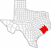
"Principal" cities Other cities Alvin • Angleton • Bellaire • Clute • Deer Park • Dickinson • Freeport • Friendswood • Galena Park • Humble • Jacinto City • Katy • Lake Jackson • La Marque • La Porte • League City • Missouri City • Pasadena • Pearland • Richmond • Rosenberg • South Houston • Stafford • Texas City • West University Place
- For a complete listing, see list of cities and towns in Houston–Sugar Land–Baytown MSA
Unincorporated
areasAtascocita • Channelview • Cloverleaf • Crosby • Cypress • Fresno • Hockley • Klein • Port Bolivar • Spring • The WoodlandsBodies of water Buffalo Bayou • Galveston Bay • Gulf Intracoastal Waterway • Houston Ship Channel • San Jacinto River • Trinity River • Lake Houston • Lake Conroe50 largest metropolitan statistical areas in the United States by population - New York
- Los Angeles
- Chicago
- Dallas–Fort Worth
- Philadelphia
- Houston
- Washington
- Miami
- Atlanta
- Boston
- San Francisco–Oakland
- Detroit
- Riverside–San Bernardino
- Phoenix
- Seattle
- Minneapolis–St. Paul
- San Diego
- St. Louis
- Tampa–St. Petersburg
- Baltimore
- Memphis
- Louisville
- Richmond
- Oklahoma City
- Hartford
- New Orleans
- Buffalo
- Raleigh
- Birmingham
- Salt Lake City
Categories:- Greater Houston
- Geography of Houston, Texas
- Geography of Harris County, Texas
- Geography of Fort Bend County, Texas
- Geography of Montgomery County, Texas
- Geography of Galveston County, Texas
- Regions of Texas


Wikimedia Foundation. 2010.