- Dunlow, West Virginia
-
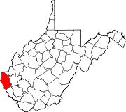
Dunlow, West Virginia — Town — Location within the state of West Virginia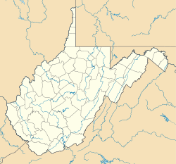
 Dunlow, West Virginia
Coordinates: 38°01′23.33″N 82°25′53.54″W / 38.0231472°N 82.4315389°WCoordinates: 38°01′23.33″N 82°25′53.54″W / 38.0231472°N 82.4315389°W Country United States State West Virginia County Wayne Area – Total 0.3 sq mi (0.7 km2) – Land 0.3 sq mi (60.814 km2) – Water 0.0 sq mi (0.002 km2) Elevation 1,101.998 ft (335.89 m) Population (2000) – Total 1,105 – Density 18.17/sq mi (7/km2) Time zone Eastern (EST) (UTC-5) – Summer (DST) EDT (UTC-5) ZIP code 25511 Area code(s) 304 FIPS code GNIS feature ID Dunlow is an unincorporated community in southern Wayne County, West Virginia, on Twelvepole Creek. It was laid out as a railroad town along the Ohio Extension of the Norfolk and Western Railway in 1892. Dunlow was incorporated in 1892. However, the railroad up the West Fork of Twelvepole Creek through Dunlow was shut down in the early 1930s, and what is left of the town is currently unincorporated. As of the 2000 census, Dunlow had a population of 1,105. As of 2009 the population was listed at 961.[1]
Contents
Town Trivia
Dunlow is also noted for its wildlife sightings. There have been several accounts of sightings of Black Panthers and other jungle animals in Dunlow. A circus train that derailed in the mid 1940's, from which several jungle creatures escaped and were never recovered, is rumored to be the source of these animals. For more about Dunlow, West Virginia, one can read "Last Train to Dunlow, History from the Hollows of Wayne County, West Virginia and the Coming of the N&W Railroad 1870-1940," by Jack Dickinson and Martha Kay Stamper.[2]
Cities / Towns located near Dunlow, WV
- Breeden, West Virginia (8.2 miles)
- Crum, West Virginia (9.2 miles)
- Genoa, West Virginia (7.3 miles)
- Kiahsville, West Virginia (3.9 miles)
- Ranger, West Virginia (11.3 miles)
- Wilsondale, West Virginia (5.8 miles)
- Cove Gap, West Virginia (6.3 miles)
- Doane, West Virginia (3.4 miles)
- Quaker, West Virginia (4.7 miles)
- Upper Tug, Kentucky (9.0 miles)
References
- ^ Dunlow, WV info at hometownlocator.com
- ^ Last Train to Dunlow, History from the Hollows of Wayne County, West Virginia and the Coming of the N&W Railroad 1870-1940," written by Jack Dickinson and Martha Kay Stamper
External links
Municipalities and communities of Wayne County, West Virginia Cities Ceredo | Huntington‡ | Kenova
Towns CDPs Unincorporated
communitiesArdel | Armilda | Bethesda | Booton | Bowen | Brabant | Buffalo Creek | Centerville | Coleman | Cove Gap | Crockett | Cyrus | Dickson | Doane | Dunlow | East Lynn | Echo | Effie | Elmwood | Ferguson | Fleming | Genoa | Gilkerson | Girard | Glenhayes | Grandview Gardens | Hidden Valley | Hubbardstown | Kiahsville | Mineral Springs | Missouri Branch | Neal | Nestlow | Oakview Heights | Quaker | Radnor | Saltpetre | Shoals | Sidney | Stepptown | Stiltner | Stonecoal | Sweet Run | Tripp | Webb | Westmoreland | Wilsondale | Winslow
Footnotes ‡This populated place also has portions in an adjacent county or counties
Categories:- Populated places in Wayne County, West Virginia
- Unincorporated communities in West Virginia
- Huntington–Ashland metropolitan area
- Metro Valley geography stubs


Wikimedia Foundation. 2010.