- New York State Route 211
-
NYS Route 211
Route information Maintained by NYSDOT and the city of Middletown Length: 23.01 mi[2] (37.03 km) Existed: 1930[1] – present Major junctions West end:  US 209 in Deerpark
 NY 17 in Middletown
East end:  NY 17K in Montgomery
Location Counties: Orange Highway system Numbered highways in New York
Interstate • U.S. • N.Y. (former) • Reference • County←  NY 210
NY 212  →
→New York State Route 211 (NY 211) is a state highway located entirely within Orange County, New York, in the United States. The western terminus is at the intersection with US 209 located in Cuddebackville, and the eastern terminus is located at Montgomery at NY 17K, where it becomes the main thoroughfare.
Through Middletown, it briefly becomes a divided highway with a maximum of five lanes in each direction (a total of ten lanes). It was also through Middletown that the famed "Miracle Mile" was born, which was the beginning of the shopping center frenzy that saw many businesses move from downtown areas of Middletown to the Route 211 Shopping Corridor.
Only in Middletown does the first sign along NY 211 with a directional banner appear, when headed eastward. At that point, the road is running more to the northwest.
Contents
Route description
Route 211 has three distinct segments, reflected on the reference markers along the highway: west of Middletown, the city of Middletown, and east of Middletown. All run through distinctly different terrain.
West of Middletown
The first 10 miles (16 km) are characterized by rugged and scenic countryside. They begin at the junction with 209. NY 211 at first heads straight east-southeast, crossing the limited downtown section of Cuddebackville and then the Basher Kill and its swampy lowlands. On the way up it makes its first crossing of the tracks of the Metro North, Port Jervis Line, also used by Norfolk Southern for freight. These will reappear at different times later along the route.
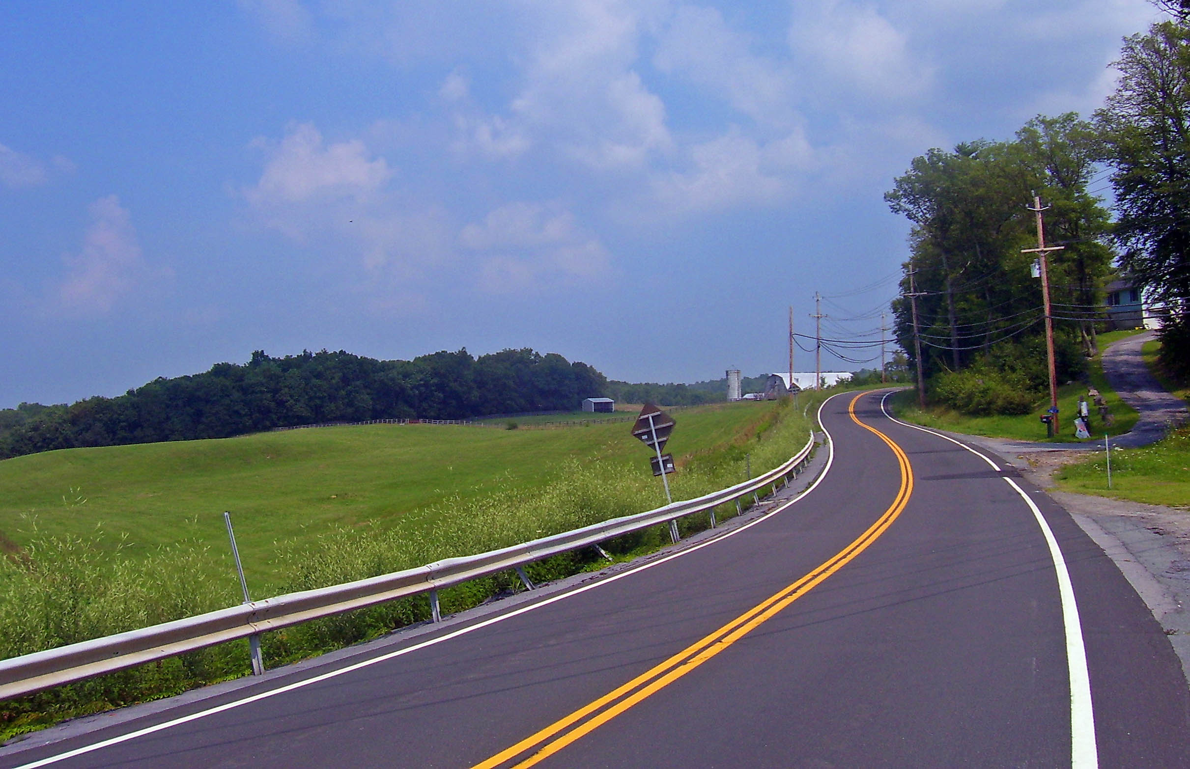
Looming ahead is a low but still formidable section of the Shawangunk Ridge, and after leaving the river's flood plain the highway immediately curves and begins to climb the ridge, here mostly wooded and undeveloped. There are some scenic cliffs ahead, and the road crests at 897 feet (273 m) above sea level just before reaching the village of Otisville.
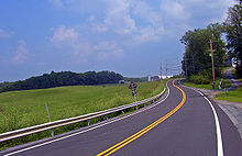 Route 211 east of Otisville.
Through the small rural village the road continues to descend, crossing the Port Jervis line again just next to the train station. In the countryside once again, passing through more open but still rolling and picturesque farmlands, it curves back and forth through Howells, gradually seeing more and more homes by the roadside, until it narrows and straightens out at the Middletown city limit.
City of Middletown
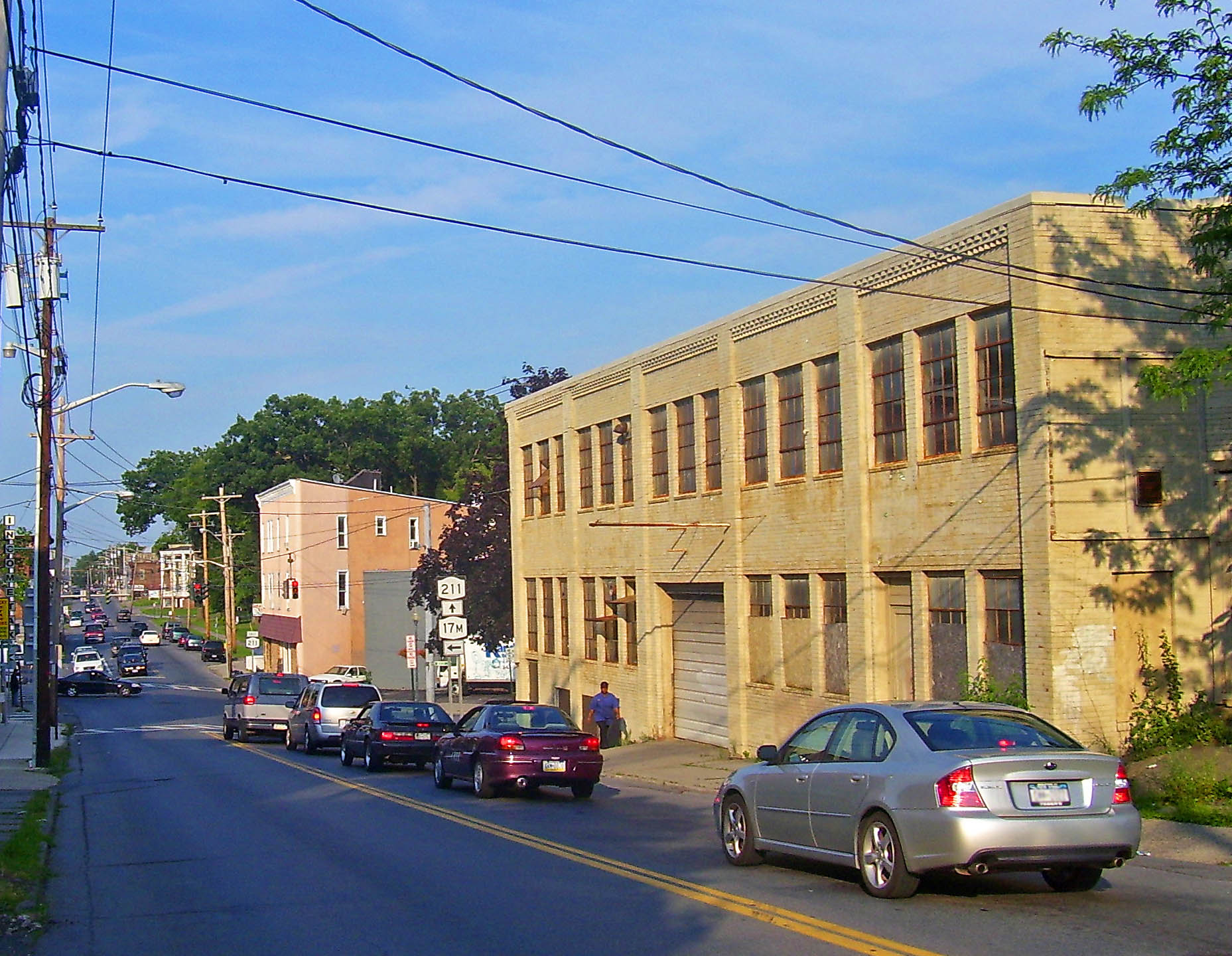
 The end of the Route 17M overlap in Middletown.
Route 211 enters the city as Monhagen Avenue for a mile, until it turns east onto West Main Street and merges with NY 17M. West Main branches to the southeast, the street name of the combined routes becoming Wickham Avenue, where these two follow a straight course to North Sreet, where NY 17M leaves to the northwest and NY 211 continues ahead east. It crosses a single track railway, which is the last vestiges of the New York, Ontario, and Western Railroad. The former headquarters/Middletown station of the O&W, heavily damaged by fire in 2004, sit next to the tracks.
There are no green New York State Department of Transportation reference markers at all along the road in Middletown (where the city is responsible for maintenance), although the road itself is amply signed.
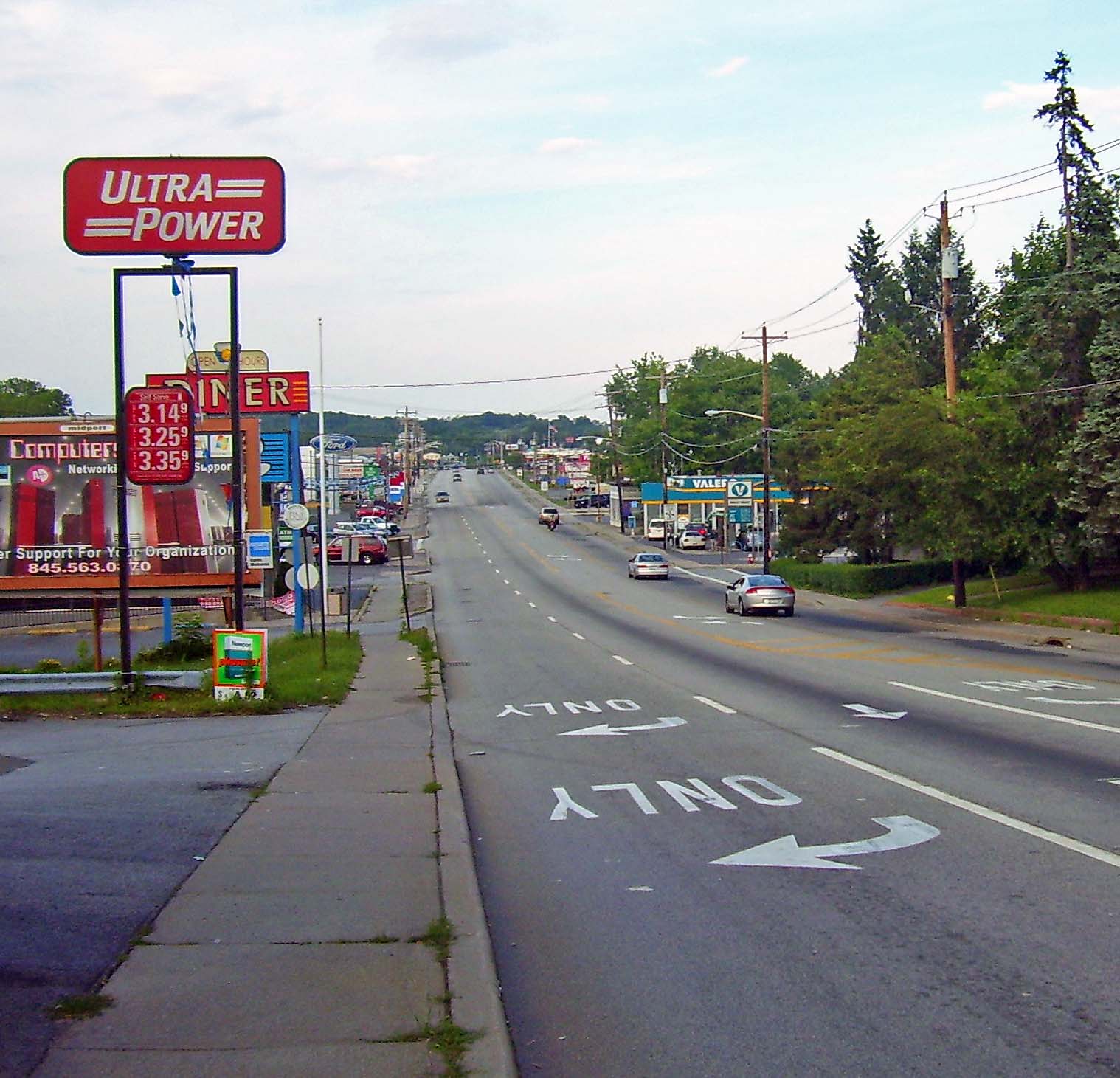
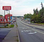 The beginning of the Middletown strip.
East of Middletown
Upon leaving the city, NY 211 expands to four lanes and becomes a major shopping strip, with many different retailers and restaurants on both sides. This continues to build through almost two miles (3 km) of the Town of Wallkill, with maximum traffic and width coming as the road passes the Wal-Mart Supercenter at the site of the Orange Plaza, crosses the Port Jervis line for the third and last time and then has its interchange with NY 17. On the opposite side are Gander Mountain and Sam's Club, and the entrance to the county's largest shopping mall, the Galleria at Crystal Run.
Beyond that, NY 211 remains divided for 0.6 mile (1 km), and then four lanes for another 0.5 mile (900 m) until it is back to two lanes going through Scotchtown, and development abates. The Port Jervis line briefly comes aside the highway as it nears the wooded tracts of Highland Lakes State Park, until leaving NY 211 behind for good. The Long Path hiking trail crosses the road at a trailer park entrance opposite Hidden Drive.
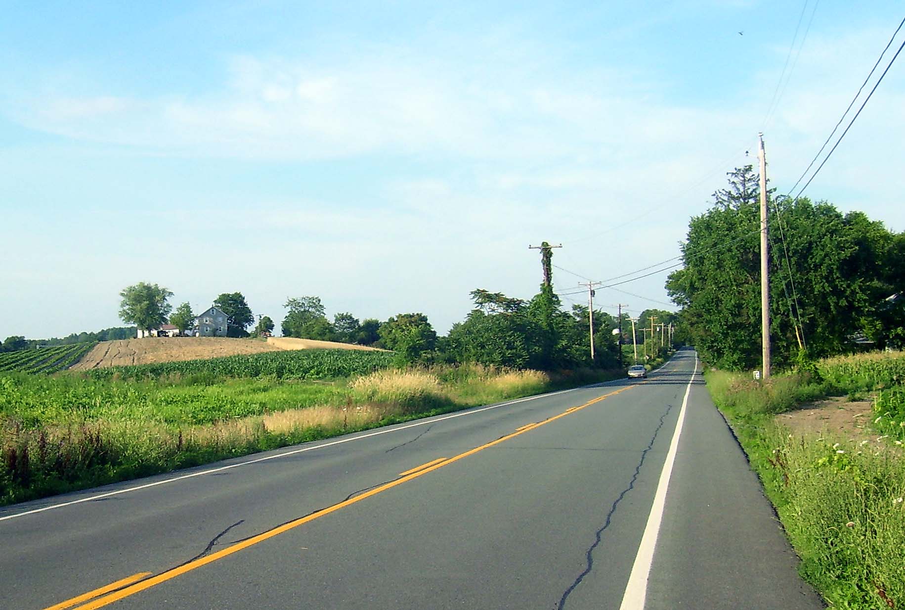
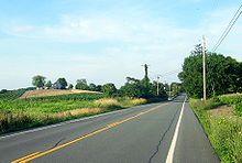 The Wallkill lowlands
The countryside along the highway is once again rural, but here NY 211 is straight and flat as it enters the lowlands around the Wallkill River. Interstate 84 runs closely parallel to the road through this section and can be seen at several points.
After crossing the river, Orange County Airport appears on the west side of the road. The northern end of NY 416 terminates on NY 211 just outside the village of Montgomery, meeting at an angle.
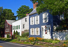 Historic houses along 211 near northern terminus in Montgomery.
The Village of Montgomery has a posted speed limit of 30mph starting at the border near Chandler Lane. The open fields on both sides of the road at the village limit transition to residential sections. The road passes Montgomery Elementary School on the east side of the road. NY 211 becomes Union Street, one the village's two major streets, passing through the larger of the village's two historic districts. At the end of downtown, NY 211 ends at a traffic light with Main Street, NY 17K.
History
The section of what is now NY 211 from North Street (now NY 17M) in Middletown to Montgomery was originally designated as part of NY 8 when the first set of posted routes in New York were assigned in 1924. NY 8 continued south from Middletown to the New Jersey state line at Unionville on modern NY 284 and east from Montgomery to Newburgh on current NY 17K.[3][4] In the 1930 renumbering of state highways in New York, the portion of NY 8 southwest of Montgomery was renumbered to NY 84 while a previously unnumbered highway between Cuddebackville and NY 17 (modern NY 17K) in Middletown was designated as NY 211.[1][5] The NY 84 designation was removed in the mid-1960s to eliminate numerical duplication with the under-construction Interstate 84. Its former routing from Middletown to Montgomery became an eastward extension of NY 211.[6][7]
The westernmost portion, according to a historical marker in Cuddebackville, follows the old Mount Hope and Lumberland Turnpike, built during the War of 1812.
Major intersections
The entire route is in Orange County.
Location Mile[2] Destinations Notes Deerpark 0.00 US 209Hamlet of Cuddebackville Middletown 10.95  NY 17M east
Western terminus of NY 17M / NY 211 overlap 11.73 NY 17M westEastern terminus of NY 17M / NY 211 overlap 14.01 NY 17Exit 120 (NY 17) Village of Montgomery 21.66  NY 416
Northern terminus of NY 416 23.01 NY 17K1.000 mi = 1.609 km; 1.000 km = 0.621 mi References
- ^ a b Standard Oil Company of New York (1930). Road Map of New York (Map). Cartography by General Drafting.
- ^ a b "2008 Traffic Volume Report for New York State" (PDF). New York State Department of Transportation. June 16, 2009. p. 188. https://www.nysdot.gov/divisions/engineering/technical-services/hds-respository/NYSDOT%20TVR%202008%20by%20Route.pdf. Retrieved February 1, 2010.
- ^ "New York's Main Highways Designated by Numbers". The New York Times: p. XX9. December 21, 1924.
- ^ State of New York Department of Public Works (1926). Official Map Showing State Highways and other important roads (Map). Cartography by Rand McNally and Company.
- ^ Standard Oil Company of New York (1929). New York in Soconyland (Map). Cartography by General Drafting.
- ^ Mobil (1965). New York (Map). Cartography by Rand McNally and Company.
- ^ Esso (1968). New York (Map). Cartography by General Drafting (1969–70 ed.).
External links
Categories:- State highways in New York
- Transportation in Orange County, New York


Wikimedia Foundation. 2010.