- Balsas River
-
For the city in Brazil, see Balsas (Maranhão). For Ecuadorian canton, see Balsas, Ecuador.
Balsas River
Mezcala River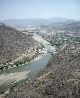
Balsas River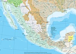
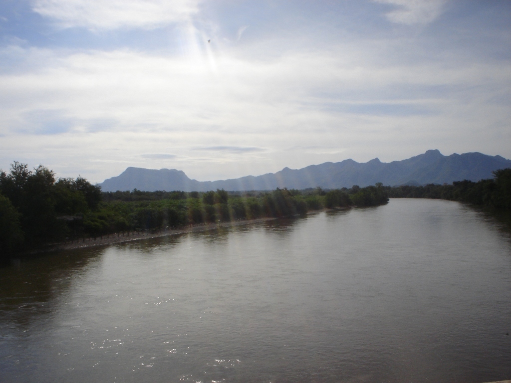
Watersheds of MexicoMouth Mangrove Point, Pacific Ocean Basin countries Mexico Length 771 kilometers (479 mi) River system Confluence of the San Martín River and Zahuapan River The Balsas River (Spanish Río Balsas, also locally known as the Mezcala River, or Atoyac River) is a major river of south-central Mexico. The basin flows through the states of Puebla, Morelos, Guerrero, and Mexico. The river empties into the Pacific Ocean at Mangrove Point, adjacent to the city of Lázaro Cárdenas, Michoacán.[1][2] Several rapids along the course of the Balsas River limit its navigability and thus the river has been largely used for generation of hydroelectric power, flood control and irrigation.[1]
Contents
History
The Balsas River valley was possibly one of the earliest maize growing sites in Mexico, dating from around 9200 years ago.[3] Later the area was populated by the Olmecs. Their culture originated at the Alto Balsas region in the Balsas River valley in Guerrero; it had dominated the region and is said to be the root of the Mesoamerican culture. However, nowadays it can only be traced to the archeological findings at Teopantecuanitlan in Capallio municipality, and is not maintained by the present population of Nahua. Teopantecuanitlan is located within the Balsas River basin and is claimed to be over 3500 years old. Though it is known that successive communities of Yop, Coixica, Matlatzinca (Chontal), Tlahuica and Xochimilca with Nahua succeeding in the end have lived in the region, archeological excavations in the area are yet to establish the hierarchical succession of the various communities.[4] During the period of 1100–480 BC, the region between the lower Balsas river valley and the Lerma-Santiago River fell under control of the Tarascan Empire.[5]
According to the 1980 Census, 47,000 people lived along the Balsas river banks, spread over 37 communities, within the six municipalities of the region. Nahua peoples constite 47% of the population, 15% are indigenous people (speaking four different languages), other large communities are Mixtec (23%) and Tlapenc (19%), and the balance 4% are Amuzgo.[4] The population increased to 60,000 in the 1990s. The communities, while retaining their individualities, show close linguistic, kinship, and cultural relationships revealed, for example, when the perform the rituals of patronal feasts.[6]
Geography and climate
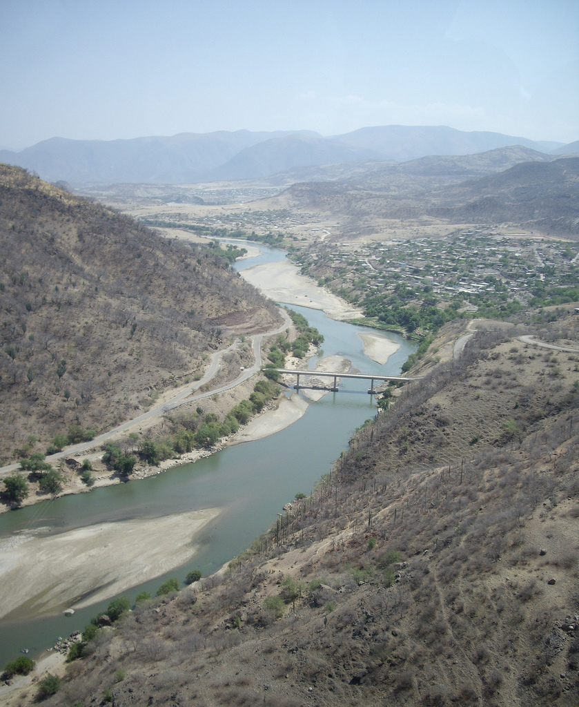
 The river at Coyuca de Catalán
The upper Balsas River basin includes the State of Puebla, the States of Mexico, Morelos, and the Guerrero Mountain Zone, as well as several river systems of the Mesa Central plateau. The main system is of the Tlapanec River, with tributaries originating in the mountains such as the Oaxaca Mixteca. It is joined by the Amacuzac River fed by streams around Xonacantapec volcano and by the San Jeronimo and Chontalcoatlan rivers. The last two rivers originate around Popocatepetl volcano and flow through the State of Morelos.[4]
With a length of some 771 kilometers (479 mi) the Balsas River is one of Mexico's longest rivers. It originates at the confluence of the San Martin and Zahuapan Rivers as Atoyac River in the state of Puebla. From here it flows south-west and then westward, into a depression through the state of Guerrero, and discharges into the Pacific Ocean at 17°56′24″N 102°08′16″W / 17.94°N 102.13778°W.[1]
The climate of the basin varies from temperate to subtropical with mean annual temperatures between 12.5 and 28 °C.[5] Rainfall in the basin is highly seasonal and some 90% of annual precipitation occurs between May and September, with 546 mm recorded in the arid areas of the valley and 1000–1600 mm further upstream in the highland lakes area.[5]
River basin development
The Balsas River basin has witnessed much economic development. Through building dams these activities aimed at irrigation, generation of electricity, and improving agriculture and living conditions of indigenous people, mainly the Nahuas who form the majority group. Seven hydropower projects are envisaged on the Balsas River. The two major projects are the La Villita and El Infiernello (in Michoecin). The Carlos Ramirez Ulloa (El Caracol) project is being developed in the Guerrero and four others are planned for the future.[7][8]
- River Basin Councils
Water management has received due attention of the Government of Mexico over the past several decades. It included more efficient water use and aimed to meet water supply needs of the major cities in Mexico. The Tepalcatepec Commission was established in 1947 under the Ministry of Water Resources (one of the three commissions established initially) for the Balsas River development. In 1960, it was subordinated to the Balsas River Commission. Its tasks included planning, design, coordination and implementation of irrigation projects, flood control and hydropower generation, covering rural and urban development and health and communications aspects. Following the enactment of a new Water Law in the country, a Master Plan was developed in 1975 covering 13 hydrological regions (102 subregions). River Basin Councils were established, and 25 are currently in position out of the 26 planned.[9]
The Balsas River has a discharge of 15–17 m3/s during the lean flow season. The steep slope of the river in a stretch of 30 km creates an elevation difference of 1200 m, providing excellent opportunities for hydropower development. Initially, 120 MW of power was generated at the power station at La Villita. This 336 MW station was built in the state of Michoacan, near the Pacific Coast. Another Balsas River project planned was the El Infiernillo; it became operational in 1964 and has an installed capacity of 1,120 MW. El Infiernillo Dam is a 149 m rockfill embankment dam.[9]
- Agriculture
Agriculture in the basin has a rich history of over 9000 years, with an impressive transformation from the stage of unwelcome grass to high-yield maize fields. The valley is therefore known as the cradle of the "maize revolution" in the region.[10]
- Irrigation and hydroelectric power generation
Two dams on the river provide for irrigation and power generation. The water stored by the dam built above Tierra Caliente is utilized for growth of cotton and rice. The Balsas River basin was first considered for hydropower development in the 1940s.[6] The basin has an area of 105,900 km2, and the two projects implemented here are the La Villita and El Infiernello (both in Michoecin).[8]
The El Infiernillo Dam is a 149 m rock fill embankment dam with a narrow central core. It is located on the Balsas River about 200 miles (320 km) southwest of Mexico City. Its height is about 148 m, crest length is 344 m, and the base width from the upstream toe to the downstream toe is 570 m.[9] The reservoir has a storage capacity of 7,090 million m3. This is the largest hydropower project in Mexico which is also expected to reduce the floods in the area.[8][11]
La-Villita is an earth-cum-rock fill dam with a crest length of 320 m, a height of 60 m, and a power generation capacity of 300 MW. This was the first dam built on the Balsas River. It is located 15 km from the Pacific Ocean.[12][13]
Both dams have a solid structure and withstood well the five earthquakes of the magnitude up to 8.1 which occurred after their construction.[12]
- Transbasin water transfer
A project has been implemented to redirect some water from the Balsas River basin to the Lerma River Basin and the Valley of Mexico. It aimed to meet the growing drinking water needs of the Mexico City, which is about 130 km from the basin. Such transfers are expected to create water-sharing disputes among the basin states in the future.[14]
- Navigational studies
The navigation of this river by shallow–draft steamers was initially promoted for the development of the Guerrero area, and in 1911 a new concession was given by the Government of Mexico for this purpose. The proposal was to use the river for passengers and freight from the point of crossing of the Acapulco Trail to the Pacific Ocean, over the river length of about 300 miles. Initially a 25 foot boat was commissioned at Balsas railroad bridge station by Gullermo Niven, a business man in Mexico City who set out to establish its feasibility in November/December 1911. He had carried recommendation letters from President Medero of Mexico to important persons in towns and villages on the way. On this exploration he was accompanied by 11 people, including two river navigation experts and Fred Macfarlene, a California financier. The exploration lasted 22 days from the time of its departure till the return of the team back to Mexico City via Manzanillo on the steamboat S.S. Ramón Corral which picked the exploration party at the last point of their journey at Orilla. During this period many events happened en-route due to rebel activities, but the navigation itself was fairly smooth except for an encounter with a rock outcrop in the middle of a narrow section of the river where the boat had overturned, injuring two people. While the river was proven navigable, investments to develop the facilities did not happen immediately due to the rebel activities in the area.[15]
Arts and crafts
During the Tarascan period, the people of the valley created many items of red-slipped buff-colored pottery, painted in white, cream or red and made many ceramic pipes and tools using bronze alloys.[5] The Mexican Indians inhabiting the Balsas river valley are noted for their bark paintings, often depicting flowers and wildlife.[16]
See also
- List of longest rivers of Mexico
References
- ^ a b c "Balsas River". Encyclopaedia Britannica. http://www.britannica.com/EBchecked/topic/50897/Balsas-River. Retrieved December 26, 2010.
- ^ Mining and engineering world. Mining and Engineering World. 1909. p. 37. http://books.google.com/books?id=EywAAAAAMAAJ. Retrieved 26 December 2010.
- ^ Kennett, Douglas J.; Winterhalder, Bruce (2006). Behavioral ecology and the transition to agriculture. University of California Press. pp. 121–. ISBN 9780520246478. http://books.google.com/books?id=wdGm0BFqtiMC&pg=PA121. Retrieved 27 December 2010.
- ^ a b c Aracely Burguete Cal y Mayor (2000). Indigenous autonomy in Mexico. IWGIA. pp. 141. ISBN 9788790730192. http://books.google.com/books?id=P49NZVncUOIC&pg=PA141. Retrieved 25 December 2010.
- ^ a b c d Peregrine, Peter N. (31 December 2001). Middle America. Springer. pp. 416–17. ISBN 9780306462597. http://books.google.com/books?id=LnZn1kfWeL8C&pg=PA416. Retrieved 27 December 2010.
- ^ a b Chris McDowell (1996). Understanding impoverishment: the consequences of development-induced displacement. Berghahn Books. pp. 162–. ISBN 9781571819277. http://books.google.com/books?id=ZuQsTLf8IK0C&pg=PA162. Retrieved 25 February 2011.
- ^ Cecilia Tortajada. "River basin management: Approaches in Mexico". vertigo.revues.org. http://vertigo.revues.org/1927. Retrieved December 29, 2010.
- ^ a b c Guillermo P. Salas (1991). Economic geology, Mexico. Geological Society of America. p. 3. ISBN 9780813752136. http://books.google.com/books?id=CcFcAAAAMAAJ. Retrieved 28 December 2010.
- ^ a b c David Barkin; Timothy King (1970). Regional economic development: the river basin approach in Mexico. CUP Archive. pp. 221–223. ISBN 9780521078375. http://books.google.com/books?id=IDk8AAAAIAAJ&pg=PA222. Retrieved 25 December 2010.
- ^ Sean B. Carroll (May 24, 2010). "Tracking the Ancestry of Corn Back 9,000 Years". The New York Times. http://www.nytimes.com/2010/05/25/science/25creature.html?_r=1&adxnnl=1&adxnnlx=1293523200-296rq8nUzPhkrc15UjMhHw. Retrieved December 28, 2010.
- ^ Proceedings: Decisions with inadequate hydrologic data, edited by D. A. Woolhiser. Water Resources Publications. 1973. p. 218. http://books.google.com/books?id=CGHrAAAAMAAJ. Retrieved 28 December 2010.
- ^ a b "Fail-Safe Large Dams In Earthquake Prone I-Iimalayan Region". IIT, Kanpur. http://webcache.googleusercontent.com/search?hl=en&q=cache:sfDWmcy2px4J:http://home.iitk.ac.in/~vinaykg/Iset387.pdf+Hydropower+generation+at+La+Villita+Dam,+Mexico&ct=clnk. Retrieved December 29, 2010.
- ^ Michael A. Cassaro; Enrique Martínez Romero; American Society of Civil Engineers. Mexico Section (February 1987). The Mexico earthquakes, 1985: factors involved and lessons learned : proceedings of the international conference, Camino Real Hotel, Mexico City, Mexico, September 19–21, 1986. American Society of Civil Engineers. ISBN 9780872625792. http://books.google.com/books?id=-_VjAAAAMAAJ. Retrieved 28 December 2010.
- ^ "Water A Shared Responsibility:State of Mexico" (pdf). Unesco.org. http://www.unesco.org/water/wwap/wwdr/wwdr2/case_studies/pdf/mexico.pdf. Retrieved December 26, 2010.
- ^ Robert Sigfrid Wicks; Roland H. Harrison (1999). Buried cities, forgotten gods: William Niven's life of discovery and revolution in Mexico and the American Southwest. Texas Tech University Press. pp. 157–162. ISBN 9780896724143. http://books.google.com/books?id=47HjGaR1dKgC&pg=PA286. Retrieved 25 December 2010.
- ^ Galeano, Eduardo; Belfrage, Cedric (1988). Century of the wind. Pantheon. p. 226. ISBN 9780394553610. http://books.google.com/books?id=unwWAAAAYAAJ. Retrieved 27 December 2010.
Coordinates: 17°56′25″N 102°08′10″W / 17.94028°N 102.13611°W
Categories:- Rivers of Mexico
- Geography of Mesoamerica

Wikimedia Foundation. 2010.