- Vepriai
Infobox Settlement
subdivision_type = Country
subdivision_name = LTU
timezone=EET
utc_offset=+2
timezone_DST=EEST
utc_offset_DST=+3
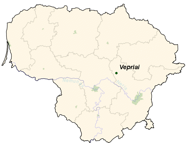
map_caption = Location of Vepriai
leader_title =
postal_code_type =
official_name = Vepriai
nickname =

image_shield =
|subdivision_type1=Ethnographic region
latd=55|latm=09|lats=00|latNS=N|longd=24|longm=34|longs=30|longEW=E
subdivision_name1 = Aukštaitija
|subdivision_type2=County
subdivision_name2 = Autolink|Vilnius County
|subdivision_type3=Municipality
subdivision_name3 = Autolink|Ukmergė district municipality
|subdivision_type4=Elderate
subdivision_name4 = Vepriai elderate
|subdivision_type6=Capital of
subdivision_name6 = Vepriai elderate
established_date = 1384|established_title=First mentioned
established_date2 =
subdivision_name5 =
population_total = 1000|population_footnotes=
population_as_of = 2005
population_blank1 =Vepriai (pronEng|ˈvæpreɪ, [væpriaǐ] ; _pl. Wieprze) is the largest
town inUkmergė district ,Lithuania , situated south-west ofUkmergė with population of about 1,000 (2005). The capital of Vepriaielderate .History
Vepriai was founded on a hill near Vepriai Lake and south of
Šventoji River . It is first mentioned inWigand of Marburg 's Chronicle of 1384 under the name of "Weperen".pl icon cite book | author = | coauthors = | title =Słownik geograficzny Królestwa Polskiego i innych krajów słowiańskich | year =1885 | editor =Filip Sulimierski , Bronisław Chlebowski, Władysław Walewski | pages =378 | publisher =Wł. Walewski | location =Warsaw | url =http://dir.icm.edu.pl/pl/Slownik_geograficzny/Tom_XIII/378 | volume=XIII | accessdate =2008-08-28 ] In theMiddle Ages Vepriai was a powerfulhill fort which has assisted in protection of Lithuanian lands from western threats, mainly theTeutonic Order . Wigand of Marburg asserted that the castle belonged to theGrand Duke of Lithuania . During the Lithuanian civil war of 1381–1384 the united forces of Grand Duke of LithuaniaVytautas and the Teutonic Order attacked and captured the castle in 1384. After the threats were eliminated, a wooden defensive castle on a "piliakalnis" was subsequently turned into a residential manor surrounded by a settlement, ruled by various noble families for several centuries.Since the first mention in 1542 its owners were
Kęsgailos family. Then it passed toOgiński ducal family. The place owned byAlexander Ogiński (1590-1653) became a dowry of his daughter Barbara Szemiott née Ogińska in the17th century and thus passed to the Szemiott (Šemetos) family but was taken back by Barbara's brotherMarcjan Aleksander Ogiński in 1681. Later it passed to theTyzenhauz family (again as a dowry) and eventually became disputed between it and theKossakowski family until 1779. In 1808 CountIgnacy Tyzenhauz sold it to Count Jozef Dominik Kossakowski. Following his death in 1840 the place was inherited by Kossakowski's daughter Pelagia, marrier to a Scottishesquire , former servant in theIndian Navy , AlexanderBower St. Clair. In 1855 the place once again changed hands, as it was sold toKsawery Podbereski and his wife Anna néeRoemer , who later sold it to CountAdam Alfred Plater . The Plater family owned the palace and the surrounding lands until 1923, when the area was nationalized by the Lithuanian state.The 17th century Renaissance palace on the Vepriai Mound was devastated by Swedish
troop s during theGreat Northern War and has been demolished later on. The other place closer to the lake has been selected for the new palace. The present Neoclassical palace was erected in the 19th century and is dominant in the manor ensemble. CountessEmilia Plater with her army has stayed in the manor during theNovember Uprising . The manor was nationalized in 1923 and has been used to house the newly established Vepriai Agricultural School since 1924.Vepriai became the center of the new parish in 1845 and has been the capital of VepriaiVolost from 1864 until 1950.Geography
The town is situated near the center of Vepriai Meteor Crater, the largest of craters found in Lithuania.
Vepriai is located in
Aukštaitija Region, in the Middle Lithuanian Lowlands, 4 km south of a majorhighway connecting Ukmergė,Jonava andKaunas cities. It is situated 11 km southwest ofDeltuva and 10,5 km northeast ofUpninkai .The third biggest river in Lithuania Šventoji flows just south of the town. Forests, hills and river
valley s are inherent to the landscape of Vepriai and its vicinity. The picturesque Vepriai Lake, situated 67 metersabove mean sea level , serves for fishing and various leisure activities of locals and arrivals. Due to its convenient placement, beautiful nature and rich heritage Vepriai is one of the most attractivetourism sites in Ukmergė District.tructures
The
derelict western pavilion of the Vepriai manor palace (19th century), decorated with aportico with 4column s of a simplifiedCorinthian order and painted in white, with the outhouse and remains of apark withpond s and a 130 m length lindenalley has survived until the present days.The neo-Gothic Vepriai
Roman Catholic Church of The Holy Virgin Mary the Queen of theRosary was built in 1910 in the place of an old wooden church. Construction of the church, designed by Władysław Stipulkowski, was funded by the Count Marian Broel - Plater and local farmers. The church suffered a belfry's blow-up byWehrmacht on26 July 1944 ; its restoration to the original appearance is pending.The oldest remaining structure in the town is a Baroque roadside chapel built after 1772 in commemoration of the
Bar Confederation . The chapel has one segment remaining which contains a large wooden figure ofcrucifix . It is the only surviving piece of the masonry Baroque architecture inUkmergė district .The largest construction took place in Vepriai center during the final decades of the
Soviet rule. In the place of the oldrectory and several other wooden buildings the modern public services' building was erected. Today it houses a shop, a bar and amotel . In the site of a demolishedwater mill a new dam was constructed in the 1990s. TheYoung Pioneer camp with 240 places used to be in the southern Vepriai since 1962, which was abandoned in the 1990s and reconstructed to the childrensummer camp in 2004.Culture
In the outskirts of the town the
Way of the Cross according to the Catholic tradition was created in 1846. Wooden chapels were replaced bymasonry chapels (aedicula s) from 1882 until 1900, only the chapel of theLast Supper ("Večernykas") and the chapel ofSt. Veronica 's Service have remained unchanged. Despite its complete destruction in winter of 1962–1963, Vepriai Way of the Cross has remained popular and has been attended abundantly throughout the Soviet occupation. The Way stretches for 5,5 km and is marked by brickchapel s, five wooden and one irongate s denotingStations of the Cross , most of which were restored in 1989. Vepriai Way of the Cross ("Veprių Kalvarijos") is one of the three remaining in Lithuania (together withVerkiai and Žemaičių Kalvarija) and is visited by local worshipers yearly inWhit Sunday ."
Joninės "' celebration has a vivid tradition in Vepriai. The feast takes place in Vepriaipinewood , near thehippodrome . It starts withhorse race , sports competitions, and performances of localfolk music bands and ends with lighting of thebonfire and a nightlong youthdiscotheque .Image gallery
References
External links
*lt icon [http://www.vepriai.ten.lt/ Vepriai website] - unofficial webpage of Vepriai town
*lt icon [http://www.vepriai.mums.lt/ Vepriai Community website]
Wikimedia Foundation. 2010.