- Tokyo
-
For other uses, see Tokyo (disambiguation).
Tokyo
東京— Metropolis — 東京都 · Tokyo Metropolis From top left: Nishi-Shinjuku, Tokyo Tower, Rainbow Bridge, Shibuya, National Diet Building

Seal
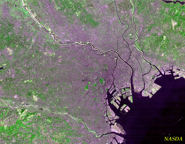
SymbolAnthem: Tokyo Metropolitan Song (東京都歌 Tokyo Toka)[1] Location of Tokyo within Japan Satellite photo of Tokyo's 23 Special wards taken by NASA's Landsat 7
 Location of Tokyo within Japan
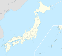
 Tokyo
TokyoCoordinates: 35°41′22.22″N 139°41′30.12″E / 35.6895056°N 139.6917°ECoordinates: 35°41′22.22″N 139°41′30.12″E / 35.6895056°N 139.6917°E Country Japan Region Kantō Island Honshu Divisions 23 special wards, 26 cities, 1 district, & 4 subprefectures Government - Type Metropolis - Governor Shintarō Ishihara - Capital Shinjuku Area(ranked 45th) - Total 2,187.66 km2 (844.7 sq mi) Population (August 1, 2011)[2] - Total 13,185,502 - Density 6,027.2/km2 (15,610.4/sq mi) - 23 Wards 8,967,665 (2011 per Prefectural Government) Demonym Tokyoite Time zone Japan Standard Time (UTC+9) ISO 3166-2 JP-13 Flower Somei-Yoshino cherry blossom Tree Ginkgo tree (Ginkgo biloba) Bird Black-headed Gull (Larus ridibundus) Website metro.tokyo.jp Tokyo (東京 Tōkyō, "Eastern Capital") [toːkjoː], English: /ˈtoʊki.oʊ/; officially Tokyo Metropolis (東京都 Tōkyō-to),[3] is one of the 47 prefectures of Japan. Tokyo is the capital of Japan, the center of the Greater Tokyo Area, and the largest metropolitan area of Japan. It is the seat of the Japanese government and the Imperial Palace, and the home of the Japanese Imperial Family. Tokyo is located in the Kantō region on the southeastern side of the main island Honshu and includes the Izu Islands and Ogasawara Islands.[4] Tokyo Metropolis was formed in 1943 from the merger of the former Tokyo Prefecture (東京府 Tōkyō-fu) and the city of Tokyo (東京市 Tōkyō-shi).
The Tokyo Metropolitan government administers the twenty-three special wards of Tokyo (each governed as a city), which cover the area that was the city of Tokyo, as well as 39 municipalities in the western part of the prefecture and the two outlying island chains. The population of the special wards is over 8 million people, with the total population of the prefecture exceeding 13 million. The prefecture is part of the world's most populous metropolitan area with upwards of 35 million people and the world's largest metropolitan economy with a GDP of US$1.479 trillion at purchasing power parity in 2008, ahead of New York City, which ranks second on the list.[5] The city hosts 47 of the Fortune Global 500 companies.[6]
Tokyo has been described as one of the three "command centers" for the world economy, along with New York City and London.[7] This city is considered an alpha+ world city, listed by the GaWC's 2008 inventory[8] and ranked third among global cities by Foreign Policy's 2010 Global Cities Index.[9] In 2010 Tokyo was named the second most expensive city for expatriate employees, according to the Mercer and Economist Intelligence Unit cost-of-living surveys,[10] and named the fourth Most Liveable City and the World’s Most Livable Megalopolis by the magazine Monocle.[11] The Michelin Guide has awarded Tokyo by far the most Michelin stars of any city in the world.[12][13] Tokyo hosted the 1964 Summer Olympics and is currently bidding to host the 2020 Summer Olympics.[14]
Contents
Etymology
Tokyo was originally known as Edo, meaning "estuary".[15] Its name was changed to Tokyo (Tōkyō: tō (east) + kyō (capital)) when it became the imperial capital in 1868, in line with the East Asian tradition of including the word capital ('京') in the name of the capital city.[15] During the early Meiji period, the city was also called "Tōkei", an alternative pronunciation for the same Chinese characters representing "Tokyo". Some surviving official English documents use the spelling "Tokei".[16] However, this pronunciation is now obsolete.[17]
History
Main article: History of TokyoTokyo was originally a small fishing village named Edo,[4] located in what was formerly part of the old Musashi Province.[18]
Edo was first fortified by the Edo clan, in the late 12th century. In 1457, Ōta Dōkan built Edo Castle. In 1590, Tokugawa Ieyasu made Edo his base and when he became shogun in 1603, the town became the center of his nationwide military government. During the subsequent Edo period, Edo grew into one of the largest cities in the world with a population topping one million by the 18th century.[19]
It became the de facto capital of Japan[20] even while the emperor lived in Kyoto, the imperial capital. After about 263 years, the shogunate was overthrown under the banner of restoring imperial rule. In 1869, the 17-year-old Emperor Meiji moved to Edo. Tokyo was already the nation's political and cultural center,[21] and the emperor's residence made it a de facto imperial capital as well, with the former Edo Castle becoming the Imperial Palace. The city of Tokyo was established, and continued to be the capital until it was abolished as a municipality in 1943 and merged with the "Metropolitan Prefecture" of Tokyo.
Central Tokyo, like Osaka, has been designed since about 1900 to be centered on major railway stations in a high-density fashion, so suburban railways were built relatively cheaply at street level and with their own right-of-way. This differs from many cities in the United States that are low-density and automobile-centric. Though expressways have been built in Tokyo, the basic design has not changed.
Tokyo went on to suffer two major catastrophes in the 20th century, but it recovered from both. One was the 1923 Great Kantō earthquake, which left 140,000 dead or missing,[22] and the other was World War II. The Bombing of Tokyo in 1944 and 1945, with 75,000 to 200,000 killed and half of the city destroyed, was almost as devastating as the atomic bombs of Hiroshima and Nagasaki combined.[23]
After the war, Tokyo was completely rebuilt, and was showcased to the world during the 1964 Summer Olympics. The 1970s brought new high-rise developments such as Sunshine 60, a new and controversial[24] airport at Narita in 1978 (some distance outside city limits), and a population increase to about 11 million (in the metropolitan area).
Tokyo's subway and commuter rail network became one of the busiest in the world[25] as more and more people moved to the area. In the 1980s, real estate prices skyrocketed during a real estate and debt bubble. The bubble burst in the early 1990s, and many companies, banks, and individuals were caught with mortgage backed debts while real estate was shrinking in value. A major recession followed, making the 1990s Japan's "Lost Decade"[26] from which it is now slowly recovering.
Tokyo still sees new urban developments on large lots of less profitable land. Recent projects include Ebisu Garden Place, Tennozu Isle, Shiodome, Roppongi Hills, Shinagawa (now also a Shinkansen station), and the Marunouchi side of Tokyo Station. Buildings of significance are demolished for more up-to-date shopping facilities such as Omotesando Hills.
Land reclamation projects in Tokyo have also been going on for centuries. The most prominent is the Odaiba area, now a major shopping and entertainment center. Various plans have been proposed[27] for transferring national government functions from Tokyo to secondary capitals in other regions of Japan, in order to slow down rapid development in Tokyo and revitalize economically lagging areas of the country. These plans have been controversial[28] within Japan and have yet to be realized.
The 2011 Tōhoku earthquake and tsunami that devastated much of the northeastern coast of Honshu was felt in Tokyo. However, due to Tokyo's earthquake-proof infrastructure, damage in Tokyo was very minor compared to areas directly hit by the tsunami,[29] although activity in the city was largely halted.[30] The subsequent nuclear crisis caused by the tsunami has also largely unaffected Tokyo, despite occasional spikes in radiation levels.[31]
Geography and administrative divisions
Main articles: Politics of Tokyo and List of mergers in TokyoTokyo Climate chart (explanation) J F M A M J J A S O N D 5210356103118136125191113823151682619154292316831252102721198221593171051125Average max. and min. temperatures in °C Precipitation totals in mm Source: JMA Imperial conversion J F M A M J J A S O N D 250372.251374.656424.966515.473606.678666.185736.688768.381707.871603.7625025441Average max. and min. temperatures in °F Precipitation totals in inches The mainland portion of Tokyo lies northwest of Tokyo Bay and measures about 90 km east to west and 25 km north to south. Chiba Prefecture borders it to the east, Yamanashi to the west, Kanagawa to the south, and Saitama to the north. Mainland Tokyo is further subdivided into the special wards (occupying the eastern half) and the Tama area (多摩地域) stretching westwards.
Also within the administrative boundaries of Tokyo Metropolis are two island chains in the Pacific Ocean directly south: the Izu Islands, and the Ogasawara Islands, which stretch more than 1,000 km away from the mainland. Because of these islands and mountainous regions to the west, Tokyo's overall population density figures far underrepresent the real figures for urban and suburban regions of Tokyo.
Under Japanese law, Tokyo is designated as a to (都), translated as metropolis.[32] Its administrative structure is similar to that of Japan's other prefectures. Within Tokyo lie dozens of smaller entities, including many cities, the twenty-three special wards, districts, towns, villages, a quasi-national park, and a national park. The twenty-three special wards (特別区 -ku), which until 1943 constituted the city of Tokyo, are now separate, self-governing municipalities, each having a mayor, a council, and the status of a city.
In addition to these 23 special wards, Tokyo also includes 26 more cities (市 -shi), five towns (町 -chō or machi), and eight villages (村 -son or -mura), each of which has a local government. The Tokyo Metropolitan Government is headed by a publicly elected governor and metropolitan assembly. Its headquarters are in the ward of Shinjuku. They govern all of Tokyo, including lakes, rivers, dams, farms, remote islands, and national parks in addition to its neon jungles, skyscrapers and crowded subways.
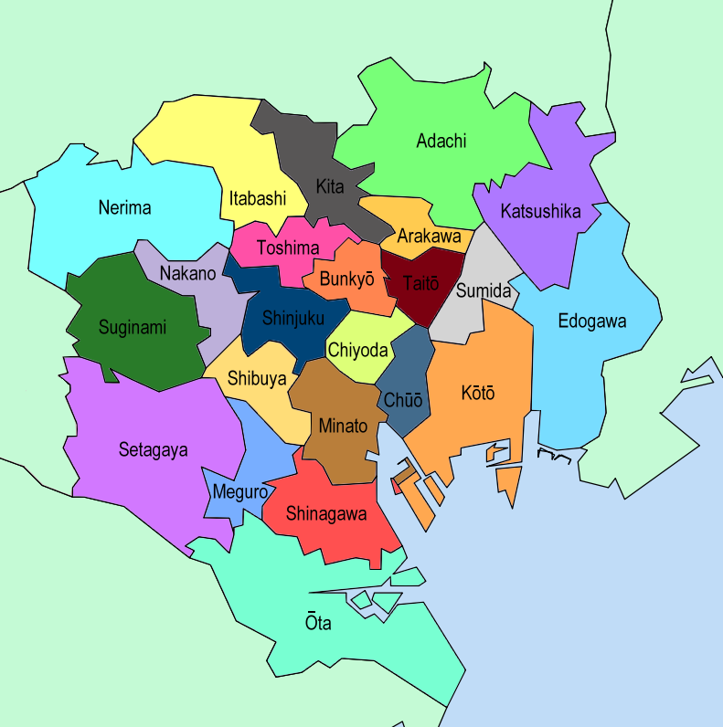
Special wards
 A map of Tokyo's 23 Special wards
The special wards (tokubetsu-ku) of Tokyo comprise the area formerly incorporated as Tokyo City. On July 1, 1943, Tokyo City was merged with Tokyo Prefecture (東京府 Tōkyō-fu) forming the current "metropolitan prefecture". As a result, unlike other city wards in Japan, these wards are not part of any larger incorporated city. Each ward is a municipality with its own elected mayor and assembly like the other cities of Japan. The special wards use the word "city" in their official English name (e.g. Chiyoda City).
The wards differ from other cities in having a unique administrative relationship with the prefectural government. Certain municipal functions, such as waterworks, sewerage, and fire-fighting, are handled by the Tokyo Metropolitan Government. To pay for the added administrative costs, the prefecture collects municipal taxes, which would usually be levied by the city.[33]
The special wards of Tokyo are:
The "three core wards" of Tokyo are Chiyoda, Chūō and Minato.[34]
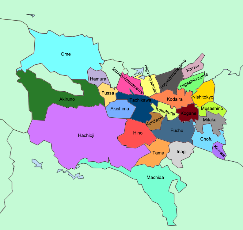
Western Tokyo
 A map of cities in western part of Tokyo
To the west of the special wards, Tokyo Metropolis consists of cities, towns and villages that enjoy the same legal status as those elsewhere in Japan.
While serving as "bed towns" for those working in central Tokyo, some of these also have a local commercial and industrial base. Collectively, these are often known as the Tama Area or Western Tokyo.
Cities
Twenty-six cities lie within the western part of Tokyo:
- Machida
- Mitaka
- Musashimurayama
- Musashino
- Nishitōkyō
- Ōme
- Tachikawa
- Tama
The Tokyo Metropolitan Government has designated Hachiōji, Tachikawa, Machida, Ōme and Tama New Town as regional centers of the Tama area,[35] as part of its plans to disperse urban functions away from central Tokyo.
Nishitama District
The far west is occupied by the district (gun) of Nishitama. Much of this area is mountainous and unsuitable for urbanization. The highest mountain in Tokyo, Mount Kumotori, is 2,017 m high; other mountains in Tokyo include Takasu (1737 m), Odake (1266 m), and Mitake (929 m). Lake Okutama, on the Tama River near Yamanashi Prefecture, is Tokyo's largest lake. The district is composed of three towns and one village.
Towns
Village
Islands
Tokyo has numerous outlying islands, which extend as far as 1850 km from central Tokyo. Because of the islands' distance from the administrative headquarters of the metropolitan government in Shinjuku, local offices administer them.
The Izu Islands are a group of volcanic islands and form part of the Fuji-Hakone-Izu National Park. The islands in order from closest to Tokyo are Izu Ōshima, Toshima, Niijima, Shikinejima, Kozushima, Miyakejima, Mikurajima, Hachijojima, and Aogashima. The Izu Islands are grouped into three subprefectures. Izu Ōshima and Hachijojima are towns. The remaining islands are six villages, with Niijima and Shikinejima forming one village.
The Ogasawara Islands include, from north to south, Chichi-jima, Nishinoshima, Haha-jima, Kita Iwo Jima, Iwo Jima, and Minami Iwo Jima. Ogasawara also administers two tiny outlying islands: Minami Torishima, the easternmost point in Japan and at 1,850 km the most distant island from central Tokyo, and Okino Torishima, the southernmost point in Japan. The last island is contested by the People's Republic of China as being only uninhabited rocks. The Iwo chain and the outlying islands have no permanent population, but host Japanese Self-Defense Forces personnel. Local populations are only found on Chichi-jima and Haha-jima. The islands form both the subprefecture of Ogasawara and the village of Ogasawara.
Subprefecture Municipality Type Hachijō Hachijō Town Aogashima Village Miyake Miyake Village Mikurajima Village Ōshima Ōshima Town Toshima Village Niijima Village Kōzushima Village Ogasawara Ogasawara Village National parks
There are several national parks within Tokyo, among them:
- Meiji no Mori Takao Quasi-National Park, around Mount Takao to the south of Hachiōji
- Ogasawara National Park. As of 2006, efforts were being made to make Ogasawara National Park a UNESCO natural World Heritage Site.
- Ueno Park, well known for its museums: Tokyo National Museum, National Science Museum, Shitamachi Museum and National Museum for Western Art, among others. There are also art works and statues at several places in the park.
Seismicity
Tokyo was hit by powerful earthquakes in 1703, 1782, 1812, 1855, and 1923.[36][37] The 1923 earthquake, with an estimated magnitude of 8.3, killed 142,000 people. Tokyo is located near the boundary of three plates.
Climate
The former city of Tokyo and the majority of mainland Tokyo lie in the humid subtropical climate zone (Köppen climate classification Cfa),[38] with hot humid summers and generally mild winters with cool spells. The region, like much of Japan, experiences a one-month seasonal lag, with the warmest month being August, which averages 27.5 °C (81.5 °F), and the coolest month being January, averaging 6.0 °C (42.8 °F). Annual rainfall averages nearly 1,530 millimetres (60.2 in), with a wetter summer and a drier winter. Snowfall is sporadic, but does occur almost annually.[39] Tokyo also often sees typhoons each year, though few are strong. The last one to hit was Fitow in 2007.[40]
Climate data for Tokyo (wards area, 1981-2000) Month Jan Feb Mar Apr May Jun Jul Aug Sep Oct Nov Dec Year Average high °C (°F) 9.9
(49.8)10.4
(50.7)13.3
(55.9)18.8
(65.8)22.8
(73.0)25.5
(77.9)29.4
(84.9)31.1
(88.0)27.2
(81.0)21.8
(71.2)16.9
(62.4)12.4
(54.3)19.96
(67.92)Average low °C (°F) 2.5
(36.5)2.9
(37.2)5.6
(42.1)10.7
(51.3)15.4
(59.7)19.1
(66.4)23.0
(73.4)24.5
(76.1)21.1
(70.0)15.4
(59.7)9.9
(49.8)5.1
(41.2)12.93
(55.28)Precipitation mm (inches) 52.3
(2.059)56.1
(2.209)117.5
(4.626)124.5
(4.902)137.8
(5.425)167.7
(6.602)153.5
(6.043)168.2
(6.622)209.9
(8.264)197.8
(7.787)92.5
(3.642)51.0
(2.008)1,528.8
(60.189)% humidity 49 50 55 60 65 72 73 71 71 66 59 52 61.9 Avg. precipitation days (≥ 1.0 mm) 4.6 5.8 9.5 10.1 9.6 11.9 10.4 8.2 11.3 9.1 6.2 3.8 100.5 Avg. snowy days 2.8 3.7 2.2 0.2 0 0 0 0 0 0 0 0.8 9.7 Sunshine hours 187.9 167.3 163.1 175.4 172.5 123.2 143.9 175.3 117.8 133.4 146.6 175.0 1,881.4 Source no. 1: Japan Meteorological Agency [41] Source no. 2: Hong Kong Observatory (precip. days) [42] Environment
Tokyo has enacted a measure to cut greenhouse gases. Governor Shintaro Ishihara created Japan's first emissions cap system, aiming to reduce greenhouse gas emission by a total of 25% by 2020 from the 2000 level.[43]
Tokyo is an example of an urban heat island, and the phenomenon is especially serious in its special wards.[40][44] According to the Tokyo Metropolitan Government,[45] the annual mean temperature has increased by about 3 °C (5.4 °F) over the past 100 years. Tokyo has been cited as a "convincing example of the relationship between urban growth and climate."[46]
Demographics
Population of Tokyo[2] By area1 Tokyo
Special wards
Tama Area
Islands12.79 million
8.653 million
4.109 million
28,000By age² Juveniles (age 0-14)
Working (age 15-64)
Retired (age 65+)1.461 million (11.8%)
8.546 million (69.3%)
2.332 million (18.9%)By hours³ Day
Night14.978 million
12.416 millionBy nationality Foreign residents
364,6534
1 Estimates as of October 1, 2007.
² as of January 1, 2007.
³ as of 2005 National Census.
4 as of January 1, 2006.
As of October 2007, the official intercensal estimate showed 12.79 million people in Tokyo with 8.653 million living within Tokyo's 23 wards.[2] During the daytime, the population swells by over 2.5 million as workers and students commute from adjacent areas. This effect is even more pronounced in the three central wards of Chiyoda, Chūō, and Minato, whose collective population as of the 2005 National Census was 326,000 at night, but 2.4 million during the day.[2]
The entire prefecture had 12,790,000 residents in October 2007 (8,653,000 in 23 wards), with an increase of over 3 million in the day. Tokyo is at its highest population ever, while that of the 23 wards peak official count was 8,893,094 in the 1965 Census, with the count dipping below 8 million in the 1995 Census.[citation needed] People continue to move back into the core city as land prices have fallen dramatically.[citation needed]
As of 2005, the most common foreign nationalities found in Tokyo are Chinese (123,661), Korean (106,697), Filipino (31,077), American (18,848), British (7,696), Brazilian (5,300) and French (3,000).[47]
The 1889 Census[citation needed] recorded 1,389,600 people in Tokyo City, Japan's largest city at the time.
Economy


Tokyo has the largest metropolitan economy in the world. According to a study conducted by PricewaterhouseCoopers, the Tokyo urban area (35.2 million people) had a total GDP of US$1.479 trillion in 2008 (at purchasing power parity), which topped the list.[5] As of 2009, 51 of the companies listed on the Global 500 are based in Tokyo, almost twice that of the second-placed city (Paris).[48]
Tokyo is a major international finance center,[49] houses the headquarters of several of the world's largest investment banks and insurance companies, and serves as a hub for Japan's transportation, publishing, and broadcasting industries. During the centralized growth of Japan's economy following World War II, many large firms moved their headquarters from cities such as Osaka (the historical commercial capital) to Tokyo, in an attempt to take advantage of better access to the government. This trend has begun to slow due to ongoing population growth in Tokyo and the high cost of living there.
Tokyo was rated by the Economist Intelligence Unit as the most expensive (highest cost-of-living) city in the world for 14 years in a row ending in 2006.[50] This analysis is for living a corporate executive lifestyle, with items like a detached house and several automobiles.[citation needed]
The Tokyo Stock Exchange is Japan's largest stock exchange, and third largest in the world by market capitalization and fourth largest by share turnover. In 1990 at the end of the Japanese asset price bubble, it accounted for more than 60% of the world stock market value.[51] Tokyo had 8,460 ha (20,900 acres) of agricultural land as of 2003,[52] according to the Ministry of Agriculture, Forestry and Fisheries, placing it last among the nation's prefectures. The farmland is concentrated in Western Tokyo. Perishables such as vegetables, fruits, and flowers can be conveniently shipped to the markets in the eastern part of the prefecture. Komatsuna and spinach are the most important vegetables; as of 2000, Tokyo supplied 32.5% of the komatsuna sold at its central produce market.
With 36% of its area covered by forest, Tokyo has extensive growths of cryptomeria and Japanese cypress, especially in the mountainous western communities of Akiruno, Ōme, Okutama, Hachiōji, Hinode, and Hinohara. Decreases in the price of lumber, increases in the cost of production, and advancing old age among the forestry population have resulted in a decline in Tokyo's output. In addition, pollen, especially from cryptomeria, is a major allergen for the nearby population centers.
Tokyo Bay was once a major source of fish.[citation needed] Presently, most of Tokyo's fish production comes from the outer islands, such as Izu Ōshima and Hachijōjima. Skipjack tuna, nori, and aji are among the ocean products.[citation needed]
Tourism in Tokyo is also a contributor to the economy.
Transportation
Main article: Transportation in Greater Tokyo Map of Tokyo Subway system
Tokyo, as the center of the Greater Tokyo Area, is Japan's largest domestic and international hub for rail, ground, and air transportation. Public transportation within Tokyo is dominated by an extensive network of clean and efficient[53] trains and subways run by a variety of operators, with buses, monorails and trams playing a secondary feeder role.
Within Ōta, one of the 23 special wards, Haneda Airport offers domestic and international flights. Outside Tokyo, Narita International Airport, in Chiba Prefecture, is the major gateway for international travelers to Japan and Japan's flag carrier Japan Airlines, All Nippon Airways, Delta Air Lines, and United Airlines all have a hub at this airport.
Various islands governed by Tokyo have their own airports. Hachijōjima (Hachijojima Airport), Miyakejima (Miyakejima Airport), and Izu Ōshima (Oshima Airport) have services to Tokyo International and other airports.
Rail is the primary mode of transportation in Tokyo, which has the most extensive urban railway network in the world and an equally extensive network of surface lines. JR East operates Tokyo's largest railway network, including the Yamanote Line loop that circles the center of downtown Tokyo. Two organizations operate the subway network: the private Tokyo Metro and the governmental Tokyo Metropolitan Bureau of Transportation. The metropolitan government and private carriers operate bus routes. Local, regional, and national services are available, with major terminals at the giant railroad stations, including Tokyo, Shinagawa, and Shinjuku.
Expressways link the capital to other points in the Greater Tokyo area, the Kantō region, and the islands of Kyūshū and Shikoku.
Other transportation includes taxis operating in the special wards and the cities and towns. Also long-distance ferries serve the islands of Tokyo and carry passengers and cargo to domestic and foreign ports.
Education
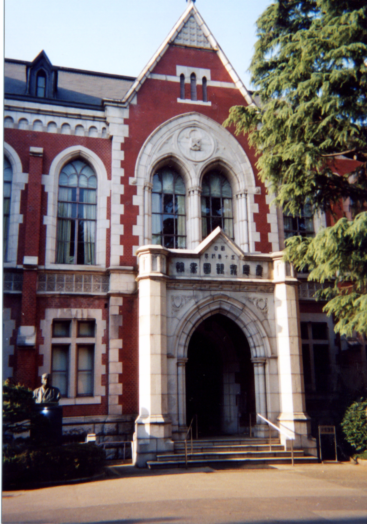
Main article: Education in Tokyo University of Tokyo, Yasuda Auditorium
Tokyo has many universities, junior colleges, and vocational schools. Many of Japan's most prestigious universities are in Tokyo, including University of Tokyo, Hitotsubashi University, Tokyo Institute of Technology, Keio University,and Waseda University, .[54] Some of the biggest national universities located in Tokyo are:
- Ochanomizu University
- University of Electro-Communications
- National Graduate Institute for Policy Studies
- University of Tokyo
- Tokyo Medical and Dental University
- Tokyo University of Foreign Studies
- Tokyo University of Marine Science and Technology
- Tokyo Gakugei University
- Tokyo University of the Arts
- Tokyo Institute of Technology
- Tokyo University of Agriculture and Technology
- Hitotsubashi University.
There is only one non-national public university: Tokyo Metropolitan University.
There are also a few universities well known for classes conducted in English and for the teaching of the Japanese language. They include:
- International Christian University
- Sophia University
- Waseda University
- Temple University Japan
For an extensive list, see List of universities in Tokyo.
Publicly-run kindergartens, elementary schools (years 1 through 6), and junior high schools (7 through 9) are operated by local wards or municipal offices. Public high schools in Tokyo are run by the Tokyo Metropolitan Government Board of Education and are called "Metropolitan High Schools". Tokyo also has many private schools from kindergarten through high school.[55]
Culture
 Tokyo National Museum, Ueno
Tokyo has many museums. In Ueno Park, there is the Tokyo National Museum, the country's largest museum and specializing in traditional Japanese art; the National Museum of Western Art; the National Museum of Science and Ueno Zoo. Other museums include the Nezu Art Museum in Aoyama; the Edo-Tokyo Museum in Sumida, across the Sumida River from the center of Tokyo; and the National Diet Library, National Archives, and the National Museum of Modern Art, which are near the Imperial Palace.
Tokyo has many theaters for performing arts. These include national and private theaters for traditional forms of Japanese drama (such as noh and kabuki) as well as modern drama. Symphony orchestras and other musical organizations perform modern and traditional music. Tokyo also hosts modern Japanese and international pop and rock music at venues ranging in size from intimate clubs to internationally-known arenas such as the Nippon Budokan.
Many different festivals occur throughout Tokyo. Major events include the Sannō at Hie Shrine, the Sanja at Asakusa Shrine, and the biennial Kanda Festivals. The last features a parade with elaborately decorated floats and thousands of people. Annually on the last Saturday of July, an enormous fireworks display over the Sumida River attracts over a million viewers. Once cherry blossoms, or sakura, bloom in spring, many residents gather in Ueno Park, Inokashira Park, and the Shinjuku Gyoen National Garden for picnics under the blossoms.
Harajuku, a neighborhood in Shibuya, is known internationally for its youth style, fashion[56] and cosplay.
Cuisine in Tokyo is internationally acclaimed. In November 2007, Michelin released their guide for fine dining in Tokyo, awarding 191 stars in total, or about twice as many as Tokyo's nearest competitor, Paris. Eight establishments were awarded the maximum of three stars (Paris has 10), 25 received two stars, and 117 earned one star. Of the eight top-rated restaurants, three offer traditional Japanese fine dining, two are sushi houses and three serve French cuisine.[57]
Sports

 Ryōgoku Kokugikan sumo wrestling arenaMain article: Sports in Tokyo
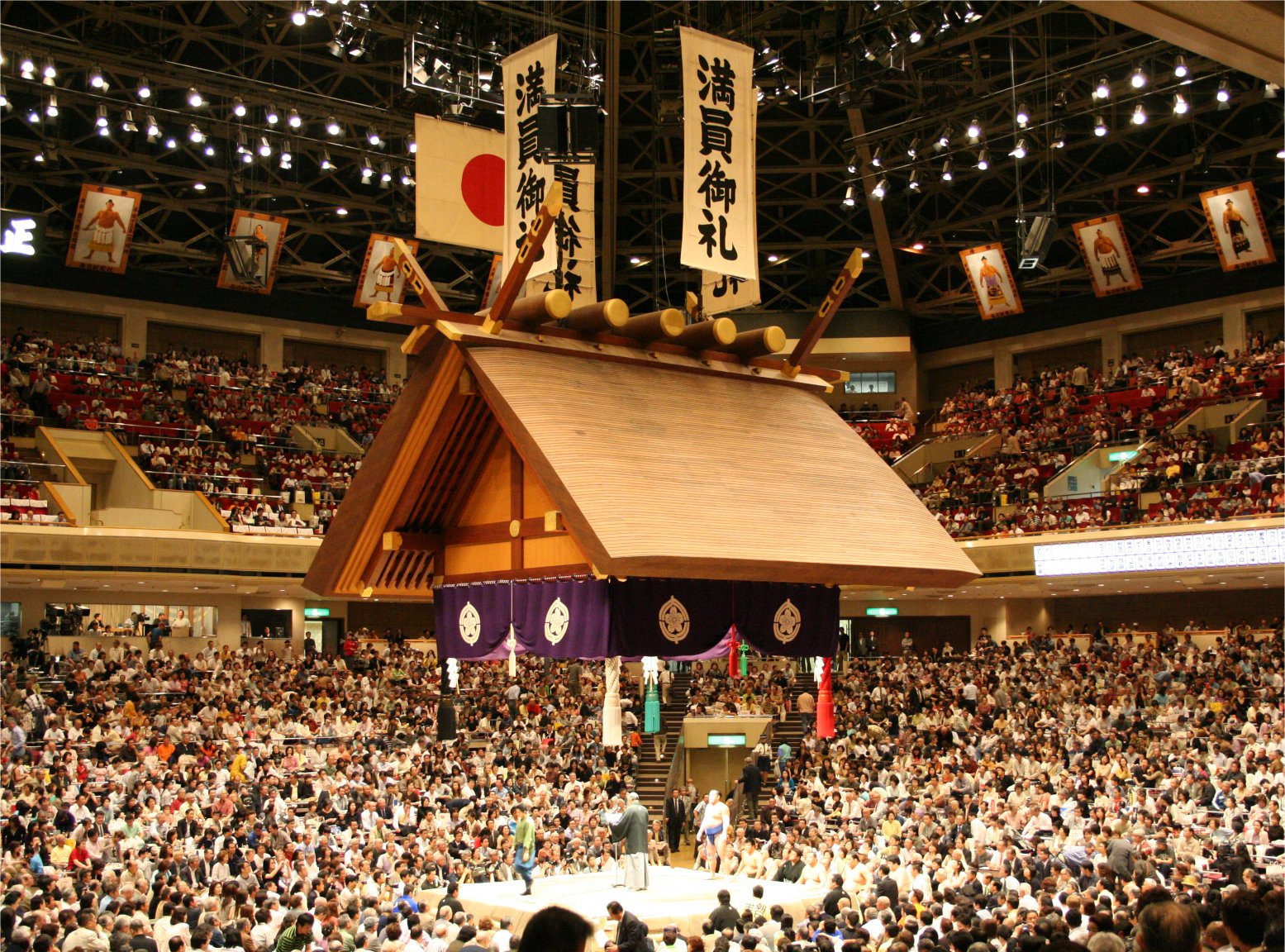
Tokyo, with a diverse array of sports, is home to two professional baseball clubs, the Yomiuri Giants who play at the Tokyo Dome and Tokyo Yakult Swallows at Meiji-Jingu Stadium. The Japan Sumo Association is also headquartered in Tokyo at the Ryōgoku Kokugikan sumo arena where three official sumo tournaments are held annually (in January, May, and September). Football (soccer) clubs in Tokyo include F.C. Tokyo and Tokyo Verdy 1969, both of which play at Ajinomoto Stadium in Chōfu.
Tokyo hosted the 1964 Summer Olympics. The National Stadium, also known as the Olympic Stadium is host to a number of international sporting events. With a number of world-class sports venues, Tokyo often hosts national and international sporting events such as tennis tournaments, swim meets, marathons, American football exhibition games, judo, and karate. Tokyo Metropolitan Gymnasium, in Sendagaya, Shibuya, is a large sports complex that includes swimming pools, training rooms, and a large indoor arena. According to Around the Rings, the gymnasium will play host to the October 2011 artistic gymnastics world championships, despite the International Gymnastics Federation's initial doubt in Tokyo's ability to host the championships following the March 11 tsunami. Tokyo is currently bidding to host the 2020 Summer Olympics.[58]
In popular culture
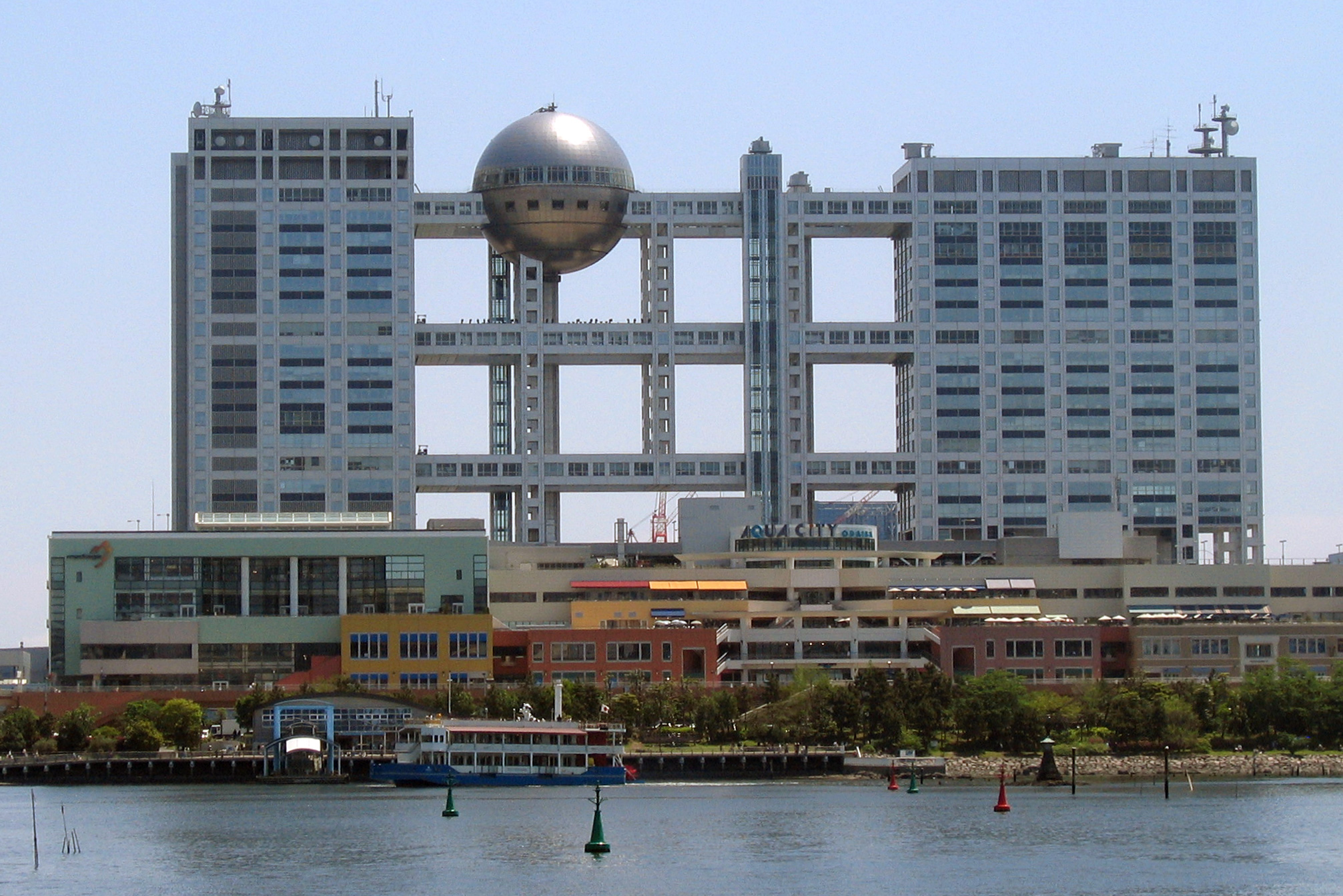
 Fuji TV headquarters
As the largest population center in Japan and the location of the country's largest broadcasters and studios, Tokyo is frequently the setting for many Japanese movies, television shows, animated series (anime), web comics, and comic books (manga). In the kaiju (monster movie) genre, landmarks of Tokyo are routinely destroyed by giant monsters such as Godzilla.
Some Hollywood directors have turned to Tokyo as a filming location for movies set in Tokyo. Well-known examples from the postwar era include Tokyo Joe, My Geisha, and the James Bond film You Only Live Twice; well-known contemporary examples include Kill Bill, The Fast and the Furious: Tokyo Drift and Lost in Translation.
Cityscape
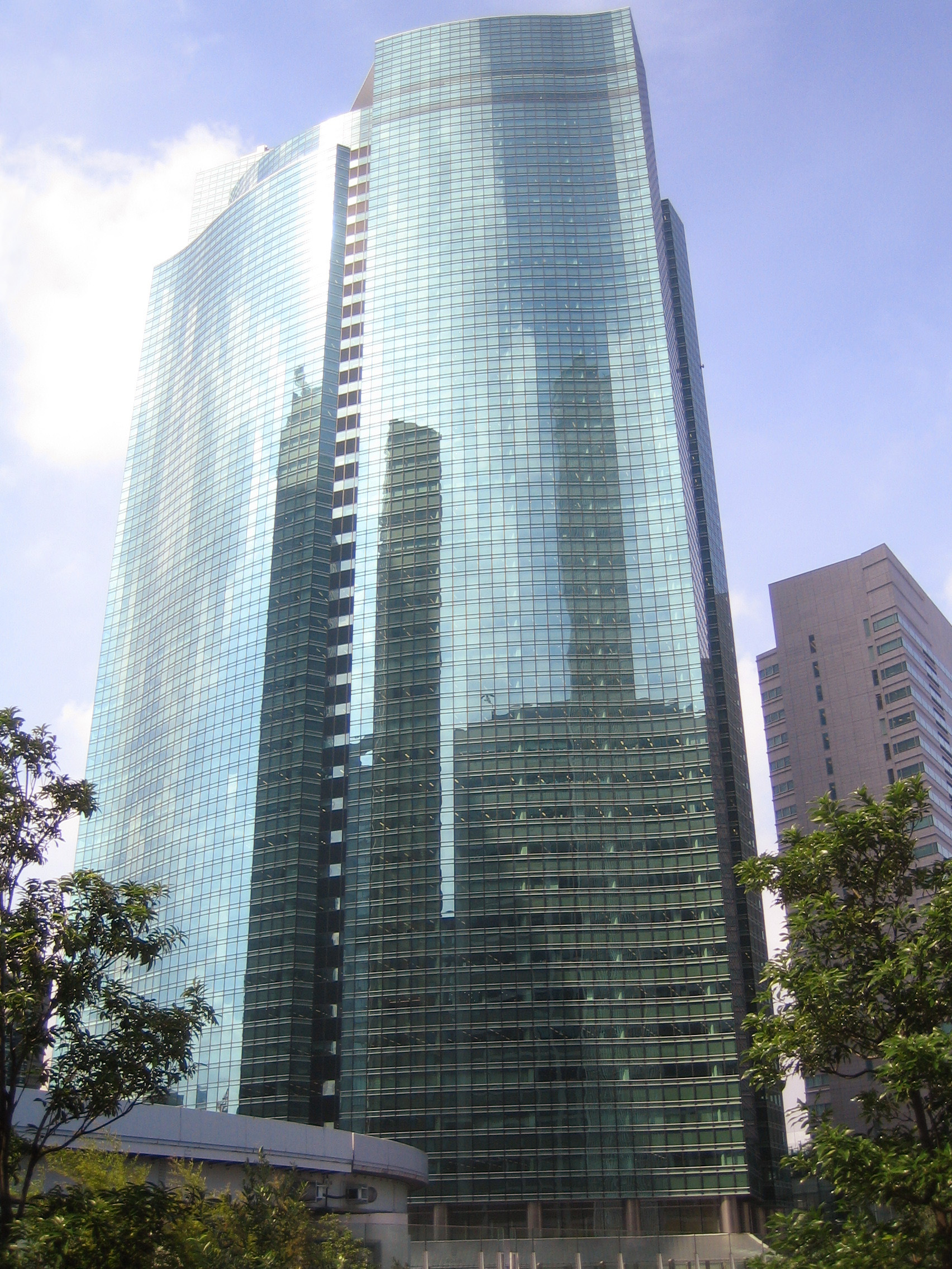
Architecture in Tokyo has largely been shaped by Tokyo's history. Twice in recent history has the metropolis been left in ruins: first in the 1923 Great Kantō earthquake and later after extensive firebombing in World War II.[59] Because of this, Tokyo's current urban landscape is one of modern and contemporary architecture, and older buildings are scarce.[59] Tokyo features many internationally famous forms of modern architecture including Tokyo International Forum, Asahi Beer Hall, Mode Gakuen Cocoon Tower and Rainbow Bridge. Tokyo also features two distinctive towers: Tokyo Tower and the new Tokyo Sky Tree which is the tallest tower in Japan and the second tallest structure in the world.[60]
Tokyo also contains numerous parks and gardens.
 Panoramic view of Shinjuku and Mount Fuji taken from Bunkyo Civic Center
 Sakura in Tokyo Imperial Palace
 Portion of city from the Tokyo Imperial Palace.
International relations
Twin towns – Sister cities
Tokyo is twinned with the following cities and states:[61]
 Beijing, China
 Berlin, Germany
 Cairo, Egypt
 Jakarta, Indonesia
 Moscow, Russia
 New South Wales, Australia
 New York City, United States
 Paris, France
 Rome, Italy
 São Paulo State, Brazil
 Seoul, South Korea
Partnerships
In addition, Tokyo has a "partnership" agreement with:
See also
- 1703 Genroku earthquake
- List of development projects in Tokyo
Notes
- ^ "東京都歌・市歌". Tokyo Metropolitan Government. http://www.seikatubunka.metro.tokyo.jp/bunka/keishou/tokasika.htm. Retrieved September 17, 2011.
- ^ a b c d "Population of Tokyo". Tokyo Metropolitan Government. http://www.metro.tokyo.jp/ENGLISH/PROFILE/overview03.htm. Retrieved 2009-01-01.
- ^ "Geography of Tokyo". Tokyo Metropolitan Government. http://www.metro.tokyo.jp/ENGLISH/PROFILE/overview02.htm. Retrieved 2008-10-18.
- ^ a b Nussbaum, Louis-Frédéric. (2005). "Tōkyō" in Japan Encyclopedia, pp. 981-982 at Google Books; "Kantō" in p. 479 at Google Books.
- ^ a b "Global city GDP rankings 2008-2025". Pricewaterhouse Coopers. https://www.ukmediacentre.pwc.com/imagelibrary/downloadMedia.ashx?MediaDetailsID=1562. Retrieved 2009-11-27.
- ^ Fortune. "Global Fortune 500 by countries: Japan". CNN. http://money.cnn.com/magazines/fortune/global500/2011/countries/Japan.html. Retrieved 2011-07-22.
- ^ Sassen, Saskia (2001). The Global City: New York, London, Tokyo (2nd ed.). Princeton University Press. ISBN 0691070636.
- ^ "GaWC - The World According to GaWC 2008". Lboro.ac.uk. 2010-04-13. http://www.lboro.ac.uk/gawc/world2008t.html. Retrieved 2010-10-29.
- ^ "THE GLOBAL CITIES INDEX 2010". Foreignpolicy.com. http://www.foreignpolicy.com/articles/2010/08/11/the_global_cities_index_2010. Retrieved 2010-10-29.
- ^ The Mercer 2009 Cost of Living Survey.
- ^ Fawkes, Piers (2009-06-18). "Top 25 Most Liveable Cities 2009 - Monocle". PSFK.com. http://www.psfk.com/2009/06/top-25-most-liveable-cities-2009-monocle-magazine-zurich-copenhagen-tokyo-munich-helsinki.html. Retrieved 2009-07-06.
- ^ (Japanese) "「ミシュランガイド東京・横浜・鎌倉2011」を発行 三つ星が14軒、二つ星が54軒、一つ星が198軒に", Michelin Japan, November 24, 2010.
- ^ Tokyo is Michelin's biggest star From The Times November 20, 2007
- ^ http://www.olympic.org/media?articleid=138217
- ^ a b Room, Adrian. Placenames of the World. McFarland & Company (1996), p360. ISBN 0786418141.
- ^ Fiévé, Nicolas and Paul Waley (2003). Japanese Capitals in Historical Perspective: Place, Power and Memory in Kyoto, Edo and Tokyo. p. 253.
- ^ "明治東京異聞~トウケイかトウキョウか~東京の読み方" Tokyo Metropolitan Archives (2004). Retrieved on September 13, 2008. (Japanese)
- ^ Nussbaum, "Provinces and prefectures" at p. 780 at Google Books.
- ^ McClain, James et al., James (1994). Edo and Paris: Urban Life and the State in the Early Modern Era. p. 13.
- ^ Sorensen, Andre (2004). The Making of Urban Japan: Cities and Planning from Edo to the Twenty First Century. p. 16.
- ^ "History of Tokyo". Tokyo Metropolitan Government. http://www.metro.tokyo.jp/ENGLISH/PROFILE/overview01.htm. Retrieved 2007-10-17.
- ^ Tokyo-Yokohama earthquake of 1923. Britannica Online Encyclopedia.
- ^ Tipton, Elise K. (2002). Modern Japan: A Social and Political History. Routledge. p. 141. ISBN 0585453225.
- ^ "Tokyo Narita International Airport (NRT) Airport Information (Tokyo, Japan)". Retrieved on September 11, 2008.
- ^ "Rail Transport in The World's Major Cities" (PDF). Japan Railway and Transport Review. http://www.jrtr.net/jrtr25/pdf/f04_oka.pdf. Retrieved 2007-10-17.
- ^ Saxonhouse, Gary R. (ed.); Robert M. Stern (ed.) (2004). Japan's Lost Decade: Origins, Consequences and Prospects for Recovery. Blackwell Publishing Limited. ISBN 1405119179.
- ^ "Shift of Capital from Tokyo Committee". Japan Productivity Center for Socio-Economic Development. Archived from the original on August 25, 2007. http://web.archive.org/web/20070825113931/http://www.jpc-sed.or.jp/eng/committee/committee06.html. Retrieved 2007-10-14.
- ^ "Policy Speech by Governor of Tokyo, Shintaro Ishihara at the First Regular Session of the Metropolitan Assembly, 2003". Tokyo Metropolitan Government. http://www.metro.tokyo.jp/ENGLISH/GOVERNOR/SPEECH/2003/0301/2.htm. Retrieved 2007-10-17.
- ^ "Despite Major Earthquake Zero Tokyo Buildings Collapsed Thanks to Stringent Building Codes". http://inhabitat.com/despite-record-breaking-earthquake-no-buildings-in-tokyo-collapsed-thanks-to-stringent-building-codes/. Retrieved 11 October 2011.
- ^ Williams, Carol J.. "Japan earthquake disrupts Tokyo, leaves capital only lightly damaged". http://www.latimes.com/. http://articles.latimes.com/2011/mar/11/world/la-fgw-japan-quake-tokyo-20110311. Retrieved 11 October 2011.
- ^ "Tokyo radiation levels – daily updates – April". http://chottomatte.net/2011/04/01/tokyo-radiation-levels-daily-updates-april/. Retrieved 11 October 2011.
- ^ "Local Government in Japan" (PDF). Council of Local Authorities for International Relations. p. 8. http://70.86.96.100/pdfs/en/localg2006.pdf. Retrieved 2008-09-14.
- ^ The Structure of the Tokyo Metropolitan Government (Tokyo government webpage)
- ^ Population of Tokyo - Tokyo Metropolitan Government (Retrieved on July 4, 2009)
- ^ "Development of the Metropolitan Center, Subcenters and New Base". Bureau of Urban Development, Tokyo Metropolitan Government. http://www.toshiseibi.metro.tokyo.jp/plan/pe-011.htm. Retrieved 2007-10-14.
- ^ "A New 1649-1884 Catalog of Destructive Earthquakes near Tokyo and Implications for the Long-term Seismic Process" (PDF). U.S. Geological Survey. http://sicarius.wr.usgs.gov/tokyo/submitted/GrunewaldJGR_submitted.pdf. Retrieved 2007-10-14.
- ^ "A new probabilistic seismic hazard assessment for greater Tokyo" (PDF). U.S. Geological Survey. http://walrus.wr.usgs.gov/reports/reprints/Stein_PRSLA_364.pdf. Retrieved 2007-10-14.
- ^ Peel, M. C., Finlayson, B. L., and McMahon, T. A.: Updated world map of the Köppen-Geiger climate classification, Hydrol. Earth Syst. Sci., 11, 1633-1644, 2007.
- ^ "Tokyo observes latest ever 1st snowfall". Kyodo News. Tokyo. March 16, 2005. Archived from the original on March 19, 2007. http://web.archive.org/web/20070319230142/http://asia.news.yahoo.com/070316/kyodo/d8nsv0600.html. Retrieved 2008-10-18.
- ^ a b Barry, Roger Graham & Richard J. Chorley. Atmosphere, Weather and Climate. Routledge (2003), p344. ISBN 0415271703.
- ^ "気象庁 / 平年値(年・月ごとの値)". Japan Meteorological Agency. http://www.data.jma.go.jp/obd/stats/etrn/view/nml_sfc_ym.php?prec_no=44&prec_ch=%93%8C%8B%9E%93s&block_no=47662&block_ch=%93%8C%8B%9E&year=&month=&day=&elm=normal&view=.
- ^ "Climatological Normals for Tokyo". Hong Kong Observatory. http://www.weather.gov.hk/wxinfo/climat/world/eng/asia/jp_ko/tokyo_e.htm. Retrieved 2010-09-13.
- ^ "World Business Council for Sustainable Development (WBCSD)". Wbcsd.org. http://www.wbcsd.org/plugins/DocSearch/details.asp?type=DocDet&ObjectId=MzAyNzQ. Retrieved 2008-10-18. [dead link]
- ^ Toshiaki Ichinose, Kazuhiro Shimodozono, and Keisuke Hanaki. Impact of anthropogenic heat on urban climate in Tokyo. Atmospheric Environment 33 (1999): 3897-3909.
- ^ "Heat Island Control Measures". .kankyo.metro.tokyo.jp. 2007-01-06. http://www2.kankyo.metro.tokyo.jp/sgw/English/heatisland.htm. Retrieved 2010-10-29.
- ^ Barry, Roger Graham; Chorley, Richard J.. Atmosphere, Weather and Climate. London: Methuen Publishing. p. 344. ISBN 041607152X.
- ^ "Tokyo Statistical Yearbook 2005, Population". Bureau of General Affairs, Tokyo Metropolitan Government. http://www.toukei.metro.tokyo.jp/tnenkan/2005/tn05qyte0510b.htm. Retrieved 2007-10-14.
- ^ "Global 500 Our annual ranking of the world's largest corporationns". CNNMoney.com. http://money.cnn.com/magazines/fortune/global500/2008/cities/. Retrieved 2008-12-04.
- ^ "Financial Centres, All shapes and sizes". The Economist. 2007-09-13. http://www.economist.com/specialreports/displaystory.cfm?story_id=9753204. Retrieved 2007-10-14.
- ^ "Oslo is world's most expensive city: survey". Reuters. January 31, 2006. http://today.reuters.com/news/newsArticle.aspx?type=worldNews&storyID=2006-01-31T113907Z_01_L312905_RTRUKOC_0_US-LIFE-CITIES.xml&archived=False. Retrieved February 1.[dead link] (inactive).
- ^ "Tokyo stock exchange". Stock-market.in. http://www.stock-market.in/2007/02/26/tokyo-stock-exchange/. Retrieved 2010-10-29.
- ^ Horticulture Statistics Team, Production Statistics Division, Statistics and Information Department, Ministry of Agriculture, Forestry and Fisheries (July 15, 2003). "Statistics on Cultivated Land Area". Archived from the original on 2008-06-24. http://web.archive.org/web/20080624195936/http://www.maff.go.jp/esokuhou/sei200305.pdf. Retrieved 2008-10-18.
- ^ "A Country Study: Japan". The Library of Congress. pp. Chapter 2, Neighborhoods. http://lcweb2.loc.gov/frd/cs/jptoc.html. Retrieved 2007-10-24.
- ^ "The Times Higher Education - QS World University Rankings 2008". QS Quacquarelli Symonds Limited. http://www.topuniversities.com/university_rankings/results/2008/overall_rankings/fullrankings/. Retrieved 2008-11-11.[dead link]
- ^ "東京都高等学校一覧" (in Japanese). Japanese Wikipedia. http://ja.wikipedia.org/wiki/東京都高等学校一覧. Retrieved 2007-10-19.
- ^ Perry, Chris (2007-04-25) (Flash). Rebels on the Bridge: Subversion, Style, and the New Subculture. Self-published (Scribd). http://www.scribd.com/doc/38260/Harajuku-Rebels-on-the-Bridge. Retrieved 2007-12-04.
- ^ "Tokyo 'top city for good eating'". BBC NEWS. November 20, 2007. http://news.bbc.co.uk/2/hi/also_in_the_news/7103255.stm. Retrieved 2008-10-18.
- ^ Tokyo to bid for 2020 Olympics
- ^ a b Hidenobu Jinnai. Tokyo: A Spatial Anthropology. University of California Press (1995), p1-3. ISBN 0520071352.
- ^ "Tokyo - Japanese Lifestyle". Tokyo Attractions - Japanese Lifestyle. Mi Marketing Pty Ltd. http://www.japaneselifestyle.com.au/tokyo/. Retrieved 2 September 2011.
- ^ a b "Sister Cities (States) of Tokyo - Tokyo Metropolitan Government". http://www.metro.tokyo.jp/ENGLISH/PROFILE/policy07.htm. Retrieved 2010-05-09.
References
- Fiévé, Nicolas and Paul Waley. (2003). Japanese Capitals in Historical Perspective: Place, Power and Memory in Kyoto, Edo and Tokyo. London: RoutledgeCurzon. 10-ISBN 070071409X/13-ISBN 9780700714094; OCLC 51527561
- McClain, James, John M Merriman and Kaoru Ugawa. (1994). Edo and Paris: Urban Life and the State in the Early Modern Era. Ithaca: Cornell University Press. 10-ISBN 0801429870/13-ISBN 9780801429873; OCLC 30157716
- Nussbaum, Louis-Frédéric and Käthe Roth. (2005). Japan encyclopedia. Cambridge: Harvard University Press. 10-ISBN 0-674-01753-6; 13-ISBN 978-0-674-01753-5; OCLC 58053128
- McClain, James, John M Merriman and Kaoru Ugawa. (1994). Edo and Paris: Urban Life and the State in the Early Modern Era. Ithaca: Cornell University Press. 10-ISBN 0801429870/13-ISBN 9780801429873; OCLC 30157716
- Sorensen, Andre. (2002). The Making of Urban Japan: Cities and Planning from Edo to the Twenty First Century. London: RoutledgeCurzon. 10-ISBN 0415226511/13-ISBN 9780415226516; OCLC 48517502
External links
 Media related to Tokyo at Wikimedia CommonsCategories:
- Summer Paralympic Games
- Host cities of the Summer Olympic Games
- Tokyo
- Capitals in Asia
- Kantō region
- Populated coastal places in Japan
- Populated places established in 1457
- Port settlements in Japan
- Prefectures of Japan


Wikimedia Foundation. 2010.