- Quezon City
-
Quezon City
Lungsod Quezon— City — Clockwise from top left : C-5 Road going to Libis, Quezon Memorial Circle, Katipunan Avenue, SM City North EDSA, People Power Monument

Flag
SealNickname(s): City of The Stars, QC Map of Metro Manila showing the location of Quezon City Map of Metro Manila showing the location of Quezon City
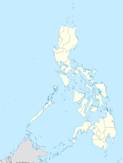
 Quezon City
Coordinates: 14°38′N 121°2′E / 14.633°N 121.033°ECoordinates: 14°38′N 121°2′E / 14.633°N 121.033°E Country  Philippines
Region National Capital Region Districts 1st to 4th districts of Quezon City Barangays 142 Incorporated (town) October 12, 1939
(as Diliman Estate)Incorporated (city) October 12, 1939
(By virtue of Commonwealth Act No. 502 as amended by Commonwealth Act No. 659 and Republic Act Nos. 333, 537, and 1575) [1]Government - Mayor Herbert M. Bautista (Liberal) - Vice Mayor Ma. Josefina "Joy" G. Belmonte-Alimurung (Liberal) - Sangguniang Panlungsod CouncilorsArea - Total 166.20 km2 (64.2 sq mi) Elevation 17.0 m (56 ft) Population (2007) - Total 2,679,450 - Density 16,121.8/km2 (41,755.4/sq mi) Time zone PST (UTC+8) ZIP Code 1100 to 1128[2] Area code(s) 2 Website quezoncity.gov.ph Quezon City (Filipino: Lungsod Quezon) is the former capital (1948–1976) and the most populous city in the Philippines. Located on the island of Luzon, Quezon City (popularly known to Filipinos as QC) is one of the cities and municipalities that make up Metro Manila, the National Capital Region. The city was named after Manuel L. Quezon, the former president of the Commonwealth of the Philippines who founded the city and developed it to replace Manila as the country's capital. Quezon City is not located in and should not be confused with Quezon province, which was also named after the president.
Having been the former capital, many government offices are located in the city, including the Batasang Pambansa Complex, the seat of the House of Representatives, which is the lower chamber in the Philippine Congress. The main campuses of two noteworthy universities, the Ateneo de Manila University and the country's National University—the University of the Philippines Diliman—are located in the city.
History
 Commonwealth President Manuel L. Quezon.
Before Quezon City was created, it was composed of small towns. These were San Francisco del Monte, Novaliches, and Balintawak. On August 23, 1896, the Katipunan led by Andres Bonifacio declared a revolution against Spain in the house of Melchora Aquino in Pugad Lawin (now known as Bahay Toro, Project 8). In the early 20th century, President Manuel L. Quezon dreamt of a city that would become the future capital of the country, replacing Manila, and home to several middle workers. It is believed that his earlier trip to Mexico influenced his vision. In 1938, President Quezon created People's Homesite Corporation and purchased 15.29 km² from the vast Diliman estate of the Tuason family (This piece of land became known as Bario Obrero "Home of the Middle Workers" before a name change to Quezon City). The National Assembly of the Philippine Commonwealth passed Commonwealth Act 502 known as the “Charter of Quezon City” originally proposed as Balintawak City, Assemblymen Narciso Ramos (father of President Fidel V. Ramos) and Ramon Mitra, Sr. (father of Speaker Ramon Mitra, Jr.) successfully lobbied the assembly to name the city after the incumbent president. President Quezon allowed the bill to lapse into law without his signature on October 12, 1939, thus establishing Quezon City. After the war, Republic Act No. 333 was signed by Elpidio Quirino on July 17, 1948 declaring Quezon City to be the republic's capital, and specifying the city's area to be 156.60 km². Baesa, Talipapa, San Bartolome, Pasong Tamo, Novaliches Poblacion, Banlat, Kabuyao, Pugad Lawin, Bagbag, Pasong Putik of the old Novaliches municipality (by then a part of Caloocan) were ceded to Quezon City. The rest of the old Novaliches municipality was left with Caloocan, thus becoming North Caloocan. On June 16, 1950, the City Charter was revised by Republic Act No. 537, changing the city's boundaries to an area of 153.59 km². Exactly six years after on June 16, 1956, more revisions to the city's land area were made by Republic Act No. 1575, which defined its area as 151.06 km². The website of the Quezon City government states that its present area is 161.12 km²[5] On October 1, 1975, Quezon City was the actual site of the "Thrilla in Manila" fight between Muhammad Ali & Joe Frazier. On November 7, 1975 the promulgation of Presidential Decree No. 824 of President Ferdinand Marcos established Metro Manila. Quezon City became one of Metro Manila's 17 cities and municipalities. The next year, Presidential Decree No. 940 transferred the capital back to Manila on June 24, 1976. On March 31, 1978, President Ferdinand Marcos ordered the transfer of the remains of President Manuel L. Quezon from the Manila North Cemetery to the erected Quezon Memorial Monument within the Quezon Elliptical Road.
Manuel L. Quezon Monument and the City Hall. On February 22, 1986, the Quezon City portion of the Epifanio de los Santos Avenue became the venue of the bloodless People Power Revolution. On February 23, 1998, Republic Act. No. 8535 was signed by President Fidel V. Ramos. The Act provided for the creation of the City of Novaliches comprising the 15 northernmost barangays of Quezon City. However, in the succeeding plebiscite on October 23, 1999, an overwhelming majority of Quezon City residents rejected the secession of Novaliches. Quezon City is the first local government in the Philippines with a computerized real estate assessment and payment system. The City government developed a database system that now contains around 400,000 property units with capability to record payments.1939 masterplans
In 1938 President Manuel L. Quezon made a decision to push for a new capital city. Manila was getting crowded and his military advisors (reportedly) told him that Manila, being by the bay, was an easy target for bombardment by naval guns in case of attack and that possibility was high in the pre war years of the late ’30s.
Of course, military advisers did not anticipate bombing from the air. Nevertheless, Quezon railroaded the idea of a totally new city at least 15 kilometers away from Manila Bay (beyond the reach of naval guns). He contacted William E. Parsons, American architect and planner, who had been the consulting architect for the islands early in the American colonial period. Parsons came over in the summer of 1939 and helped select the Diliman (Tuason) estate as the site for the new city. Unfortunately he passed away later that year. His partner Harry Frost took over. Frost collaborated with Juan Arellano, engineer AD Williams and landscape architect/planner Louis Croft to craft a grand master plan for the new capital Quezon City.
The plan was approved by the Philippine authorities in 1941. The core of the new city was to be a 400-hectare central green, about the size of New York’s Central Park, and defined by North, South (Timog), East and West Avenues. On one corner of the proposed Diliman Quadrangle was delineated a 25-hectare elliptical site. This was to contain a large capitol building to house the Philippine Legislature and ancillary structures for the offices of representatives.
On either side of the giant ellipse were supposed to have been built — the new Malacañang Palace and the Supreme Court Complex. The three branches of government would finally and efficiently be located close to each other.
Geography
The city lies on the Guadalupe plateau which is a relatively high plateau on the northeast corner of the metropolis – between the lowlands of Manila to the southwest and the Marikina River valley to the east. The southern portion is drained by the very narrow San Juan River and its tributaries to Pasig River, while running in the northern portions of the city is the equally narrow Tullahan River.
Quezon City is bordered by Manila to the southwest, by Caloocan and Valenzuela, Philippines to the west and northwest. To the south lies San Juan and Mandaluyong while Marikina and Pasig borders Quezon City to the southeast. To the north across Marilao River lies San Jose del Monte in the province of Bulacan and to the east lies Rodriguez and San Mateo, both in the province of Rizal.
The city can be divided into a number of areas. The southern portion of the city is divided into a number of places including Diliman, Commonwealth, the Project areas, Cubao, Kamias, Kamuning, New Manila, San Francisco del Monte and Sta. Mesa Heights. The northern half of the city is often called Novaliches and contains the areas of Fairview and Lagro. Most of these areas have no defined boundaries and are primarily residential in nature.
Climate
Quezon City features a Tropical monsoon climate, with warm weather and dry and wet seasons.
Economy
 New high-rise condominiums in Quezon City reflect the city's growing economy as seen in this image of Eastwood City - a commercial and residential development.
The commercial center of the city is in Cubao where many shopping malls and the Aurora Tower can be found. There is a farmers plaza and farmers market. Fiesta Carnival is an enclosed amusement park cum carnival which is located in the heart of the Cubao Commercial Center. You will also find the Araneta Coliseum, a venue for concerts as well as sports events.
Quezon City is home to the Philippines' major broadcasting networks. Television companies such as TV5, ABS-CBN, GMA Network, GEM TV, UNTV, Net 25, PTV, RPN and IBC all have their headquarters in Quezon City.
Tomas Morato and Timog Avenues are the heart of a restaurant and entertainment row with a wide array of prices, cultures, and flavors while Banawe Avenue is dubbed as the Autoparts Capital of the Philippines because of the concentration of car parts shops and accessories and home to clusters of authentic Chinese restaurants aside from Binondo.The Tallest Building in the City is a 40 storey Eastwood Parkview Located in Eastwood City.
Communications
Quezon City's communication system is powered by the PLDT, Globe Telecom, BayanTel and others. Cellular networking in the Philippines, particularly the Metropolitan areas, is increasing rapidly together with the low cost of calls and text messaging. Such big companies that control the cellular networks in the Philippines and Quezon City itself are Globe Telecom, Smart Communications (PLDT) and Sun Cellular from Digitel.
Education
The city has several major educational institutions. Two of the most well-known are the Ateneo de Manila University and the University of the Philippines Diliman. Also in Quezon City are medical schools such as the Our Lady of Fatima University – Fatima Medical Science Foundation, Far Eastern University - Nicanor Reyes Medical Foundation, Capitol Medical Center Colleges, and the University of the East – Ramon Magsaysay Memorial Medical Center. The Technological Institute of the Philippines, one of the top engineering schools in the Philippines, Polytechnic University of the Philippines also has an extension campus in Commonwealth area. The city government operates the Quezon City Polytechnic University, which has campuses in Novaliches, Batasan Hills, and Barangay Sto. Cristo. Business and management schools include Entrepreneurs School Of Asia located in Libis, Philippine School of Business Administration (PSBA), and National College of Business and Arts (NCBA). Popular women's colleges such as Saint Theresa's College, Saint Pedro Poveda College (formerly known as Poveda Learning Center), and Miriam College are also found in the city. Sectarian schools such as the Catholic Siena College of Quezon City, St. Paul University of Quezon City, St. Mary's College of Quezon City, St. Joseph's College of Quezon City, Colegio de San Lorenzo, Shepherd's Grace School, the Episcopal Trinity University of Asia, and the Iglesia ni Cristo – affiliated New Era University are also found in the city. Other schools include the Central Colleges of the Philippines, Philippine Rehabilitation Institute, the main branch of the AMA Computer University, and numerous campuses of information technology schools such as Asia School of Arts & Sciences (ASAS), Informatics International College, and STI College.
Notable secondary public schools include Philippine Science High School, Quezon City Science High School, Ernesto Rondon High School, Don Alejandro Roces Sr. Science-Technology High School, Batasan Hills National High School, and the University of the Philippines Integrated School. Quezon City also holds the largest number of private elementary and secondary schools in Metro Manila, such as Ateneo de Manila High School, Claret School of Quezon City, Sacred Heart Academy (with branches in La Loma and Novaliches), Diliman Preparatory School, Miriam College, School of the Holy Spirit, School of Saint Anthony, Mater Carmeli School, Grace Christian High School, Quezon City Christian Academy, Lourdes School of Quezon City, Our Lady of Fatima University, Falcon School (Quezon City), Divine Grace School, Holy Family School, St. Bridget School, Quezon City Academy, Saint Claire School, and Kostka School. The diocesan schools are the Immaculate Concepcion Cathedral School (Diocese of Cubao) and Good Shepherd Cathedral School (Diocese of Novaliches). Many Catholic parishes also operate parochial schools of their own as well.
Transportation
Currently, two elevated light rail systems and one heavy rail system run through Quezon City: LRT 1 – at EDSA (C-4) connecting North Avenue and Baclaran (Manila) MRT 2 – at Aurora Boulevard (R-6) connecting Santolan (Pasig City) and C.M.Recto Avenue (Manila), and MRT 3 – at EDSA (C-4) from Taft Avenue (R-2 in Pasay City) to North Avenue.
An elevated rail transit system (MRT-4) that was supposed to follow the general alignment of Quezon and Commonwealth Avenues (R-7) was shelved. In its place, a 22 kilometer rail system will be built. The MRT-7 project will commence at North Avenue, connecting the MRT-3 at its northern terminus. It will then go through Commonwealth Avenue, then through Regalado, Quirino Highway, ending in San Jose del Monte, Bulacan. The system has a proposed spur line to connect itself to MRT-2 in Katipunan, passing through the University of the Philippines Diliman and Katipunan Avenue.
The following elevated railway stations in the city (Only 13 Stations):
 Katipunan Avenue, a major road in Quezon City. The trees on the right side of the image are part of the Ateneo de Manila University campus.
MRT-3 (with 5 Stations):
- North Avenue-(Connected to LRT-1 Yellow Line)
- Quezon Avenue
- Kamuning
- Araneta Center-Cubao-(Connected to LRT-2 Purple Line)
- Santolan
LRT-2 (with 5 Stations):
- Gilmore
- Betty Go-Belmonte
- Araneta Center-Cubao-(Connected to MRT-3 Blue Line)
- Anonas
- Katipunan
LRT-1 (with 3 Stations)
- Balintawak
- Roosevelt
- North Avenue-(Connected to MRT-3 Blue Line)
Public transportation within the city, like in most of the urban areas in the Philippines, is facilitated mostly using inexpensive jeepneys and buses. Tricycles give access to more secluded areas, while taxi cabs are available to navigate any course.
This City has 3 Circumferential Roads. The following are:
- C-3: Sgt. Emilio Rivera Avenue and Araneta Avenue
- C-4: Epifanio de los Santos Avenue or EDSA
- C-5: Mindanao Avenue, Tandang Sora Avenue, Congressional Avenue Extension, Katipunan Avenue and E. Rodriguez Avenue
For the list of other Quezon City Major Roads, see Major roads in Metro Manila
Religion
The majority of the population is Roman Catholic, and in 2002, Quezon City was made an episcopal see for two new Catholic dioceses: Cubao and Novaliches, as the very populous Archdiocese of Manila was carved up and five new dioceses created. A number of religious orders have set up convents and seminaries in the city. Various Protestant faiths have seen a significant increase in membership over recent decades and are well represented in Quezon City. While the Islamic faith has its largest concentrations in the south of the Philippines, there is a significant population in Quezon City. The Salam compound in Barangay Culiat houses one of the area's landmark mosques. The Iglesia ni Cristo (Church of Christ) Central Office is located in Quezon City. The Church of Jesus Christ of Latter-day Saints have Manila Philippines Temple and the Missionary Training Center located at Temple Drive Greenmeadows Subdivision of the city and The Kingdom of Jesus Christ, The Name Above Every Name located at Novaliches (Central Office), EDSA-Cubao, Muñoz and Fairview. The Philippine Branch office of the Jehovah's Witnesses is located in San Francisco del Monte Avenue. The seat of the Presiding Bishop, the Cathedral of Sts. Mary and John of the Episcopal Church, the national offices of the United Church of Christ in the Philippines, the National Council of Churches in the Philippines as well as a number of Protestant seminaries are located in the city. And the Headquarters of the UCKG HelpCenter (Universal Church of the Kingdom of God) is located at the former Quezon Theater building. Church So Blessed is a Christian Church located infront of GMA Network and in Commonwealth Ave.
Government
 Map showing the districts of Quezon City.
Like other cities in the Philippines, Quezon City is governed by a mayor and vice mayor elected to three-year terms. The mayor is the executive head and leads the city's departments in executing the city ordinances and improving public services. The vice mayor heads the legislative council consisting of 24 members. These councilors represent the four (4) legislative districts of the city. The council is in charge of formulating and enacting city ordinances.
Quezon City, being a part of the Metro Manila region, has its mayor in the Metro Manila Council headed by the Metro Manila Development Authority (MMDA). This council formulates development plans that seeks to solve the problems and improve the conditions in the metropolis.
Quezon City is made up of 142 barangays (the smallest local government units) which handle governance in a much smaller area. These barangays are grouped into the aforementioned legislative districts. Each district, in turn is represented in the House of Representatives of the Philippines.
See also: Barangays of Quezon CityMayors
Main article: List of mayors of Quezon CityPresident Manuel L. Quezon acted as mayor from October 12 to November 4, 1939, pending the resignation from another position of his intended appointee, Tomas B. Morato. Since a president can, under Philippine law, hold multiple portfolios inferior to the position of president, Quezon took the position of mayor in a concurrent capacity. However, it is erroneous to view him as the first mayor, as a president holding a concurrent position is not listed in the roster of incumbents for those offices.
Sub-divisions/Districts
Diliman
Diliman, located at the center of southern Quezon City, is where many government offices, including City Hall, are located. Diliman is home to several educational institutions such as the UP Diliman, FEU-FERN College, Philippine Science High School Main Campus, Claret School of Quezon City, School of the Holy Spirit, Diliman Preparatory School, and Quezon City Science High School, the regional science high school in NCR region.
 A View of SM City North EDSA, the largest shopping mall in the Philippines, in the Diliman District.
At the center of Diliman lies the Quezon Memorial Circle, where the late President Manuel L. Quezon is interred. Around the monument is the two-kilometer Quezon Memorial Circle, also known as the Elliptical Road (R-7/C-5).
The Quezon City Hall, one of the tallest city halls in the country, is located along the Circle. Surrounding the city hall are spacious parks and open areas. The head offices of some national government are located in Diliman:
- Land Transportation Office (LTO)
- Bureau of Internal Revenue (BIR)
- Philippine Nuclear Research Institute (PNRI)
- Social Security System (SSS)
- National Power Corporation (NAPOCOR)
- National Printing Office (NPO)
- Philippine Drug Enforcement Agency (PDEA)
- Dangerous Drugs Board (DDB)
- National Statistics Office (NSO)
- National Housing Authority (NHA)
- Housing and Land Use Regulatory Board (HLURB)
- National Telecommunications Commission (NTC)
- Philippine Institute of Volcanology and Seismology (PHIVOLCS)
- Philippine Atmospheric, Geophysical and Astronomical Services Administration (PAGASA)
- Advanced Science and Technology Institute (ASTI)
- Land Transportation Franchishing and Regulatory Board (LTFRB)
- Philippine Information Agency (PIA)
- National Computer Center (NCC)
- Commission on Information and Communications Technology (CICT)
- Commission on Higher Education (CHED)
- Occupational Safety and Health Center (OSHC)
- Office of the Ombudsman
- Court of Tax Appeals
- The Departments of Agriculture (DA), Agrarian Reform (DAR), Interior and Local Government (DILG), Environment and Natural Resources (DENR) and Social Welfare and Development (DSWD).
Population Census Census Pop. Rate 1939 39,013 — 1948 107,977 12.0% 1960 397,990 11.5% 1970 754,452 6.6% 1975 956,864 4.9% 1980 1,165,865 4.0% 1990 1,669,776 3.7% 1995 1,989,419 3.6% 2000 2,173,831 1.92% 2007 2,679,450 2.93% Near the Circle are many important health centers and institutions. Along East Avenue stand the Philippine Heart Center, the East Avenue Medical Center (EAMC), the National Kidney and Transplant Institute, and the Philippine Mental Health Association. Along North Avenue is the Veterans Memorial Medical Center (VMMC) and the Philippine Health Association. The Philippine Children's Medical Center and Lung Center of the Philippines are located along Quezon Avenue (R-7).
The headquarters of PTV, RPN, IBC, PBS, ABS-CBN Broadcast Center, and GMA Network Center are also located in Diliman. The online publication covering Diliman, the Diliman Diary, is also based there.[3]
Most of the rest of the area is residential. Some villages in this portion of Diliman are Teachers Village, U.P. Village, and Sikatuna Village. Those closer to the University of the Philippines campus such as Teachers Village and U.P. Village remain mostly residential although there are two major secondary schools in the area namely Claret School of Quezon City and Holy Family School, and many have converted spare rooms into boarding facilities for out-of-town students attending schools in the area: U.P., Ateneo, and Miriam College. The eastern edge of the Diliman area is roughly bound by Katipunan Avenue which passes in front of Ateneo and Miriam and runs behind the U.P Diliman campus.
Commonwealth Ave : Old Balara, Holy Spirit, Batasan Area and Fairview
North of Diliman lies the Commonwealth area, so named because of Commonwealth Avenue (R-7) (formerly called Don Mariano Marcos Avenue) which runs through its center. This is primarily a middle-class residential area home to many subdivisions (residential associations) such as Don Jose Heights, Ideal Subdivision, Jordan Park Homes, Palmera Homes QC, Casa Milan, Geneva Gardens, Doña Carmen Subdivision, Filinvest 1 and 2 and other subdivisions. The population is so big as it is equivalent to a single highly-urbanized city. These include the areas of Batasan Hills (formerly called Constitution Hills), and within the proposed National Government Center.
Most Populous Barangays Rank Barangay Population 1 Commonwealth 172,834 2 Batasan Hills 148,624 3 Payatas 117,001 4 Holy Spirit 106,038 5 Pasong Tamo 82,340 Tandang Sora
For the hero of the Philippines nicknamed Tandang Sora, see Melchora Aquino. Sigaw sa Pugad Lawin Monument.
This is located between Commonwealth to the east, North Ave to the south, San Francisco del Monte (Frisco) Avenue to the west and Fairview-Sauyo to the north. It takes its name from the "Grand Old Lady of the Revolution", Melchora Aquino or Tandang Sora, whose remains lie on the Himlayang Pilipino memorial park at Barangay Pasong Tamo.
The area is primarily residential with Projects 6 and 8 located here, as are other subdivisions, like Town & Country Gardenville, San Pedro Subdivisions, National Power Corporation or NPC Village, National Irrigation Administration or NIA Village, Reymar Subdivision, Philand Subdivision, Villa Corrina, San Miguel Village, Gloria Subdivisions, Jem Subdivisions, Corazonville subdivision and many more. A large portion of Tandang Sora district is Barangay Bahay Toro, where a historic site of the Philippine Revolution known as Pugad Lawin is located. There are some industrial facilities especially near the Mindanao Avenue area. Culiat, a Muslim compound, is also to be found here, as are the central offices of the Iglesia ni Cristo and New Era University. The transmitter of GMA 7 (DZBB-TV) is located near Culiat. Many educational centers are also within the area.
Also in the area are Congressional Avenue, Visayas Avenue, and Mindanao Avenue (forming part of C-5).
Loyola Heights
Loyola Heights, to the southeast of Diliman is Marikina City's gateway to Quezon City. The Aurora Boulevard (R-6) and Katipunan Avenue (C-5) provide easy access, but often experience traffic jams during rush hours. Also located in Loyola Heights is the Katipunan Station of the Manila LRT Purple Line (LRT-2), which runs in an east-west direction, providing rapid access to the cities of Manila, Quezon City, Marikina and Pasig, and San Juan. Passengers can transfer to the Manila LRT Yellow Line at Recto station in Manila, or to the Manila Metro Rail Transit System (Blue Line) at Araneta Center-Cubao station.
The main campus of the Ateneo de Manila University and Miriam College are located in Loyola Heights.
Loyola Heights also has numerous commercial study centers such as The Loyola Heights-Xavierville Kumon Center, Newton Study Center, LHSC, and others which offer after-school tutorial services.
Loyola Heights is an upper middle-class and rich residential area that caters to students of the Ateneo de Manila University, University of the Philippines Diliman, and Miriam College, members of the schools' faculty and staff, and their families. La Vista Subdivision, north of Miriam College, is an upscale gated community where some of the country's top politicians own residences, including President Gloria Macapagal-Arroyo, as well as many of the country's moneyed elite. Accessed through La Vista is Loyola Grand Villas, another upscale gated community. Across Katipunan, the main thoroughfare of the area, are Varsity Hills and Xavierville, both upper class and upper middle-class subdivisions. Near these areas, and right beside La Vista, are some squatters' settlements, making the Loyola Heights area a place of mixed socio-economic classes.
Cubao

Cubao, south of Diliman is an important commercial area. At its heart is the Araneta Center along EDSA (C-4) and Aurora Boulevard (R-6). It is a 35-hectare commercial estate owned and developed by the Araneta family. Department stores and retail centers can also be found here, such as Gateway Mall, Plaza Fair, Rustan's, Shopwise Supercenter, SM Cubao, Ali Mall and Farmer's Plaza. At the center is Araneta Coliseum, often called the Big Dome. Many musical concerts, ice shows, circus shows, religious crusades, wrestling, cock-fighting and basketball games are held in this 20,000-capacity coliseum. In the outskirts of Araneta Center is the Cubao Expo, an artists' colony and site of weekend flea markets. It is also a home to call centers like APAC, Telus, and Stellar.
Cubao is also the home of the Cubao Cathedral the seat of the Roman Catholic Diocese of Cubao.
SM hypermarket is located just outside the Araneta Center, along EDSA.
Nightclubs also abound within the Cubao area, catering to a full range of tastes.
There are residential areas ranging from the middle class to the upper-upper class. Araneta Center is also home to the Embassy of the Republic of Colombia.
North from Araneta Center along EDSA (C-4) are numerous bus terminals, a place where one can take a bus ride to almost any point in Luzon as well as in the Visayas especially Samar, Leyte, and Iloilo. It is also an intersection point for two of city's commuter train lines (the MRT-3 and the LRT-2).[citation needed]
There are two campuses here of Access Computer College, a degree-awarding tertiary educational institution. One is at EDSA and the other Anonas.
Bagumbayan
Located at the southeastern corner of Quezon City, Bagumbayan is one of the newly developed commercial areas in Quezon City. The Eastwood City Business Center is situated here. It consists of several office and residential skyscrapers, including many local IT and consumer electronic firms. Numerous bars and restaurants have been put up since 2000 along E. Rodriguez Jr. Avenue (C-5). Many of which are open-air restaurants and coffee shops reminiscent of Paris boulevards, but with a modern architecture. With this, Bagumbayan is fast becoming one of the hippest areas for night entertainment, similar to the Malate and Ermita districts of Manila.
West of Bagumbayan are many high-end gated communities like the Acropolis, Blue Ridge, Greenmeadows, White Plains, Corinthian Hills, and Corinthian Gardens. Further west are Camp Aguinaldo and Camp Crame. Camp Aguinaldo is the general headquarters of the Armed Forces of the Philippines while Camp Crame is the headquarters of the Philippine National Police. Bagumbayan also covers a smallest portion of Ortigas Avenue at the corner of EDSA (at the side of Corinthian Gardens) where Robinsons Galleria, EDSA Shrine, and Cyberpod Corinthian are located.
Timog area
Surrounding Timog Avenue (South Avenue) and Tomas Morato Avenue is a popular entertainment area. Located along these two avenues are many fine-dining restaurants and bars. Discothèques, Karaoke joints and comedy bars provide patrons with all-night long recreation. It is home to many gay bars such as Chicos, Adonis and Gigolo, which are popular for their lively night time entertainment.
In the South Triangle (the area bounded by Quezon Avenue (R-7), Timog Avenue (South Avenue) and EDSA) are located the head offices of ABS-CBN and GMA Network. Most Filipino entertainment shows are produced here, and it is also home to many Filipino celebrities.
See also: Scouting memorialsSeveral of the streets in the surrounding area were named in honor of the 22 Boy Scouts who died in a plane crash en route to joining the 11th World Scout Jamboree. A memorial stands in the center of a rotunda at the intersection of Timog and Tomas Morato Avenues, which accounts for the Timog area being called as the Scout Area. Near the scouting memorial is the location of the former Ozone disco, site of the worst fire in Philippine history.
Novaliches
The Northern district is composed of Novaliches, and is primarily residential. The La Mesa Dam Watershed occupies the eastern portion. The La Mesa Dam supplies much of northern Metro Manila's water supply. Adjacent to the watershed is the La Mesa Eco-Park, where one can stroll and unwind at Metro Manila's only forest space. Also located in the park are convention centers, picnic areas, swimming pools, an orchidarium, and a large lagoon for boating activities. It was also the site of the rowing and dragon boat events for the 2005 Southeast Asian Games. Rowing is regularly done here. Also located here are four big malls: SM City Fairview, Robinsons Place Novaliches, SM City Novaliches, and Novaliches Plaza Mall.
Novaliches town proper is the site of the Metro Manila College (MMC), formerly known as Novaliches Academy (NA), Quezon City Polytechnic University (not to be confused with PUP – Commonwealth Campus), and Sto. Niño de Novaliches School. Barangay Fairview is home to the Far Eastern University - Nicanor Reyes Medical Foundation, National College of Business and Arts, School of Saint Anthony in Lagro, Mater Carmeli School in Sacred Heart Village, Divine Grace School in Maligaya Park Subdivision, just near SM Fairview, and Novaliches Cathedral (Cathedral Shrine and Parish of the Good Shepherd), the seat of the Roman Catholic Diocese of Novaliches.
The name Novaliches probably came from the name of a village outside Valencia, Spain.[citation needed] In the 19th century, the district was known as Hacienda Tala to settlers who cultivated the land and considered it a star ("tala") from heaven. The haciendero, Marquez de Novaliches, was given the title due to his services in the Carlist Wars of the 19th century.[citation needed]
Novaliches was once a separate town was part of Rizal province before being ceded to Quezon City in the 1940s. During World War II, the La Mesa Dam and Balara Filters were prime targets for Japanese, Filipino and American attacks, being the water sources for most of the northern part of Manila and Rizal.[citation needed]
This district is among the largest in the city, having shared boundaries with the two sections of Caloocan City, Valenzuela City, San Jose del Monte City in Bulacan and Montalban, Rizal. The oldest part of the city is in the town center, aptly named Novaliches Bayan. But because of population growth the density of people gradually widened reaching up the edge of the La Mesa Reservoir (Lagro and Fairview). The population growth started when the National Housing Authority started housing projects in the outskirts of Novaliches and along Tandang Sora; Fairview and Lagro, on opposite sides of the La Mesa Watershed, were developed as housing projects by the Government Service Insurance System.[citation needed]
The studios and broadcast antenna of TV5 are located along Quirino Highway, in Barangay San Bartolome.
In 1999, a plebiscite was held among the voters of Quezon City to determine the cityhood of Novaliches. The proposed creation of "Novaliches City" would have resulted in the secession of 15 barangays from Quezon City. At the plebiscite's end, votes that were against the separation heavily outnumbered those that were in favor.
New Manila
New Manila is located on west central portion of the city. This is a largely residential district that was named after Quezon City's neighbor to the southwest, Manila. The area was first settled after the second World War by some of the more affluent families who wished to escape the stress of living in Manila. As a result, many of the houses here stand on lots measuring 500 square meters and above.
The main thoroughfares are Aurora Boulevard, Gilmore Avenue, and Eulogio Rodriguez Sr. Avenue. Aurora Boulevard begins at the Quezon City – Manila border and reaches New Manila upon crossing EDSA. Gilmore crosses Ortigas Avenue, giving it access to Mandaluyong, Pasig, and San Juan cities. Eulogio Rodriguez Sr. Avenue diverges from Aurora Boulevard a few meters from EDSA.
Aurora Boulevard is the site of Broadway Centrum, where the first GMA Network entertainment shows were shot, now given by GMA to Eat Bulaga!;at present, Broadway Centrum was also given to TV5 for its TV shows P.O.5, Star Factor, and Face to Face. Saint Paul University Quezon City stands at the corner of Aurora Boulevard and Gilmore Avenue, across a row of shops specializing in computer equipment and an office of SYKES Asia. Trinity University of Asia, Saint Joseph's College of Quezon City, the Christ the King Mission Seminary and St. Luke's Medical Center are all located along Eulogio Rodriguez Avenue, as are the Quezon Institute and the Philippine Charity Sweepstakes Office. Informatics Sta. Mesa, an International Computer School that offers Higher Education Programs and Short Courses is also located along Aurora Blvd near Araneta Avenue.
Also located near New Manila is Quezon City's "Funeral Home Row", Araneta Avenue. This is attributed to the unusually high concentration of funeral homes in the area. Curiously, also located along Araneta Avenue is a columbary as well, where urns of cremated remains can be stored. Balete Drive, between Aurora Boulevard and Eulogio Rodriguez Sr. Avenue, is also the setting for many urban legends. The cathedral of the Roman Catholic Diocese of Cubao is located in Lantana Street, near Eulogio Rodriguez Sr. Avenue. The offices and studios of the MOWELFUND is located a few blocks from the cathedral.
Santa Mesa Heights
Sta. Mesa Heights is said to be where many middle class and upper middle class families reside. Most of the areas in Sta. Mesa Heights are residential. It is also home to the National Shrine of Our Lady of Lourdes and The Shrine of Our Lady of La Naval. Angelicum College, Lourdes School of Quezon City, and St. Theresa's College of Quezon City are three prestigious private Catholic schools to be found here. Philippine Rehabilitation Institute and Capitol Medical Center Colleges are also located here. This is also a location of Philippine Orthopedic Center located along Banawe Avenue corner Maria Clara Street. The main thoroughfares of this area are Banawe, D. Tuazon, Mayon, N.S. Amoranto (formerly called Retiro), Del Monte, Sgt. Rivera and A. Bonifacio Avenue.
San Francisco Del Monte
It was founded on February 17, 1590 by San Pedro Bautista. It was meant to be a place for retreat for residents in Intramuros in Manila. The former name of nearby Amoranto Avenue, Retiro or retreat in Spanish, was said to refer to the place as a retreat on top a hill. In reality, however, the name is part of the "Rizalian streets starting from Sampaloc.[4] The St. Francis of Assisi Church was the first building in the area.
It was an independent town during the Spanish era that had an area of 250 acres (1.0 km2) of land filled with wildlife and trees. It was later absorbed by Quezon City when it was created. Today, it is a heavily populated district. Although it contains many residential areas such as Barangay San Antonio, there are many industrial facilities here, mostly found along Judge Juan Luna street. The two main intersections of this area are Roosevelt Ave. and Del Monte Ave. Also located here are the Siena College of Quezon City and the PMI Colleges, Quezon City.
When it was first founded, it was around 2.5 km² in area. It reached out to what is currently Project 7 and 8 and all the way out to Timog Ave area. Currently, it is composed of Brgy. Paraiso, Paltok, Masambong, Damayan and Del Monte.
San Francisco Del Monte is also referred to as SFDM.
Galas-Santol
The Galas-Santol District of Quezon City is located in its southeast border with the City of Manila. Located in the Galas area is the elementary school named after Manuel L. Quezon's wife, Aurora A. Quezon . Carlos L. Albert High School named after a former vice mayor of the city. SM City Sta. Mesa lies at the end of the Araneta avenue.
The Project Areas
The Project areas include Project 1(Bgy. Roxas or Roxas District), Projects 2 & 3 (composed of all Barangays named Quirino), Project 4, Project 5 (Bgy. E. Rodriguez), Project 6, Project 7 (Barangays Bungad & Veterans Village), and Project 8 (Barangays Bahay Toro, Baesa & Sangandaan). These areas are among the first residential subdivisions in the city developed by former Philippine Presidents Quezon, Quirino and Marcos.
Located in Project 8 is the main campus of AMA Computer University, among others.
La Loma
La Loma is located on the southwest area of Quezon City. It is composed of 5 barangays along the vicinity of its main streets, Amoranto Avenue and A. Bonifacio Street. The district is famed as the birthplace of many popular Filipino culinary figures and establishments, especially devoted to the Lechon. The nearby La Loma Cemetery is named after the district.
International relations
Twin towns / Sister cities
 Caracas, Venezuela
 Chiba City, Japan
 Daly City, California, United States
- Kenosha, Wisconsin, United States
 New Westminster, Canada
- Salt Lake City, Utah, United States
 Taipei, Taiwan
- San Jose del Monte City, Philippines
- General Santos City, Philippines
- Iloilo City, Philippines
- Puerto Princesa City, Philippines
- New York, New York, United States
- Las Vegas, Nevada, United States
References
External links
- Quezon City Official Government Website
- Quezon City – WikiPilipinas: The Hip 'n Free Philippine Encyclopedia
- Detailed History of Quezon City
- Quezon City Public Library System
- Quezon City at WN
- Quezon City, the largest city in terms of population

Valenzuela City North Caloocan, San Jose del Monte City, Bulacan Rodriguez, Rizal South Caloocan 
San Mateo, Rizal
Marikina Quezon City

Manila San Juan, Mandaluyong Pasig Preceded by
ManilaCapital of the Philippines
1948–1976Succeeded by
ManilaQuezon City History Economy Officials Barangays Greater Manila Area Spots Metropolitan Manila · Republic of the Philippines Metropolitan ManilaCaloocan
Las Piñas
MakatiParañaque
Pasay
PasigTaguig
ValenzuelaMetropolitan Manila Development Authority Cities of the PhilippinesHighly-urbanized Cities Angeles · Bacolod · Baguio · Butuan · Cagayan de Oro · Caloocan · Cebu · Davao · General Santos · Iligan · Iloilo · Lapu-Lapu · Las Piñas · Lucena · Makati · Malabon · Mandaluyong · Mandaue · Manila · Marikina · Muntinlupa · Navotas · Olongapo · Parañaque · Pasay · Pasig · Puerto Princesa · Quezon City · San Juan · Tacloban · Taguig · Zamboanga
Independent
Component CitiesComponent Cities Alaminos · Antipolo · Bago · Bais · Balanga · Batangas · Batac · Bayawan · Baybay · Bayugan · Biñan · Bislig · Bogo · Borongan · Cabadbaran · Cabanatuan · Cadiz · Calamba · Calapan · Calbayog · Candon · Canlaon · Carcar · Catbalogan · Cauayan · Cavite · Danao · Dapitan · Dasmariñas · Digos · Dipolog · Dumaguete · El Salvador · Escalante · Gapan · Gingoog · Guihulngan · Himamaylan · Iriga · Isabela · Kabankalan · Kidapawan · Koronadal · La Carlota · Lamitan · Laoag · Legazpi · Ligao · Lipa · Maasin · Malaybalay · Malolos · Marawi · Masbate · Mati · Meycauayan · Muñoz · Naga, Cebu · Oroquieta · Ozamiz · Pagadian · Palayan · Panabo · Passi · Roxas · Sagay · Samal · San Carlos, Negros Occidental · San Carlos, Pangasinan · San Fernando, La Union · San Fernando, Pampanga · San Jose · San Jose del Monte · San Pablo · Santa Rosa · Silay · Sipalay · Sorsogon · Surigao · Tabaco · Tabuk · Tacurong · Tagaytay · Tagbilaran · Tagum · Talisay, Cebu · Talisay, Negros Occidental · Tanauan · Tandag · Tangub · Tanjay · Tarlac · Tayabas · Toledo · Trece Martires · Tuguegarao · Urdaneta · Valencia · Victorias · Vigan
Largest cities of the Philippines Rank City Population Pop. Growth Rate Region

Metro Manila

Metro Cebu1 Quezon City 2,679,450 2.53% National Capital Region 2 Manila 1,660,714 0.03% National Capital Region 3 Caloocan 1,378,856 2.53% National Capital Region 4 Davao City 1,363,337 1.81% Davao Region 5 Cebu City 798,809 2.16% Central Visayas 6 Zamboanga City 774,407 3.54% Zamboanga Peninsula 7 Antipolo 633,971 5.22% CALABARZON 8 Pasig 617,301 2.29% National Capital Region 9 Taguig 613,343 4.07% National Capital Region 10 Valenzuela 568,928 2.23% National Capital Region based on the Philippines 2007 Census Categories:- Metro Manila
- Quezon City
- Cities in the Philippines
- Former national capitals
- Planned capitals


Wikimedia Foundation. 2010.