- Cudworth Airport
-
Cudworth Airport IATA: none – ICAO: none – TC LID: CKS3Summary Airport type Private Operator J. Saxinger Location Hoodoo No. 401, near Cudworth, Saskatchewan Elevation AMSL 1,875 ft / 572 m Coordinates 52°29′17″N 105°45′50″W / 52.48806°N 105.76389°WCoordinates: 52°29′17″N 105°45′50″W / 52.48806°N 105.76389°W Map Former location in Saskatchewan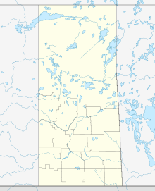
 CKS3
CKS3Runways Direction Length Surface ft m 04/222,500762TurfSource: Canada Flight Supplement[1] Cudworth Airport,
(TC LID: CKS3), was located 1.5 NM (2.8 km; 1.7 mi) west southwest of Cudworth, Saskatchewan, Canada.See also
References
- ^ Canada Flight Supplement. Effective 0901Z 20 October 2011 to 0901Z 15 December 2011
External links
- Page about this aerodrome on COPA's Places to Fly airport directory
Airports in Canada By name A–B · C–D · E–G · H–K · L–M · N–Q · R–S · T–ZBy location indicator CA · CB · CC · CD · CE · CF · CG · CH · CI · CJ · CK · CL · CM · CN · CO · CP · CR · CS · CT · CV · CW · CY · CZBy province/territory National Airports System Calgary · Charlottetown · Edmonton · Fredericton · Gander · Halifax · Iqaluit · Kelowna · London · Moncton · Montréal-Mirabel · Montréal-Trudeau · Ottawa · Prince George · Québec · Regina · Saint John · St. John's · Saskatoon · Thunder Bay · Toronto · Vancouver · Victoria · Whitehorse · Winnipeg · YellowknifeRelated List of airports by ICAO code: C · List of defunct airports in Canada · List of heliports in Canada · List of international airports in Canada · National Airports System · Operation Yellow RibbonCategories:- Defunct airports in Saskatchewan
- Hoodoo No. 401, Saskatchewan
- Saskatchewan airport stubs

Wikimedia Foundation. 2010.