- Florida State Road 707
-
State Road 707
Route information Maintained by FDOT Length: 5.7 mi (9.17 km) Major junctions South end: CR 707 in Stuart NW Wright Boulevard to 
 US 1 / SR 5 in North River Shores
North end:  SR 732 in Ocean Breeze Park
Highway system Florida State and County Roads
Interstate • US • SR (Pre-1945) • Toll • County←  SR 706
SR 708  →
→State Road 707 is the Florida Department of Transportation designation of a 5.7-mile (9.2 km) stretch of the former Dixie Highway (US 1) between Stuart and Jensen Beach in Martin County, Florida. Although sometimes called Old Dixie Highway, this is a misnomer because the present US 1 has always been called Federal Highway, not Dixie Highway, in Martin County. Its correct local street name is Dixie Highway from Stuart north to the its intersection with N.E Sewall's Point Road in Jensen Beach, where it becomes known as N.E. Indian River Drive. Its northern terminus is the roundabout at the western approach of the Jensen Beach Causeway (SR 732), where it continues north as Martin County Road 707. Its southern terminus is at the roundabout with Joan Jefferson Way from which it continues south along the railroad tracks as Martin County Road 707. Before reaching the roundabout, State Road 707 passes under the new Roosevelt Bridge which now carries US 1 over the St. Lucie River and has no present intersection with the current edition of US 1 (SR 5). Other communities served by SR 707 include Rio and Ocean Breeze Park.
History
In the late 1970s, the SR 707 designation was applied to two much longer stretches of south Florida highway:
- A stretch of former Dixie Highway alongside the Florida East Coast Railroad tracks from Fort Pierce to Jensen Beach, from which the current SR 707 enters Stuart (a similar stretch from Fort Pierce northward to Vero Beach was originally signed SR 605 and is now CR 605). The stretch between the railroad tracks and the Indian River is locally known as Indian River Drive and St. Lucie County Road 707. Communities served by Saint Lucie County Road 707 include Eden, Walton, Ankona, and Eldred in Saint Lucie County. Some maps still indicate the northernmost 0.5 mile (in Fort Pierce) to be SR 707.
- A stretch of Ocean Drive/Beach Street from Bridge Road (on Jupiter Island) to Beach Road in Jupiter Inlet Colony to SR 811/Alternate SR A1A in Jupiter served as Alternate SR A1A before it was redesignated SR 707 (some street signs near the southern end still show "Alternate A1A," as does the northern end of SR 811). The portion of this road in Martin County is now known as Martin County Road 707; south of the county line, it's Palm Beach County Road 707. Jupiter Lighthouse Park - with Jupiter Lighthouse - is accessible from the Beach Road segment of this southern part of CR 707.
Unlike the St. Lucie County segment of the former SR 707, the Martin County segment did not parallel the FEC rails as the former alignment of Dixie Highway. This was done by a former alignment of SR A1A, now designated Martin County Road A1A, from Stuart to Jupiter. Former alignments of Dixie Highway in southern Florida include SR 811 and Palm Beach County Road 811 in Palm Beach County, SR 811 and the former SR 5A in Broward County, and SR 909 and the former SR 815 in Miami-Dade County.
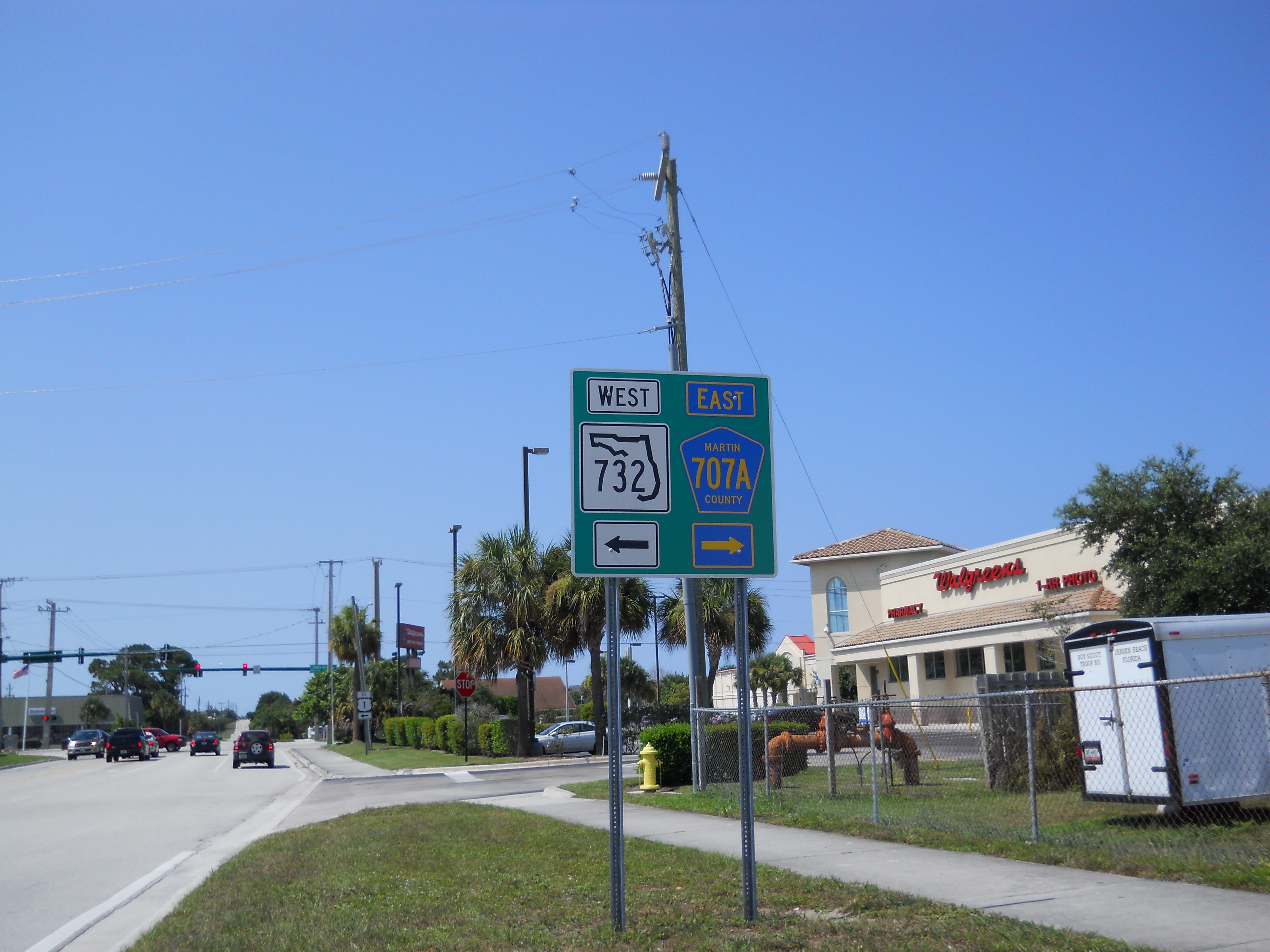
Martin County Road 732: The former State Road 707A
 Sign just south Intersection of NE Savanna(h) Rd. and NE Jensen Beach Blvd. indicating junction of SR 732 to the west and CR 707A to the east
Until the 1990s, SR 707 had a state-maintained "spur route" that actually connected Indian River Drive (SR 707) in Ocean Breeze Park to North Federal Highway (US 1-SR 5) in West Jensen. The 2.9-mile (4.7 km) east–west street, signed State Road 707A followed Jensen Beach Boulevard (some 1980s-vintage maps indicate it as Commercial Boulevard) between the two major north–south highways.
When Florida Department of Transportation removed the State Road designation from SR 707A (and at roughly the same time, several other State Roads in the Stuart area), Jensen Beach Boulevard was redesignated Martin County Road 732 - not to be confused with SR 732, which is the nearby Jensen Beach Causeway, also locally known as Northeast Causeway Boulevard.
Interestingly, as of January 27, 2007, there is signage on Jensen Beach Boulevard indicating that it is now State Road 732.
Another spur route: Martin County Road 723 (former State Road 723)
While the former SR 707A was sporting its State Road shields, the former State Road 723 was also a signed spur of SR 707. A 1.8-mile-long north–south street locally known as Savannah Road, the former State Road (and current Martin County Road 723) has its southern terminus at an intersection with Old Dixie Highway (SR 707) in Rio; the northern terminus of SR/CR 723 is an intersection with Jensen Beach Boulevard (former SR 707A/current CR 732) in Jensen Beach. Savannah Road is primarily a commercial highway even though it is lined with residential developments: shopping centers are clustered near its interchange with Jensen Beach Boulevard while business and industrial parks straddle the county road near its southern terminus.
Categories:- State highways in Florida
- State Roads in Martin County, Florida

Wikimedia Foundation. 2010.