- Lingwood and Burlingham
-
Coordinates: 52°37′30″N 1°29′28″E / 52.625°N 1.491°E
Lingwood and Burlingham 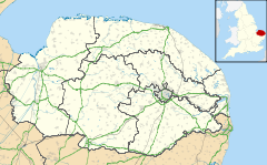
 Lingwood and Burlingham
Lingwood and Burlingham shown within NorfolkArea 9.39 km2 (3.63 sq mi) Population 2,504 - Density 267 /km2 (690 /sq mi) OS grid reference TG 363 087 Parish Lingwood and Burlingham District Broadland Shire county Norfolk Region East Country England Sovereign state United Kingdom Post town NORWICH Postcode district NR13 Police Norfolk Fire Norfolk Ambulance East of England EU Parliament East of England List of places: UK • England • Norfolk Lingwood and Burlingham is a civil parish in the English county of Norfolk, comprising the large village of Lingwood together with the smaller villages of Burlingham Green, North Burlingham and South Burlingham. The villages are all within 4 kilometres (2.5 mi) of each other, some 15 kilometres (9.3 mi) equidistant from the town of Great Yarmouth and the city of Norwich.[1]
The civil parish was created in 1935, by the merger of the ancient parishes of Lingwood, Burlingham St Andrew, Burlingham St Edmond and Burlingham St Peter. It has an area of 9.39 square kilometres (3.63 sq mi) and in the 2001 census had a population of 2,504 in 1,047 households. For the purposes of local government, the parish falls within the district of Broadland.[2][3]
Lingwood is served by Lingwood railway station on the Norwich-Great Yarmouth Wherry Line.
The name Lingwood originates from "Lingwoode", the first name given to the area, meaning "slope of a wood". The village was first noted in 1190.
Notable residents
- The cricketing brothers Eric, Geoff and Bill Edrich were all born in the village of Lingwood.
Notes
- ^ Ordnance Survey (2005). OS Explorer Map OL40 - The Broads. ISBN 0-319-23769-9.
- ^ "Burlingham CP Norfolk through time". Great Britain Historical GIS Project.. http://www.visionofbritain.org.uk/relationships.jsp?u_id=10124530&c_id=10001043. Retrieved 27 December 2005.
- ^ "Census population and household counts for unparished urban areas and all parishes". Office for National Statistics & Norfolk County Council (2001).. http://www.norfolk.gov.uk/consumption/groups/public/documents/general_resources/ncc017867.xls. Retrieved 2 December 2005.
External links
- Map sources for Lingwood.
- Map sources for Burlingham Green.
- Map sources for North Burlingham.
- Map sources for South Burlingham.
- Information from Genuki Norfolk on Lingwood.
- Information from Genuki Norfolk on North Burlingham.
- Information from Genuki Norfolk on South Burlingham.
Categories:- Broadland
- Villages in Norfolk
- Civil parishes in Norfolk
- Norfolk geography stubs

Wikimedia Foundation. 2010.