- Westborough, Massachusetts
:"For geographic and demographic information on the
census-designated place Westborough, please see the article Westborough (CDP),Massachusetts ." Infobox Settlement
official_name = Westborough, Massachusetts
nickname = The Hundredth Town
motto =
imagesize = 250px
image_caption = Nathan Fisher House, Westborough
image_
mapsize = 250px
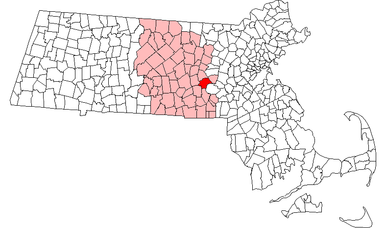
map_caption = Location in Worcester County in Massachusetts
mapsize1 =
map_caption1 =
subdivision_type = Country
subdivision_name =United States
subdivision_type1 = State
subdivision_name1 =Massachusetts
subdivision_type2 = County
subdivision_name2 = Worcester
government_type =Open town meeting
leader_title = Board of
Selectmen
leader_name = Timothy Dodd
Lydia Goldblatt
Rod Jane
George Thompson
Leigh Emery
established_title = Settled
established_title2 = Incorporated
established_date = 1675
established_date2 = 1717
area_magnitude =
area_total_km2 = 56.0
area_total_sq_mi = 21.6
area_land_km2 = 53.1
area_land_sq_mi = 20.5
area_water_km2 = 2.8
area_water_sq_mi = 1.1
area_water_percent =
area_urban_km2 =
area_urban_sq_mi =
area_metro_km2 =
area_metro_sq_mi =
population_as_of = 2000
population_note =
settlement_type = Town
population_total = 17997
population_density_km2 = 338.6
population_density_sq_mi = 876.9
population_metro =
population_density_metro_km2 =
population_density_metro_sq_mi =
population_urban =
timezone = Eastern (EST)
utc_offset = -5
timezone_DST = EDT
utc_offset_DST = -4
latd = 42 |latm = 16 |lats = 10 |latNS = N
longd = 71 |longm = 37 |longs = 00 |longEW = W
elevation_m = 91
elevation_ft = 300
website = http://www.town.westborough.ma.us/
postal_code_type = ZIP code
postal_code = 01581
area_code = 508 / 774
blank_name = FIPS code
blank_info = 25-75015
blank1_name = GNIS feature ID
blank1_info = 0618390
footnotes =Westborough is a town in Worcester County,
Massachusetts ,United States . The population was 17,997 at the 2000 census. The town is governed under theopen town meeting system.History
Before recorded time, the area now known as Westborough was a well travelled crossroads. As early as 7,000 B.C., prehistoric people in dugout canoes followed the Sudbury and Assabet Rivers to their headwaters in search of
quartzite for tools and weapons. During the period from 1200-1600 A.D., seasonal migrations brought Nipmuc Indians to hunt and fish near Cedar Swamp and Lake Hoccomocco. Using Fay Mountain as a landmark, Indians crisscrossed Westborough on well worn paths: the old Connecticut Path leading west from Massachusetts Bay; the Narragansett Trail leading south, and the trail (along the present Milk Street) leading to Canada. [The section about Westborough history is based on notes titled [http://www.westborough.com/westborough_history.htm "The Hundredth Town"] , written by Kristina N. Allen, which in turn are based on her 1984 book "On the Beaten Path", with the exception of the Northborough paragraph which is based on class notes from Mr. Antonio, former principal of the Eli Whitney school who later taught Westborough history at Armstrong school before retiring.]The early English explorer
John Oldham followed these trails through Westborough in 1633, and settlers in search of fertile farmlands followed not long after. By late 1675, a few families had settled near Lake Chauncy, in the "west borough" of Marlborough.On
November 18 ,1717 , Westborough was incorporated as the hundredth town in Massachusetts, populated by twenty-seven families. Soon large farms were carved out, mills built along the Assabet River and Jack Straw Brook, and taverns flourished. Westborough's first minister, Reverend Ebenezer Parkman, shepherded the growing town of colonists through the years toward independence from Great Britain. Forty-six minutemen from Westborough fought under Captain Edmund Brigham in theRevolutionary War In 1775, Northborough split off as the "north borough" of Westborough, much as Westborough split off from Marlborough some 58 years before. However, the two towns shared a meetinghouse for some time more.
In 1810 the route from Boston to Worcester was straightened and improved into an official
turnpike (the present Route 9), and along its Westborough route, the Wesson Tavern Common, Forbush Tavern and Nathan Fisher's store prospered. The center of commerce shifted downtown in 1824 with the arrival of the steam train through Westborough's center. Therailroad brought a new era to the town industry: over the next century, local factories shipped boots and shoes, straw hats, sleighs, textiles, bicycles, and eventually abrasive products, across the nation. Westborough dairies supplied cities with milk and local greenhouses shipped out carnations, while the eight orchards found ready markets for their produce.The industrial progress of the entire country is indebted to Westborough's most famous native son Eli Whitney Jr. Born in 1765, Whitney invented the
cotton gin in 1795 after graduating from Yale, In 1798 he introducedmass production to the United States at his Whitney Arms Company in New Haven,Connecticut . Whitney's legacy is apparent in the modern industries located within the town's borders:AstraZeneca , Dover Electric, Proteon,Genzyme ,EMC Corporation ,IBM ,PFPC , the US Headquarters of National Grid USA, headquarters odBose Corporation and the global headquarters ofAmerican Superconductor .Registered Historic Places
Westborough is home to six
Nationally Registered Historic Place s:
* Joseph Lothrop House, now known as 1790 Restaurant & Tavern, corner of Route 9 and Park Street. (added in 1974)
* Jonah Warren House — 64 Warren St. (addedDecember 5 ,1998 )
*Lyman School for Boys — Junction of Oak St. and Milk St. (addedAugust 25 ,1994 )
* Maples Cottage — East of Shrewsbury on Oak St. (addedApril 25 ,1980 )
* Nathan Fisher House — East of Shrewsbury on MA 9 (addedApril 25 ,1980 )
* West Main Street Historic District — Roughly bounded by Milk, Main, Blake, and Fay streets (addedJuly 16 ,1987 )
** Expanded to include 83-118 West Main St. (1990)
* Westborough State Hospital — Along Lyman St. North of Chauncy Lake and junction of Milk St. and MA 9 (addedFebruary 21 ,1994 )Geography
According to the
United States Census Bureau , the town has a total area of 21.6square mile s (56.0km² ),of which, 20.5 square miles (53.1 km²) of it is land and 1.1 square miles (2.8 km²) of it is water or 5.09 percent. The averageelevation of the town is approximately 300 feet (91 m). The town contains numerous bodies of water, including Lake Chauncy, Mill Pond, Lake Hoccomocco, and the Westborough Reservoir. Lake Chauncy is open to swimming, boating, and fishing, and has a public beach open to residents of Westborough and Northborough during the summer months.Adjacent towns
Westborough is located in Central Massachusetts, located about 29
mile s (47 km) west of Boston and 12 miles (19 km) east of Worcester.It is bordered by six towns:
*Grafton
*Hopkinton
*Northborough
*Shrewsbury
*Southborough
*UptonDemographics
Infobox Mass Town Govt
align = right
wraparound = yes
county = Worcester
clerk_courts = Dennis P. McManus (D)
cty_treasurer = Position Eliminated
da = Joseph D. Early, Jr. (D)
deeds = Anthony J. Vigliotti (D)
probate = Stephen Abraham (D)
sheriff = Guy W. Glodis (D)
state_rep =George N. Peterson (R)
Karyn E. Polito (R)
Paul J.P. Loscocco (R)
state_sen = Pamela P. Resor (D)
gov_councilors = Thomas J. Foley (D)
fed_rep = James P. McGovern (D-3rd District),
fed_sen =Edward Kennedy (D)John Kerry (D)As of thecensus GR|2 of 2000, there were 17,997 people (grew to 18,737 in 2004), 6,534 households, and 4,521 families residing in the town. Thepopulation density was 876.9 people persquare mile (338.6/km²). There were 6,773 housing units at an average density of 330.0 per square mile (127.4/km²). The racial makeup of the town was 88.18% White, 1.44% Black or African American, 0.13% Native American, 8.09% Asian, 0.02% Pacific Islander, 0.79% from other races, and 1.35% from two or more races. Hispanic or Latino of any race were 3.26% of the population.There were 6,534 households out of which 38.8% had children under the age of 18 living with them, 60.6% were married couples living together, 6.4% had a female householder with no husband present, and 30.8% were non-families. 25.1% of all households were made up of individuals and 9.8% had someone living alone who was 65 years of age or older. The average household size was 2.62 and the average family size was 3.21.
In the town the population was spread out with 28.4% under the age of 18, 5.2% from 18 to 24, 32.5% from 25 to 44, 22.4% from 45 to 64, and 11.6% who were 65 years of age or older. The median age was 37 years. For every 100 females there were 98.8 males. For every 100 females age 18 and over, there were 94.0 males.
The median income for a household in the town was $73,418, and the median income for a family was $94,610. Males had a median income of $66,157 versus $40,030 for females. The
per capita income for the town was $35,063. About 3.0% of families and 4.7% of the population were below thepoverty line , including 3.3% of those under age 18 and 5.3% of those age 65 or over. As of 2005 the labor force was over 9,300 people with an unemployment rate in the town of 3.1%. Additionally in 2004, the number of registered voters in the town reached 11,532.Education
Public schools
Westborough has a public school system. [http://westborough.ma.schoolwebpages.com/education/components/scrapbook/default.php?sectionid=1 Westborough Public Schools] operates the town's six schools, including three elementary schools, two middle schools and one high school.
*Hastings Elementary School
*Armstrong Elementary School
*Annie E. Fales Elementary School
*Mill Pond School
*Sarah W. Gibbons Middle School
*Westborough High SchoolThe Mill Pond School is the newest school addition to Westborough. The Mill Pond School consists of grade 4 to 6, then Gibbons Middle School which consists of grades 7 and 8, and then Westborough High School. There are various options depending upon residents' geographic location in the town for preschool through third grade. Graduation rates in the high school are consistently above 95% and the vast majority of these graduates attend a four-year college.
Westborough receives an extremely low education reimbursement from the Commonwealth (10th from the bottom) based upon a formula which was set in 1993. The district is working with state legislators to attempt to re-formulate Chapter 70 funding so that it is more equitable. [ [http://westborough.ma.schoolwebpages.com/education/components/scrapbook/default.php?sectionid=1 Westborough Public Schools website] ]
In a 2004/2005 study by School Matters, a service of Standard and Poors, Westborough Public School system was rated as one of the top public school systems in Massachusetts that consistently outperformed peer schools on MCAS reading and math proficiency test over the last four years. Westborough was the only school system in Worcester County other than Harvard, MA to achieve this top state wide ranking. Westborough ranked 16 out of 204 school systems rated in the state of Massachusetts in this study. In 2005,
Money Magazine listed Westborough #36 in its survey of Top 100 Best Places to Live, citing the financial support and staffing levels found in the Westborough Public Schools.The following facts published as part of the 2005 MCAS tests results give a profile of the academics throughout the Westborough Public Schools. [ [http://www.boston.com/news/special/inside_our_schools/westborough.htm The State of Education: Westborough, MA] , "Boston.com", 2005.]
* Total enrollment (2004-2005): 3,507- ranked 88/328 districts
* Grades Served: K-12
* Racial Make-up: African-American (1.4%), Asian (11.8%), Hispanic (4%), Native American (1%), White (82.8%)
* Gender Make-up of Student Body: Male (51.1%) Female (48.9%)
* Students whose first language is not English: (6.8%)- ranked 79/328 districts
* Students in Special Education: (11.9%)- ranked 285/328 districts
* Students from low-income families: (4.9%)- ranked 246/328 districts
* Dropouts per 100 students: (0.0%)- ranked 1/256 districts
* Average number of Absences per student: 6
* Percent of days the average student attended school: (96.8%)- ranked 9/328 districts
* Students who repeated a grade: (0.6%)- ranked 216/327 districts
* Total Number of Teachers: 272
* Student/Teacher Ratio: 12.9 to 1- ranked 138/328 districts
* Core Academic teachers identified as 'highly qualified': (96.4%)- ranked 173/328 districts
* Teachers licensed in their teaching assignment: 96.7%
* Average Teacher Salary: $51,590- ranked 129/328 districts
* Total School Spending: $33,055,171
* Per-Pupil Spending overall: $9,375- ranked 94/325 districts
* Per-Pupil spending on Regular Education: $8,143- ranked 52/308 districts
* Per-Pupil Spending on Special Education: $18,908- ranked 68/325 districts
* Number of Students per Computer: 4.5- ranked 167/327 districts
* Plans of High School Graduates: Four-year private college (42.5%), Four-year public college (37%), Two-year private college (0%), Two-year public college (6.8%), Other education (0.9%), Joined workforce (7.8%), Military Service (2.3%), Other (0%), Unknown (2.7%)Transportation
The Town of Westborough is located at the strategic intersection of the
Massachusetts Turnpike (Interstate 90 ) and Interstate 495, making it easily accessible from all directions, and providing an ideal location for both residents and businesses.Route 30 (Main Street) and Route 135 (South Street/Milk Street) intersect in a rotary at the town's center, while Route 9 runs nearby serving much of the town's commerce.
Growing traffic problems on Route 30 (Main Street) have recently become a major issue in town. There have recently been many construction projects to ease the traffic congestion downtown. The Bay State Commons shopping area has recently opened, and people say that traffic is even worse when commuters are heading west after a workday.
Westborough is served by a commuter rail station on the
Framingham/Worcester Line Westborough currently does not provide any public transportation apart from public school buses and free transportation for senior citizens.
Media
MediaNewspapers:
*TheBoston Globe (Boston)
*TheTelegram & Gazette (Worcester)
*TheBoston Herald (Boston)
*The MetroWest Daily News
*The Community Advocate
*The Westborough NewsBroadcast
*Channel 2: WGBH - (PBS) - Boston
*Channel 4: WBZ - (CBS ) - Boston, WBZ-TV
*Channel 5: WCVB - (ABC) - Boston
*Channel 6: WFXT - (FOX) - Boston, FOX 25
*Channel 7: WHDH - (NBC ) - Boston, 7 NBC
*Channel 11: Westborough TV Public Notice and Community Access Channel- Westborough
*Channel 12: Westborough TV Area Government Access Channel-Westborough
*Channel 13: Westborough TV Educational and Area Schools Access Channel-Westborough High School
*Channel 27: WUNI - (Univision ) - WorcesterPoints of interest
* [http://www.trails.com/tcatalog_trail.asp?trailid=CGN017-016 Assabet Reservoir] – hiking trails
* [http://www.town.westborough.ma.us/Public_Documents/WestboroughMA_ByLaws/S00124854 Lake Chauncy] - swimming, boating, fishing
* [http://www.westborocc.com/index_en.shtml Westborough Country Club] - semi-private, 9-hole, par 35 golf club
* [http://www.westboroughcharm.org Westborough Charm Bracelet] - hiking trail
*The Eli Whitney birthplace, located on Eli Whitney Street and marked with a commemorative stone
*Fay Mountain - The highest point in Westborough and a one-time landmark for Native AmericansAnnual events
*Annual Boy Scout Breakfast-March
*High School Musical-March
*Middle School Musical-April
*Spring Carnival-April
*Little League Parade-April
*Memorial Day Parade
*High School Graduation Ceremony-June
*4th of July Block Party
*Homecoming - October
*High School Play-November
*Middle School Play-November
*Thanksgiving Day Football game
*Christmas Singalong
*Westborough High School Winter Concert-DecemberPlaces of worship
Westborough is home to the following religious organizations:
* [http://www.bethtikvahsynagogue.org Beth Tikvah Synagogue]
* [http://www.chabadwestboro.org Chabad of Westborough]
* [http://www.cbnaishalom.org Congregation B'nai Shalom]
* [http://www.uccwestboro.org Evangelical Congregational Church]
*First Baptist Church Westborough
* [http://www.firstumchurch.com First United Methodist Church]
* [http://www.goodshepherdcares.org Good Shepherd Lutheran Church]
* [http://www.newhopechapel.net New Hope Chapel]
* [http://www.stlukes-parish.org St. Luke the Evangelist and Rectory]
* [http://www.ststeph.com St. Stephen's Episcopal Church]
* [http://www.uuwestborough.org Unitarian Universalist Congregational Society of Westborough]
* [http://www.chapelofthecross.com Chapel of the Cross]Notable residents
*
Jaime Brockett , 1970s folk singer.
*Jim Campbell , NHL hockey player from 1995-2006.
*Andrew Clements , children's author; wrote the popular bookFrindle
*AdmiralLouis E. Denfeld , served asChief of Naval Operations of theUnited States Navy
*Mark D. Devlin the author of "Stubborn Child" (ISBN 0-6891-1476-1), which details his stay at theLyman School for Boys
*Esther Forbes , Pulitzer Prize winning author of "Johnny Tremain" (1943)
*Ashley Hayden ,Luge r who competed at the2002 Winter Olympics inSalt Lake City .
*Richard B. Johnson the author of "Abominable Firebug " (ISBN 0-595-38667-9) which details his stay at theLyman School for Boys
*John Ruggles , American politician and "Father of the Patent"
*Nikki Stone ,1998 Winter Olympics gold medal winner of Women's AerialsFreestyle Skiing
*Jeffrey Thomas, science fiction and horror author of such books as "Punktown," "Deadstock," and "Blue War."
*Eli Whitney , inventor of thecotton gin andinterchangeable parts References
External links
* [http://www.town.westborough.ma.us/Home/ Westborough official website]
* [http://westborough.ma.schoolwebpages.com/ Westborough official school district website]
Wikimedia Foundation. 2010.