- Northborough, Massachusetts
-
Northborough, Massachusetts — Town — First Parish Church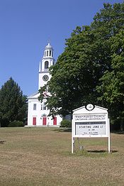

SealLocation in Worcester County in Massachusetts

Coordinates: 42°19′10″N 71°38′30″W / 42.31944°N 71.64167°WCoordinates: 42°19′10″N 71°38′30″W / 42.31944°N 71.64167°W Country United States State Massachusetts County Worcester Settled 1672 Incorporated 1766 Government – Type Open town meeting – Town
AdministratorJohn W. Coderre – Board of
SelectmenBill Pantazis
Aaron Hutchins
Leslie Rutan
Jeff Amberson
Dawn RandArea – Total 18.8 sq mi (48.6 km2) – Land 18.5 sq mi (48.0 km2) – Water 0.2 sq mi (0.6 km2) Elevation 300 ft (91 m) Population (2010) – Total 14,155 – Density 754.3/sq mi (291.3/km2) Time zone Eastern (UTC-5) – Summer (DST) Eastern (UTC-4) ZIP code 01532 Area code(s) 508 / 774 FIPS code 25-46820 GNIS feature ID 0618375 Website www.town.northborough.ma.us Northborough is a town in Worcester County, Massachusetts, United States. The official spelling of the town's name is "Northborough", but the shorter spelling "Northboro" is also used. The population was 14,155 at the 2010 census.
For geographic and demographic information on the census-designated place Northborough, please see the article Northborough (CDP), Massachusetts.
Contents
History
Northborough was first settled in 1672. On January 24, 1766, the district of Northborough was established within neighboring Westborough. On August 23, 1775, the district became a town, and on June 20, 1807 part of neighboring Marlborough was annexed to Northborough.[1][2]
The first Meeting House was established in 1746, with the legal governor of the town being called the Town Minister. The first Town Minister was Reverend John Martyn.
Geography
According to the United States Census Bureau, the town has a total area of 18.8 square miles (49 km2), of which 18.5 square miles (48 km2) is land and 0.2 square miles (0.52 km2), or 1.17%, is water.
Adjacent towns
Northborough is located in Central Massachusetts, bordered by:
- Southborough is located to the southeast. The border, however, is only 500 yards long and is in the woods with no accessible trail.
- Marlborough is located to the north of Southborough and due east of Northborough. The most accessible way to enter Marlborough from Northborough is through Route 20
- Berlin is located to the north of Northborough.
- Boylston is located to the northwest; I-290 splits Northborough from Boylston.
- Shrewsbury is located to the west, and is the town that separates Northborough from Worcester. Shrewsbury is accessible via Route 20 or Route 9.
- Westborough is located to the south of Northborough, and is accessible via Route 9.
Of the six towns that make up Northborough's borders, and including Northborough as the seventh, Northborough is the fourth largest town by population.
Demographics
Historical populations Year Pop. ±% 1860 1,565 — 1870 1,504 −3.9% 1880 1,676 +11.4% 1890 1,952 +16.5% 1900 2,164 +10.9% 1910 1,713 −20.8% 1920 1,753 +2.3% 1930 1,946 +11.0% 1940 2,382 +22.4% 1950 3,122 +31.1% 1960 6,687 +114.2% 1970 9,218 +37.8% 1980 10,568 +14.6% 1990 11,929 +12.9% 2000 14,013 +17.5% 2001* 14,252 +1.7% 2002* 14,331 +0.6% 2003* 14,419 +0.6% 2004* 14,634 +1.5% 2005* 14,645 +0.1% 2006* 14,689 +0.3% 2007* 14,795 +0.7% 2008* 14,683 −0.8% 2009* 14,852 +1.2% 2010 14,155 −4.7% * = population estimate. Source: United States Census records and Population Estimates Program data.[3][4][5][6][7][8][9][10][11] As of the census of 2000,[12] there were 14,013 people, 4,906 households, and 3,865 families residing in the town. The population density was 756.1 inhabitants per square mile (291.9 /km2). There were 5,002 housing units at an average density of 269.9 per square mile (104.2 /km2). The racial makeup of the town was 93.01% White, 0.65% Black or African American, 0.08% Native American, 5.05% Asian, 0.07% Pacific Islander, 0.36% from other races, and 0.78% from two or more races. Hispanic or Latino of any race were 1.28% of the population.
There were 4,906 households out of which 43.4% had children under the age of 18 living with them, 68.9% were married couples living together, 7.6% had a female householder with no husband present, and 21.2% were non-families. 17.1% of all households were made up of individuals and 6.2% had someone living alone who was 65 years of age or older. The average household size was 2.83 and the average family size was 3.22.
In the town the population was spread out with 29.5% under the age of 18, 4.5% from 18 to 24, 31.3% from 25 to 44, 25.0% from 45 to 64, and 9.8% who were 65 years of age or older. The median age was 37 years. For every 100 females there were 96.8 males. For every 100 females age 18 and over, there were 93.0 males.
The median income for a household in the town was $79,781, and the median income for a family was $90,480. Males had a median income of $65,437 versus $41,042 for females. The per capita income for the town was $32,889. About 1.7% of families and 2.8% of the population were below the poverty line, including 2.0% of those under age 18 and 9.3% of those age 65 or over.
Government
County government: Worcester County Clerk of Courts: Dennis P. McManus (D) District Attorney: Joseph D. Early, Jr. (D) Register of Deeds: Anthony J. Vigliotti (D) Register of Probate: Stephen Abraham (D) County Sheriff: Lew Evangelidis (R) State government State Representative(s): Harold P. Naughton, Jr (D) State Senator(s): Harriette L. Chandler (D), James B. Eldridge (D) Governor's Councilor(s): Jen Caissie (R), Marilyn M. Petitto Devaney (D) Federal government U.S. Representative(s): James P. McGovern (D-3rd District), U.S. Senators: John Kerry (D), Scott Brown (R)  Northborough public library, 1899
Library
The Northborough Free Library was established in 1868.[13][14] In fiscal year 2009, the town of Northborough spent 1.5% ($645,208) of its budget on its public library— $43.41 per person.[15]
Education
Northborough has many schools, public and private. It is home to four public elementary schools serving grades pre-K–5: Lincoln Street School, Marguerite E. Peaslee School, Fannie E. Proctor School, and Marion E. Zeh school. Private schools include The Cornerstone Academy, Alhuda Academy and St. Bernadette's. In 2002 the Northborough Middle School was renamed after superintendent of schools, Robert E. Melican. All of the public schools in Northborough are part of the Northborough-Southborough School District. The public high school serving Northborough is Algonquin Regional High School, shared with Southborough. The mascot for Northborough-Southborough students is the Tomahawk. Algonquin's main sports rivals are the Westborough Rangers. Debates have erupted over whether Northborough and Southborough should have separate high schools; however, citizens of both Northborough and Southborough successfully fought to keep the school regionalized. Assabet Valley Regional Technical Vocational High School is an alternate choice for Northborough students, though the majority of students attend Algonquin. Private schools in the area include Fay School and St. Mark's School in Southborough, St. John's High School in Shrewsbury or Notre Dame Academy in Worcester.
For information on Algonquin Regional High School athletics, see: Algonquin Regional High School
Notable residents
- Joseph Henry Allen, Unitarian minister and scholar[16]
- William Francis Allen, classical scholar[16]
- Mark Fidrych, former pitcher for the Detroit Tigers and 1976 American League Rookie of the Year
- Richard Herrick, recipient of first kidney transplant
- Gregory Goodwin Pincus, one of the three "fathers" of the birth control pill[17]
- Nathaniel Raymond, human rights investigator and anti-torture advocate
- Luther Rice, Baptist minister and founder of George Washington University
- Mike Sherman, former head coach of the Green Bay Packers
- Daniel Wesson, co-founder of the Smith & Wesson gun manufacturing company
References
- ^ First- Thirty Second Report of the Commissioner of Public Records, Massachusetts
- ^ The annexation was requested by Jonas Bartlett, whose property straddled the border between the two towns. The minutes of town meetings for both towns record the change, which redrew the boundary to conform to Bartlett's property line.
- ^ "TOTAL POPULATION (P1), 2010 Census Summary File 1, All County Subdivisions within Massachusetts". United States Census Bureau. http://factfinder2.census.gov/bkmk/table/1.0/en/DEC/10_SF1/P1/0400000US25.06000. Retrieved September 13, 2011.
- ^ "Massachusetts by Place and County Subdivision - GCT-T1. Population Estimates". United States Census Bureau. http://factfinder.census.gov/servlet/GCTTable?_bm=y&-geo_id=04000US25&-_box_head_nbr=GCT-T1&-ds_name=PEP_2009_EST&-_lang=en&-format=ST-9&-_sse=on. Retrieved July 12, 2011.
- ^ "1990 Census of Population, General Population Characteristics: Massachusetts". US Census Bureau. December 1990. Table 76: General Characteristics of Persons, Households, and Families: 1990. 1990 CP-1-23. http://www.census.gov/prod/cen1990/cp1/cp-1-23.pdf. Retrieved July 12, 2011.
- ^ "1980 Census of the Population, Number of Inhabitants: Massachusetts". US Census Bureau. December 1981. Table 4. Populations of County Subdivisions: 1960 to 1980. PC80-1-A23. http://www2.census.gov/prod2/decennial/documents/1980a_maABC-01.pdf. Retrieved July 12, 2011.
- ^ "1950 Census of Population". Bureau of the Census. 1952. Section 6, Pages 21-10 and 21-11, Massachusetts Table 6. Population of Counties by Minor Civil Divisions: 1930 to 1950. http://www2.census.gov/prod2/decennial/documents/23761117v1ch06.pdf. Retrieved July 12, 2011.
- ^ "1920 Census of Population". Bureau of the Census. Number of Inhabitants, by Counties and Minor Civil Divisions. Pages 21-5 through 21-7. Massachusetts Table 2. Population of Counties by Minor Civil Divisions: 1900, 1910, and 1920. http://www2.census.gov/prod2/decennial/documents/41084506no553ch2.pdf. Retrieved July 12, 2011.
- ^ "1890 Census of the Population". Department of the Interior, Census Office. Pages 179 through 182. Massachusetts Table 5. Population of States and Territories by Minor Civil Divisions: 1880 and 1890. http://www2.census.gov/prod2/decennial/documents/41084506no553ch2.pdf. Retrieved July 12, 2011.
- ^ "1870 Census of the Population". Department of the Interior, Census Office. 1872. Pages 217 through 220. Table IX. Population of Minor Civil Divisions, &c. Massachusetts. http://www2.census.gov/prod2/decennial/documents/1870e-05.pdf. Retrieved July 12, 2011.
- ^ "1860 Census". Department of the Interior, Census Office. 1864. Pages 220 through 226. State of Massachusetts Table No. 3. Populations of Cities, Towns, &c.. http://www2.census.gov/prod2/decennial/documents/1860a-08.pdf. Retrieved July 12, 2011.
- ^ "American FactFinder". United States Census Bureau. http://factfinder.census.gov. Retrieved 2008-01-31.
- ^ C.B. Tillinghast. The free public libraries of Massachusetts. 1st Report of the Free Public Library Commission of Massachusetts. Boston: Wright & Potter, 1891. Google books
- ^ http://northboroughlibrary.org/northborough/ Retrieved 2010-11-10
- ^ July 1, 2008 through June 30, 2009; cf. The FY2009 Municipal Pie: What’s Your Share? Commonwealth of Massachusetts, Board of Library Commissioners. Boston: 2010. Available: Municipal Pie Reports. Retrieved 2011-11-11
- ^ a b Who Was Who in America, Historical Volume, 1607-1896. Marquis Who's Who. 1967.
- ^ "Dr. Pincus, Developer of Birth-Control Pill, Dies". The New York Times. August 23, 1967. http://www.nytimes.com/learning/general/onthisday/bday/0409.html. Retrieved 2007-07-21. "Dr. Gregory Goodwin Pincus, one of the three "fathers" of the birth-control pill, died here tonight at Peter Bent Brigham Hospital of myeloid metaplasia, a rare blood disease. He was 64 years old and lived in Northboro."
External links
Categories:- Towns in Worcester County, Massachusetts


Wikimedia Foundation. 2010.