- Marshfield, Massachusetts
-
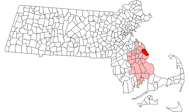
Marshfield, Massachusetts — Town — Marshfield Town Hall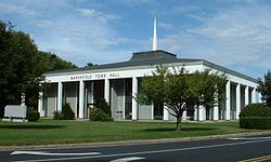 Location in Plymouth County in Massachusetts
Coordinates: 42°05′30″N 70°42′22″W / 42.09167°N 70.70611°WCoordinates: 42°05′30″N 70°42′22″W / 42.09167°N 70.70611°W Country United States State Massachusetts County Plymouth Settled 1632 Incorporated 1640 Government – Type Open town meeting Area – Total 31.7 sq mi (82.2 km2) – Land 28.5 sq mi (73.7 km2) – Water 3.3 sq mi (8.5 km2) Elevation 17 ft (5 m) Population (2010) – Total 25,132 – Density 881.8/sq mi (341.0/km2) Time zone Eastern (UTC-5) – Summer (DST) Eastern (UTC-4) ZIP code 02050 Area code(s) 339 / 781 FIPS code 25-38855 GNIS feature ID 0619470 Website http://www.townofmarshfield.org Marshfield is a town in Plymouth County, Massachusetts, United States, on Massachusetts's South Shore. The population was 25,132 at the 2010 census.
See also: Green Harbor, Marshfield (CDP), Rexhame, Marshfield Hills, and Ocean Bluff and Brant Rock.
Contents
History
See
Main article: History of Marshfield, MassachusettsGeography
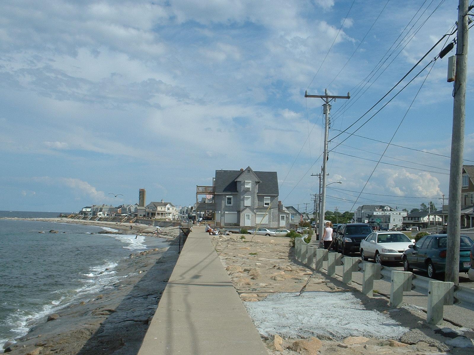
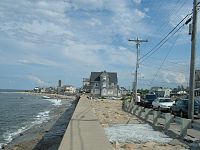 Ocean Bluff looking south
Marshfield is located on the South Shore, about where Cape Cod Bay meets the Massachusetts Bay.
According to the United States Census Bureau, the town has a total area of 31.74 square miles (82.2 km²). 28.46 square miles (73.7 km²) of it is land and 3.28 square miles (8.5 km²) of it (10.33%) is water. Marshfield is bordered by Massachusetts Bay to the east, Duxbury to the south and southeast, Pembroke to the west, Norwell to the northwest, and Scituate to the north and northeast. Marshfield is eighteen miles (29 km) east of Brockton and twenty-nine miles southeast of Boston.
Marshfield is named for the many salt marshes which border the salt and brackish borders of the town. There are three rivers, the North (along the northern border of the town), South (which branches at the mouth of the North River and heads south through the town) and the Green Harbor River (which flows just west of Brant Rock and Green Harbor Point at the south of town).
The South River divides a peninsula from the rest of the town, where Rexhame village and the Humarock and Fourth Cliff neighborhoods of the town of Scituate lie. The Scituate neighborhoods can be reached by land by two bridges, by boat, or by foot along Rexhame Beach. The Rexhame-Humarock peninsula is a barrier beach with an 84 ft (26 m). high moraine, one of only two barrier beach moraines on the east coast of the United States.
Marshfield is also the site of several small forests and conservation areas, including the Daniel Webster Wildlife Sanctuary along the Green Harbor River and the North River Wildlife Sanctuary, along Route 3A.
The Town of Marshfield MA has six separate zip codes: Marshfield 02050, Brant Rock 02020, Ocean Bluff 02065, North Marshfield 02059, Marshfield Hills 02051, Green Harbor 02041.
This quaint seaside Town is politically divided by eight Villages: Marshfield Center, Fieldston, Ocean Bluff, Rexhame, Brant Rock, Green Harbor, Marshfield Hills, and North Marshfield
The following beaches comprise Marshfield's five mile long public seashore: Rexhame, Fieldston, Sunrise, Ocean Bluff, Brant Rock, Blackman’s Point, Blue Fish Cove, Burke’s and Green Harbor. See History of Marshfield, Massachusetts.
Marshfield is a popular summer beach destination. Tourists and vacationers cause the town's population to nearly double from Memorial Day through Labor Day weekend. Only full-time residents can vote on public tax matters.
Demographics
Historical populations Year Pop. ±% 1850 1,837 — 1860 1,870 +1.8% 1870 1,659 −11.3% 1880 1,781 +7.4% 1890 1,713 −3.8% 1900 1,810 +5.7% 1910 1,738 −4.0% 1920 1,379 −20.7% 1930 1,625 +17.8% 1940 2,419 +48.9% 1950 3,267 +35.1% 1960 6,748 +106.6% 1970 15,223 +125.6% 1980 20,916 +37.4% 1990 21,531 +2.9% 2000 24,324 +13.0% 2001* 24,546 +0.9% 2002* 24,666 +0.5% 2003* 24,614 −0.2% 2004* 24,495 −0.5% 2005* 24,509 +0.1% 2006* 24,489 −0.1% 2007* 24,488 −0.0% 2008* 24,739 +1.0% 2009* 24,887 +0.6% 2010 25,132 +1.0% * = population estimate.
Source: United States Census records and Population Estimates Program data.[1][2][3][4][5][6][7][8][9][10]As of the census of 2000, there were 24,324 people, 8,905 households, and 6,598 families residing in the town.[11] The population density was 854.8 people per square mile (330.1/km²). There were 9,954 housing units at an average density of 349.8 per square mile (135.1/km²). The racial makeup of the town was 92.69% White, 3.54% Black or African American, 0.11% Native American, 0.37% Asian, 0.02% Pacific Islander, 0.52% from other races, and 0.76% from two or more races. Hispanic or Latino of any race were 2.67% of the population.
There were 8,905 households out of which 37.4% had children under the age of 18 living with them, 60.9% were married couples living together, 10.1% had a female householder with no husband present, and 25.9% were non-families. 20.9% of all households were made up of individuals and 7.2% had someone living alone who was 65 years of age or older. The average household size was 2.73 and the average family size was 3.20.
In the town the population was spread out with 27.4% under the age of 18, 5.7% from 18 to 24, 31.2% from 25 to 44, 26.2% from 45 to 64, and 9.5% who were 65 years of age or older. The median age was 37 years. For every 100 females there were 95.3 males. For every 100 females age 18 and over, there were 91.6 males.
The median income for a household in the town was $83,540, and the median income for a family was $104,207. The median home value was $440,600.[12] Males had a median income of $87,992 versus $52,773 for females. The per capita income for the town was $64,003. About 3.8% of families and 0.9% of the population were below the poverty line, including 6.7% of those under age 18 and 4.8% of those age 65 or over.
Government
On the national level, Marshfield is a part of Massachusetts's 10th congressional district, and is currently represented by William Keating (D). The state's senior (Class II) member of the United States Senate, re-elected in 2008, is John Kerry. The junior (Class I) senator, elected in 2010, is Scott Brown. In the United States Senate special election in Massachusetts, 2010 the results were; Scott Brown (R): 66% and Martha Coakley (D): 33%.
On the state level, Marshfield is represented in the Massachusetts House of Representatives as a part of the Fourth Plymouth district, which also includes much of the town of Scituate. The representative for Marshfield and Scituate in the Massachusetts House of Representatives is Jim Cantwell (D). The town is represented by Robert Hedlund (R) in the Massachusetts Senate as a part of the Plymouth and Norfolk district, which includes the towns of Cohasset, Duxbury, Hingham, Hull, Norwell, Scituate and Weymouth.[13] The town is patrolled by the First (Norwell) Barracks of Troop D of the Massachusetts State Police.[14]
Marshfield is governed on the local level by the open town meeting form of government, and is led by a town administrator and a board of selectmen. The current board of selectmen includes a direct descendant of Pilgrim Richard Warren. The modern town hall is located at the intersection of Routes 3A and 139, just south of the South River. The town has its own police and fire stations, with firehouses located in Marshfield Hills, Ocean Bluff and near the fairgrounds. The town's Ventress Memorial Library is located a short distance east of the town hall, and is a member of the Old Colony Library Network (OCLN). There is also an independent library, the Clift Rodgers Free Library, in Marshfield Hills. The town has three post offices, in the same neighborhoods as the fire stations.
Voter Registration and Party Enrollment as of October 15, 2008[15] Party Number of Voters Percentage Democratic 4,848 27.31% Republican 2,509 14.13% Unaffiliated 10,338 58.24% Minor Parties 57 0.32% Total 17,752 100% Education
Marshfield operates its own school system for the town's nearly 4,700 students. There are five elementary schools:[16]
- Governor Edward Winslow Elementary School[17]
- Daniel Webster Elementary School
- Eames Way Elementary School
- Martinson Elementary School
- South River Elementary School
The Elementary Schools serve students from pre-kindergarten through fifth grade. (Eames Way and South River, however, do not have pre-kindergarten classes).
The Furnace Brook Middle School serves students from sixth through eighth grade. FBMS is a top school, winner of the Jimmy Fund Cancer Research Foundation Contest in 2006, 2007,2009 and 2011. The school consists of 3 clusters in each grade level (Red, Yellow, and Crimson in 6th; Green, Purple, and Blue in 7th; and Gold, Pink, and Orange in 8th).
Marshfield High School serves grades nine through twelve. Marshfield High School's athletic teams are known as the Rams, and their colors are green, white, and black. Their chief rival is Duxbury High School and they play against them in the Thanksgiving football game. There are no private or vocational schools in the town; the nearest private schools are in neighboring Scituate and Duxbury (as well as a charter school in Norwell). The nearest college is Bridgewater State College in Bridgewater, MA.
Transportation
Route 3, also known as the Pilgrims Highway, skirts the town along the Pembroke town line, and can be accessed in Marshfield via the Route 139 exit. Route 139 loops through the town, with a long portion passing along the beaches of the Ocean Bluff and Fieldston neighborhoods before heading north and east into Pembroke. Route 3A also passes through the town, entering from the south in Duxbury and exiting over the North River into Scituate.
There is daily bus service connecting with the MBTA station in Braintree and another bus connecting with South Station in Boston. The nearest train station is the Greenbush station in Scituate. There is a commuter ferry to Boston available in Hingham. The nearest major airport is Logan International Airport in Boston. The area is also served by T.F. Green Airport in Rhode Island and the town's own municipal airport for general aviation. The nearest freight rail service is in Wareham.
Notable residents
- Aerosmith rock band members Steven Tyler, Joey Kramer and Brad Whitford.
- F. Lee Bailey, attorney
- Dicky Barrett, lead singer of Boston band The Mighty Mighty Bosstones.
- Steve Carell and his wife Nancy Walls, comedians.
- Joe Castiglione, baseball radio announcer, Boston Red Sox
- Susan Cooper, a writer
- Jeff Corwin, naturalist, host of The Jeff Corwin Experience on Animal Planet
- Reginald Fessenden 1866-1932, radio pioneer
- Ryan Gibbons, Dallas Cowboys offensive lineman
- Sean Morey, Arizona Cardinals wide receiver
- Lance Norris, writer and actor
- Jesse Reed, nail manufacturer and inventor of ship's steering gear in 1847, 1849, and 1858
- Daniel Webster 1782–1852, statesman, orator, senator, Secretary of State to three U.S. presidents
- Fletcher Webster son of Daniel Webster who gave his life for the Union in the Battle of Bull Run
- Edward Winslow 1595-1655, Pilgrim Governor of Plymouth Colony
- Josiah Winslow first native born governor of Plymouth Colony
- John Winslow (British Army officer) Major-General in British Army who removed the Acadians from Nova Scotia, as described in famous Longfellow poem, "Evangeline". The Town of Winslow, Maine is named after him.
- Isaac Winslow—Judge and President of the Council of the Province of Massachusetts
- Susanna Fuller White—a Mayflower Pilgrim. First English bride married in New England, and first English woman to give birth in New England
- Joseph Patrick Kennedy II former U.S.Congressman, and son of Bobby Kennedy
- Sean Morris pro lacrosse player for the Boston Cannons and Boston Blazers
- Edward Rowe Snow, famous lighthouse historian and author
- Joseph Spang, inventor of the Cube Steak Machine
- Template:Kimberly G La Torraca Nation's top closing attorney
- Lieutenant Peregrine White first English child born in New England
- Sarah Smith Kent—grand aunt of Abigail Smith Adams, the second First Lady of the United States
- Adelaide Phillips--most famous female opera singer in America during the 19th century
- John Bourne—Patriot who fought at the Battle of Bunker Hill and along with General George Washington at Valley Forge
- Resolved White--Mayflower Pilgrim
- John Thomas (general) (1724-June 2, 1776) General in the Continental Army during the American Revolution. He led the 2nd Massachusetts Regiment, composed of volunteers from Plymouth County during the Siege of Boston. Thomas Park, a national historical site and monument on Dorchester Heights in South Boston commemorating the Siege of Boston, was named after him. Thomaston, Maine is named after him.
- Nathaniel Ray Thomas—one of the leading loyalists of New England during the American Revolution.
Ralph Fletcher [the author] grew up here and wrote a book about it. James Ian Kirkland - dinosaur paleontologist, Utah State Paleontologist.
References
- ^ "TOTAL POPULATION (P1), 2010 Census Summary File 1, All County Subdivisions within Massachusetts". United States Census Bureau. http://factfinder2.census.gov/bkmk/table/1.0/en/DEC/10_SF1/P1/0400000US25.06000. Retrieved September 13, 2011.
- ^ "Massachusetts by Place and County Subdivision - GCT-T1. Population Estimates". United States Census Bureau. http://factfinder.census.gov/servlet/GCTTable?_bm=y&-geo_id=04000US25&-_box_head_nbr=GCT-T1&-ds_name=PEP_2009_EST&-_lang=en&-format=ST-9&-_sse=on. Retrieved July 12, 2011.
- ^ "1990 Census of Population, General Population Characteristics: Massachusetts". US Census Bureau. December 1990. Table 76: General Characteristics of Persons, Households, and Families: 1990. 1990 CP-1-23. http://www.census.gov/prod/cen1990/cp1/cp-1-23.pdf. Retrieved July 12, 2011.
- ^ "1980 Census of the Population, Number of Inhabitants: Massachusetts". US Census Bureau. December 1981. Table 4. Populations of County Subdivisions: 1960 to 1980. PC80-1-A23. http://www2.census.gov/prod2/decennial/documents/1980a_maABC-01.pdf. Retrieved July 12, 2011.
- ^ "1950 Census of Population". Bureau of the Census. 1952. Section 6, Pages 21-10 and 21-11, Massachusetts Table 6. Population of Counties by Minor Civil Divisions: 1930 to 1950. http://www2.census.gov/prod2/decennial/documents/23761117v1ch06.pdf. Retrieved July 12, 2011.
- ^ "1920 Census of Population". Bureau of the Census. Number of Inhabitants, by Counties and Minor Civil Divisions. Pages 21-5 through 21-7. Massachusetts Table 2. Population of Counties by Minor Civil Divisions: 1920, 1910, and 1920. http://www2.census.gov/prod2/decennial/documents/41084506no553ch2.pdf. Retrieved July 12, 2011.
- ^ "1890 Census of the Population". Department of the Interior, Census Office. Pages 179 through 182. Massachusetts Table 5. Population of States and Territories by Minor Civil Divisions: 1880 and 1890. http://www2.census.gov/prod2/decennial/documents/41084506no553ch2.pdf. Retrieved July 12, 2011.
- ^ "1870 Census of the Population". Department of the Interior, Census Office. 1872. Pages 217 through 220. Table IX. Population of Minor Civil Divisions, &c. Massachusetts. http://www2.census.gov/prod2/decennial/documents/1870e-05.pdf. Retrieved July 12, 2011.
- ^ "1860 Census". Department of the Interior, Census Office. 1864. Pages 220 through 226. State of Massachusetts Table No. 3. Populations of Cities, Towns, &c.. http://www2.census.gov/prod2/decennial/documents/1860a-08.pdf. Retrieved July 12, 2011.
- ^ "1850 Census". Department of the Interior, Census Office. 1854. Pages 338 through 393. Populations of Cities, Towns, &c.. http://www2.census.gov/prod2/decennial/documents/1850c-11.pdf. Retrieved July 12, 2011.
- ^ "Marshfield town, Plymouth County, Massachusetts - Fact Sheet - American FactFinder". U.S. Census Bureau. http://factfinder.census.gov/servlet/SAFFFacts?_event=&geo_id=06000US2502338855&_geoContext=01000US%7C04000US25%7C05000US25023%7C06000US2502338855&_street=&_county=marshfield&_cityTown=marshfield&_state=04000US25&_sse=on&pctxt=fph&pgsl=060&_submenuId=factsheet_1&ds_name=ACS_2008_3YR_SAFF&_ci_nbr=null&qr_name=null. Retrieved 2009-12-06.
- ^ "Marshfield town, Plymouth County, Massachusetts - Fact Sheet - American FactFinder". U.S. Census Bureau. http://factfinder.census.gov/servlet/ACSSAFFFacts?_event=Search&geo_id=&_geoContext=&_street=&_county=marshfield&_cityTown=marshfield&_state=04000US25. Retrieved 2010-04-08.
- ^ "Massachusetts Legislators :: By City and Town". http://www.mass.gov/legis/city_town.htm. Retrieved 2009-12-06.
- ^ "Station D-1, SP Norwell". http://www.mass.gov/?pageID=eopsterminal&L=5&L0=Home&L1=Law+Enforcement+%26+Criminal+Justice&L2=Law+Enforcement&L3=State+Police+Troops&L4=Troop+D&sid=Eeops&b=terminalcontent&f=msp_divisions_field_services_troops_troop_d_msp_field_troop_d_station_d1&csid=Eeops. Retrieved 2009-12-06.
- ^ "Registration and Party Enrollment Statistics as of October 15, 2008" (PDF). Massachusetts Elections Division. http://www.sec.state.ma.us/ele/elepdf/st_county_town_enroll_breakdown_08.pdf. Retrieved 2010-05-08.
- ^ "Town of Marshfield, MA - Marshfield Schools". http://www.townofmarshfield.org/Public_Documents/MarshfieldMA_WebDocs/schools. Retrieved 2009-12-06.
- ^ "Governor Edward Winslow Elementary School". http://www.mpsd.org/GOVERNORWINSLOW/index.html. Retrieved 2011-01-01.
External links
Municipalities and communities of Plymouth County, Massachusetts Cities 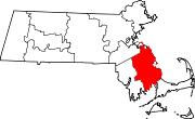
Towns CDPs Bridgewater | Duxbury | Green Harbor-Cedar Crest | Hanson | Hingham | Kingston | Marion Center | Marshfield | Marshfield Hills | Mattapoisett Center | Middleborough Center | North Lakeville | North Pembroke | North Plymouth | North Scituate | Ocean Bluff-Brant Rock | Onset | Plymouth Center | Scituate | South Duxbury | Wareham Center | West Wareham | Weweantic | White Island Shores
Other
villages- Ventress Memorial Library (public library)
- Answer Book/Marshfield: Everything you need to know
Categories:- Populated coastal places in Massachusetts
- Towns in Plymouth County, Massachusetts
- Populated places established in 1632


Wikimedia Foundation. 2010.