- North Berwick (CDP), Maine
-
North Berwick, Maine — CDP — Town Hall Location within the state of Maine
 North Berwick, Maine
Coordinates: 43°18′14″N 70°44′6″W / 43.30389°N 70.735°WCoordinates: 43°18′14″N 70°44′6″W / 43.30389°N 70.735°W Country United States State Maine County York Area – Total 3.2 sq mi (8.3 km2) – Land 3.2 sq mi (8.3 km2) – Water 0.0 sq mi (0.0 km2) Elevation 141 ft (43 m) Population (2000) – Total 1,580 – Density 493.5/sq mi (190.6/km2) Time zone Eastern (EST) (UTC-5) – Summer (DST) EDT (UTC-4) ZIP code 03906 Area code(s) 207 FIPS code 23-50290 GNIS feature ID 0572254 North Berwick is a census-designated place (CDP) in the town of North Berwick in York County, Maine, United States. The population was 1,580 at the 2000 census. It is part of the Portland–South Portland–Biddeford, Maine Metropolitan Statistical Area.
Contents
Geography
North Berwick is located at 43°18′14″N 70°44′6″W / 43.30389°N 70.735°W (43.303999, -70.734949).[1]
According to the United States Census Bureau, the CDP has a total area of 3.2 square miles (8.3 km²), all of it land. North Berwick is drained by the Great Works River and its tributary, the Negutaquet River.
Demographics
As of the census[2] of 2000, there were 1,580 people, 601 households, and 420 families residing in the CDP. The population density was 493.5 people per square mile (190.6/km²). There were 626 housing units at an average density of 195.5/sq mi (75.5/km²). The racial makeup of the CDP was 96.33% White, 1.08% Black or African American, 0.32% Native American, 0.70% Asian, 0.06% from other races, and 1.52% from two or more races. Hispanic or Latino of any race were 0.70% of the population.
There were 601 households out of which 33.9% had children under the age of 18 living with them, 55.2% were married couples living together, 10.5% had a female householder with no husband present, and 30.1% were non-families. 23.5% of all households were made up of individuals and 9.0% had someone living alone who was 65 years of age or older. The average household size was 2.55 and the average family size was 3.00.
In the CDP the population was spread out with 25.1% under the age of 18, 7.0% from 18 to 24, 31.6% from 25 to 44, 22.8% from 45 to 64, and 13.4% who were 65 years of age or older. The median age was 38 years. For every 100 females there were 92.7 males. For every 100 females age 18 and over, there were 87.9 males.
The median income for a household in the CDP was $39,931, and the median income for a family was $46,964. Males had a median income of $34,000 versus $20,662 for females. The per capita income for the CDP was $17,992. About 4.5% of families and 5.4% of the population were below the poverty line, including 10.3% of those under age 18 and none of those age 65 or over.
References
- ^ "US Gazetteer files: 2010, 2000, and 1990". United States Census Bureau. 2011-02-12. http://www.census.gov/geo/www/gazetteer/gazette.html. Retrieved 2011-04-23.
- ^ "American FactFinder". United States Census Bureau. http://factfinder.census.gov. Retrieved 2008-01-31.
External links
Municipalities and communities of York County, Maine Cities 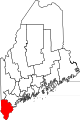
Towns CDPs Berwick | Cape Neddick | Kennebunk | Kennebunkport | Kittery | Kittery Point | Lake Arrowhead | North Berwick | Sanford | South Eliot | South Sanford | Springvale | West Kennebunk | York Harbor
Other
villagesCategories:- Census-designated places in Maine
- Portland – South Portland – Biddeford metropolitan area
- Populated places in York County, Maine


Wikimedia Foundation. 2010.