- Lindfield, West Sussex
-
Coordinates: 51°00′49″N 0°05′00″W / 51.0135°N 0.0833°W
Lindfield 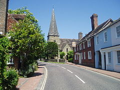
Lindfield High Street leading to All Saints Church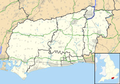
 Lindfield
Lindfield shown within West SussexArea 2.24 km2 (0.86 sq mi) [1] Population 5,394 [1] 2001 Census - Density 2,407 /km2 (6,230 /sq mi) OS grid reference TQ345255 - London 34 miles (55 km) N Parish Lindfield District Mid Sussex Shire county West Sussex Region South East Country England Sovereign state United Kingdom Post town HAYWARDS HEATH Postcode district RH16 Dialling code 01444 Police Sussex Fire West Sussex Ambulance South East Coast EU Parliament South East England UK Parliament Mid Sussex Website http://www.lindfieldparishcouncil.org.uk List of places: UK • England • West Sussex Lindfield is a village and civil parish in the Mid Sussex District of West Sussex, England. The parish lies to the north-east of Haywards Heath, of which the village is a part of the built-up area. It stands on the upper reaches of the River Ouse. The name 'Lindfield' means 'open land with lime trees.'
The parish Church, All Saints, stands at the top of the High Street and its history goes back to 1098. One of the oldest houses in the village is Church House, formerly known as The Tiger, and still referred to as "The Tiger" by Lindfield residents.
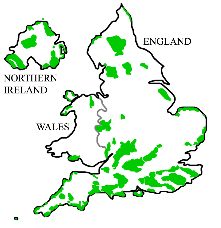
It is classified as an Area of Outstanding Natural Beauty.
Contents
About the village
The village stands on high ground above the upper reaches of the River Ouse. It is situated close to both the natural beauty of the High Weald and to Haywards Heath with its amenities and station on the main London-Brighton railway line. Lindfield has a rich historic and architectural heritage. The ancient High Street, lined with lime trees, has over forty medieval and post medieval timber-framed houses, with many individual shops. At the bottom of the High Street is a natural spring-fed pond with fish, ducks, swans and herons. Beyond lies the Common which, over the centuries, has witnessed many events - fairs, festivals, bonfire celebrations and sporting activities; cricket has been played there since 1747[2]. Today, it is still central to village celebrations and leisure activities. In addition to the Common there is Pickers' Green, providing pitches for cricket, football, stoolball and a children’s play area.
History
The High Street follows an ancient north-south track that has existed for thousands of years, long before the Romans built a major road a mile to the west of the village.
Lindfield first appeared as Lindefeldia, ‘open land with lime trees’, in a Saxon charter of 765 AD, in which King Ealdwulf granted lands for the building of a Minster church. By Domesday the lands were held by the Archbishop of Canterbury.
King Edward III recognised the importance of medieval Lindfield and in 1343 granted the town a royal charter to hold a market every Thursday and two annual eight day fairs. For centuries the fairs continued each April and August with the summer fair becoming one of the largest sheep sales in Sussex.
Lindfield was once part of the thriving Wealden iron industry. As early as 1539, William Levett of Buxted, a county curate with a thriving sideline in iron and armaments, was recorded as extracting iron ore at Lindfield. Later the Henslowe family of Lindfield were actively engaged in the iron milling business in association with Ralph Hogge, parson Levett's former servant and later a major ironmaster in his own right.
In 1841 the London-Brighton railway opened, passing to the west of the parish with a ‘Station for Cuckfield and Lindfield Towns’ on open land that was to become the town of Haywards Heath. The construction of the Ouse Valley branch line reached Lindfield in 1866 with a proposed station to the north of All Saints’ Church but the line was abandoned for financial reasons.
Nature and the countryside
The Eastern Road Nature Reserve, off Lewes Road, is a 9 acres (36,000 m2) reserve alongside the Scrase Stream. It is managed to encourage diverse vegetation which supports a wealth of wildlife. Myriads of insects and butterflies, together with the autumn fruits, provide food for resident and visiting birds such as warblers, finches and siskins. The wetland areas sustain healthy populations of frogs, newts, dragonflies and other aquatic insects.
The countryside around Lindfield is part of the High Weald Area of Outstanding Natural Beauty, which runs through Sussex, Surrey and Kent. The High Weald, an ancient landscape with its small fields, abundant woodlands, rolling hills, narrow steep valleys, heaths and sandstone outcrops, is one of Europe’s rare landscapes. Ashdown Forest is five miles (8 km) northeast of the village.
Footpaths with views across the Ouse valley radiate into the High Weald from Lindfield. The High Weald Landscape Trail and Sussex Border Path pass close to Lindfield linking with these local paths.
-

Village Pond, haunt to ducks and swans
-

Half-timbered and brick-built Elizabethan houses
-

Old Place, built in 1590 and later the village Poor House[3]
-

The Welkin School prior to its demolition
Cultural references
The 1997 third-person shooter video game MDK, developed by Shiny Entertainment, features a gigantic strip mining city-vehicle named a 'Minecrawler' which attempts to consume the village.
References
- ^ a b "2001 Census: West Sussex – Population by Parish". West Sussex County Council. http://www.westsussex.gov.uk/communityandliving/census2001/pop_parish_summary.pdf. Retrieved 10 April 2009.
- ^ Lindfield Cricket Club Website
- ^ "‘One of the finest High Streets.....’". http://www.lindfieldparishcouncil.gov.uk/Core/LindfieldPC/UserFiles/Files/highstreetmap.pdf. Retrieved 24 September 2009.
External links
- Lindfield Parish Council - including a detailed history
- Lindfield History Project Group
East of England 
East Midlands North East North West South East South West West Midlands Yorkshire and Humber Towns Villages and hamlets Albourne · Ansty · Ardingly · Ashurst Wood · Balcombe · Bolney · Clayton · Copthorne · Crawley Down · Cuckfield · Fulking · Goddards Green · Handcross · Hassocks · Hickstead · Horsted Keynes · Hurst Wickham · Hurstpierpoint · Keymer · Lindfield · Newtimber · Pease Pottage · Poynings · Pyecombe · Saddlescombe · Sayers Common · Scaynes Hill · Sharpthorne · Slaugham · Staplefield · Turners Hill · Twineham · Walstead · Warninglid · West HoathlyCivil parishes Categories:- Mid Sussex
- Villages in West Sussex
-


Wikimedia Foundation. 2010.