- Saskatchewan River
Geobox|River
name = Saskatchewan River
native_name =
other_name =
category =
etymology =
nickname =
image_caption =
country = Canada
state =Saskatchewan ,Manitoba
region =
district =
municipality =
source_confluence = North andSouth Saskatchewan River s
source_confluence_location =Prince Albert, Saskatchewan
source_confluence_region =
source_confluence_country =
source_confluence_elevation = 380
source_confluence_lat_d = 53 | source_confluence_lat_m = 14 | source_confluence_lat_s = 6 | source_confluence_lat_NS = N
source_confluence_long_d = 105 | source_confluence_long_m = 4 | source_confluence_long_s = 58 | source_confluence_long_EW = W
mouth = Lake Winnipeg
mouth_location =Grand Rapids, Manitoba
mouth_region =
mouth_country =
mouth_elevation = 220
mouth_lat_d = 53 | mouth_lat_m = 11 | mouth_lat_s = 6 | mouth_lat_NS = N
mouth_long_d = 99 | mouth_long_m = 15 | mouth_long_s = 22 | mouth_long_EW = W
length = 547
width =
depth =
volume =
watershed = 335900
discharge = 700
discharge_max =
discharge_min =
free =
free_type =
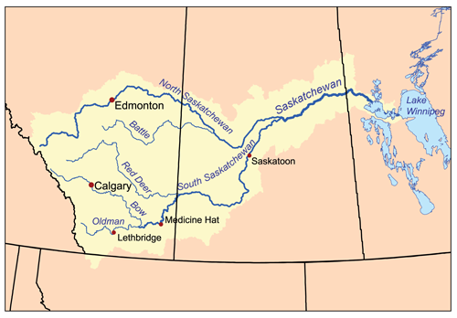
map_caption = Saskatchewan River Watershed
footnotes =The Saskatchewan River (Cree: "kisiskāciwani-sīpiy", "swift flowing river") is a major river in
Canada , approximately 550 km (340 mi) long, flowing roughly eastward acrossSaskatchewan andManitoba to drain intoLake Winnipeg . Through its tributaries the North Saskatchewan and South Saskatchewan, its watershed encompasses much of theprairie regions of central Canada, stretching westward to theRocky Mountains inAlberta and into northernMontana in theUnited States . It reaches approximately km to mi|1939|precision=0 to its furthest headwaters on theBow River , a tributary of the South Saskatchewan in Alberta Cite web| url= http://atlas.nrcan.gc.ca/site/english/learningresources/facts/rivers.html#bay | title= Rivers of Canada | author= The Atlas of Canada | year= 2004 | month= October | accessdate= 2007-02-20
(Webpage shows that the South Saskatchewan River has a much higher flow than the Saskatchewan River. But since the South is a tributary of the Saskatchewan River, it must be assumed that the data is reversed.)] .Description
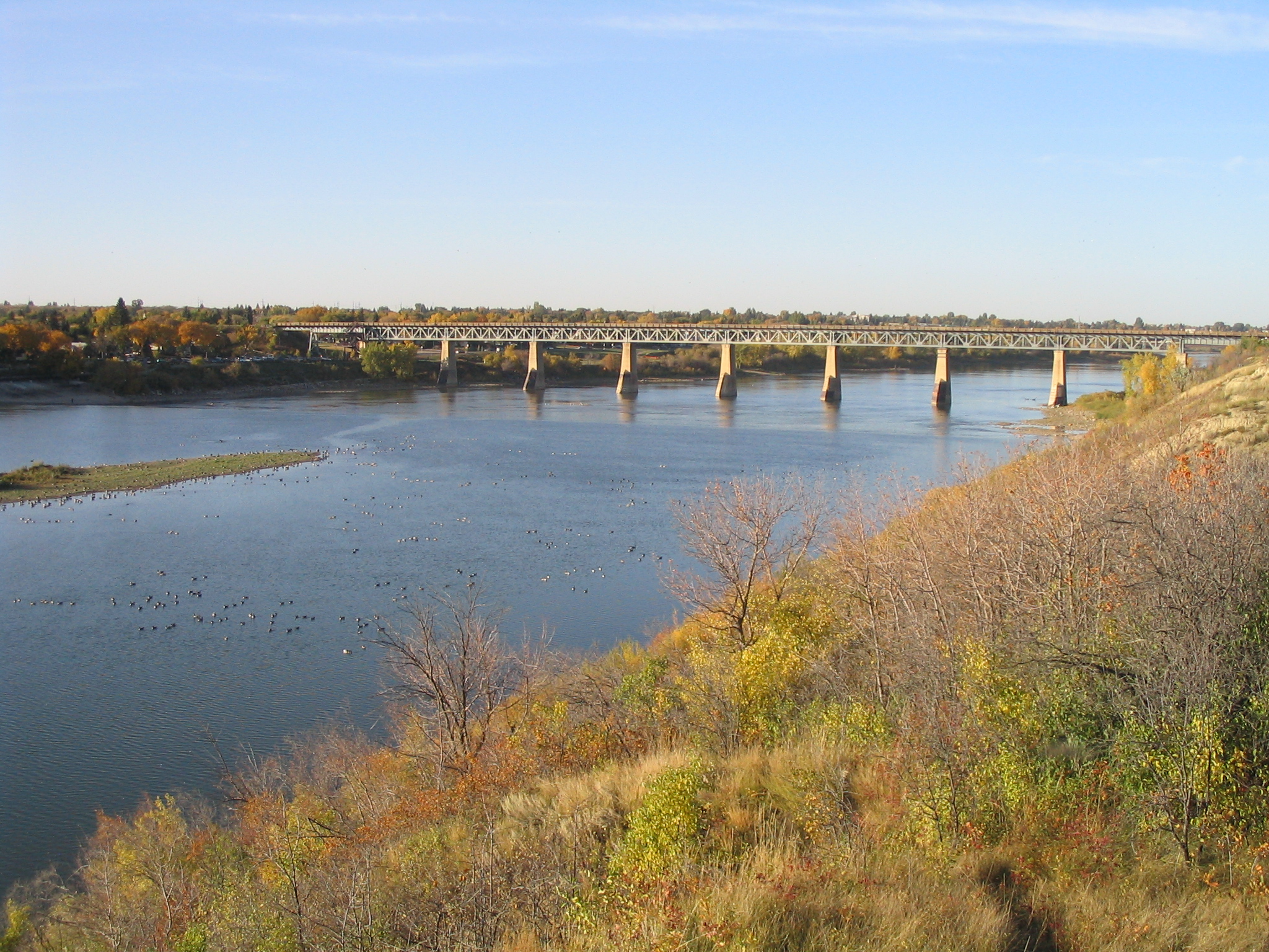
It is formed in central Saskatchewan, approximately 40 km (25 mi) east of Prince Albert, by the confluence of its two major branches, the North Saskatchewan and the South Saskatchewan, at the
Saskatchewan River Forks . Both source rivers originate fromglacier s in the Alberta Rockies.The combined stream flows east-northeast, into Codette Lake formed by the Francis Finlay dam at Nipawin then into
Tobin Lake , formed by theE. B. Campbell Dam . It then flows northeast, off the edge of the prairies of theGreat Plains onto theCanadian Shield , passing through a region of marshes, where it is joined from the northwest by theTorch River and theMossy River . At the northern edge of the marshes it flows east, twisting between a series of small lakes into west-central Manitoba to The Pas, where it is joined from the southwest by theCarrot River . Southeast of The Pas, it forms several streams in a delta on the northwest side of Cedar Lake, then exiting the lake on its southeast end and flowing approximately 5 km (3 mi) toLake Winnipeg , entering on the northwest shore north of Long Point.The river, like the province of
Saskatchewan , takes its name from the Cree word "kisiskāciwani-sīpiy", meaning "swift flowing river". The river and its tributaries provided an important route of transportation forFirst Nations and earlyEurope an trappers.Hydroelectric power plants are built on the river at Nipawin, and E.B. Campbell (formerly Squaw Rapids) inSaskatchewan and at Grand Rapids inManitoba .History
The Saskatchewan River and its two major tributaries formed an important transportation route during the
Precontact ,Fur Trade , and early Settlement periods in the Canadian West.First Nations inhabiting the area of the rivers included at one time or another theAtsina ,Cree ,Saulteaux ,Blackfoot Confederacy ,Assiniboine , andSioux .Henry Kelsey penetrated the area in the 1690s for theHudson's Bay Company , andLouis de la Corne, Chevalier de la Corne established the furthest western post of the French Empire in America (SeeNew France ) just east of the Saskatchewan River Forks atFort de la Corne . In addition to this theHudson's Bay Company andNorth West Company both ran numerous fur posts up the river and its two branches throughout the late eighteenth to late nineteenth centuries.York boats andcanoes formed the primary means of travel during the fur trade period.In the mid nineteenth century Metis settlements became important along stretches of the rivers (notably at the
Southbranch Settlement ,Prince Albert, Saskatchewan andSt. Albert, Alberta ).Riverboats were introduced from theRed River of the North in the nineteenth century and remained an important means of transportation until the 1890s and the coming of railroads to the area.The earliest settlements in Saskatchewan and Alberta generally were established around the rivers. Examples include
Fort Edmonton (Edmonton, Alberta ),Fort Battleford (Battleford, Saskatchewan ), Prince Albert, Saskatchewan, andCumberland House, Saskatchewan .In Popular Culture
The Saskatchewan River is featured in the "
The Arrogant Worms " song "The Last Saskatchewan Pirate ".ee also
*
List of Manitoba rivers
*List of Saskatchewan rivers
*List of Alberta rivers
*Manitoba Hydro References
External links
* [http://www.ccge.org/ccge/english/Resources/rivers/tr_rivers_saskatchewanRiver.asp Canadian Council for Geographic Education page with a series of articles on the history of the Saskatchewan River] .
Wikimedia Foundation. 2010.