- Oakham Rural District
-
Oakham Motto: Parva Componere Magnis (To compare great things with small) 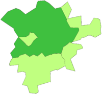
Geography Status Rural district 1911 area 52,553 acres (212.67 km2) 1961 area 52,553 acres (212.67 km2) HQ Catmose, Oakham History Origin Rural sanitary district Created 1894 Abolished 1974 Succeeded by Rutland Demography 1901 population 6,761 1971 population 10,851 Politics Governance Oakham Rural District Council Subdivisions Type Civil parishes Oakham was a rural district in Rutland, England from 1894 to 1974, covering the north of the county.
The rural district had its origins in the Oakham Rural Sanitary District, formed in 1875. Oakham RSD had an identical area to Oakham poor law union, and consisted of thirty-one civil parishes of which twenty-nine were in Rutland and two in Leicestershire.
The Local Government Act 1894 redesignated the area as Oakham Rural District, at the same time transferring the Leicestershire parishes of Cold Overton and Knossington to Melton Mowbray Rural District.
The rural district included the town of Oakham until 1911, when it was constituted a separate urban district.[1] The Rural District Council continued to be based in the town, however.[2]
Parishes
The rural district consisted of the following parishes:[3]
- Ashwell
- Barleythorpe
- Barrow
- Braunston
- Brooke
- Burley
- Cottesmore
- Edith Weston
- Egleton
- Empingham
- Exton
- Greetham
- Gunthorpe
- Hambleton
- Horn
- Langham
- Leighfield
- Lyndon
- Manton
- Martinsthorpe
- Normanton
- Oakham (until 1911)
- Market Overton
- Stretton
- Teigh
- Thistleton
- Tickencote
- Whissendine
- Whitwell
References
- ^ "Oakham RD". Vision of Britain. http://www.visionofbritain.org.uk/relationships.jsp?u_id=10002746&c_id=10001043. Retrieved 2008-06-27.[]
- ^ London Gazette: no. 45472. p. 45472. 1971-09-16.
- ^ F A Youngs Jr., Guide to the Local Administrative Units of England, Vol.II: Northern England, London, 1991
Coordinates: 52°41′N 0°40′W / 52.69°N 0.67°W
Categories:- History of Rutland
- Local government in Rutland
- Districts of England created by the Local Government Act 1894
- Districts of England abolished by the Local Government Act 1972
- Rural districts of England
- Rutland geography stubs

Wikimedia Foundation. 2010.