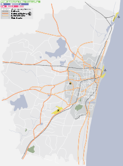
- Chitlapakkam
-
Chitlapakkam (சிட்லப்பாக்கம்) — suburb — Coordinates 12°56′15″N 80°08′19″E / 12.93739°N 80.13874°ECoordinates: 12°56′15″N 80°08′19″E / 12.93739°N 80.13874°E Country India State Tamil Nadu District(s) Kancheepuram Population 25,292 (2001[update]) Time zone IST (UTC+05:30) Chitlapakkam (Tamil: சிட்லபாக்கம்) is a panchayat town in Kanchipuram district in the state of Tamil Nadu, India. It is a residential township located south of Chennai. It is well known for its small lake and adjoining ecosystems. Chitlapakkam has the highest water table level in Chennai.
Contents
Location in Context
Areas of Chennai 
Chromepet Chromepet Chromepet 
Tambaram Sanitorium/Chitlapakkam Lake 
Hastinapuram Lake / Nanmangalam Reserved Forest  Chitlapakkam

Tambaram East Selaiyur Hastinapuram Lake Overview
Chitlapakkam is a fast-developing suburb, located about 7 km from the Chennai International Airport. It is near to Tambaram. Land values grew as the demographics favoured software professionals working with various IT Companies in Sholinganallur or OMR as the IT super highway is just 9 km away from Chitlapakkam. Tambaram Sanatorium railway station is nearby (2 km). This developing township is located in such a way that major suburbs such as Pallavaram, Chromepet, Selaiyur, Tambaram Sanatorium, Tambaram, etc. can be reached within 10 minutes. Rapid development has led to increased pollution.
The main attraction near the area is the famed Kumaran Kundram temple of Lord Muruga atop the hill is a 15 minutes walk from here.
The Chitlapakkam Lake has water almost all throughout the year; there are plans to modernise it with boating facilities.
Chitlappakkam and Sithalapakkam are frequently mistaken with Chitlapakkam, as both are suburbs of Tambaram. Chitlappakkam is the more developed and well-established suburb. The famous Madras Institute of Technology, home to alumni including former President and scientist Dr Abdul Kalam is located near Chromepet Station and is very near Chitalapakkam.
Demographics
As of 2001[update] India census,[1] Chitlapakkam had a population of 25,292. Males constitute 52% of the population and females 48%. Chitlapakkam has an average literacy rate of 84%, higher than the national average of 59.5%; with male literacy of 86% and female literacy of 82%. 9% of the population is under 6 years of age.
References
- ^ "Census of India 2001: Data from the 2001 Census, including cities, villages and towns (Provisional)". Census Commission of India. Archived from the original on 2004-06-16. http://web.archive.org/web/20040616075334/http://www.censusindia.net/results/town.php?stad=A&state5=999. Retrieved 2008-11-01.
Categories:- Cities and towns in Kanchipuram district
Wikimedia Foundation. 2010.


