- Kayseri
-
"Caesarea Mazaca" redirects here. For other locations with similar names, see Caesarea (disambiguation).
Kayseri — City —  Location of Kayseri, Turkey
 Kayseri
Coordinates: 38°44′N 35°29′E / 38.733°N 35.483°ECoordinates: 38°44′N 35°29′E / 38.733°N 35.483°E Country  Turkey
Region Central Anatolia Province Kayseri Government – Mayor Mehmet Özhaseki (AKP) Elevation 1,050 m (3,445 ft) Population (2010)[1] – Metro 1.064.164 Time zone EET (UTC+2) – Summer (DST) EEST (UTC+3) Postal code 38x xx Area code(s) (+90) 352 Licence plate 38 Website www.kayseri.bel.tr
www.kayseri.gov.trKayseri (pronounced [ˈkajseɾi]) is a large and industrialized city in Central Anatolia, Turkey. It is the seat of Kayseri Province. The city of Kayseri, as defined by the boundaries of Kayseri Metropolitan Municipality, is structurally composed of five metropolitan districts, the two core districts of Kocasinan and Melikgazi, and since 2004, also Hacılar, İncesu and Talas. In conjunction with the addition of new districts and first stage municipalities into the metropolitan area, the city's population, which was 690,000 in 2000, was over 1,050,000 as of 2010,[1] making it the seventh most populous city in Turkey.
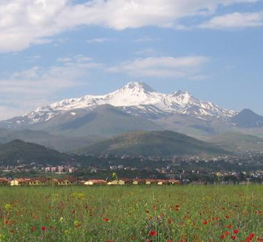
Kayseri is located at the foot of the extinct volcano Mount Erciyes that towers 3916 m over the city. Its inhabitants (Kayserili) are renowned for their alertness, entrepreneurial spirit and a strict understanding regarding the management of economies, the last point having been the subject of more than a few legends in Turkey. The city itself is a blend of wealth, modernity and provincial conservatism[2] and is often cited in the first ranks among Turkey's cities that fit the definition of Anatolian Tigers.[3]
Renowned for its culinary specialties such as mantı, pastirma and sucuk, the city is also rich in historical monuments (dating especially from the Seljuk period). While it is generally visited en-route to the international tourist attractions of Cappadocia, Kayseri has many visitor's attractions by its own right; Seljuk and Ottoman era monuments in and around the center, Mount Erciyes as trekking and alpinism center, Zamantı River as rafting center, the historic sites of Kultepe, Ağırnas, Talas and Develi to name a few. Kayseri is served by Erkilet International Airport and is home to Erciyes University.
Contents
Etymology
Kayseri was originally called Mazaka or Mazaca by the Hattians. It was changed to Eusebia after Ariarathes V Eusebes, King of Cappadocia (163–130 BCE). It was changed again by Archelaus (d. 17), last King of Cappadocia (36 BCE–14 CE) and a Roman puppet, to Caesarea (in Cappadocia, to distinguish it from other cities with the same name) in honour of Caesar Augustus†. When the Muslim Arabs arrived they amended the name to Kaisariyah and this became Kayseri when the Seljuk Turks took control ca. 1080, which it has retained since.[4]
History
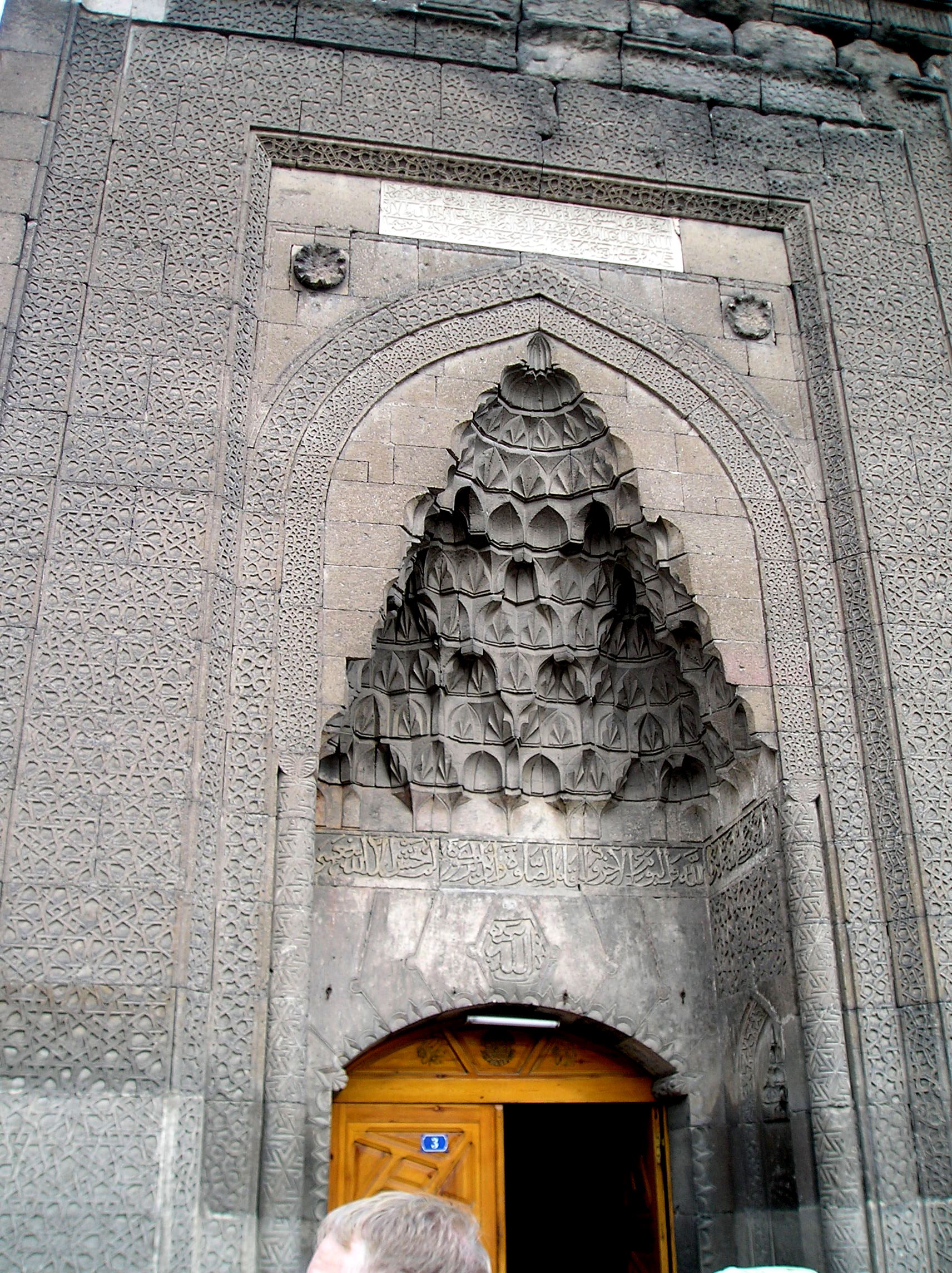
 Door detail from the Seljuk era Hunat Hatun Mosque and Külliye, built in 1238 by Sultana Hunat Hatun, wife of the Anatolian Seljuk Sultan Alaeddin Keykubad I and mother of Sultan Gıyaseddin Keyhüsrev II.
Kayseri has been a continuous settlement since 3000 BCE with the establishment of the ancient trading colony of Kultepe (Ash Mountain) which associated with Hittites. The city has always been a vital trade center since it is located on major trade routes, particularly along what was called the Great Silk Road. Kültepe, one of the oldest cities in Asia Minor, lies nearby.
As Mazaca, the city served as the residence of the kings of Cappadocia. In ancient times, it was on the crossroads of the trade routes from Sinope to the Euphrates and from the Persian Royal Road that extended from Sardis to Susa. In Roman times, a similar route from Ephesus to the East also crossed the city.
The city's name was changed to Elimtesaria in honor of the Cappadocian king Ariathes V (163–130 BCE). The name was changed again to Caesarea by the last Cappadocian King Archelaus[4] or perhaps by Tiberius.[5]
Caesarea stood on a low spur on the north side of Mount Erciyes (Mons Argaeus in ancient times). The site, now called the old town, diplays only a few traces from the old town. It was destroyed by the Sassanid king Shapur I after his victory over the Emperor Valerian I in 260. At the time it was recorded to have around 400,000 inhabitants. In the 4th century, bishop Basil established an ecclesiastical centre on the plain, about one mile to the northeast, which gradually supplanted the old town. A portion of Basil's new city was surrounded with strong walls and turned into a fortress by Justinian.
 Walls of the Seljuk era Sahabiye Medresesi, built in 1267 by the Seljuk vizier Sahip Ata Fahreddin Ali.
The Arab general (and later the first Umayyad Caliph) Muawiyah invaded Cappadocia and took Caesarea from the Byzantines temporarily in 647.[6] The city was called Kaisariyah by the Arabs and later Kayseri[4] when it was captured shortly by the Seljuk sultan Alp Arslan in 1064. It became one of the most prominent centers of initially the Danishmendids (1074–1178), and later the Anatolian Seljuk Sultanate (1178–1243), until it fell to the Mongols in 1243. Within the walls lies the greater part of Kayseri rebuilt between the 13th and 16th centuries. The city became Ottoman in the 15th century.
Thus, there were three golden-age periods for Kayseri. The first, dating back to 2000 BCE, was when the city was a trade post between the Assyrians and the Hittites. The second golden age came during the Roman rule (200 - 300). The third golden age was during the reign of Seljuks (1178–1243), when the city was the second capital of the state.
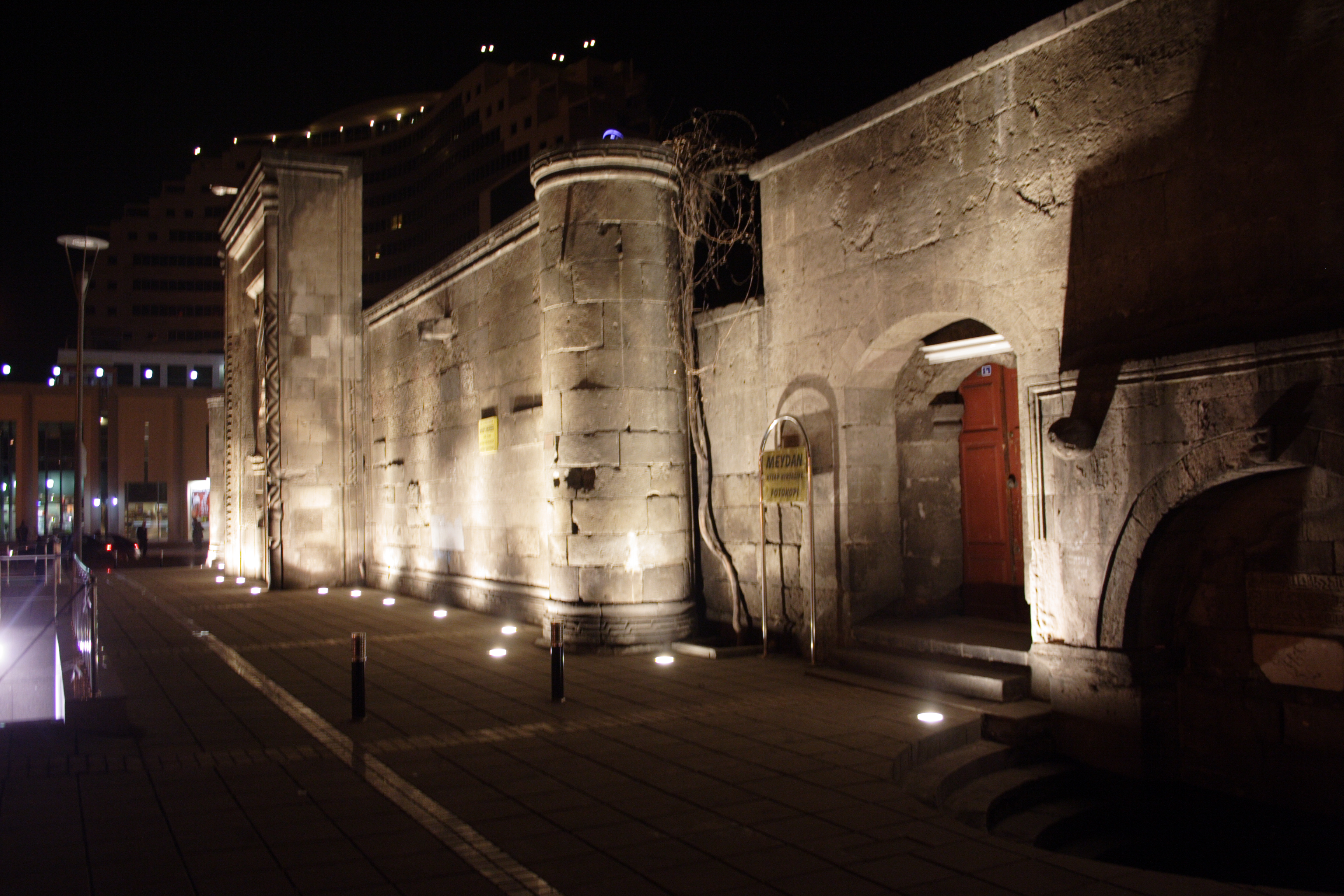
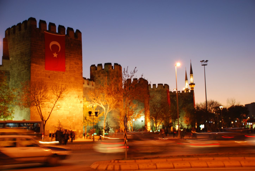
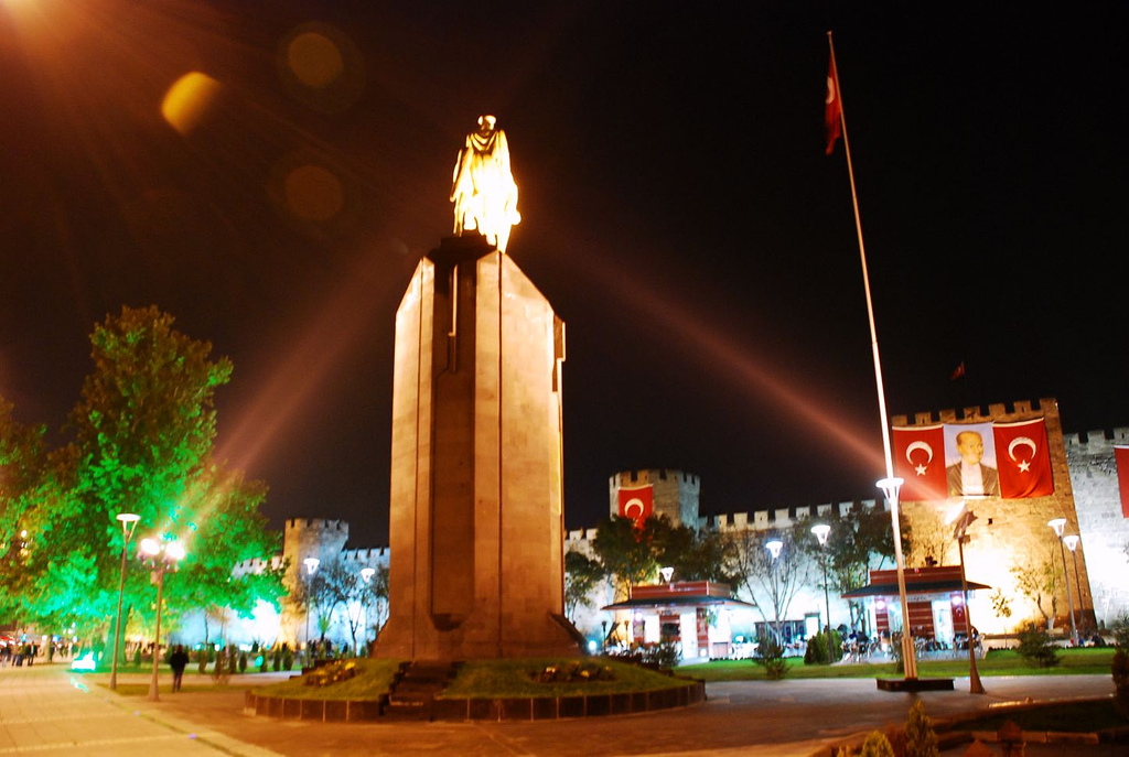
 Kayseri Castle walls in 2006.
 View of the castle from the main square.
The 1500-year-old castle, built initially by the Byzantines and expanded by the Seljuks and Ottomans, is still standing in good condition in the central square of the city. The short-lived Seljuk rule left large number of historical landmarks; historical buildings such as the Hunad Hatun Mosque complex, Kilij Arslan[disambiguation needed
 ] Mosque, The Grand Mosque[disambiguation needed ] and Gevher Nesibe Hospital. The Grand Bazaar dates from the latter part of the 1800s, but the adjacent caravanserai (where merchant traders gathered before forming a caravan) dates from around 1500. The town's older districts (which were filled with ornate mansion-houses mostly dating from the 18th and 19th centuries) were subjected to wholesale demolitions starting in the 1970s.[7] The city is famous for its carpet sellers, and a range of carpets and rugs can be purchased reasonably ranging from new to 50 or more years old.
In the 4th century the city became central to early Christianity when St. Basil the Great established an ecclesiastical centre here.[2]. It is a Roman Catholic titular see[8] and was the seat of an Armenian diocese.[9]
The building that hosts Kayseri Lisesi was arranged to host the Turkish Grand National Assembly during the Turkish War of Independence when the Greek army had advanced very close to Ankara, the base of the Turkish National Movement.
Climate
Kayseri has a continental climate (Köppen climate classification Dsa) featuring a semi-arid climate (according to the Köppen climate classification BSk), consisting of very cold, snowy winters and hot, dry summers with cool nights due to Kayseri's high elevation. Rainfall occurs mostly during the spring and autumn, yet precipitation is generally low throughout the year.
Climate data for Kayseri Month Jan Feb Mar Apr May Jun Jul Aug Sep Oct Nov Dec Year Record high °C (°F) 17.0
(62.6)20.1
(68.2)26.6
(79.9)31.2
(88.2)33.4
(92.1)36.0
(96.8)40.7
(105.3)40.0
(104.0)36.0
(96.8)32.6
(90.7)24.8
(76.6)21.0
(69.8)40.7
(105.3)Average high °C (°F) 3.9
(39.0)5.9
(42.6)11.6
(52.9)17.5
(63.5)22.1
(71.8)26.7
(80.1)30.5
(86.9)30.7
(87.3)26.6
(79.9)20.1
(68.2)12.3
(54.1)5.9
(42.6)17.82
(64.07)Average low °C (°F) −6.7
(19.9)−5.1
(22.8)−1.3
(29.7)3.4
(38.1)6.8
(44.2)9.8
(49.6)12.2
(54.0)11.6
(52.9)7.5
(45.5)3.8
(38.8)−1
(30.2)−4.5
(23.9)3.04
(37.48)Record low °C (°F) −28.1
(−18.6)−28.4
(−19.1)−28.1
(−18.6)−11.6
(11.1)−5.5
(22.1)−0.4
(31.3)3.7
(38.7)2.1
(35.8)−2.5
(27.5)−8.3
(17.1)−16.2
(2.8)−25.5
(−13.9)−28.4
(−19.1)Precipitation mm (inches) 33.6
(1.323)33.6
(1.323)42.5
(1.673)57.2
(2.252)56.6
(2.228)35.9
(1.413)14.3
(0.563)8.5
(0.335)12.9
(0.508)34.8
(1.37)37.2
(1.465)39.0
(1.535)406.1
(15.988)% humidity 76 72 62 58 56 50 44 44 47 58 69 77 59.4 Avg. rainy days 11.6 11.6 12.3 13.5 13.5 8.4 2.8 2.4 4.2 7.9 9.3 11.6 109.1 Avg. snowy days 9 9 6 1 0 0 0 0 0 0 3 8 36 Sunshine hours 89.9 112 151.9 183 254.2 309 362.7 350.3 270 201.5 138 80.6 2,503.1 Source no. 1: Devlet Meteoroloji İşleri Genel Müdürlüğü[10] Source no. 2: Weather2[11] Political structure
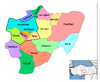
The city of Kayseri consists of the following metropolitan districts:
 Metropolitan districts of Kayseri.
Name Akkışla Bünyan Develi Felâhiye Hacılar İncesu Kocasinan Melikgâzi Özvatan Sarıoğlan Sarız Talas Ulubaş Tomarza Yahyâlı Yeşilhisar Economy
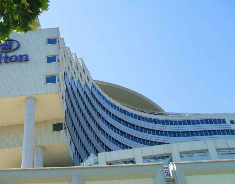
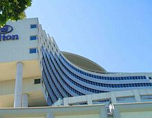 The Hilton Hotel building in Kayseri
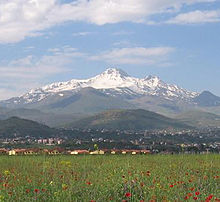 Mount Erciyes near Kayseri is a popular destination for winter sports.
Kayseri received notable public investments in the 1920s and 1930s. Sumer Textile and Kayseri Tayyare Fabrikasi (airplane manufacturer) were set up here during the post Republican Era with the help of German and particularly Russian experts. The latter manufactured the first aircraft "made in Turkey" in the 1940s. After the 1950s, the city suffered from a decrease in the amount of public investment. It was, however, during the same years that Kayseri businessmen and merchants became transformed into countrywide capitalists. Families such as Sabancı, Has, Dedeman, Hattat and Ozilhan who started out as small-scale merchants in the city of Kayseri became prominent actors in the Turkish economy. These families set up their headquarters in cities such as Istanbul and Adana, nevertheless often coming back to Kayseri to invest.
Thanks to the economic liberalization policies introduced in the 1980s, a new wave of merchants and industrialists from Kayseri joined their predecessors. Most of these new industrialists choose Kayseri as base of their operations. As a consequence of better infrastructures, the city achieved a remarkable industrial growth since 2000 and is one of the key cities that characterizes the class of Anatolian Tigers, with a favorable environment present especially for small and medium enterprises. Some social scientists trace this economic success to a modernist Islamic outlook referred to as "Islamic Calvinism" which they say is taking root in Kayseri.[12]
Transport
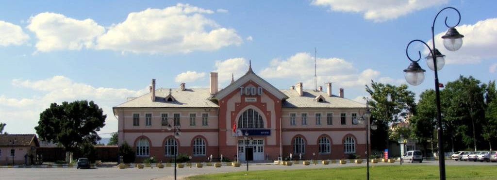
 Kayseri Train Station
The city is served by Erkilet International Airport and the International Air Transport Association symbol for the airport is ASR. The airport is at a short distance from Kayseri center. There are several flights per day to Istanbul, Turkey's premium air transportation hub. Since the air transportation industry in Turkey is presently registering a fast growth rate, new flights from Kayseri to several other localities in Turkey and outside Turkey are soon to be expected.
Kayseri is connected to the rest of country with railroad service. There are four trains per day to Ankara. To the east there are two branches: one to Kars and Doğukapi toward Armenia, and another to Tatvan on the west shore of Lake Van.
Since the city is located in central Turkey, transportation via cars and buses are highly efficient. It takes approximately 3 hours to reach Ankara, approximately 3 hours to Mediterranean shores and 45 minutes to Cappadocia. The symbol of the city, Mount Erciyes, which is a notable ski center in winters and a trekker's paradise in summers, is at only 30 minutes' drive from the city centre.
The transportation within the city relies mainly on buses, and personal vehicles. A light rail transit system called Kayseray has constructed end of the 2009.[specify]
Sports
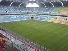 Kadir Has Stadium
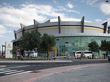 Kadir Has Sports Arena
The city has one professional football team competing in the top-flight of Turkish football: Kayserispor, playing in the Turkcell Super League. Kayserispor is one of the most promising teams in Turkey and finished fifth in the league for two seasons in a row.[when?] It is the only Turkish team to have won the UEFA Intertoto Cup, in 2007. Another team from the region, Kayseri Erciyesspor, was relegated to the second league last year.
The Erciyes Ski Centre at Mount Erciyes is one of the largest in Turkey.
Sports venues
- Kadir Has Stadium is a new generation post-modern stadium and as part of the Atatürk Sports Complex; it is located in the outskirts of the city. It will hold at least 33,000 people and it is totally covered. It is shared by the two Kayserian football clubs, as before, and the Kadir Has Stadium is the new home for both teams. The stadium and surrounding sports complex are served by the Light-rail system, Kayseray, making access to the complex easier for traveling locals. It was completed in early 2009. The inauguration of stadium was made with a Kayserispor – Fenerbahce league match.
- Kadir Has Sports Arena is an indoor arena complex, which was opened in 2008. It has an seating capacity of 7,200 people. The arena was one of the venues of the 2010 FIBA World Championship.
Education
 Mimar Sinan Park
Kayseri Lisesi High School, established in 1893, is one of the oldest high schools in Turkey. In 2000, the private Kılıçarslan High School in Kayseri and Anatoli College in Salonica became sister schools.
The city's largest university, Erciyes University, was founded in 1978 and is a continuation of a number of schools founded in 1206 and 1956.[13] The city also has a newly established state university, Abdullah Gül, and two private universities Melikşah and Nuh Naci Yazgan.
Notable Kayserians
(alphabetical order)
- Abdullah Gül - Turkey's current President
- Alparslan Türkeş-politician
- Arandzar - Armenian writer
- Basil of Caesarea - Byzantine theologian (one of the Cappadocian Fathers)
- Balyan family - a dynasty of famous Ottoman imperial architects of Armenian ethnicity
- Dikran Kelekian - a notable collector and dealer of Islamic art
- Elia Kazan - Greek movie director
- Emel Heinreich - actress, author and film-director.
- Fatih Solak - national basketball player
- Mehmet Topuz - professional footballer, currently playing for Fenerbahçe S.K.
- Gevher Nesibe - Seljuk princess who endowed the city's landmark 13th century medical center (Darüşşifa, Dâr al-Shifâ)
- Gregory the Illuminator - founder of the Armenian Apostolic Church
- Gregory of Nyssa - brother of Basil of Caesarea, also a Byzantine theologian, one of the Cappadocian Fathers
- Göksel Arsoy - movie star
- Hagop Kevorkian - connoisseur of art
- İsmet Özel - poet
- Kadir Has - business tycoon
- Latife Tekin - author
- Metin Kaçan - writer
- Mimar Sinan - The greatest imperial master architect of the Ottoman Empire
- Nesrin Nas - politician
- Orhan Delibaş - boxer
- Pavlos Karolidis - historian and politician
- Reyhan Karaca - singer
- Romanos IV Diogenes - Byzantine General and later Emperor (1068–1071)
- Sinan Bolat - professional soccer goalkeeper, currently playing for Standard Liege
- Theodore Alyates - Byzantine General of the Cappadocian Thema, fought alongside the Emperor Romanos IV Diogenes at the Battle of Manzikert (1071).
- Umut Bulut - Turkish footballer
International relations
Main article: List of twin towns and sister cities in TurkeyTwin towns — Sister cities
Kayseri is twinned with: (in alphabetical order)
 Homs, Syria
 Sialkot, Pakistan[14]
 Mostar, Bosnia and Herzegovina
 Krefeld, Germany
 Nalchik, Russia
- Saarbrücken, Germany
 Yongin, South Korea
See also
References
- ^ a b http://report.tuik.gov.tr/reports/rwservlet?adnks = &report = turkiye_il_koy_sehir.RDF&p_kod = 1&desformat = html&ENVID = adnksEnv (TÜİK)
- ^ Vincent Boland. Article: "Marriage of old and new sways voters in Turkey". Financial Times. http://www.ft.com/cms/s/d28e6bfe-200e-11dc-9eb1-000b5df10621.html Article:. Retrieved 2007-06-21.
- ^ ESI. Full text "Islamic Calvinists: Change and Conservatism in Central Anatolia". European Stability Initiative, Berlin. http://www.esiweb.org/pdf/esi_document_id_69.pdf Full text. Retrieved 2005-09-19.
- ^ a b c Everett-Heath, John (2005). = Main&entry = t209.e3530 "Kayseri". Concise Dictionary of World Place-Names. Oxford University Press. http://www.oxfordreference.com/views/ENTRY.html?subview = Main&entry = t209.e3530. Retrieved 12 1 1 2007.
- ^ Catholic Encyclopedia
- ^ Ostrogorsky, George. History of the Byzantine State. New Jersey: Rutgers University Press, 1969. Pg 116.
- ^ [1] Traditional houses in Kayseri
- ^ "Caesarea in Cappadocia". Catholic Hierarchy. http://www.catholic-hierarchy.org/diocese/d3c20.html.
- ^ "Caesarea". Catholic Encyclopedia. http://www.newadvent.org/cathen/03133b.htm.
- ^ http://www.dmi.gov.tr/veridegerlendirme/il-ve-ilceler-istatistik.aspx?m=KAYSERI
- ^ http://www.myweather2.com/City-Town/Turkey/Kayseri/climate-profile.aspx?month=12
- ^ http://www.esiweb.org/index.php?lang=en&id=156&document_ID=69
- ^ http://i-cias.com/e.o/kayseri.htm
- ^ http://www.nation.com.pk/pakistan-news-newspaper-daily-english-online/Regional/Lahore/15-Jan-2010/Punjab-Turkey-sign-four-MoUs
External links
 Kayseri in Kayseri Province (in the Central Anatolia region) of Turkey
Urban districts 
Rural districts RegionsAegean Black Sea Central Anatolia Eastern Anatolia Marmara Mediterranean Southeastern Anatolia Metropolitan centers in TurkeyCategories:- Kayseri Province
- Cities in Turkey
- Central Anatolia Region
- Kayseri
- Archaeological sites in Turkey
- Cappadocia
- Roman sites in Turkey


Wikimedia Foundation. 2010.