- Clayoquot Sound
-
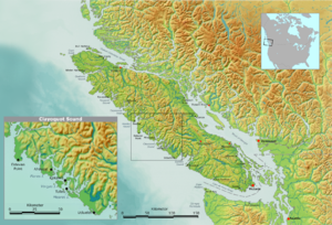 Map of Vancouver Island with inset of Clayoquot Sound region
Clayoquot Sound (
 /ˈklɑːkwɒt/)[1][2] is located on the west coast of Vancouver Island in the Canadian province of British Columbia. It is bordered by the Esowista Peninsula to the south, and the Hesquiaht Peninsula to the North. It is a body of water with many inlets and islands. Major inlets include Sydney Inlet, Shelter Inlet, Herbert Inlet, Bedwell Inlet, Lemmens Inlet, and Tofino Inlet. Major islands include Flores Island, Vargas Island, and Meares Island. The name is also used for the larger region of land around the waterbody (essentially its watershed).
Contents
Origin of the name
The name Clayoquot is derived from the name of a first nations band, today known as the Tla-o-qui-aht,[3][4] meaning "different" or "changing".[5][6][7]
History
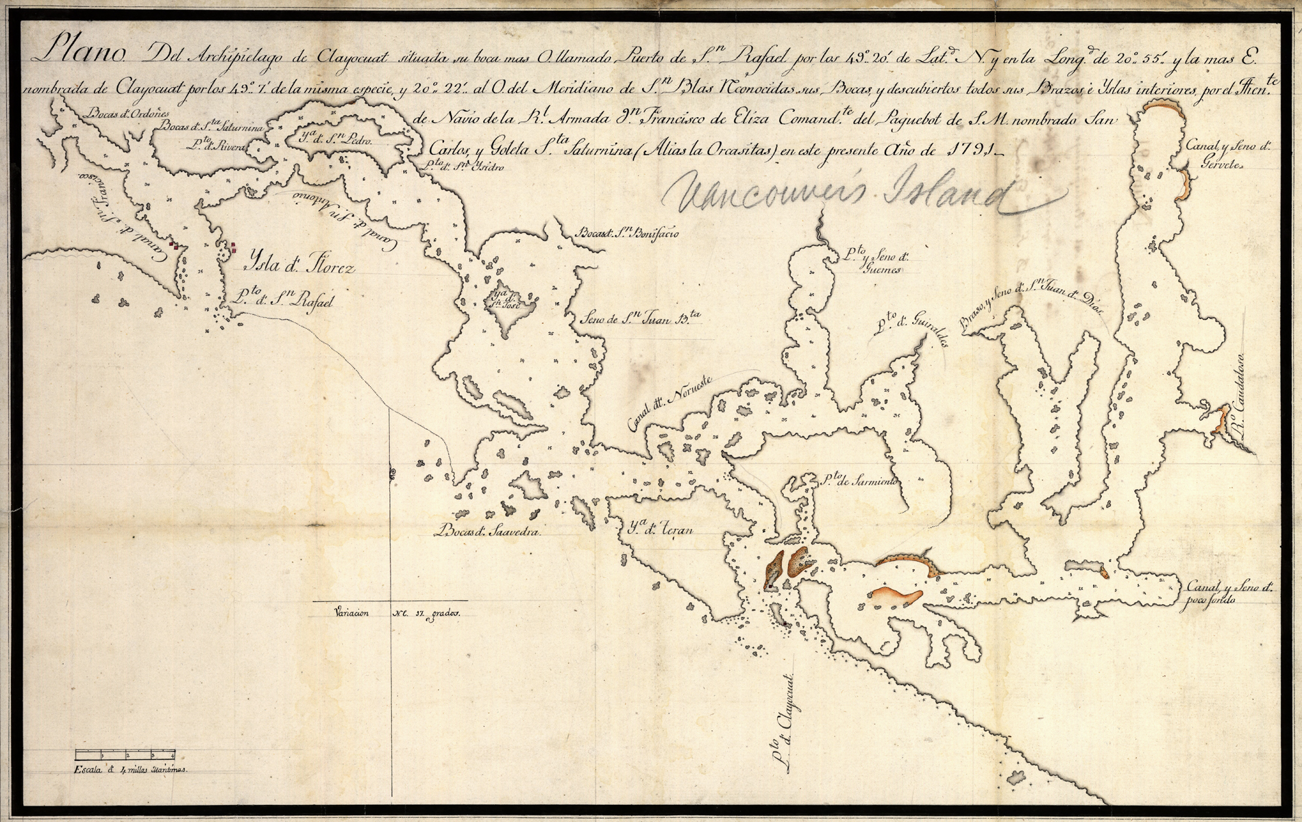
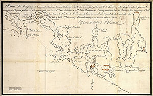 Spanish map of Clayoquot Sound made during the 1791 exploration voyage of Francisco de Eliza
First Nations have inhabited the area for thousands of years. The oldest dated location within Nuu-cha-nulth territory is 4200 years (at Yuquot, Nootka Island). However due to a number of factors, including rising post-glacial sea-level rise, most will date the beginnings of human habitation beyond 9,000 years before present.[8]
In the late 18th century, Clayoquot Sound was explored by various European and American ships, which were mainly involved in the fur trade. In 1791 the complex inner waters were explored and mapped by José María Narváez and Juan Carrasco while their commander, Francisco de Eliza met and befriended Wickaninnish, the chief of the Tla-o-qui-aht peoples.[9][10]
Indigenous peoples and governments
The members of three major First Nations band governments of the Nuu-chah-nulth peoples inhabit the Clayoquot Sound re: the Hesquiaht in the North, the Ahousaht in the middle, and the Tla-O-Qui-Aht in the south, focused on the village of Opitsaht on Meares Island. The village of Tofino lies opposite Opitsaht on the southern promontory of the entrance to the sound.
Ecology, parks and terrain
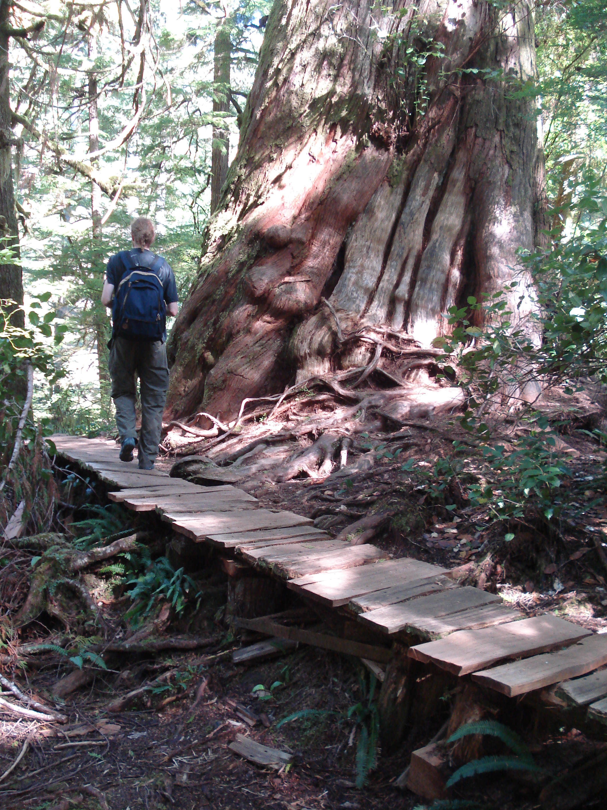
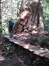 A giant cedar on Meares Island in Clayoquot Sound
The land around Clayoquot Sound includes vast coastal temperate rain forest, rivers, lakes, marine areas and beaches. It includes part of the Pacific Rim National Park Reserve and some of Strathcona Provincial Park. The total size of the Clayoquot Sound region, including both land and water, is 350,000 hectares (860,000 acres).[11] More than 200,000 hectares have been part of a multi-year study[12] using Terrestrial Ecosystem Mapping (TEM) to identify areas prone to geologic and geomorphic hazards, in particular, landslides, soil erosion, and sedimentation, as well as identify and characterize terrain conditions associated with these hazards.The region contains the largest area of intact (unlogged) temperate rainforest left on Vancouver Island.[13][14]
Clayoquot Sound is home to wolves, black bears, cougars, grey whales, orcas, porpoises, seals, sea lions, river otters, bald eagles, osprey, Marbled Murrelets, Pacific Loons, Roosevelt Elk, martens, and raccoons.
Logging protests
The sound has been a focal point for conflict between the forest industry and environmental protesters.
In 1984, the first logging blockades in Canadian History occurred on Meares Island. The BC government decided 90% of Meares Island would be logged, and in response the blockades occurred. In the end, a legal application from the Nuu-chah-nulth First Nation was granted, imposing a legal injunction on logging on Meares Island.[15] As of December 2009, this injunction still stands.
In the summer of 1993, protesters responded to the 1993 'Clayoquot Land Use Decision', made by the British Columbia government, permitting logging in 2/3 of the old growth forest in Clayoquot.[16] As a result of the Clayoquot Land Use Decision, over 12,000 individuals attended logging blockades in Clayqout Sound, resulting in over 850 arrests.[17] Activists eventually gained the support of major organizations such as Greenpeace and the Sierra Club[18] Activist Australian rock group Midnight Oil also brought attention to the conflict when they performed an early morning concert at the protesters' camp.[19] The Land Use Decision still stands today.
Clayoquot Sound was designated a World Biosphere Reserve by UNESCO in 2000.[20] This designation brought World recognition of the ecological importance of Clayoquot Sound, and a $12M monetary fund to "support research, education and training in the Biosphere region".[21]
At the end of July 2006, a new set of Watershed Plans was approved, opening the door for logging in a further 90,000 hectares of forest in Clayoquot Sound, including the pristine old-growth valleys[22][23][24]
As of 2007, both logging tenures within Clayoquot Sound are now controlled by first nation logging companies.[25] Iisaak Forest Resources controls Timber Forest License (TFL) 57 in Clayoquot Sound.[26][27] MaMook Natural Resources Ltd, in conjunction with Coulson Forest Products, manages TFL54 in Clayoquot Sound.[28][29]
See also
References
- ^ "Clayoquot Arm". BC Geographical Names. http://apps.gov.bc.ca/pub/bcgnws/names/2580.html.
- ^ Kayak Routes of the Pacific Northwest Coast: Edited Peter McGee: "Clayoquot Sound" by Bonny Glambeck and Dan Lewis, pg. 155
- ^ BCGNIS: Clayoquot Sound, http://ilmbwww.gov.bc.ca/bcgn-bin/bcg10?name=1975
- ^ The Canadian Encyclopedia; Clayoquot Sound, http://www.thecanadianencyclopedia.com/index.cfm?PgNm=TCE&Params=A1ARTA0010166
- ^ The Wild Coast: West Coast Vancouver Island, John Kimantis, Whitecap Books, 2005, pg. 259
- ^ Tofino Botanical Gardens Foundation, http://www.tbgf.org/clayoquot/communities.php
- ^ Friends Of Clayoquot Sound: About Clayoquot Soundhttp://www.focs.ca/clayoquot/index.asp
- ^ MacMillan, Emergence of the West Coast Culture Type, 1999, pg 105
- ^ McDowell, Jim (1998). José Narváez: The Forgotten Explorer. Spokane, Washington: The Arthur H. Clark Company. pp. 50–60. ISBN 0-87062-265-X.
- ^ Pethick, Derek (1980). The Nootka Connection: Europe and the Northwest Coast 1790-1795. Vancouver: Douglas & McIntyre. pp. 54–55. ISBN 0-88894-279-6.
- ^ UVIC: A Political Space: Reading the Global Through Clayoquot Sound, http://web.uvic.ca/clayoquot/home.html
- ^ http://a100.gov.bc.ca/pub/acat/public/viewReport.do?reportId=13528
- ^ Friends of Clayoquot Sound: Why Protect Clayoquot Sound: http://www.focs.ca/clayoquot/whyprotect.asp
- ^ The Canadian Encyclopedia.com; Clayoquot Sound, http://www.thecanadianencyclopedia.com/index.cfm?PgNm=TCE&Params=A1ARTA0010166
- ^ Food and Agriculture Organization of the United Nations: Beyond Conflict in Clayoquot Sound; the future of sustainable forestry, ftp://ftp.fao.org/docrep/fao/005/y4503e/y4503e08.pdf pg 8
- ^ UVIC: VI-Wilds: Clayoquot Sound; Vulnerable Ecosystems, http://icor.uvic.ca/viwilds/ve-clayoquot.html
- ^ Friends of Clayoquot Sound: Clayoquot Land Use Decision, http://www.focs.ca/logging/clud.asp
- ^ Great Wilds Spaces: Clayoquot Sound; Flores and Vargas Island Provincial Parks, http://www.greatwildspaces.org/clayoquot.html
- ^ UVIC, Clayoquot Chronology Appendix, http://web.uvic.ca/clayoquot/files/appedix/Appendix2.pdf
- ^ Clayoquot Biosphere Trust: History, http://www.clayoquotbiosphere.org/biosphere/history.php
- ^ British Columbia; Ministry of Forests and Range, http://www.for.gov.bc.ca/dsi/Clayoquot/clayoquot_sound.htm
- ^ West Coast Aquatic: Ha-Shilth-Sa article: Clayoquot Sound watershed plans released: War of the Woods II averted, http://www.westcoastaquatic.ca/article_Clayoquot_watershed0806.htm
- ^ CBC: Environmentalists angry over new logging in Clayoquot Sound: 2006, http://www.cbc.ca/canada/british-columbia/story/2006/08/02/clayquot-logging.html
- ^ Canada.com; Vancouver Sun article; Eco-logging deal in the works for Clayoquot Sound, August 9, 2006, http://www.canada.com/vancouversun/news/story.html?id=3e81fb9c-b97a-4811-b2ea-6b2f923e95a4&k=81662
- ^ Wilderness Committee: Clayoquot Sound, http://wc-zope.emergence.com:8080/WildernessCommittee_Org/campaigns/wildlands/clayoquot
- ^ Friends of Clayoquot Sound; Logging - Factsheet, http://www.focs.ca/logging/factsheet.asp
- ^ Iisaak Forest Resources: http://www.iisaak.com/operations.html
- ^ The Coulson Group: http://www.coulsongroup.com/products.html
- ^ Friends of Clayoquot Sound: Logging - Factsheet, http://www.focs.ca/logging/factsheet.asp
External links
Categories:- Biosphere reserves of Canada
- Old growth forests
- Sounds of British Columbia
- Clayoquot Sound region
- Nuu-chah-nulth

Wikimedia Foundation. 2010.