- Maralinga Tjarutja
-
Maralinga Tjarutja
South Australia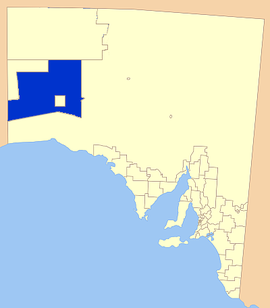
Location of the Maralinga Tjarutja CouncilPopulation: 105 • Density: 0.001/km² (0.0/sq mi) Established: 2006 Area: 102863.6 km² (39,715.9 sq mi) Council Seat: Ceduna (outside Councial area) Region: The Outback State District: Flinders Federal Division: Grey LGAs around Maralinga Tjarutja: Ngaanyatjarraku, WA Anangu Pitjantjatjara Yankunytjatjara Anangu Pitjantjatjara Yankunytjatjara Laverton Shire, WA Maralinga Tjarutja Outback Areas Community Development Trust Laverton Shire, WA Outback Areas Community Development Trust Outback Areas Community Development Trust The Maralinga Tjarutja are the Indigenous Australian people who traditionally inhabit the remote western areas of South Australia. They are a Southern Pitjantjatjara people.
The lands of the Maralinga Tjarutja bear their own name. These lands, in South Australia's remote west, comprise Maralinga Tjaruta, one of the four local government areas of South Australia classified an Aboriginal Council (AC). The area measures 102863.6 km²[1], making it the largest local government area of South Australia by area (followed by Anangu Pitjantjatjara Yankunytjatjara to the north, which is nearly as large), with a population of only 105[2], all in the community of Oak Valley.
The Maralinga people had been moved from their lands in the 1950s to allow British nuclear tests. The Maralinga Tjarutja native title land was handed back to the Maralinga people in January 1985 under legislation passed by both houses of the South Australian Parliament in December 1984 and proclaimed in January 1985. Maralinga people resettled on the land in 1995 and named the main community Oak Valley Community.
Maralinga Tjarutja Council
The Maralinga Tjarutja Council is an incorporated body constituted by the traditional owners (Yalata and Maralinga people) to administer the lands granted to the under the Maralinga Tjarutja Land Rights Act 1984 (SA). The head office is at: 43 McKenzie Street, Ceduna. Dr Archie Barton AM was the Administrator until 2006, and was involved in the campaign in 1982-1984 on behalf of the Yalata and Maralinga people for land rights to the Maralinga Tjarutja lands.
The Maralinga Tjarutja and the Pila Nguru (or Spinifex people) also jointly own and administer the 21,357.85 km² Mamungari Conservation Park, which area is contained in the area total for the council area. Emu Field is now part of the council area, too, while the 3,300 km² Maralinga area is still a roughly square shaped enclave within the council area.
A part of the land surveyed and known as Section 400 remains occupied by the Crown through a provision of the Act mentioned above, for up to 50 years. This land includes the area of land occupied by the Maralinga Township and the areas in which actual atomic tests were carried out.
See also
- Emu Field
- Mamungari Conservation Park
- Maralinga, South Australia
- British nuclear tests at Maralinga
- Woomera Prohibited Area
- Downwinders
References
- ^[dead link]abs.gov.au
- ^ [1] censusdata.abs.gov.au, 2006 Census QuickStats : Maralinga Tjarutja (AC) (Local Government Area) . 2007.
- Emma Pedler (2002-08-22). "Returning the Maralinga Tjarutja Lands". Statewide Afternoons, ABC South Australia. http://www.abc.net.au/sa/stories/s656146.htm.
- ATNS
- Maralinga Tjarutja Council at Agreements, Treaties and Negotiated Settlements (ATNS) project at Indigenous Studies Program, The University of Melbourne
- Southern Pitjantjatjara People
- SAMLISA Steering Committee
- Aboriginal Legal Rights Movement Inc
- Anangu Pitjantjatjara
- Oak Valley (Maralinga) Inc.
- Maralinga Piling Trust (1994 - )
- Strategy for Aboriginal Managed Lands in South Australia (2000 - )
- Maralinga Tjarutja Land Rights Act 1984 (SA)
- Hansard extract from South Australian House of Assembly, 15 October 2003, of Second Reading Speech on co-management of the unnamed conservation park
Local Government Areas of South Australia Metropolitan Adelaide Adelaide · Adelaide Hills · Burnside · Campbelltown · Charles Sturt · Gawler · Holdfast Bay · Marion · Mitcham · Norwood Payneham & St Peters · Onkaparinga · Playford · Port Adelaide Enfield · Prospect · Salisbury · Tea Tree Gully · Unley · Walkerville · West TorrensEyre Peninsula Ceduna · Cleve · Elliston · Franklin Harbour · Kimba · Lower Eyre Peninsula · Port Augusta · Port Lincoln · Streaky Bay · Tumby Bay · Wudinna · WhyallaCentral Barossa · Barunga West · Clare and Gilbert Valleys · Copper Coast · Flinders Ranges · Goyder · Light · Mallala · Mount Remarkable · Northern Areas · Orroroo Carieton · Peterborough · Port Pirie · Wakefield · Yorke PeninsulaSouthern and Hills Murray Mallee Southeast Outback Anangu Pitjantjatjara Yankunytjatjara · Coober Pedy · Maralinga Tjarutja · Nepabunna · Outback Areas Community Development Trust · Roxby Downs · YalataCoordinates: 26°29′25″S 132°00′28″E / 26.4902777778°S 132.007777778°E
Categories:- Populated places established in 2006
- 2006 establishments in Australia
- Aboriginal tribes of South Australia
- Local Government Areas of South Australia
- Native title in Australia
- Nullarbor Plain
- Far North (South Australia)

Wikimedia Foundation. 2010.