Washington State Route 10
- Washington State Route 10
Infobox WA State Route|route=10|sec=045
length_mi=16.16
length_ref=
length_round=2
formed=1969
dir1=West
dir2=East
from=
to=
type=State
previous_route=10|previous_type=US|next_type=State|next_route=11
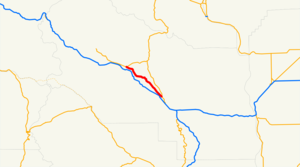
State Route 10 is a highway in the state of Washington, U.S.A. It parallels Interstate 90 for about 16 miles in Kittitas County, terminating about 3 miles northwest of Ellensburg. In the 1920s and 1930s it was known as the Yellowstone Highway providing access to the national park for adventurous Seattlites in the family car.
History
State Route 10 is part of the original roadway of U.S. Route 10, which ran from Detroit, Michigan to Seattle from 1926 to 1969. Today US 10 only runs from Bay City, Michigan to West Fargo, North Dakota, with Interstate 94 and Interstate 90 replacing it throughout most of the West. In Washington, I-90 now occupies most of US 10's old routing; SR 10 is one of a number of short segments of the original routing that diverge from the interstate in places, and is the only one to inherit the old U.S. highway's numeric designation.
Milepost numbering on SR 10 is derived from the numbering used on US 10 when it originated in Seattle: posted mile markers along the 16-mile highway begin with milepost 89 near its northwest terminus and end with milepost 104 in the southeast. This also means that the mileposts on SR 10 are closely aligned with the mileposts on nearby Interstate 90; e.g., SR 10 milepost 92 is just across the Yakima River from I-90 milepost 92.
Major intersections
The entire route is in unincorporated Kittitas County.
References
External links
* [http://www.angelfire.com/wa2/hwysofwastate/sr010.html Highways of Washington State]
Wikimedia Foundation.
2010.
Look at other dictionaries:
Washington State Route 20 — State Route 20 Whidbey Scenic Isle Way North Cascades Highway … Wikipedia
Washington State Route 31 — State Route 31 Nearby state routes with SR 31 highlighted in red. Route inform … Wikipedia
Washington State Route 20 — (SR 20) Autres noms North Cross Highway Longueur 701,87 … Wikipédia en Français
Washington State Route 14 — La State Route 14, également appelée Lewis and Clark Highway, est une route d État dans l État de Washington, aux États Unis. Elle s étend sur environ 290 kilomètres à partir de sa jonction avec l autoroute Interstate 5 à Vancouver dans l… … Wikipédia en Français
Washington State Route 27 — infobox WA State Route type=State route=27 sec=115 length mi=90.00 length ref= length round=2 formed=1964 dir1=South dir2=North from= junction= to= in Spokane Valley previous type=State previous route=26 next type=State next route=28State Route… … Wikipedia
Washington State Route 16 — Karte … Deutsch Wikipedia
Washington State Route 12 — Several highways in the U.S. state of Washington have been numbered 12: *U.S. Route 12 in Washington *Washington State Route 12 (1964 1967), now SR 14 *Primary State Highway 12 (Washington) (1937 1970) and State Road 12 (Washington 1923 1937),… … Wikipedia
Washington State Route 525 — State Route 525 Whidbey Scenic Isle Way … Wikipedia
Washington State Route 524 Spur — State Route 524 Spur may refer to:*State Route 524 Spur (Edmonds, Washington), Third Avenue and Pine Street in Edmonds, Washington *State Route 524 Spur (Lynnwood, Washington), 44th Avenue W in Lynnwood, Washingtonee also*Washington State Route… … Wikipedia
Washington State Route 504 — La State Route 504, également appelée Spirit Lake Memorial Highway, est une route d État dans les comtés de Cowlitz et de Skamania, dans l État de Washington, aux États Unis. Elle s étend sur environ 83,3 kilomètres et effectue une jonction… … Wikipédia en Français
Washington State Route 14 — State Route 14 Route information D … Wikipedia
