- Morphett Vale, South Australia
-
Morphett Vale
Adelaide, South Australia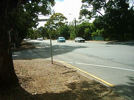
Wheatsheaf Road, facing eastPopulation: 23,052 (2006 Census) Established: 1840 Postcode: 5162 Area: 12.76 km² (4.9 sq mi) LGA: City of Onkaparinga Suburbs around Morphett Vale: Lonsdale Reynella Old Reynella Christie Downs Morphett Vale Woodcroft Noarlunga Centre Hackham Onkaparinga Hills Morphett Vale is a southern suburb of Adelaide, South Australia in the City of Onkaparinga. It is the largest suburb in the state, with a population of more than 23,000 and an area of 12.76km², followed by Paralowie with nearly 10,000 fewer residents. There are approximately 1,000 businesses in Morphett Vale.
Contents
History
- See Also: mount Hurtle
Morphett Vale was the first major town south of Adelaide.[1] In October 1840, a town called Dublin was subdivided leading to the development of Morphett Vale. [2] By 1866, the town was said to have ‘a large number of neat residences, many of which have fine vineyards attached’.[3]
Morphett Vale was named after John Morphett. The town quickly boasted churches and chapels, a brewery, wind flour mill, court house and police station. [4]
Agriculture consisted of cereal, mixed farms and vineyards. 1852 saw the formation of the Morphett Vale District council which merged with Noarlunga in 1932.[5] During the second world war the district was a major producer of flax.[6]
Extensive land subdivision occurred during the 1960s, transforming the area from a rural region to a metropolitan suburb.
Some notable buildings and businesses include: Doctors House on the corner of Beach and Main South Roads, The Emu winery which was later demolished to make way for Wirreanda High School and a housing sub-division. The Heritage listed Old Courthouse is visible alongside early churches in William Street.
Currently does not have a railway service traveling through the town but did have the Willunga railway line that has since been replaced by a bicycle/pedestrian path. The old Station Master's Residence is now the The Southern Districts Workingman's Club and has been substantially remodelled to its current form. The last tenants of this building are still residents of Morphett Vale.
Country Fire Service
The Morphett Vale CFS station is located on the corner of Doctors Road and States Road at Hackham. It is an entirely volunteer based brigade with 40 firefighters, 5 Auxiliary members and 12 Cadets. The brigade is one of the busiest in the state, responding to between 300 and 400 emergencies each year. The suburbs primarily covered by the brigade are Morphett Vale, Hackham, Onkaparinga Hills, Reynella and Woodcroft. These suburbs include approximately 25,000 residents as well as industrial zones and large areas of rural land.
Three fire appliances are maintained by the brigade, two 2000 litre four wheel drive trucks supplied by the State Government and a smaller 400 litre quick attack vehicle that was purchased by the brigade.[1]
Schools
Morphett Vale boasts a number of schools within its boundaries including:
- Calvary Lutheran School
- Coorara Primary School
- Flaxmill Primary School
- Morphett Vale East Primary School
- Morphett Vale West Primary School
- Pimpala Primary School
- Prescott Primary Southern
- Southern Vales Christian College
- Stanvac Primary School
- Sunrise Christian School
- Wirreanda High School
- Woodcroft College
- Former Schools in the area
- In 2000, Morphett Vale South Primary School was closed. The site, located on Elizabeth Road next to the Elizabeth Road local shops, has now been completely cleared and turned into a housing estate.
- Morphett Vale High School closed at the end of 2008. The school is scurrently undergoing some demolition and refurbishment for future relocation of other local school based services
Sporting Clubs and Grounds
- Morphett Vale Football Club - Wheatsheaf Road
- Morphett Vale Tennis Club - Wheatsheaf Road
- Morphett Vale Netball Club - Wheatsheaf Road
- Onkaparinga Rugby Club - Taylors Reserve, States Road
- Noarlunga Tigers Basketball Club - Taylors Reserve, States Road
References
Coordinates: 35°07′05″S 138°31′44″E / 35.118°S 138.529°E
Suburbs of the City of Onkaparinga Aberfoyle Park · Aldinga · Aldinga Beach · Blewitt Springs · Chandlers Hill · Cherry Gardens · Christie Downs · Christies Beach · Clarendon · Coromandel East · Coromandel Valley · Darlington · Dorset Vale · Flagstaff Hill · Hackham · Hackham West · Happy Valley · Huntfield Heights · Ironbank · Kangarilla · Lonsdale · McLaren Flat · McLaren Vale · Maslin Beach · Moana · Morphett Vale · Noarlunga Centre · Noarlunga Downs · O'Halloran Hill · O'Sullivan Beach · Old Noarlunga · Old Reynella · Onkaparinga Hills · Port Noarlunga · Port Noarlunga South · Port Willunga · Reynella · Reynella East · Seaford · Seaford Heights · Seaford Meadows · Seaford Rise · Sellicks Beach · Sellicks Hill · Tatachilla · The Range · Whites Valley · Willunga · Willunga South · WoodcroftCategories:- Suburbs of Adelaide

Wikimedia Foundation. 2010.