- Dong Tac Airport
-
Dong Tac Airport
Sân bay Đông TácIATA: TBB – ICAO: VVTH Location of airport in Vietnam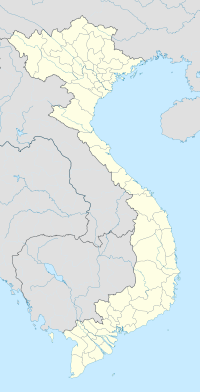
 TBB
TBBSummary Airport type Public Operator Middle Airport Authority Location Tuy Hoa Elevation AMSL 20 ft / 6 m Coordinates 13°02′58″N 109°20′01″E / 13.04944°N 109.33361°ECoordinates: 13°02′58″N 109°20′01″E / 13.04944°N 109.33361°E Runways Direction Length Surface ft m 03L/21R 9,520 2,902 Concrete 02/20 2,720 844 Asphalt 03R/21L
Closed9,3002,935Concrete- For the military use of the facility during the Vietnam Wars, see Tuy Hoa Air Base
Dong Tac Airport (IATA: TBB, ICAO: VVTH) (Vietnamese: Sân bay Đông Tác) is located just south of Tuy Hoa within Phu Yen Province along the central coast of Southern Vietnam.
Airlines and destinations
Airlines Destinations Vietnam Airlines Hanoi Vietnam Airlines operated by VASCO Ho Chi Minh City History
During the Vietnam War Đông Tác Airport was known as Tuy Hoa Air Base. It was built in 1966, and was one of several South Vietnamese Air Force air bases built and used by the United States Air Force.
External links
- Airport information for VVTH at World Aero Data. Data current as of October 2006.
 Airports in Vietnam
International Domestic Buon Ma Thuot (BMV) · Cà Mau (CAH) · Con Dao (VCS) · Dien Bien Phu (DIN) · Dong Hoi (VDH) · Phu Quoc-Duong Dong (PQC) · Pleiku (PXU) · Qui Nhon (UIH) · Rach Gia (VKG) · Son La (SQH) · Tuy Hoa (TBB) · Vinh (VII) · Vung Tau (VTG)Planned International: Ho Chi Minh City-Long Thanh · Phu Quoc-Phu Quoc International · Quang Ninh
Domestic: Lang Son · Thanh Hoa · An GiangNo civil use Bac Giang · Bien Hoa · Cao Bang · Da Lat-Cam Ly · Hai Phong-Kien An · Hanoi-Bach Mai · Hanoi-Gia Lam ·This article about a Vietnamese building or structure is a stub. You can help Wikipedia by expanding it. 
This article about transport in Vietnam is a stub. You can help Wikipedia by expanding it.
