- Cohuna, Victoria
-
- For the Central American palm tree see Attalea cohune.
Cohuna
Victoria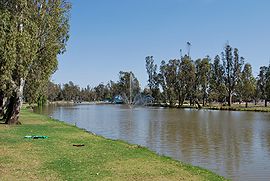
Gunbower Creek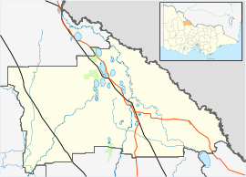
 Cohuna
Population: 1,893 (2006)[1] Postcode: 3568 Coordinates: 35°48′S 144°12′E / 35.8°S 144.2°ECoordinates: 35°48′S 144°12′E / 35.8°S 144.2°E Location: LGA: Shire of Gannawarra State District: Rodney Federal Division: Mallee Cohuna (
 /koʊˈhuːnə/)[2] is a town situated 274 kilometres (170 mi) north of Melbourne, on the Murray Valley Highway, in northern Victoria, Australia. At the 2006 census, Cohuna had a population of 1,893.[1]
Contents
History
A Post Office opened in the area on 18 September 1875, known as Mologa until 1876, then Cohuna and renamed Cullen in 1884 when Cohuna Township PO opened. This latter office was renamed Cohuna around 1887.[3]
The town today
 The Cohuna water tower
Surrounded by dairy farms, and situated on the banks of Gunbower Creek, (an anabranch of the Murray River), the town is a popular holiday spot as well as a regional sports centre with a wide range of facilities.
Cohuna is the main access point to the attractions of the vast red gum and box forest covered Gunbower Island, which lies between Gunbower Creek and the Murray, and is home to diverse native birdlife, kangaroos and emus.
Legend has it that John Farnham was "discovered" in Cohuna, and he returned in 2002 for a free one-off show.[4][5] The Bee Gees also played in Cohuna in their early days.[6]
More recently, Australian artist Sarah Blasko used Cohuna landmarks such as a local cafe and hospital for her video "Planet New Year".[citation needed]
Gunbower Creek runs along the main street and garden park. Golf, tennis, camping, fishing, water-skiing, canoeing, birdwatching and bushwalking are popular with visitors.
The Cohuna water tower is adorned with the town's name, and visible for kilometres.
Cohuna is a plastic bag free town.[citation needed]
Events and Sport
The Cohuna Bridge To Bridge is a range of sporting events for all fitness levels including an 8-kilometre (5.0 mi) swim, 1.2 km (0.75 mi) swim, 6.5 km (4.0 mi) run, jog, walk, 25 km (16 mi) and 50 km (31 mi) bike ride, 10 km (6.2 mi) and 20 km (12 mi) paddle, triathlon and team events.
Cohuna hosts an Easter Tennis Tournament and Golf Tournament.
The local agricultural show is held in March.
The town has an Australian rules football team competing in the Central Murray Football League, the Cohuna Kangas.[7]
Golfers play at the Cohuna Golf Club on Weymouth Road.[8]
References
- ^ a b Australian Bureau of Statistics (25 October 2007). "Cohuna (Urban Centre/Locality)". 2006 Census QuickStats. http://www.censusdata.abs.gov.au/ABSNavigation/prenav/LocationSearch?collection=Census&period=2006&areacode=UCL210800&producttype=QuickStats&breadcrumb=PL&action=401. Retrieved 1 February 2011.
- ^ Macquarie Dictionary, Fourth Edition (2005). Melbourne, The Macquarie Library Pty Ltd. ISBN 1-876429-14-3
- ^ Premier Postal History. "Post Office List". https://www.premierpostal.com/cgi-bin/wsProd.sh/Viewpocdwrapper.p?SortBy=VIC&country=. Retrieved 2008-04-11
- ^ McIntyre, Kylie. "Biography". John Farnham - through the eyes of a fan. http://www.johnfarnham.com/biography.html. Retrieved 2008-10-20.
- ^ "Cohuna Attractions". Cohuna & District Progress Association. http://www.cohuna.org.au/attractions.htm. Retrieved 2008-10-20.
- ^ Williams, Gail (2005-03-06). "Barry Gibb Interview". Sunday Times. Bee Gees World. http://www.beegees-world.com/archives109.html. Retrieved 2008-10-20.
- ^ Full Points Footy. "Cohuna". http://www.fullpointsfooty.net/cohuna_kangas.htm. Retrieved 2009-04-25
- ^ Golf Select. "Cohuna". http://www.golfselect.com.au/armchair/courseView.aspx?course_id=953. Retrieved 2009-05-11
External links
Towns in the Shire of Gannawarra Benjeroop • Cohuna • Kangaroo Lake • Kerang • Koondrook • Lake Charm • Lalbert • Leitchville • Macorna • Murrabit • Mystic Park • Quambatook • Tittybong • Tragowel •
Categories:- Towns in Victoria (Australia)


Wikimedia Foundation. 2010.