- Drummuir
-
Not to be confused with Drummore.
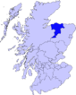
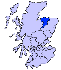
Drummuir (Gaelic: Druim Iubhair) is a small village in Scotland, in the traditional county of Banffshire, and in the Moray council area. It is between Dufftown (five miles), Keith (seven/eight miles) and Huntly (nine miles).
Its old name was Botriphnie, and this is the name still sometimes used for the parish. Drummuir comes from Druim Iubhair, Scottish Gaelic for "Yew Ridge"; the name Botriphnie (Both Draighnigh), may come from Pictish origins and be a "Pit-" name, meaning "Thorn Farm".
Drummuir's biggest building is "Drummuir Castle", a Strawberry Hill-type Gothic Victorian building, with extensive gardens. The castle was built by the Gordon-Duffs who are still the main landowners in the area.
The Keith and Dufftown Railway runs by the village from a defunct distillery. It is rarely used now, but is still in good condition.
The River Isla which flows down to Keith through Strathisla, and Davidston Burn (or Davieburn), a small tributary of the Isla are the two main rivers in the area. Ben Rinnes is clearly visible to the east, and makes a strong visual impression.
In 2002, this normally peaceful community was disturbed when a body of a teenage girl was found there. [1]
Coordinates: 57°29′03″N 3°02′01″W / 57.4841°N 3.0337°W
Places in Moray Achnastank · Aberlour · Alves · Archiestown · Arradoul · Auchbreck · Auchinderran · Auchindoun · Auchnarrow · Auchenhalrig · Aultmore · Backlands · Ballindalloch · Bogmoor · Branderburgh · Broadley · Buckie · Burghead · Burniestrype · Cabrach · Chapeltown · Clochan · College of Roseisle · Craigellachie · Cullen · Cummingston · Dallas · Darnaway · Deskford · Dipple · Drummuir · Drybridge · Dufftown · Duffus · Dyke · Elgin · Farmtown · Findhorn · Findochty · Fochabers · Forres · Fogwatt · Garmouth · Glass · Hopeman · Ianstown · Inchberry · Keith · Kellas · Kingston · Kinloss · Knockando · Lhanbryde · Longmorn · Lossiemouth · Maggieknockater · Miltonduff · Mosstodloch · Nether Dallachy · Newmill · Ordiquish · Portessie · Portgordon · Portknockie · Rathven · Rafford · Rothes · Rothiemay · Spey Bay · Strathlene · Stotfield · Tomintoul · Unthank · Upper Dallachy · Urquhart
 Categories:
- Places in Moray
- Moray geography stubs
Wikimedia Foundation. 2010.