- 2005 North Indian Ocean cyclone season
-
2005 North Indian Ocean cyclone season 
Season summary mapFirst storm formed: January 7, 2005 Last storm dissipated: December 22, 2005 Strongest storm: Baaz and Fanoos – 998 hPa (mbar), 85 km/h (50 mph) (3-minute sustained) Depressions: 14 Deep depressions: 8 Cyclonic storms: 4 Severe cyclonic storms: 0 Total fatalities: At least 1,227 direct, 4,000 missing Total damage: Unknown North Indian Ocean cyclone seasons
2003, 2004, 2005, 2006, 2007The 2005 North Indian Ocean cyclone season has no bounds, but cyclones tend to form between April and December, with peaks in May and November. These dates conventionally delimit the period of each year when most tropical cyclones form in the northern Indian Ocean.
The scope of this basin is limited to north of the Equator and west of the Malay peninsula. The IMD and JTWC monitor this basin. The Arabian Sea and Bay of Bengal make up this basin, abbreviated ARB and BOB, respectively.
2005 was active, with 8 storms this year, tying it with 1987, 1996, and 1998 for the 2nd most active season, behind 1992.
Season summary
In 2005, a total of twelve cyclonic disturbances were identified in North Indian Ocean, against a normal of fifteen. However, it was highest after 1992. Four of them became cyclonic storm in Bay of Bengal and were named, against a normal of five to six.[1]
Storms
Tropical Depression 01B
Tropical depression (SSHS) 

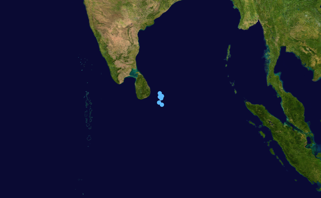
Duration January 7 – January 10 Intensity 55 km/h (35 mph) (1-min), 1000 mbar (hPa) In the second week of January, an area of convection persisted southeast of Sri Lanka. It organized into a tropical depression on January 8, but dissipated on the 10th due to vertical shear.
Cyclonic Storm Hibaru
Cyclonic storm (IMD) Tropical storm (SSHS) 

Duration January 13 – January 17 Intensity 65 km/h (40 mph) (3-min), 1000 mbar (hPa) Just behind the previous storm, a trough of low pressure developed into a tropical depression on January 13. Located a few hundred miles east-southeast of Sri Lanka, it meandered to the west, becoming a Cyclonic Storm on the 15th. Like its predecessor, Hibaru dissipated southeast of Sri Lanka on the 17th. This is the first season with two systems forming in January. The formation of a cyclonic storm in the month of January over low latitude is very rare; the last such occurrence was in the year 1987 (30 Jan. – 4 Feb, over the Bay of Bengal).
Depression ARB 01
Depression (IMD) Duration June 21 – June 22 Intensity 45 km/h (30 mph) (3-min), 992 mbar (hPa) Existed between June 21 and June 22, with MSW of 25 knots and pressure of 992 mb.
Depression BOB 02
Depression (IMD) Duration June 27 – July 5 Intensity 45 km/h (30 mph) (3-min), 990 mbar (hPa) Existed between June 27 and July 5, with MSW of 25 knots and pressure of 990 mb. Heavy rains from the depression caused flooding in India which killed at least 34 people.[2]
Deep Depression BOB 03
Deep depression (IMD) Duration July 29 – July 31 Intensity 55 km/h (35 mph) (3-min), 988 mbar (hPa) Torrential rains from the depression, and possibly other monsoonal storms, caused significant flooding in India which resulted in 1,044 fatalities.[3]
Depression BOB 04
Tropical depression (SSHS) Duration September 12 – September 16 Intensity 45 km/h (30 mph) (1-min), 992 mbar (hPa) Existed between September 12 and September 16 with MSW of 25 knots and pressure of 992.
Depression ARB 02
Tropical depression (SSHS) Duration September 14 – September 16 Intensity 50 km/h (30 mph) (1-min), 996 mbar (hPa) Existed between September 14 and September 16 with MSW of 25 knots and pressure of 996.
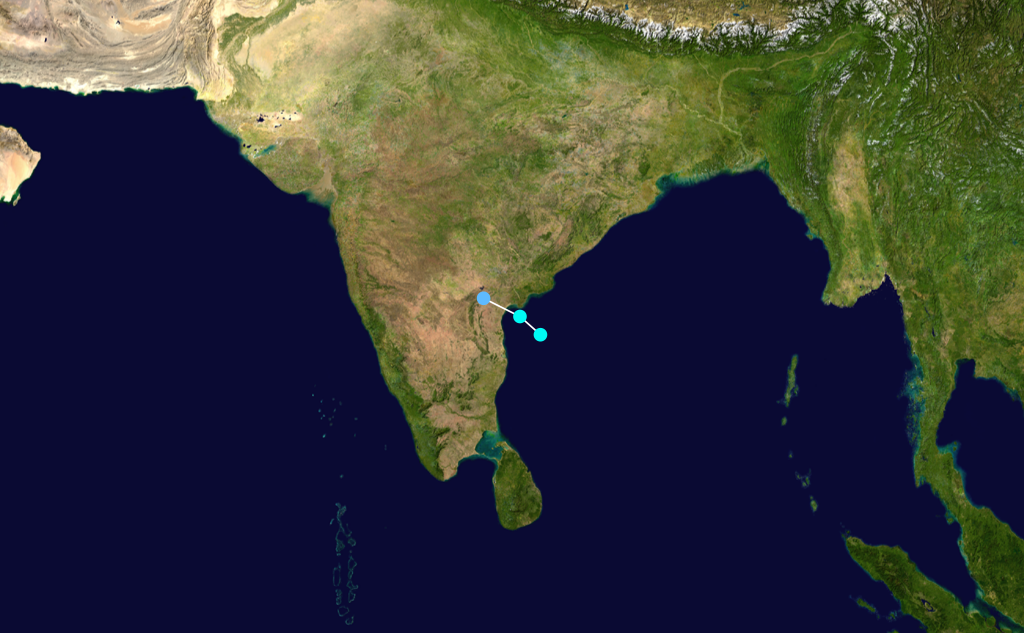
Cyclonic Storm Pyarr
Cyclonic storm (IMD) Duration September 17 – September 21 Intensity 75 km/h (45 mph) (3-min), 988 mbar (hPa) An area of convection developed in the South China Sea on September 12. It moved west-northwestward, moving inland over Thailand on the 13th. It reached the Bay of Bengal on the 15th, and slowly developed. On September 17 it was upgraded to a tropical depression by the Indian Meteorological Department (but not by the JTWC), and on September 18 it became Cyclonic Storm Pyarr. The next day Pyarr made landfall, and on September 22 it dissipated over northwestern India.
Tropical Storm 03B
Tropical storm (SSHS) 

Duration October 1 – October 3 Intensity 65 km/h (40 mph) (1-min), 994 mbar (hPa) Tropical Storm 3B, which formed on October 2, hit Bangladesh on the 3rd as a 40 mph (64 km/h) tropical storm.
Deep Depression BOB 05
Deep depression (IMD) Tropical storm (SSHS) 

Duration October 26 – October 29 Intensity 55 km/h (35 mph) (3-min), 998 mbar (hPa) Tropical Storm 4B hit southeastern India on October 28 and dissipated the next day. Pakistan named this storm Baaz, the next name on the list, but the RSMC (New Delhi) did not upgrade it.
Heavy rains from the storm caused significant flooding in India. At least 100 people were killed, 50,000 were evacuated, and over 100,000 others were affected.[4]
Depression BOB 06
Tropical depression (SSHS) Duration November 20 – November 22 Intensity 45 km/h (30 mph) (1-min), 1002 mbar (hPa) Existed between November 20 and November 20 with MSW of 25 knots and pressure of 1002.
Cyclonic Storm Baaz
Cyclonic storm (IMD) Tropical storm (SSHS) 

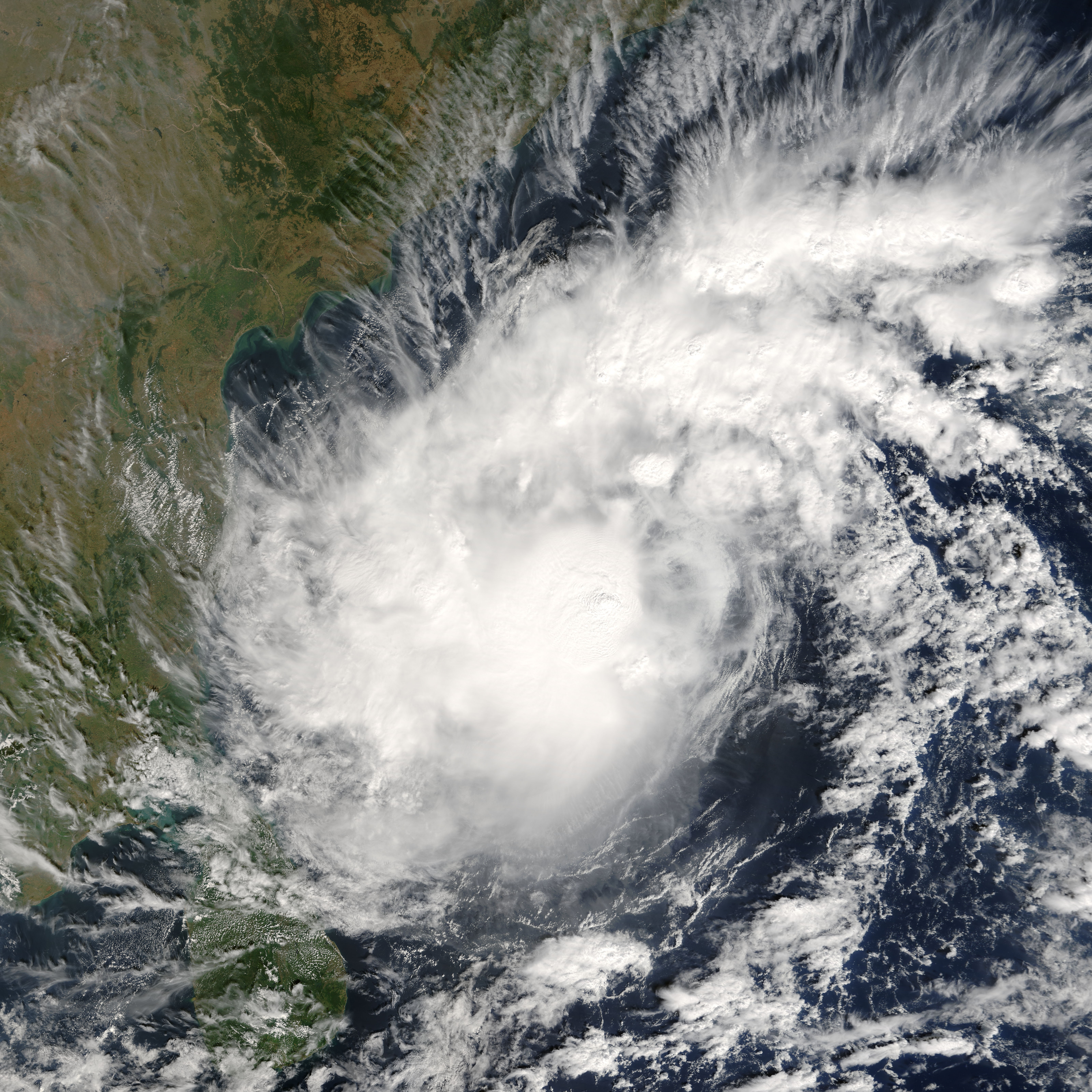
Duration November 28 – December 2 Intensity 85 km/h (50 mph) (3-min), 998 mbar (hPa) The Joint Typhoon Warning Center issued a Tropical Cyclone Formation Alert early on November 27 on a low pressure system with persistent convection around its center not far from the Andaman Islands in the Bay of Bengal. At 2100Z that same day, about 100 n mi west of Port Blair, the JTWC upgraded the low pressure to a tropical depression, with the Indian Meteorological Department following suit the next day. It was upgraded into a tropical storm on the JTWC's following advisory at 0900Z on November 28. On November 28, the official RSMC in New Delhi upgraded the tropical storm to Baaz. The storm eventually dissipated as a significant tropical cyclone over sea near or north of Chennai. Baaz refers to the Saker Falcon in Arabic.
Cyclonic Storm Fanoos
Severe cyclonic storm (IMD) Category 1 tropical cyclone (SSHS) 

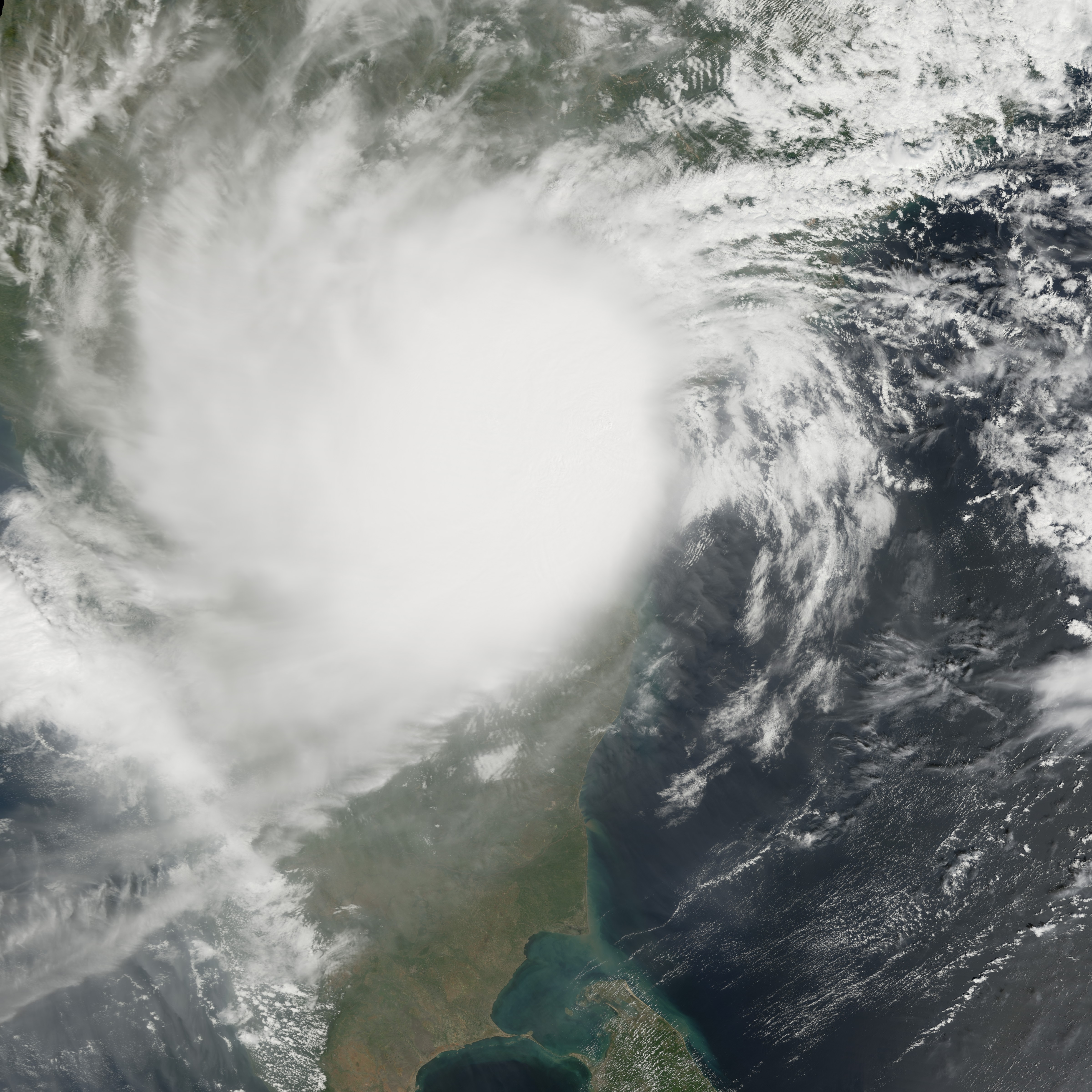
Duration December 6 – December 10 Intensity 95 km/h (60 mph) (3-min), 998 mbar (hPa) Tropical Storm 06B formed 550 nautical miles (1,020 km) east of Chennai on December 6, west of the Andaman Islands. It became Cyclonic Storm Fanoos on December 7. However, Fanoos weakened into a deep depression prior to crossing north Tamil Nadu coast near Vedaranyam at 0530 UTC (1100 IST) December 10. Fanoos weakened further into a low pressure area over south Tamil Nadu coast next day. Its remnants entered Arabian Sea but regeneration did not occur. Fanoos means chandelier in Urdu.
Severe damage was reported in Sri Lanka where thousands of homes were either damaged or destroyed. Due to the quick weakening prior to landfall, only minor damage occurred in Tamil Nadu. However, heavy rains forced the evacuation of 30,000 residents in the area. No fatalities were reported from Fanoos.[5]
Deep Depression BOB 09
Deep depression (IMD) Tropical storm (SSHS) 

Duration December 15 – December 22 Intensity 55 km/h (35 mph) (3-min), 1000 mbar (hPa) A depression formed over Southeast Bay of Bengal on December 15. On December 17 it was recognised by the JTWC when it was 220-nautical-mile (410 km) east of Colombo, Sri Lanka. The system weakened into an area of low pressure over water on December 22.
See also
- List of North Indian Ocean cyclone seasons
- 2005 Atlantic hurricane season
- 2005 Pacific hurricane season
- 2005 Pacific typhoon season
- South-West Indian Ocean cyclone seasons: 2004-05, 2005-06
- Australian region cyclone seasons: 2004-05, 2005-06
- South Pacific cyclone seasons: 2004-05, 2005-06
References
- ^ http://www.wmo.ch/pages/prog/www/tcp/documents/PTC33Report.pdf
- ^ "India: Floods". Office for the Coordination of Humanitarian Affairs. July 8, 2005. http://cidi.org/disaster/05b/ixl10.html. Retrieved December 29, 2008.[dead link]
- ^ "India: Floods". Office for the Coordination of Humanitarian Affairs. August 5, 2005. http://cidi.org/disaster/05b/ixl38.html. Retrieved December 29, 2008.[dead link]
- ^ "India: Floods". Office for the Coordination of Humanitarian Affairs. October 27, 2005. http://cidi.org/disaster/05b/ixl161.html. Retrieved December 29, 2008.[dead link]
- ^ "Cyclone Fanoos Dissipates over Tamil Nadu". Asia-Pacific Disaster Alerts. December 11, 2005. http://www.afap.org/apcedi/2005/12/apcedi-alert-sri-lanka-bobw-cyclone_11.html. Retrieved December 29, 2008.
External links
- Gary Padgett Tropical Cyclone Summary
- Gary Padgett Tropical Cyclone Summary Part 2
- Tropical Cyclone Operational Plan for the Bay of Bengal and the Arabian Sea
- Impact of Cyclonic Storms and Suggested Mitigation Actions (by India Meteorological Department)
- WMO/ESCAP Panel on Tropical Cyclones Thirty-third session
2000–09 North Indian Ocean cyclone seasons Categories:


Wikimedia Foundation. 2010.