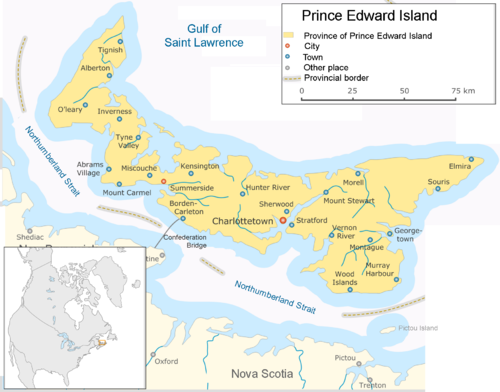
- Prince Edward Island
-
This article is about the Canadian province. For the sub-Antarctic islands, see Prince Edward Islands. For other uses of PEI, see Pei (disambiguation).
Prince Edward Island
Île-du-Prince-Édouard (French)

Flag Coat of arms Motto: Latin: Parva sub ingenti
(The small protected by the great)
Capital Charlottetown Largest city Charlottetown Largest metro Charlottetown Official languages English (de facto) Demonym Prince Edward Islander, Islander Government Type Lieutenant Governor Frank Lewis Premier Robert Ghiz (Liberal) Legislature Legislative Assembly of Prince Edward Island Federal representation in Canadian parliament House seats 4 of 308 (1.3%) Senate seats 4 of 105 (3.8%) Confederation July 1, 1873 (8th) Area Ranked 13th Total 5,683.91 km2 (2,194.57 sq mi) Land 5,683.56 km2 (2,194.43 sq mi) Water (%) 0 km2 (0 sq mi) (0%) Proportion of Canada 0.1% of 9,984,670 km2 Population Ranked 10th Total (2009) 141,551 (est.)[1] Density (2009) 24.91 /km2 (64.5 /sq mi) GDP Ranked 10th Total (2009) C$4.75 billion[2] Per capita C$31,278 (13th) Abbreviations Postal PE ISO 3166-2 CA-PE Time zone UTC-4 Postal code prefix C Flower Pink Lady's Slipper Tree Red Oak Bird Blue Jay Website www.gov.pe.ca Rankings include all provinces and territories Prince Edward Island (PEI or P.E.I.; French: Île-du-Prince-Édouard, pronounced: [il dy pʁɛ̃s edwaːʁ], Scottish Gaelic: Eilean a' Phrionnsa) is a Canadian province consisting of an island of the same name, as well as other islands. The maritime province is the smallest in the nation in both land area and population. The island has a few other names: "Garden of the Gulf" referring to the pastoral scenery and lush agricultural lands throughout the province; and "Birthplace of Confederation", referring to the Charlottetown Conference in 1864, although PEI did not join the confederation itself until 1873 when it became the seventh Canadian province.
According to the 2009 estimates, Prince Edward Island has 141,000 residents. It is located in a rectangle defined roughly by 46°–47°N, and 62°–64°30′W and at 5,683.91 km2 (2,194.57 sq mi) in size,[3] it is the 104th largest island in the world, and Canada's 23rd largest island. The island was named for Prince Edward, Duke of Kent and Strathearn (1767–1820), the fourth son of King George III and the father of Queen Victoria.
Contents
Geography
Main article: Geography of Prince Edward Island
Prince Edward Island is located in the Gulf of St. Lawrence west of Cape Breton Island, north of the Nova Scotia peninsula, and east of New Brunswick. Its southern shore bounds the Northumberland Strait. The island has two urban areas. The largest surrounds Charlottetown Harbour, situated centrally on the island's southern shore, and consists of the capital city Charlottetown, and suburban towns Cornwall and Stratford and a developing urban fringe. A much smaller urban area surrounds Summerside Harbour, situated on the southern shore 40 km (25 mi) west of Charlottetown Harbour, and consists primarily of the city of Summerside. As with all natural harbours on the island, Charlottetown and Summerside harbours are created by rias.
The island's landscape is pastoral. Rolling hills, woods, reddish white sand beaches, ocean coves and the famous red soil have given Prince Edward Island a reputation as a province of outstanding natural beauty. The provincial government has enacted laws that attempt to preserve the landscape through regulation, although there is a lack of consistent enforcement, and an absence of province-wide zoning and land-use planning.[citation needed]
 The landward side of sand dunes in Cavendish
The island's lush landscape has a strong bearing on its economy and culture. Author Lucy Maud Montgomery drew inspiration from the land during the late Victorian Era for the setting of her classic novel Anne of Green Gables. Today, many of the same qualities that Montgomery and others found in the island are enjoyed by tourists who visit year-round. They enjoy a variety of leisure activities, including beaches, various golf courses, eco-tourism adventures, touring the countryside, and enjoying cultural events in local communities around the island.
The smaller, rural communities as well as the towns and villages throughout the province proudly retain a slower-paced, old-world flavour, something factoring heavily into Prince Edward Island's popularity as a destination for relaxation. The economy of most rural communities on the island is based on small-scale agriculture, given the size of farm properties is small when compared with other areas in Canada. There is an increasing amount of industrial farming as older farm properties are consolidated and modernized.
The coastline consists of a combination of long beaches, dunes, red sandstone cliffs, salt water marshes and numerous bays and harbours. The beaches, dunes and sandstone cliffs consist of sedimentary rock and other material with a high iron concentration which oxidises upon exposure to the air. The geological properties of a white silica sand found at Basin Head are unique in the province; the sand grains cause a scrubbing noise as they rub against each other when walked on, aptly named the singing sands. Large dune fields on the north shore can be found on barrier islands at the entrances to various bays and harbours. The magnificent sand dunes at Greenwich are of particular significance. The shifting, parabolic dune system is home to a variety of birds and rare plants and is also a site of significant archeological interest.
Geology
Between 250 to 300 million years ago, freshwater streams flowing from ancient mountains brought silt, sand and gravel into what is now the Gulf of St. Lawrence. These sediments accumulated to form a sedimentary basin, and make up the island's bedrock. When Pleistocene glaciers receded about 15,000 years ago, glacial debris such as till was left behind to cover most of the area that would become the island. This area was connected to the mainland by a strip of land, but when ocean levels rose as the glaciers melted this land strip was flooded, forming the island. As the land rebounded from the weight of the ice, the island rose up to elevate it further from the surrounding water.[4][5][6]
Climate
 The coast of Prince Edward Island around Cavendish
Winters are moderately cold, with clashes of cold Arctic air and milder Atlantic air causing frequent temperature swings. From December to April, the island usually has many storms (which may produce rain as well as snow) and blizzards. Springtime temperatures typically remain cool until the sea ice has melted, usually in late April or early May. Summers are moderately warm, but rarely uncomfortable, with the daily maximum temperature only occasionally reaching as high as 30 °C (86 °F). Autumn is a rather pleasant season, as the moderating Gulf waters delay the onset of frost, although storm activity does increase over that of summer. There is ample precipitation throughout the year, although it is heaviest in the late autumn and early winter and mid spring.
Climate data for Charlottetown Month Jan Feb Mar Apr May Jun Jul Aug Sep Oct Nov Dec Year Record high °C (°F) 15.1
(59.2)13.3
(55.9)16.3
(61.3)22.9
(73.2)31.2
(88.2)32.2
(90.0)33.9
(93.0)34.4
(93.9)31.5
(88.7)24.4
(75.9)21.3
(70.3)16.7
(62.1)34.4
(93.9)Average high °C (°F) −3.3
(26.1)−3.3
(26.1)0.9
(33.6)6.7
(44.1)14.1
(57.4)19.6
(67.3)23.2
(73.8)22.6
(72.7)18
(64)11.8
(53.2)5.7
(42.3)−0.1
(31.8)9.7 Average low °C (°F) −12.6
(9.3)−12.4
(9.7)−7.1
(19.2)−1.4
(29.5)4
(39)9.6
(49.3)13.8
(56.8)13.5
(56.3)9.1
(48.4)3.8
(38.8)−1.1
(30.0)−8.1
(17.4)0.9 Record low °C (°F) −30.5
(−22.9)−29.8
(−21.6)−23.9
(−11.0)−13.6
(7.5)−6.7
(19.9)−1.1
(30.0)4.4
(39.9)2
(36)−0.6
(30.9)−6.7
(19.9)−15
(5)−28.1
(−18.6)−30.5
(−22.9)Precipitation mm (inches) 106.4
(4.189)85.5
(3.366)91.8
(3.614)87.8
(3.457)97.7
(3.846)93.2
(3.669)85.8
(3.378)87.3
(3.437)95.4
(3.756)108.6
(4.276)110.8
(4.362)123.1
(4.846)1,173.3
(46.193)Rainfall mm (inches) 42.1
(1.657)30.1
(1.185)38.8
(1.528)59
(2.32)93.8
(3.693)93.2
(3.669)85.8
(3.378)87.3
(3.437)95.4
(3.756)105.2
(4.142)87.1
(3.429)62.6
(2.465)880.4
(34.661)Snowfall cm (inches) 71.1
(27.99)60.2
(23.7)53.4
(21.02)28.9
(11.38)3.8
(1.5)0
(0)0
(0)0
(0)0
(0)3.1
(1.22)23.0
(9.06)68.4
(26.93)311.9
(122.8)Avg. precipitation days 18.8 16.1 16 15.4 14.7 12.8 12.4 11.3 13.7 15 17.5 20.6 184.3 Avg. rainy days 6.8 5.1 7.4 11.1 14.5 12.8 12.4 11.3 13.7 14.4 12.8 8.5 130.8 Avg. snowy days 16.2 14.1 12.2 7.4 0.9 0 0 0 0 1.2 7.5 16.2 75.7 Sunshine hours 105.3 115.2 142.7 150.8 197.1 225.5 248.2 223.2 175.7 123.3 77.1 74.5 1,858.6 Source: Environment Canada [7] History
Main article: History of Prince Edward Island Lighthouse on Panmure Island
Before the influx of Europeans, the Mi'kmaq people inhabited Prince Edward Island. They named the Island Epekwitk, meaning "resting on the waves"; Europeans represented the pronunciation as Abegweit.[8] The natives believed that the island was formed by the Great Spirit placing on the Blue Waters some dark red crescent-shaped clay.
French colony
In 1534, Jacques Cartier was the first European to see the island.[8] As part of the French colony of Acadia, the island was called "Île Saint-Jean".
Battle at Port-la-Joye
Main article: Battle at Port-la-JoyeAfter the Siege of Louisbourg (1745) during King George's War, the New Englanders also captured Île Saint-Jean (Prince Edward Island). The New Englanders had a force of two war ships and 200 soldiers stationed at Port-La-Joye. To regain Acadia, Ramezay was sent from Quebec to the region to join forces with the Duc d'Anville Expedition. Upon arriving at Chignecto, he sent Boishebert to Ile Saint-Jean on a reconnaissance to assess the size of the New England force.[9] After Boishebert returned, Ramezay sent Joseph-Michel Legardeur de Croisille et de Montesson along with over 500 men, 200 of whom were Mi'kmaq, to Port-La-Joye.[10] In July 1746, the battle happened near York River.[11] Montesson and his troops killed forty New Englanders and captured the rest. Montesson was commended for having distinguished himself in his first independent command.[12]
Expulsion of the Acadians
Roughly one thousand Acadians lived on the island, many of whom had fled to the island from mainland Nova Scotia during the first wave of the British-ordered expulsion in 1755, reaching a population of 5,000.[13] However, many more were forcibly deported during the second wave of the expulsion after the Siege of Louisbourg (1758). In the Ile Saint-Jean Campaign (1758) General Jeffery Amherst ordered Colonel Andrew Rollo to capture the island. Many Acadians died in the expulsion enroute to France: on December 13, 1758, the transport ship Duke William sank and 364 died. A day earlier the Violet sank and 280 died; several days later the Ruby sank with 213 on board.[14]
British colony
Great Britain obtained the island from France under the terms of the Treaty of Paris in 1763 which settled the Seven Years' War. The British called their new colony St. John's Island (also the Island of St. John's).
The first British governor of St. John's Island, Walter Patterson, was appointed in 1769. Assuming office in 1770, he had a controversial career during which land title disputes and factional conflict slowed the initial attempts to populate and develop the island under a feudal system. In an attempt to attract settlers from Ireland, in one of his first acts (1770) Patterson led the island's colonial assembly to rename the island "New Ireland", but the British Government promptly vetoed this as exceeding the authority vested in the colonial government; only the Privy Council in London could change the name of a colony.[15]
Raid on Charlottetown (1775)
During the American Revolutionary War Charlottetown was raided in 1775 by a pair of American-employed privateers.[16] Two armed schooners, Franklin and Hancock, from Beverly, Massachusetts, made prisoner of the attorney-general at Charlottetown, on advice given them by some Pictou residents after they had taken eight fishing vessels in the Gut of Canso.[17]
During and after the American Revolutionary War, from 1776 to 1783, the colony's efforts to attract exiled Loyalist refugees from the rebellious American colonies met with some success. Walter Patterson's brother, John Patterson, one of the original grantees of land on the island, was a temporarily exiled Loyalist and led efforts to persuade others to come.
The 1787 dismissal of Governor Patterson and his recall to London in 1789 dampened his brother's efforts, leading John to focus on his interests in the United States (one of John's sons, Commodore Daniel Patterson, became a noted United States Navy hero, and John's grandsons, Rear Admiral Thomas H. Patterson and Lt. Carlile Pollock Patterson USN, achieved success).
Edmund Fanning, also a Loyalist exiled by the Revolution, took over as the second governor, serving until 1804. His tenure was more successful than Patterson's.[citation needed]
On November 29, 1798, during Fanning's administration, Great Britain granted approval to change the colony's name from St. John's Island to Prince Edward Island to distinguish it from similar names in the Atlantic, such as the cities of Saint John, New Brunswick and St. John's in Newfoundland. The colony's new name honoured the fourth son of King George III, Prince Edward Augustus, the Duke of Kent (1767–1820), who subsequently led the British military forces on the continent as Commander-in-Chief, North America (1799–1800), with his headquarters in Halifax. (Prince Edward later became the father of the future Queen Victoria.)
During the 19th century the colony of Prince Edward Island began to attract "adventurous Victorian families looking for elegance on the sea. Prince Edward Island became a fashionable retreat in the nineteenth century for British nobility."[18]
The island is known in Scottish Gaelic as Eilean a' Phrionnsa (lit. "the Island of the Prince", the local form of the longer 'Eilean a' Phrionnsa Iomhair/Eideard') or Eilean Eòin for some Gaelic speakers in Nova Scotia though not on PEI (lit. "John's Island" in reference to the island's former name of St. John's Island: the English translation of Île Saint Jean); in Míkmaq as Abegweit or Epekwitk roughly translated "land cradled in the waves".
 Confederation Bridge, PEI and NB.
Confederation
In September 1864, Prince Edward Island hosted the Charlottetown Conference, which was the first meeting in the process leading to the Articles of Confederation and the creation of Canada in 1867. Prince Edward Island did not find the terms of union favourable and balked at joining in 1867, choosing to remain a colony of the United Kingdom. In the late 1860s, the colony examined various options, including the possibility of becoming a discrete dominion unto itself, as well as entertaining delegations from the United States, who were interested in Prince Edward Island joining the United States of America.[citation needed]
 Prince Edward Island map 1874
In 1871, the colony began construction of a railway and, frustrated by Great Britain's Colonial Office, began negotiations with the United States.[citation needed] In 1873, Prime Minister Sir John A. Macdonald, anxious to thwart American expansionism and facing the distraction of the Pacific Scandal, negotiated for Prince Edward Island to join Canada. The Dominion Government of Canada assumed the colony's extensive railway debts and agreed to finance a buy-out of the last of the colony's absentee landlords to free the island of leasehold tenure and from any new immigrants entering the island (accomplished through the passage of the Land Purchase Act, 1875).[19] Prince Edward Island entered Confederation on 1 July 1873.[20]
As a result of having hosted the inaugural meeting of Confederation, the Charlottetown Conference, Prince Edward Island presents itself as the "Birthplace of Confederation" with several buildings, a ferry vessel, and the Confederation Bridge (constructed 1993 to 1997). The most prominent building in the province with this name is the Confederation Centre of the Arts, presented as a gift to Prince Edward Islanders by the 10 provincial governments and the Federal Government upon the centenary of the Charlottetown Conference, where it stands in Charlottetown as a national monument to the "Fathers of Confederation". The Centre is one of the 22 National Historic Sites of Canada located in Prince Edward Island.[21][22]
Demographics
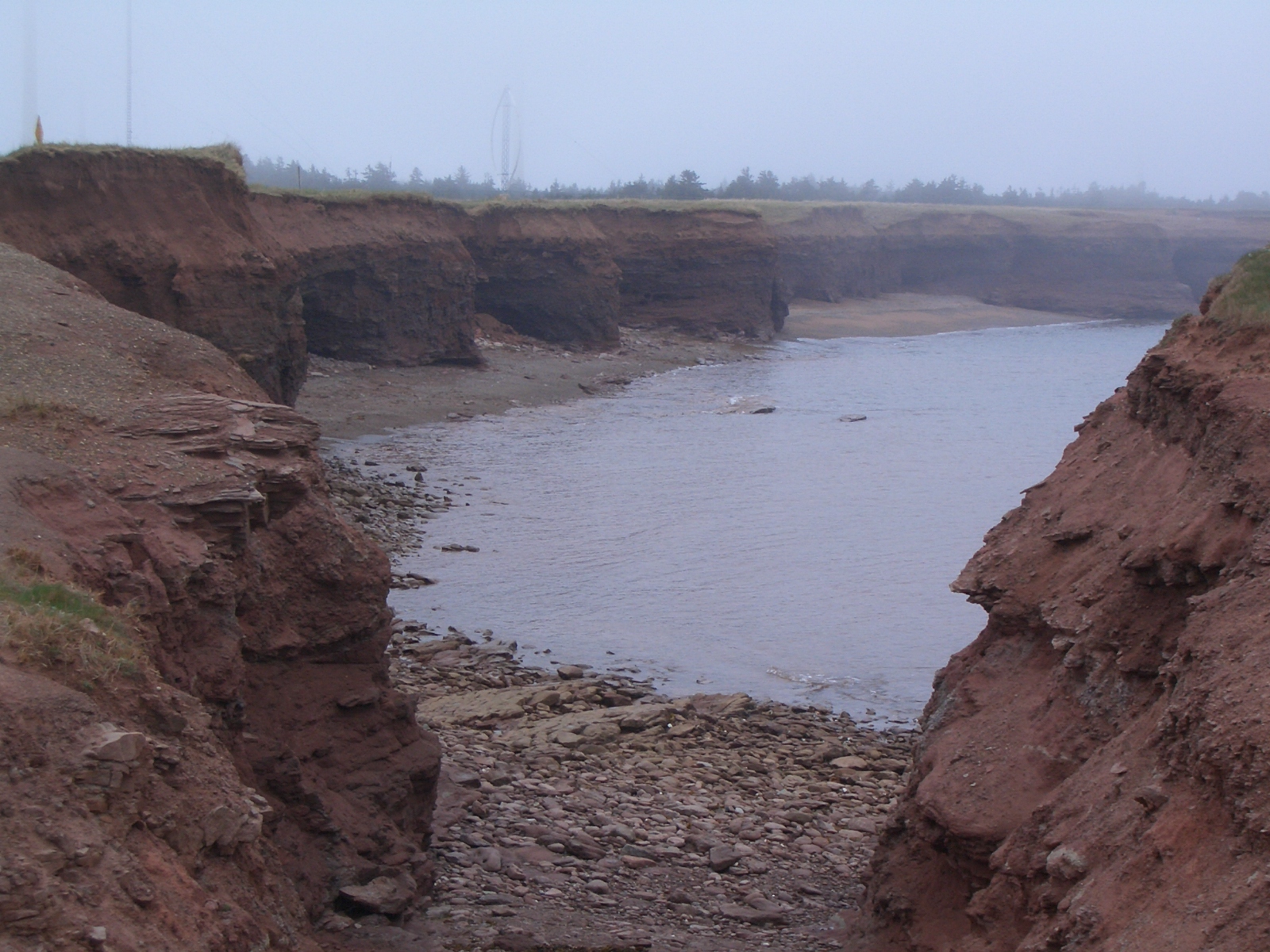
 Sandstone cliffs at North Cape enshrouded in fogMain article: Demographics of Prince Edward Island
According to the 2001 Canadian Census,[23] the largest ethnic group consists of people of Scottish descent (38.0%), followed by English (28.7%), Irish (27.9%), French (21.3%), German (4.0%), and Dutch (3.1%) descent. In recent times the island has received an influx of immigrants from Asia and Africa. Almost half of respondents identified their ethnicity as "Canadian."
Population of Prince Edward Island since 1851 Year Population Mean annual 5-year 10-year Rank* Percentage change 1851 62,678 – – – 5 1861 80,857 2.6 – 29.0 1871 94,021 1.5 – 16.3 1881 108,891 1.5 – 15.8 1891 109,078 0.017 – 0.2 6 1901 103,259 −0.55 – −5.3 7 1911 93,728 −0.96 – −9.2 9 1921 88,615 −0.56 – −5.4 1931 88,038 −0.065 – −0.7 1941 95,047 0.77 – 8.0 1951 98,429 0.35 – 3.6 10 1956 99,285 0.17 0.9 – 1961 104,629 1.1 5.4 6.3 1966 108,535 0.74 3.7 9.3 1971 111,635 0.56 2.9 6.7 1976 118,225 1.2 5.9 8.9 1981 122,506 0.7 3.6 9.7 1986 126,640 0.67 3.4 7.1 1991 129,765 0.49 2.5 5.9 1996 134,557 0.73 3.7 6.3 2001 135,294 0.11 0.5 4.2 2006 135,851 NA 0.4 NA * among provinces.
† Preliminary 2006 census estimate.
Source: Statistics Canada[24][25]Language
 Mother tongue in Prince Edward Island (red: English, blue: French).
 Rolling hills characterise a significant portion of the island's landscape.
The 2006 Canadian census showed a population of 135,851. Of the 133,570 singular responses to the census question concerning 'mother tongue' the most commonly reported languages were:
Rank Language Number Percent 1. English 125,265 93.8% 2. French 5,345 4.0% 3. Dutch 865 0.6% 4. German 275 0.2% 5. Spanish 220 0.2% 6. Chinese 190 0.1% 7. Arabic 150 0.1% 8. Hungarian 120 0.1% 9. Mi'kmaq 90 0.1% 10. Japanese 80 0.1% 11. Polish 70 0.1% 12. Korean 65 In addition, there were also 105 responses of both English and a 'non-official language'; 25 of both French and a 'non-official language'; 495 of both English and French; 10 of English, French, and a 'non-official language'; and about 1,640 people who either did not respond to the question, or reported multiple non-official languages, or else gave another unenumerated response. (Figures shown are for the number of single language responses and the percentage of total single-language responses.)[26]
Religion
Traditionally the population has been evenly divided between Catholic and Protestant affiliations. The 2001 census indicated number of adherents for the Roman Catholic Church with 63,240 (47%) and various Protestant churches with 57,805 (43%). This included the United Church of Canada with 26,570 (20%); the Presbyterian Church with 7,885 (6%) and the Anglican Church of Canada with 6,525 (5%); those with no religion were among the lowest of the provinces with 8,705 (6.5%).[27]
Economy
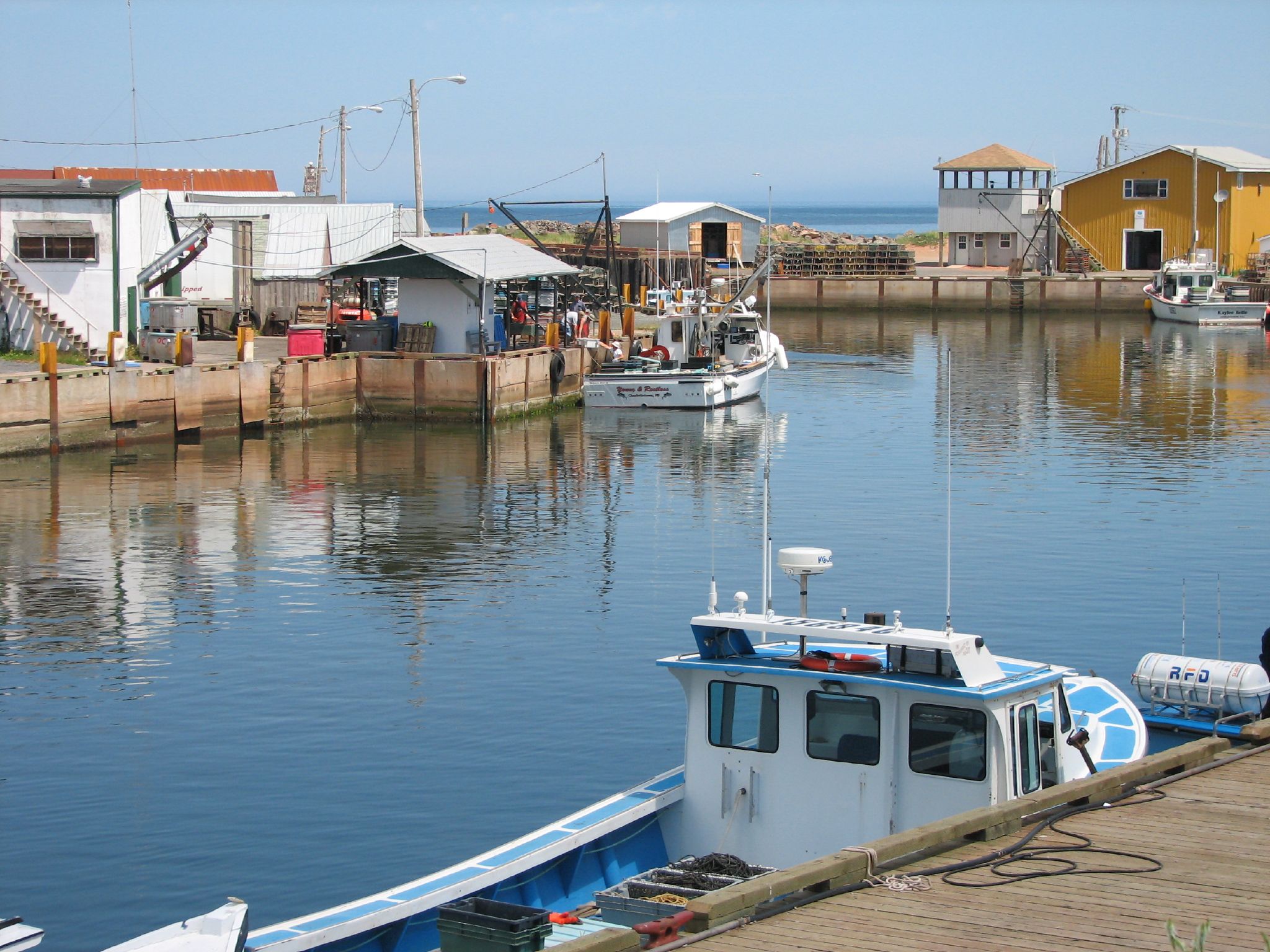
 Fisheries form one of the major industries of Prince Edward Island.
The provincial economy is dominated by the seasonal industries of agriculture, tourism, and the fishery. The province is limited in terms of heavy industry and manufacturing. Although commercial deposits of minerals have not been found, exploration for natural gas beneath the eastern end of the province has resulted in the discovery of an undisclosed quantity of gas.
Agriculture remains the dominant industry in the provincial economy, as it has since colonial times. During the 20th century, potatoes replaced mixed farming as the leading cash crop, accounting for one-third of provincial farm income. The province currently accounts for a third of Canada's total potato production, producing approximately 1.3 billion kilograms annually.[28] Comparatively, the state of Idaho produces approximately 6.2 billion kilograms annually, with a population approximately 9.5 times greater.[29] The province is a major producer of seed potatoes, exporting to more than twenty countries around the world.[28]
 Farmland on Prince Edward Island.
The island's economy has grown significantly over the last decade in key areas of innovation. Aerospace, Bioscience, ICT and Renewable energy have been a focus for growth and diversification. Aerospace alone now accounts for over 25% of the province's international exports and is the island's fourth largest industry at $355 million in annual sales.
As a legacy of the island's colonial history, the provincial government enforces extremely strict rules for non-resident land ownership. Residents and corporations are limited to maximum holdings of 400 and 1,200 hectares respectively. There are also restrictions on non-resident ownership of shorelines.
Many of the province's coastal communities rely upon shellfish harvesting, particularly lobster fishing[30] as well as oyster fishing and mussel farming.
The provincial government provides consumer protection in the form of regulation for certain items, ranging from apartment rent increases to petroleum products including gas, diesel, propane and heating oil. These are regulated through the Island Regulatory and Appeals Commission (IRAC).[31] IRAC is authorised to limit the number of companies who are permitted to sell petroleum products.
The sale of carbonated beverages such as beer and soft drinks in non-refillable containers, such as aluminum cans or plastic bottles, was banned in 1976 as an environmental measure in response to public concerns over litter. Beer and soft drink companies opted to use refillable glass bottles for their products which were redeemable at stores and bottle depots. The introduction of recycling programs for cans and plastic bottles in neighbouring provinces in recent years (also using a redemption system) has seen the provincial government introduce legislation to reverse this ban with the restriction lifted on May 3, 2008.[32][33][34]
Prince Edward Island has Canada's highest provincial retail sales tax rate, currently (2008) established at 10%. The tax is applied to almost all goods and services except some clothing, food and home heating fuel. The tax is also applied to the Federal Goods and Services Tax.
At present, approximately fifteen percent of electricity consumed on the island is generated from renewable energy (largely wind turbines); the provincial government has set renewable energy targets as high as 30-50% for electricity consumed by 2015. Until wind generation, the province relied entirely on electricity imports on a submarine cable from New Brunswick. A thermal oil-fired generating station in Charlottetown is also available.
Persons employed on Prince Edward Island earn a minimum wage of $9.00/hour as of October 1, 2010.[35]
Transportation
 Cardigan River, one of The Three Rivers
Prince Edward Island's transportation network has traditionally revolved around its seaports of Charlottetown, Summerside, Borden, Georgetown, and Souris —linked to its railway system, and the two main airports, Charlottetown and Summerside, for communication with mainland North America. The railway system was abandoned by CN in 1989 in favour of an agreement with the federal government to improve major highways.
Until 1997, the province was linked by two passenger-vehicle ferry services to the mainland: one, provided by Marine Atlantic, operated year-round between Borden and Cape Tormentine, New Brunswick; the other, provided by Northumberland Ferries Limited, operates seasonally between Wood Islands and Caribou, Nova Scotia. A third ferry service provided by CTMA operates seasonally between Souris and Cap-aux-Meules, Quebec, in the Magdalen Islands.
On June 1, 1997, the Confederation Bridge opened, connecting Borden-Carleton to Cape Jourimain, New Brunswick. The longest bridge over ice covered waters in the world,[36] it replaced the Marine Atlantic ferry service. Since then, the Confederation Bridge's assured transportation link to the mainland has altered the province's tourism and agricultural and fisheries export economies.
The province has very strict laws regarding use of road-side signs. Billboards and the use of portable signs are banned. There are standard direction information signs on roads in the province for various businesses and attractions in the immediate area. Some municipalities' by-laws also restrict the types of permanent signs that may be installed on private property.
 Province House, PEI
There is an extensive bicycling / hiking trail that spans the island. The Confederation Trail is a 470 kilometre recreational trail system. The land once was owned and used by Canadian National Railway (CN) as a rail line on the island.
Government
Main articles: Government of Prince Edward Island and Politics of Prince Edward IslandPrince Edward Island has a high level of political representation, with four Members of Parliament, four Senators, 27 Members of the Legislative Assembly and two cities, seven towns and sixty incorporated rural communities yielding over five hundred municipal councilors and mayors. This gives a total of 566 elected officials for a population (as of 2006) of 135,851.
Communities
Ten largest Communities by population Community 2011 2001 Charlottetown 32,545a 32,455 Summerside 15,654b 14,433 Stratford 8,043 6,314 Cornwall 5,375 4,412 Montague 5,134 2,014 Kensington 1,385 1,379 Souris 1,232 1,238 Alberton 1,081 975 Tignish 998 846 Georgetown 678 680 aCensus agglomeration population: 58,358.
bCensus agglomeration population: 16,200.Education
Prince Edward Island is home to one university, the University of Prince Edward Island (UPEI), located in the city of Charlottetown. The university was created by the Island legislature to replace Prince of Wales College and St. Dunstan's University. UPEI is also home to the Atlantic Veterinary College, which offers the region's only veterinary medicine program.
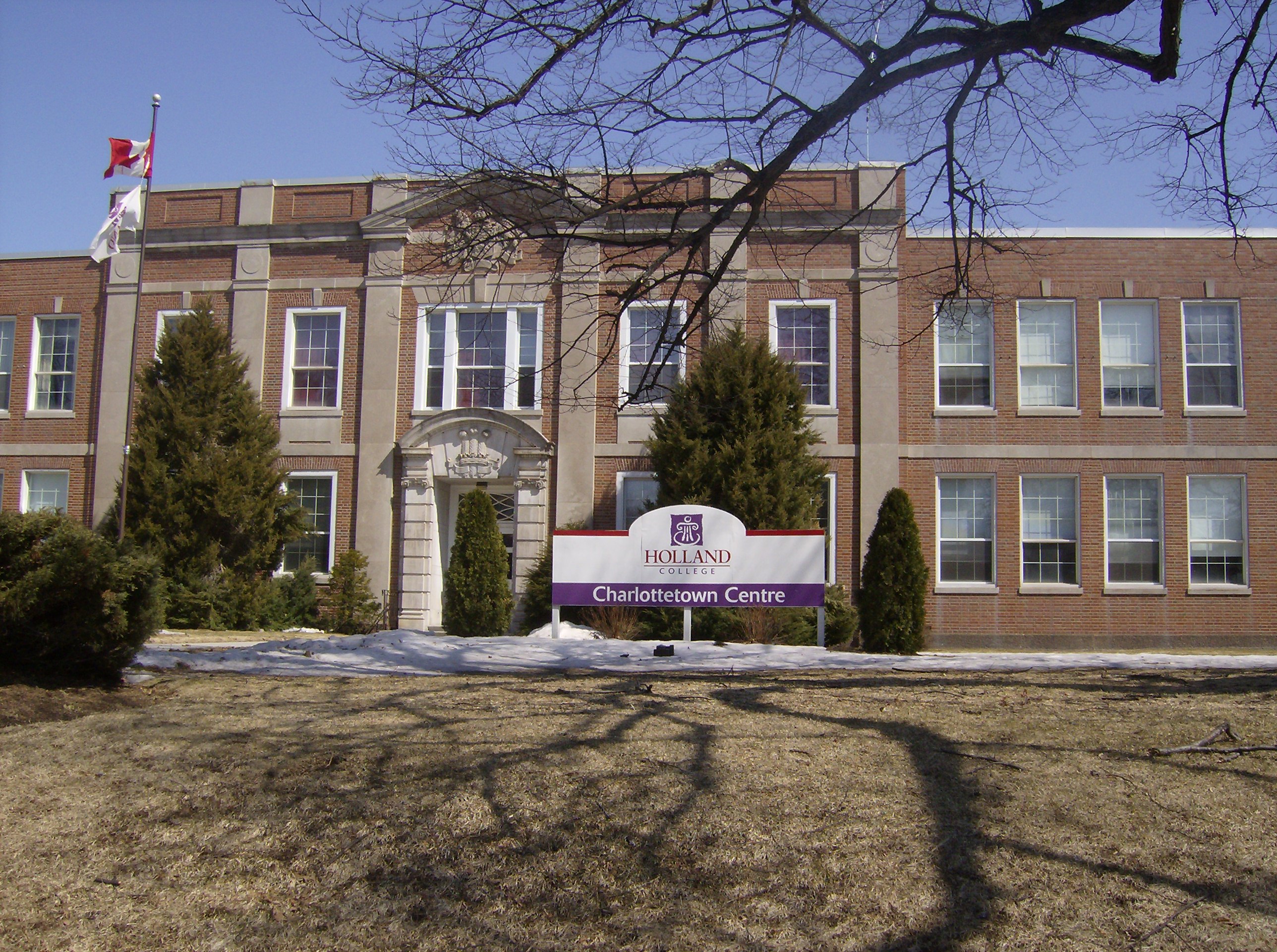
Holland College is the provincial community college, with campuses across the province, including specialised facilities such as the Atlantic Police Academy, Marine Training Centre, and the Culinary Institute of Canada.
Prince Edward Island's public school system has two English language school districts, Eastern and Western, as well as a Francophone district, the Commission scolaire de langue française. The English language districts have a total of 10 secondary schools and 54 intermediate and elementary schools while the Francophone district has 6 schools covering all grades.
Prince Edward Island, along with most rural regions in North America, is experiencing an accelerated rate of youth emigration. The provincial government has projected that public school enrollment will decline by 40% during the 2010s.
Health care
 Panorama of the banks of the River Clyde in New Glasgow
The province has a single health administrative region (or district health authority called Health PEI. Health PEI receives funding for its operations and is regulated by the Department of Health and Wellness. There are eight hospitals in the province.
- Queen Elizabeth Hospital (Charlottetown)
- Prince County Hospital (Summerside)
- Kings County Memorial Hospital (Montague)
- Community Hospital (O'Leary)
- Souris Hospital (Souris)
- Stewart Memorial Hospital (Tyne Valley)
- Western Hospital (Alberton)
- Hillsborough Hospital (Charlottetown) - the province's only psychiatric hospital
Due to its small tax base and population, Prince Edward Island does not offer all specialist services that are available in many Canadian provinces. Consequently, patients requiring specialist services are referred to clinics and specialists in neighbouring provinces. Specialist operations and treatments are also provided at larger tertiary referral hospitals in neighbouring provinces such as the IWK Health Centre and Queen Elizabeth II Health Sciences Centre in Nova Scotia or the Saint John Regional Hospital, Moncton Hospital, and Dr. Georges-L.-Dumont University Hospital Centre in New Brunswick.
Ground ambulance service in Prince Edward Island is provided under contract by Island EMS. Air ambulance service is provided under contract by LifeFlight.
In recent decades, Prince Edward Island's population has shown statistically significant and abnormally high rates of diagnosed rare cancers, particularly in rural areas. Health officials, ecologists and environmental activists point to the use of pesticides for industrial potato farming as a primary contaminant.[37]
Prince Edward Island is the only province in Canada that does not provide abortion services through its hospitals. The last abortion was performed in the province in 1982 prior to the opening of the Queen Elizabeth Hospital which saw the closure of the Roman Catholic-affiliated Charlottetown Hospital and the non-denominational Prince Edward Island Hospital; a condition of the "merger" being that abortions not be performed in the province. In 1988 following the court decision R. v. Morgentaler, the then-opposition Progressive Conservative Party of Prince Edward Island tabled a motion demanding that the ban on abortions be upheld at the province's hospitals; the then-governing Prince Edward Island Liberal Party under Premier Joe Ghiz acquiesced and the ban was upheld.[38] The Government of Prince Edward Island will fund abortions for women who travel to another province. However, most hospitals in neighbouring New Brunswick and Nova Scotia will not perform abortions on women who are not residents of those provinces. Women desiring an abortion in Prince Edward Island must have two Prince Edward Island physicians assess the situation as being medically necessary and if they qualify, travel to the nearest hospital in Ontario or Quebec. Otherwise, women from Prince Edward Island may travel to the nearest private user-pay Morgentaler Clinic in Fredericton, New Brunswick where they must pay for the procedure using their own funds.[39][40][41][42][43]
Culture
 Sandstone archSee also: Music of Prince Edward Island
The island's cultural traditions of art, music and creative writing are supported through the public education system. There is an annual arts festival, the Charlottetown Festival, hosted at the Confederation Centre of the Arts.
Lucy Maud Montgomery, who was born in Clifton (now New London) in 1874, wrote some 20 novels and numerous collections and anthologies. Her first Anne book Anne of Green Gables was published in 1908. The musical play Anne of Green Gables has run every year at the Charlottetown festival for more than four decades. The sequel, Anne & Gilbert, premiered in the Playhouse in Victoria in 2005. The fictional location of Green Gables, the house featured in Montgomery's Anne books, is in Cavendish, on the north shore of PEI.
Elmer Blaney Harris founded an artists colony at Fortune Bridge and set his famous play Johnny Belinda on the island. Robert Harris was a well-known artist.
Prince Edward Island's documented music history begins in the 19th century with religious music, some written by the local pump and block maker and organ-importer, Watson Duchemin. Several big bands including the Sons of Temperance Band and the Charlottetown Brass Band were active. Today, Acadian, Celtic, folk, and rock music prevail, with exponents including Gene MacLellan, his daughter Catherine MacLellan, Al Tuck, Lennie Gallant and Two Hours Traffic. The celebrated singer-songwriter Stompin' Tom Connors spent his formative years in Skinners Pond. A 4/4 March for bagpipes was composed in honour of Prince Edward Island.[44]
There is also an annual jazzfestival, the P.E.I. Jazz and Blues Festival.[45] The one week long series of concerts takes place at a multitude of venues including Murphy's Community Center, outdoor stages and churches at Charlotteville. The moving of its date to mid August caused in 2011 a serious loss in funding from Ottawa's regional development agency ACOA.[46] The musician's line up in 2011 included Oliver Jones, Sophie Milman, Matt Dusk, Jack de Keyzer, Jack Semple, Meaghan Smith, Meaghan Blanchard, Hupman Brothers, Alex Dean, Charlie A'Court, Sean Ferris, Jimmy Bowskill, West End Blues Band, Bad Habits, Brian McConnell and Mellotones.
Sports
- In 2009, Prince Edward Island hosted the Jeux Du Canada Summer Games.
- Prince Edward Island Rocket play in the Quebec Major Junior Hockey League.
- In 2008, and 2009 Prince Edward Island Hosted the "Tour Du PEI" a province wide cycling race consisting of women from around the world.
Notable people and residents
- Milton Acorn - 20th century poet, Named by his peers 'The People's Poet'
- Alex Campbell – 20th century politician, the longest serving premier of the province.
- Amber MacArthur - television and Internet broadcasting personality, author
- David (Eli) MacEachern – world-champion bobsledder and Olympic gold medalist at 1998 games in Nagano, Japan
- Martha MacIsaac – actress most notable for her role in Superbad
- Adam McQuaid – professional ice hockey player, defenceman for the Boston Bruins of the National Hockey League (NHL), 2009–present
- Brad Richards – professional ice hockey player, Centre for the New York Rangers of the National Hockey League (NHL), 2000–present
- James Jeffrey Roche – 19th century Irish-American poet and diplomat
- Jacob Gould Schurman – American educator and diplomat, who served as President of Cornell University and U.S. Ambassador to Germany.
- Mark Strand - poet, former U.S. Poet Laureate Consultant in Poetry
- Jonathan Torrens – actor and star of the Canadian TV series, The Trailer Park Boys
See also
- Higher education in Prince Edward Island
- Petroleum pricing in Prince Edward Island
- Scouting and Guiding in Prince Edward Island
- Symbols of Prince Edward Island
Lists:
- List of counties of Prince Edward Island
- List of lieutenant governors of Prince Edward Island
- List of premiers of Prince Edward Island
References
- ^ "Canada's population estimates: Table 2 Quarterly demographic estimates". Statcan.gc.ca. 2010-06-28. http://www.statcan.gc.ca/daily-quotidien/100628/t100628a2-eng.htm. Retrieved 2010-06-30.
- ^ "Gross domestic product, expenditure-based, by province and territory". 0.statcan.ca. 2010-11-04. http://www40.statcan.ca/l01/cst01/econ15.htm. Retrieved 2011-02-23.
- ^ Statistics Canada (March 2007). "2006 Census population and dwelling counts". http://www12.statcan.ca/english/census06/data/profiles/community/Details/Page.cfm?Lang=E&Geo1=PR&Code1=11&Geo2=PR&Code2=01&Data=Count&SearchText=Prince%20Edward%20Island&SearchType=Begins&SearchPR=01&B1=All&GeoLevel=&GeoCode=11. Retrieved 2007-03-13.
- ^ Prince Edward Island - The Canadian Encyclopedia Retrieved: 2011-04-06
- ^ Russel, F. The Atlantic Coast. The Illustrated Natural History of Canada. Natural Science of Canada Ltd. Toronto. 1970. pp. 30-31. LCCCN 70109048
- ^ Parks Canada, Teacher Resource Centre, Prince Edward Island National Park of Canada Retrieved: 2011-04-06
- ^ "Canadian Climate Normals 1971-2000". Environment Canada. http://www.climate.weatheroffice.ec.gc.ca/climate_normals/results_e.html?Province=PEI%20&StationName=&SearchType=&LocateBy=Province&Proximity=25&ProximityFrom=City&StationNumber=&IDType=MSC&CityName=&ParkName=&LatitudeDegrees=&LatitudeMinutes=&LongitudeDegrees=&LongitudeMinutes=&NormalsClass=A&SelNormals=&StnId=6526&. Retrieved 2009-07-15.
- ^ a b Island Information: Quick Facts, website of the Government of Prince Edward Island, 2010-04-27. Retrieved on 2010-10-25.
- ^ Boishebert Canadian Biography On Line
- ^ John Clarence Webster's, "Memorial on Behalf of Sieur de Boishebert" (Saint John: Historical Studies No. 4, Publications of the New Brunswick Museum, 1942) at p. 11.
- ^ http://www.muiniskw.org/pgHistory2.htm
- ^ http://www.biographi.ca/009004-119.01-e.php?BioId=36129
- ^ The Canadian Enclyclopedia, Hurtig Publishers Ltd., Edmonton, Alberta, (1988) p 1753.
- ^ Earl Lockerby. The Deportation of the Acadians from Prince Edward Island.
- ^ Brendan O'Grady, Exiles and Islanders: The Irish Settlers of Prince Edward Island, p. 15)
- ^ PEI Provincial Government. "Historical Milestones". http://www.gov.pe.ca/infopei/index.php3?number=12183&lang=E. Retrieved 2007-08-17.
- ^ Julian Gwyn. Frigates and Foremasts. University of British Columbia. 2003. p. 58
- ^ PEI history Government of Canada
- ^ "Assembly Timeline". Legislative Assembly of Prince Edward Island. Government of Prince Edward Island. http://www.gov.pe.ca/photos/original/assemblytimelin.pdf. Retrieved 22 October 2011.
- ^ Library and Archives Canada. "Canadian Confederation, Provinces and Territories, Prince Edward Island". http://www.collectionscanada.gc.ca/confederation/023001-3110-e.html#h. Retrieved 2009-12-27.
- ^ "Prince Edward Island". Directory of Designations of National Historic Significance of Canada. Parks Canada. http://www.pc.gc.ca/apps/lhn-nhs/page3_E.asp?locateinp=&nhsprov=Prince+Edward+Island&nhschoice=nhsdesig&list4=Generate+List. Retrieved 23 October 2011.
- ^ Confederation Centre of the Arts National Historic Site of Canada. Canadian Register of Historic Places. Retrieved 23 October 2011.
- ^ Statistics Canada (2002). "Population of Canada's Provinces". http://www40.statcan.ca/l01/cst01/demo26c.htm. Retrieved 2007-04-03.
- ^ PEI population trend (Statistics Canada).
- ^ Population urban and rural, by province and territory (Statistics Canada, 2005).
- ^ "Detailed Mother Tongue (186), Knowledge of Official Languages (5), Age Groups (17A) and Sex (3) (2006 Census)". 2.statcan.ca. 2010-12-07. http://www12.statcan.ca/english/census06/data/topics/RetrieveProductTable.cfm?ALEVEL=3&APATH=3&CATNO=&DETAIL=0&DIM=&DS=99&FL=0&FREE=0&GAL=0&GC=99&GK=NA&GRP=1&IPS=&METH=0&ORDER=1&PID=89201&PTYPE=88971&RL=0&S=1&ShowAll=No&StartRow=1&SUB=701&Temporal=2006&Theme=70&VID=0&VNAMEE=&VNAMEF=&GID=837934. Retrieved 2011-02-23.
- ^ "Religions in Canada". 2.statcan.ca. http://www12.statcan.ca/english/census01/products/highlight/Religion/Page.cfm?Lang=E&Geo=PR&View=1a&Code=11&Table=1&StartRec=1&Sort=2&B1=11&B2=All. Retrieved 2011-02-23.
- ^ a b "PEI Potato". PEI Potato. http://www.peipotato.org/english/consumer_whypeipotatoes.asp. Retrieved 2011-02-23.
- ^ "Idaho Potato Production". Potatopro.com. 2008-11-12. http://www.potatopro.com/Newsletters/20081112.htm. Retrieved 2011-02-23.
- ^ Lobster Fishing (PEIonline)
- ^ Island Regulatory and Appeals Commission (PEI Government).
- ^ Government of PEI. "PEI Bans the Can". Archived from the original on 2007-05-28. http://web.archive.org/web/20070528095759/http://www.gov.pe.ca/infopei/onelisting.php3?number=43924. Retrieved 2007-04-03.
- ^ CBC (2007-04-26). "End to can ban receives full support of legislature". CBC News. http://www.cbc.ca/canada/prince-edward-island/story/2007/04/26/canban-legislature.html. Retrieved 2007-04-27.
- ^ Government of PEI. "Government to lift "can-ban" May 3 beverage container management system encourages returns and recycling". http://www.gov.pe.ca/news/getrelease.php3?number=5670. Retrieved 2008-04-26.
- ^ Government of PEI. "Minimum Wage Order". Archived from the original on 2007-05-05. http://web.archive.org/web/20070505064716/http://www.gov.pe.ca/cca/index.php3?number=49717. Retrieved 2008-05-01.
- ^ The Confederation Bridge[dead link] (official website).
- ^ The Globe and Mail (December 06). "Pesticides are what's killing our kids". http://www.theglobeandmail.com/servlet/story/RTGAM.20061206.wxcancerenviro06/BNStory/cancer/Atlantic/. Retrieved 2007-04-03.
- ^ National Post (November 11). "P.E.I.'s status as pro-life 'sanctuary' challenged". http://www.nationalpost.com/news/status+life+sanctuary+challenged/5716723/story.html. Retrieved 2011-11-16.
- ^ The Guardian (July 08). "Abortion policy to remain same: Ghiz". http://www.theguardian.pe.ca/index.cfm?sid=150146&sc=98. Retrieved 2010-05-13.
- ^ CBC News (July 00). "P.E.I. won't change abortion policy". http://www.cbc.ca/news/story/2000/07/19/abortion19jul00.html. Retrieved 2010-05-13.
- ^ CBC News (January 07). "Abortion information line disconnected". http://www.cbc.ca/canada/prince-edward-island/story/2008/01/29/abortion-line.html. Retrieved 2010-05-13.
- ^ Pro-Choice Action Network (November 00). "Canada Health Act Violates Abortion Services: Five Basic Principles Not Met". http://www.prochoiceactionnetwork-canada.org/articles/healthact.shtml. Retrieved 2010-05-13.
- ^ Life Canada Inc. (2003). "Your province and tax-funded abortions". http://www.lifecanada.org/html/defunded%20abortion/province.html. Retrieved 2010-05-13.
- ^ Archie Cairns - Book 1 Pipe Music 'Prince Edward Island' 4/4 March 1995
- ^ "P.E.I. Jazz and Blues Festival". http://www.jazzandblues.ca/. Retrieved August 10, 2011.
- ^ "Jazz festival loses ACOA funding". CBC news. cbc.ca. Aug 9, 2011. http://www.cbc.ca/news/arts/story/2011/08/09/pei-jazz-festival-acoa-funding-584.html. Retrieved August 10, 2011.
Further reading
- Arsenault, Georges (1989). The Island Acadians, 1720–1980. Charlottetown: Ragweed Press. ISBN 9780920304815. OCLC 42887917.
- Baglole, Harry (1977). Exploring Island History: A Guide to the Historical Resources of Prince Edward Island. Belfast, P.E.I.: Ragweed Press. ISBN 092030401X. OCLC 4114534.
- Bolger, Francis (1973). Canada's Smallest Province: A History of Prince Edward Island. Charlottetown: Prince Edward Island 1973 Centennial Commission. OCLC 1031515. Also under OCLC 223434609
- Beck, E Boyde; Burden, P John (1996). Prince Edward Island : an (un)authorized history. Charlottetown: Acorn Press. ISBN 9780969860617. OCLC 36817364.
- Bumsted, JM (1987). Land, settlement, and politics on eighteenth-century Prince Edward Island. Kingston, ON: McGill-Queen's University Press. ISBN 9780773505667. OCLC 17199722. http://books.google.com/books?id=nxXRjL-d6ewC. Retrieved 2009-09-16.
- Clark, Andrew Hill (1959). Three Centuries and the Island. A Historical Geography of Settlement and Agriculture in Prince Edward Island, Canada. Toronto: University of Toronto Press. OCLC 203962. A very broad look at the historical geography of P.E.I.
- Ives, Edward D (1999). Drive Dull Care Away: Folksongs from Prince Edward Island. Charlottetown: Institute of Island Studies. ISBN 9780919013346. OCLC 123276052. http://books.google.com/books?id=WNNwgB4d7PgC. Retrieved 2009-09-16.
- MacKinnon, Frank (1995). Church politics and education in Canada : the P.E.I. experience. Calgary: Detselig Enterprises. ISBN 9781550591040. OCLC 35292426.
- MacKinnon, Wayne (1973). The Life of the Party: A History of the Liberal Party in Prince Edward Island. Summerside, P.E.I.: Prince Edward Island Liberal Party.
- Sharpe, Errol (1976). A people's history of Prince Edward Island. Toronto: Steel Rail. ISBN 0887910033. OCLC 2893908.
- Smitheram, Verner; Milne, David; Dasgupta, Satadal (1982). The Garden transformed: Prince Edward Island, 1945-1980. Charlottetown: Ragweed Press. ISBN 9780920304105. OCLC 9469420.
- Livingston, Walter Ross (1931). Responsible Government in Prince Edward Island: A Triumph of Self-Government under the Crown. Iowa City, IA: University of Iowa Press. OCLC 1678512. http://www.questia.com/PM.qst?a=o&d=29232556. Retrieved 2009-09-16.
- Weale, David; Baglole, Harry (1973). The Island and Confederation: the end of an era. Summerside, P.E.I.: Williams and Crue. OCLC 1340051.
External links
- The Government of Prince Edward Island Government official website
- Prince Edward Island at the Open Directory Project
- The Government Prince Edward Island Visitor's Guide
- CBC Digital Archives – PEI Elections: Liberal landslides and Tory tides
- Confederation Bridge
- Marine Training Centre
- PEI info
- The official website about the Island Waste Management Corporation
- University of Prince Edward Island
- Maritime Tourism
- Genealogy and History
Categories:- Prince Edward Island
- Provinces and territories of Canada
- Islands of Prince Edward Island
- Former British colonies
- British North America
- States and territories established in 1873


Wikimedia Foundation. 2010.