- Thandwe
-
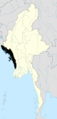
Thandwe
သံတွဲမြို့— Town — Thandwe 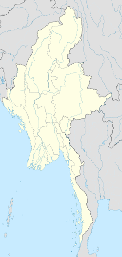
 Thandwe
Coordinates: 18°28′04.06″N 94°22′05.38″E / 18.4677944°N 94.3681611°E Country Myanmar State Rakhine Township Thandwe Town Thandwe Time zone MST (UTC6:30) Postal codes  Artist rendition of Sandoway in the late 1800s.
Thandwe (Burmese: သံတွဲမြို့; MLCTS: samtwai: mrui., pronounced [θàndwɛ́ mjo̰]; formerly Sandoway) is a town and major seaport in Rakhine State, the westernmost part of Myanmar. Thandwe is very ancient, and is said to have been at one time the capital of Rakhine State, then called Arakan. The district has an area of 3,784 square miles (9,800 km2). The country is mountainous, the Arakan Mountains sending out spurs which reach the coast. Some of the peaks in the north attain 4,000 and more ft. The streams are only mountain torrents to within a few miles of the coast; the mouth of the Khwa forms a good anchorage for vessels of from 9 to 10 ft (3.0 m). draught. The rocks in the Arakan Range and its spurs are metamorphic, and comprise clay, slates, ironstone and indurated sandstone; towards the south, ironstone, trap and rocks of basaltic character are common; veins of steatite and white fibrous quartz are also found. The rainfall in 1905 was 23-49 in. Except a few acres of tobacco, all the cultivation is rice.
Contents
Climate
Climate data for Thandwe Month Jan Feb Mar Apr May Jun Jul Aug Sep Oct Nov Dec Year Average high °C (°F) 30.5
(86.9)31.8
(89.2)33.4
(92.1)34.5
(94.1)33.6
(92.5)30.1
(86.2)29.3
(84.7)29.2
(84.6)30.7
(87.3)32.3
(90.1)32.3
(90.1)31.0
(87.8)31.56
(88.80)Average low °C (°F) 12.2
(54.0)12.9
(55.2)17.3
(63.1)22.4
(72.3)24.5
(76.1)23.8
(74.8)23.5
(74.3)23.5
(74.3)23.4
(74.1)22.8
(73.0)19.8
(67.6)14.9
(58.8)20.08
(68.15)Precipitation mm (inches) 2
(0.08)1
(0.04)1
(0.04)17
(0.67)299
(11.77)1299
(51.14)1408
(55.43)1404
(55.28)614
(24.17)206
(8.11)64
(2.52)8
(0.31)5,323
(209.57)Source: HKO Ngapali Beach
Ngapali Beach is a beach located 7 kilometres (4 mi) from the town of Thandwe (Sandoway), in Rakhine State, Myanmar. It is the most famous beach in Myanmar and is a popular tourist destination. Myanmar's political climate means that Ngapali is not as well publicized as other good beaches of Southeast Asia.
The beach stretches for 3 km (2 mi) and overlooks the Indian Ocean. The name "Ngapali", has no meaning in Burmese, but comes from the Italian "Napoli" (the city of Naples).[citation needed]
Ngapali Beach has been promoted as a major tourist destination in Myanmar. Several resorts and hotels are located in Ngapali, usually of the high end - such as Bayview Ngapali, Amata Resort, Amazing Ngapali and also the government owned Anawa. Ngapali used to have private bungalos, but these were torn down in the late 1990s to make way for the development of hotels. The hotels and small tourism industry helps to provide income for the villages around Ngapali and also Thandwe. There is also a golf course nearby.
The beach is served by Thandwe Airport. All of Myanmar's internal airlines, Myanma Airways, Air Mandalay, Yangon Airways,Air KBZ and Air Bagan have frequent flights to Thandwe from most of their destinations. Ngapali's isolation means that few people are able to afford the airfare, thus making it more popular amongst tourists as an unspoilt and private beach.
References
 This article incorporates text from a publication now in the public domain: Chisholm, Hugh, ed (1911). Encyclopædia Britannica (11th ed.). Cambridge University Press.
Ngapali Beach is a beach located 7 kilometres (4 mi) from the town of Thandwe (Sandoway), in Rakhine State, Myanmar. It is the most famous beach in Myanmar and is a popular tourist destination. Myanmar's political climate means that Ngapali is not as well publicized as other good beaches of Southeast Asia.
The beach stretches for 3 km (2 mi) and overlooks the Indian Ocean. The name "Ngapali", has no meaning in Burmese, but comes from the Italian "Napoli" (the city of Naples).[citation needed]
Ngapali Beach has been promoted as a major tourist destination in Myanmar. Several resorts and hotels are located in Ngapali, usually of the high end - such as Sandoway Resort (www.sandowayresort.com), Bayview Ngapali, Amata Resort, Amazing Ngapali and also the government owned Anawa. Ngapali used to have private bungalos, but these were torn down in the late 1990s to make way for the development of hotels. The hotels and small tourism industry helps to provide income for the villages around Ngapali and also Thandwe. There is also a golf course nearby.
The beach is served by Thandwe Airport. All of Myanmar's internal airlines, Myanma Airways, Air Mandalay, Yangon Airways , Air KBZ and Air Bagan have frequent flights to Thandwe from most of their destinations. Ngapali's isolation means that few people are able to afford the airfare, thus making it more popular amongst tourists as an unspoilt and private beach.
External links
Rakhine State Capital: SittweSittwe District 
Maungdaw District Kyaukpyu District Thandwe District Main cities and towns Categories:- Populated places in Rakhine State
- Beaches of Burma
- Visitor attractions in Burma
- Township capitals of Burma


Wikimedia Foundation. 2010.