- Locmariaquer
French commune
nomcommune=Locmariaquer
native_name=Lokmaria-Kaer
caption=General view of the harbour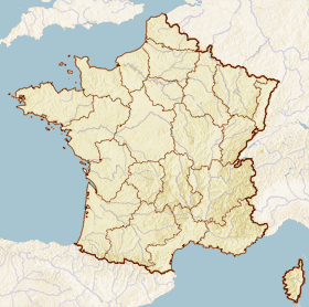
x = 41
y = 104
lat_long=coord|47|34|12|N|2|56|39|W|region:FR_type:city
région=Bretagne
département=Morbihan
arrondissement=Lorient
canton=Auray
insee=56116
cp=56740
maire=Michel Jeannot
mandat=2008 – 2014
intercomm=C.C. des Trois Rivières
alt moy=16 m
alt mini=0 m
alt maxi=19 m
hectares=1,099
km²=10.99
sans=1,367
date-sans=1999
dens=124
date-dens=1999Locmariaquer ( _br. Lokmaria-Kaer) is a village and commune of western
France , on the western shore of theGulf of Morbihan , in the "département" ofMorbihan , unit length|mi|8.5|1 south ofAuray by road.Crest
This crest was created 30 years ago by the local artist Jean-Baptiste Corlobé. The arms portray:
*upper portion of shield: a silver dolmen on a
sinople field
*central band: ermine banner, recalling that we are at the heart of Brittany.
*lower band: and a gold sailboat on blue fieldAll are surmounted by a baronial crown (Locmariaquer was part of the former barony of Kaër). It bears the
Breton language motto: "Kaër e mem bro" which can be interpreted in two ways: "Kaër is my country" or "my country is beautiful" (the phrase orginated with JM François Jacob in 1933).Geography
The municipality of Locmariaquer is located at the western tip of the
Gulf of Morbihan in Brittany and has manybeaches facing theAtlantic Ocean and the bayQuiberon .This small town is loaded with the most fascinating ancient stone structures in the world, and may be thought of as the most important oyster fishery in France. It is especially famous for its giant Balon Oysters.Towns bordering on the
Canton of Auray : Saint-Philibert andCrac'h Demographics
At the 1999
census , the village had a population of formatnum:1,367.Economy
Locmariaquer has a small
port , but is one of the most importantoyster producing areas in the world, due to its production of the finest and possibly the rarest oyster types.History of oyster farming
The ancient Romans knew of the existence of deposits of natural edible
oyster s (or flat oyster) ("Ostrea edulis", Linn.), but it was not until the late 19th century thatoyster farming started. The municipality of Locmariaquer was then regarded as the cradle of the edible oyster. The first concessions in the Auray River were issued in 1882.Three generations devoted themselves to building oyster parks on the shores of Locmariaquer: they had to remove the mud, replace it with sand, and map out the locations.
Their job was to collect the spat (oyster larvae) clime coat the tiles or stakes and to take off or ("détroquage") the growing areas and then sow the young oysters in parks for breeding for a duration of three years, during which there was a need to protect oysters against predators, algae, toxins, and storms.
After 1927, Locmariaquer specialized mainly in the reproduction and the half-rearing of the oysters, after growing them to half size they were shiped off to Marennes, Holland England and Spain. The oyster industry grew to be very prosperous: 350 to 400 people worked in the construction of sites and parks almost all year round. However, in 1973–1974, flat oysters in the Gulf of Morbihan were decimated or destroyed by parasites. They were then replaced by cultivated oysters of Japanese origin, "Crassostrea gigas").
Today, "Locmariaquérois" oyster farmers are cultivating
Pacific oyster s in the Gulf and River St Philibert. The crop and livestocks of the flat oyster are mainly in the Bay of Quiberon. Despite mechanization tests, the need of manpower is still high, both in culture itself and the pre-marketing operations (refining, sizing, etc.).In 2008, thirty oyster farms still exist around Locmariaquer. They occupy about fifty people full time, as well as seasonal workers in October to May. Sales to wholesalers, retailers or directly to consumers are handled individually by the farms. If you are very observant you may find a few vendors selling the old original Plattes oysters.
Villages and landmarks in the commune
Bellevue, Coët Courzo, Coët Er Roué, Fetanstirec, Keranlay, Kercadoret, Kerdaniel, Keréré, Kergolvan, Kerguerec, Kerhelle, Kerhern, Kerhuiltan, Keriaval, Kerigan, Kerinis, Kerivaud, Kerjean, Kerlavarec, Kerlogonan, Kerlud, Kerouarch, Kerpenhir, Kerveresse, Lann Brick, Lann Y Nis, Le Brénéguy, Le Guilvin, Le Lézard, Le Moustoir, Le Nélud, Le Palud, Le Pont Er Lenn, Le Vinglé, Les Pierres Plates, Locquidy, Mané-Lud, Pointe de Kerpenhir, Pointe Er Hourel, Pointe Erlong, Pointe Er Ville, Pont Er Vugale, Rouick, Saint-Pierre Loperet, Scarpoche and Toul Y Niss.
ights
Roman remains are to be seen, but the place owes its celebrity to the
megalith ic monuments in the vicinity, some of which are among the largest extant.Religious Heritage
;Notre Dame de KerdroOf romanesque style, this church was built between 1082 and 1120 by the monks of
Quimperlé . Today, only thetransept and thechoir of the original building remain. On the exterior one can read the inscription "Hic Domus Dei" (Here is the house of God). This section presents external walls of an archaic stonework (intercalation of Roman cubic stone, bricks and scattered bricks of Roman origin).The South Gate is protected by an advanced porch whose wooden ceiling was removed in 1988, showing a cartouche bearing the words "Haec Porta Coelli" (Here is the door of heaven). Near the southern entrance, in the wall is included a superb granite
baptismal font , decorated with leaves and grapes, going back to the 16th century.Inside, the greatest interest of the church resides in its surviving Romanesque features. The transept and
apse were included in supplementary inventory of "Monument historique " by decree of 24 April 1925.In 1960, The twelve windows were equipped with modern stained glass, created by the firm of Rault,
glass maker inRennes . The motifs of the seven windows of thenave and transept are abstract, the five windows of the choir presenting figurative
* boat and fish (fishing),
* wheat (agriculture),
* the acronym NDK (for "Notre Dame de Kerdro"),
* bunch of tiles (oyster farming),
* dolmen and menhirs (megaliths). These windows are admired by most visitors for their great sobriety and their remarkable brightness.;Chapelle du Moustoir Rebuilt in 1883, the chapel is dedicated to Saint Gildas, but also to Father Claude Philippe, a non-juring priest, who died in 1796 and was buried in this place. The chapel is located north of the town; it was fully restored in recent years by an association that continues to ensure its maintenance. Each year, on the last Sunday of June, a Pardon and a
Fest Noz are organized.;Chapelle Saint-Pierre-Loperec Built in 1772, this chapel was built to celebrate Mass and organize a Pardon for the survivors of shipwrecks, of which there were many at the time. It can be visited in summer and during the traditional annual Pardon on the first Sunday of July.
;Chapelle Saint-Michel The chapel was built in 1749 by Christophe Paul De Robien, Baron de Kaër who previously acquired the former chapel built on Gallo-Roman ruins. When the foundations of the present chapel were built, a quantity of medallions bearing the effigy of Caesar and other motifs were found.
Today, the chapel looks like a rectangular building 14 metres long and 7 meters wide. On its portal is a decoration depicting three lily flowers in relief and a stone bearing the date 1813 and a damaged patch representing the arms of Robien.
During the summer months of July and August "friends of the chapel" association has chosen to use the chapel for exhibitions of contemporary art, at the same time highlighting the work of restoration carried out in 1986.
;Statue of the Virgin "Notre-Dame de Kerdro"Built on the rocks at the edge of Kerpenhir in 1962: 2.70 m high, it was carved in granite by
Jules-Charles Le Bozec in 1946 but spent 16 years in the church before being moved to its present location. It replaces a statue erected in 1883 and destroyed by the Germans along with the fort duringWorld War II .Civil Heritage
Land of legends and mysteries, Locmariaquer is home to a remarkable concentration of megaliths. Just like nearby Carnac, the city holds unique and rare monuments dating from the Neolithic period. Here men have left a legacy of prestigious burial structures prefiguring the era of the great pyramids. The Great Menhir of Er Grah, the Table of Merchants, the mounds of Er Grah and many other monuments decorate the landscape of Locmariaquer.
Megaliths *
Broken Menhir of Er Grah , the largestmenhir in the world, at nearly 20m, is currently broken into 4 pieces.
* Cairn from la Table des Marchand
*Tumulus d'Er Grah
* LesPierres Plates (the flat stones), cubit long driveway covered nearly 25 m..
* House and mounds ofMané Retual
*Dolmen Kercadoret
* DolmenKerveresse
* DolmenMané Lud Economy
Locmariaquer has a small
port , andoyster culture is carried on close to it.See also
*
Carnac Stones
*Communes of the Morbihan department References
*
* Heritage department of the municipality of LocmariaquerNotes
One important reference is The Oysters of Locmariaquer by Eleanor Clark, who won the National Book Award for her work on the history, culture, and oyster industry in this Breton seaport. External links
* [http://www.locmariaquer.fr Official site] fr icon
* [http://www.culture.gouv.fr/public/mistral/merimee_fr?ACTION=CHERCHER&FIELD_98=INSEE&VALUE_98=56116 French Ministry of Culture list for Locmariaquer] fr icon
* [http://www.viamichelin.co.uk/viamichelin/gbr/dyn/controller/mapPerformPage?strAddress=&strCP=56740&strLocation=Locmariaquer&strCountry=1424&image2.x=28&image2.y=7 Map of Locmariaquer on Michelin] en icon

Wikimedia Foundation. 2010.