- Miramichi Airport
-
"YCH" redirects here. For the hospital in Richmond Hill, Ontario, see York Central Hospital.
Miramichi Airport IATA: YCH – ICAO: CYCH Summary Airport type Public Operator Miramichi Airport Commission Location Miramichi, New Brunswick Elevation AMSL 108 ft / 33 m Coordinates 47°00′28″N 065°26′57″W / 47.00778°N 65.44917°WCoordinates: 47°00′28″N 065°26′57″W / 47.00778°N 65.44917°W Map Location in New Brunswick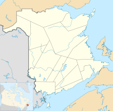
 CYCH
CYCHRunways Direction Length Surface ft m 09/27 5,899 1,798 Asphalt Statistics (2010) Aircraft movements 6,255 Source: Canada Flight Supplement[1]
Movements from Statistics Canada[2]Miramichi Airport (IATA: YCH, ICAO: CYCH) is located 1.6 NM (3.0 km; 1.8 mi) south of Miramichi, New Brunswick, Canada.
The runway is 5,899 × 159 ft (1,798 × 48 m) and is maintained year-round. It has a pavement overlay (from 1998), new approach lights and a new taxiway. The airport is the home base of the Department of Natural Resources and Energy Air Tanker Operations, and Forest Protection Limited, who own and operate the air tanker fleet. In addition, a General Electric J85 engine test facility is located at the airport.
The airport is the former site of CFB Chatham, a military air base, which closed in 1996, after military units were moved to other bases. There are several abandoned runways in the area which are still used for local glider operations.
Runways
Since the closure of the airbase, the airport only has one runway operational for aircraft and one closed runway for glider use only.
- 09/27 - formerly 27-60 with one end abandoned[3]
Closed
The three former runways were paved and marked to indicate their closure or non-use.[4]
- 04/22 – 5,200 ft (1,585 m)
- 10/28 – 7,500 ft (2,286 m) - glider only
- 15/33 – 5,513 ft (1,680 m) - closed
References
- ^ Canada Flight Supplement. Effective 0901Z 20 October 2011 to 0901Z 15 December 2011
- ^ Total aircraft movements by class of operation
- ^ http://www.militarybruce.com/history/base-history_8.html
- ^ http://www.ourairports.com/airports/CYCH/pilot-info.html
Airports in Canada By name A–B · C–D · E–G · H–K · L–M · N–Q · R–S · T–ZBy location indicator CA · CB · CC · CD · CE · CF · CG · CH · CI · CJ · CK · CL · CM · CN · CO · CP · CR · CS · CT · CV · CW · CY · CZBy province/territory National Airports System Calgary · Charlottetown · Edmonton · Fredericton · Gander · Halifax · Iqaluit · Kelowna · London · Moncton · Montréal-Mirabel · Montréal-Trudeau · Ottawa · Prince George · Québec · Regina · Saint John · St. John's · Saskatoon · Thunder Bay · Toronto · Vancouver · Victoria · Whitehorse · Winnipeg · YellowknifeRelated List of airports by ICAO code: C · List of defunct airports in Canada · List of heliports in Canada · List of international airports in Canada · National Airports System · Operation Yellow Ribbon Category ·
  Portal ·
  WikiProjectCategories:
- Airports in New Brunswick
- Buildings and structures in Miramichi, New Brunswick
- Transportation in Miramichi, New Brunswick
- Atlantic Canada airport stubs

Wikimedia Foundation. 2010.