- Corman Park No. 344, Saskatchewan
-
Rural Municipality of Corman Park No. 344 — Rural Municipality — Rural Municipality Office and Police Station Location of Corman Park in Saskatchewan
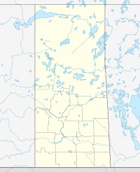

Coordinates: 52°14′N 106°40′W / 52.24°N 106.67°W Country Canada Province Saskatchewan Region Saskatchewan Incorporated 1970 Government – Reeve Mel Henry – Governing body Council of the RM Area – Total 1,978.14 km2 (763.8 sq mi) Population (2006) – Total 8,351 – Density 4.2/km2 (10.9/sq mi) Time zone CST Postal code S7K 5W1 (for RM office) Area code(s) 306 Website Official Site The Rural Municipality of Corman Park No. 344, Saskatchewan surrounds the city of Saskatoon, Saskatchewan. RM of Corman Park No. 344 started as a 3 × 3 township square RM, and expanded to a very large RM. It was formed in 1970 according to the Saskatchewan Gazette by combining the smaller rural municipalities of Cory 344, Warman 374, and Park 375. RM 374 Warman and RM 375 Park were disorganized at the end of 1969. The rural municipality must work closely with the Meewasin Valley Authority that has responsibility for the area around the Saskatchewan River.
There is a Super Dual Auroral Radar Network Radar site operated by the University of Saskatchewan in the rural municipality.
Contents
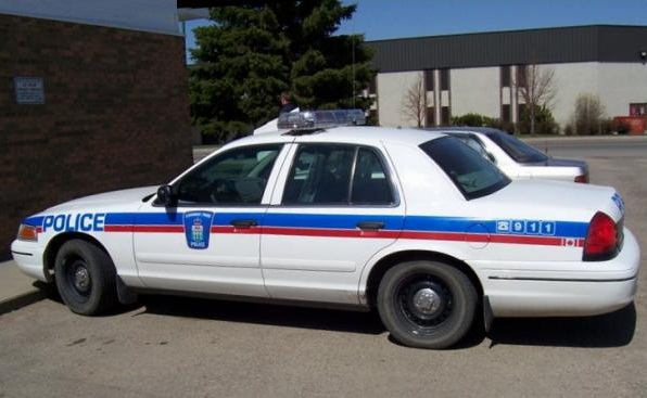
Police Service
 Corman Park Police Cruiser at the Municipal office in Saskatoon
The rural municipality operates a small police service of five officers who work in partnership with the Royal Canadian Mounted Police and contracts with the City of Saskatoon and the other municipalities to provide fire protection. Corman Park Police Service actively partners with all other law enforcement agencies in the Saskatoon and district police universe including the Saskatoon Police Service and Dalmany Police Service.
[1] The Corman Park Police Service acts in partnership with the Royal Canadian Mounted Police under the terms of Order In Council 109/2001 as amended by O.I.C. 92/2006. The Service opearates out of the Municipal office in Saskatoon.
History
Municipal historical properties
The rural municipality has two designated historical properties:
- Opimihaw (now referred to as Wanuskewin Heritage Park) is a 58 hectare property with 14 precontact archaeological sites in the in the Opimihaw Creek valley.[2]
- Bone Trail in the 1800s buffalo bones were collected on the prairie, and transported along this trail to Saskatoon for transfer onto rail cars so that they could be sent to eastern Canada where they were crushed into fertilizer.[3]
Population
As of the census in 2001, there were 8,093 people living in the RM of Corman Park. By the 2006 census, the population had increased 3.8%, to 8,351. It has by far the largest population of any rural municipality in Saskatchewan, more than double that of the next largest (Buckland No. 491 in 2001; Edenwold No. 158 in 2006). The area immediately surrounding Saskatoon is part of the Saskatoon Regional Health Authority. The South Saskatchewan River flows from the southwest corner to the northeast corner of the RM.
Canada census – Corman Park No. 344, Saskatchewan Community Profile References: 2006[5]The area's German Canadian population is much higher proportionately than the national or provincial averages: 43.4% (3,645 persons).[6]
Government of the RM
The offices for the RM are located in Lawson Heights, Saskatoon. All rural municipalities have elected councils, along with an elected head called a reeve. As of November 2011, the reeve is Mel Henry, and the councillors are:
- Division 1: Perry Ulrich
- Division 2: David Fox
- Division 3: Lynne Samson
- Division 4: John Germs
- Division 5: John Rempel
- Division 6: Bill Dyck
- Division 7: Irene Pilka
- Division 8: Joanne Janzen
- Division 9: Wendy Trask
- Division 10: Joseph Kasahoff
- Division 11: Leonard Kasahoff
A majority of voters in a November 2011 plebiscite favoured the council be changed from 11 to 8 councillors. This is controversial and the elected councillors have requested that the provincial government not take action on the plebiscite. It is unclear whether the council will continue to have 11 councillors or will change to 8.[7]
Urban communities
- Beaver Creek
- Bergheim
- Blumenheim
- Cathedral Bluffs
- Cedar Villa
- Cory
- Dalmeny
- Eagle Ridge Country Estates [8]
- Floral
- Furdale
- Grasswood
- Haultain
- Langham
- Martensville
- Merrill
- Osler
- Neuhorst
- Rheinland
- Riverside Estates
- South Corman Park
- Sutherland former town now amalgamated into Saskatoon
- Warman
Saskatchewan railways
(current or historic)
- Colonsay Branch C.P.R—serves Saskatoon, Colonsay, Forslund, Zangwill, Young, Plassey
- Minnedosa–Saskatoon–Edmonton Section C.P.R—serves Colonsay, Elstow, Blucher, Cheviot, Floral, Sutherland, Saskatoon, Cory, Dunfermline, Asquith, Rhyl, Kinley, Perdue Keppel, Vance, Biggar
- Carlton Branch, C.N.R—serves Saskatoon, Warman, Dalmeny
- Delisle Elrose Branch C.N.R—serves Saskatoon, Delisle, Birdview, Swanson, Ardath
- Regina Branch, C.N.R—serves Kenaston, Strong, Hanley, Indi, Dundurn, Strehlow, Haultain, Grasswood, Nutana, Saskatoon, Clarks Crossing, Warmsn, Osler
- Winnipeg, Edmonton, Prince Rupert Division, C.N.R—serves Winnipeg, Saskatoon, Edmonton, Jasper
See also
Footnotes
- ^ Sask Biz
- ^ Opimihaw Provincial Heritage Property
- ^ Bone Trail Municipal Heritage Property
- ^ Corrections to the 2006 Census Data
- ^ "2006 Community Profiles". Statistics Canada. Government of Canada. 2009-02-24. http://www12.statcan.ca/census-recensement/2006/dp-pd/prof/92-591/index.cfm?Lang=E. Retrieved 2009-02-24.
- ^ Ethnocultural portrait of Canada, Corman Park No. 344, Saskatchewan
- ^ French, Janet (19 November 2011). "Disregard referendum: Corman Park council asks Minister to ignore vote result". Saskatoon Star Phoenix. http://www.thestarphoenix.com/news/Disregard+referendum+Corman+Park/5729802/story.html. Retrieved 19 November 2011.
- ^ Provincial Gazette
- ^ Canadian Maps: January 1925 Waghorn's Guide. Post Offices in Man. Sask. Alta. and West Ontario.
External links
 Subdivisions of Saskatchewan
Subdivisions Communities Cities Estevan · Flin Flon (part) · Humboldt · Lloydminster (part) · Martensville · Meadow Lake · Melfort · Melville · Moose Jaw · North Battleford · Prince Albert · Regina · Saskatoon · Swift Current · Weyburn · YorktonRural municipalities Aberdeen · Abernethy · Antelope Park · Antler · Arborfield · Argyle · Arlington · Arm River · Auvergne · Baildon · Barrier Valley · Battle River · Bayne · Beaver River · Bengough · Benson · Big Arm · Biggar · Big Quill · Big River · Big Stick · Birch Hills · Bjorkdale · Blaine Lake · Blucher · Bone Creek · Bratt's Lake · Brittania · Brock · Brokenshell · Browning · Buchanan · Buckland · Buffalo · Calder · Caledonia · Cambria · Cana · Canaan · Canwood · Carmichael · Caron · Chaplin · Chester · Chesterfield · Churchbridge · Clayton · Clinworth · Coalfields · Colonsay · Connaught · Corman Park · Cote · Coteau · Coulee · Craik · Cupar · Cut Knife · Cymri · Deer Forks · Douglas · Duck Lake · Dufferin · Dundurn · Eagle Creek · Edenwold · Elcapo · Eldon · Elfros · Elmsthorpe · Emerald · Enfield · Enniskillen · Enterprise · Estevan · Excel · Excelsior · Eyebrow · Eye Hill · Fertile Belt · Fertile Valley · Fillmore · Fish Creek · Flett's Springs · Foam Lake · Fox Valley · Francis · Frenchman Butte · Frontier · Gainsborough · Garden River · Garry · Glen Bain · Glen McPherson · Glenside · Golden West · Good Lake · Grandview · Grant · Grass Lake · Grassy Creek · Gravelbourg · Grayson · Great Bend · Greenfield · Griffin · Gull Lake · Happyland · Happy Valley · Harris · Hart Butte · Hazel Dell · Hazelwood · Heart's Hill · Hillsborough · Hillsdale · Hoodoo · Hudson Bay · Humboldt · Huron · Indian Head · Insinger · Invergordon · Invermay · Ituna Bon Accord · Kellross · Kelvington · Keys · Key West · Kindersley · King George · Kingsley · Kinistino · Lacadena · Lac Pelletier · Laird · Lajord · Lake Alma · Lake Johnston · Lakeland · Lake Lenore · Lake of the Rivers · Lakeside · Lakeview · Langenburg · Last Mountain Valley · Laurier · Lawtonia · Leask · Leroy · Lipton · Livingston · Lomond · Lone Tree · Longlaketon · Loon Lake · Loreburn · Lost River · Lumsden · Manitou Lake · Mankota · Maple Bush · Maple Creek · Mariposa · Marquis · Marriott · Martin · Maryfield · Mayfield · McCraney · McKillop · McLeod · Meadow Lake · Medstead · Meeting Lake · Meota · Mervin · Milden · Milton · Miry Creek · Monet · Montmartre · Montrose · Moose Creek · Moose Jaw · Moose Mountain · Moose Range · Moosomin · Morris · Morse · Mountain View · Mount Hope · Mount Pleasant · Newcombe · Nipawin · North Battleford · North Qu'Appelle · Norton · Oakdale · Old Post · Orkney · Paddockwood · Parkdale · Paynton · Pense · Perdue · Piapot · Pinto Creek · Pittville · Pleasantdale · Pleasant Valley · Ponass Lake · Poplar Valley · Porcupine · Prairiedale · Prairie Rose · Preeceville · Prince Albert · Progress · Reciprocity · Redberry · Redburn · Reford · Reno · Riverside · Rocanville · Rodgers · Rosedale · Rosemount · Rosthern · Round Hill · Round Valley · Rudy · Runnymede · Saltcoats · Sarnia · Saskatchewan Landing · Sasman · Scott · Senlac · Shamrock · Shellbrook · Shell Lake · Sherwood · Silverwood · Sliding Hills · Snipe Lake · Souris Valley · South Qu'Appelle · Spalding · Spiritwood · Spy Hill · St. Andrews · Stanley · Star City · St. Louis · St. Peter · St. Philips · Stonehenge · Storthoaks · Surprise Valley · Sutton · Swift Current · Tecumseh · Terrell · The Gap · Three Lakes · Tisdale · Torch River · Touchwood · Tramping Lake · Tullymet · Turtle River · Usborne · Val Marie · Vanscoy · Victory · Viscount · Wallace · Walpole · Waverley · Wawken · Webb · Wellington · Weyburn · Wheatlands · Whiska Creek · White Valley · Willner · Willow Bunch · Willow Creek · Willowdale · Wilton · Winslow · Wise Creek · Wolseley · Wolverine · Wood Creek · Wood River · WrefordTopics Coordinates: 52°14′29″N 106°40′09″W / 52.24139°N 106.66917°W
Categories:


Wikimedia Foundation. 2010.