- Shillington, Bedfordshire
-
Coordinates: 51°59′06″N 0°21′36″W / 51.98488°N 0.3601°W
Shillington 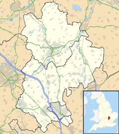
 Shillington
Shillington shown within BedfordshirePopulation 1,831 (2001) OS grid reference TL127340 Parish Shillington Unitary authority Central Bedfordshire Ceremonial county Bedfordshire Region East Country England Sovereign state United Kingdom Post town HITCHIN Postcode district SG5 Dialling code 01462 Police Bedfordshire Fire Bedfordshire and Luton Ambulance East of England EU Parliament East of England UK Parliament Mid Bedfordshire List of places: UK • England • Bedfordshire Shillington is an English village and civil parish located in the county of Bedfordshire. In the south of the parish, the hamlet of Pegsdon is almost encircled by Hertfordshire, and since 1985 the parish has included the village of Higham Gobion to the west.[1] It has a population of 1,831.[2]
The first recorded name of the village (1060) is Scytlingedune, possibly meaning 'The Hill of the Followers of Scyttle'. Scyttle being a Saxon. As local lore has it, this name gradually evolved into Shitlington but it was changed to the modern Shillington when a famous monarch visited, some sources say Queen Victoria, others Queen Elizabeth I.
Some people locally claim that 'All roads lead away from Shillington', in which there is some truth, as more efficient routes avoid the village altogether. Because of this, Shillington is still (in parts) a picturesque and rather isolated village, although it does cover a large area.
Its curious size, but small population, is because, originally, it was made up of several 'Ends', as is not uncommon in Bedfordshire. These Ends gradually grew and merged into the Shillington that exists today. Many parts of the village are still referred to by their original names, by villagers and to a lesser extent officially. The elder generation of villagers have developed a colloquial geography of the village, based on the common saying Odds and Ends. The oldest parts of the villages called Ends and the newest parts, built in the twentieth century, Odds.
A list of Ends:
- Apsley End
- Handscome End
- Upton End
- Bury End
- Hillfoot End
A list of Odds:
- Greenfields Odd
- Bryant's Odd
- Marquis Odd
- Scytles Odd
The village is home to Shillington Lower School and has several pubs; Noah's Ark, The Crown and The Musgrave Arms. The village has a history of public houses, and at one time was home to seventeen simultaneously, the Five Bells being the most memorable.
Contents
All Saints Church
Shillington's church, All Saints Church, has been referred to as the "Cathedral of the Chilterns", being situated on, one could argue, the most northerly and last of the Chiltern Hills when travelling from the south. The building was originally a Saxon monastery, which grew richer and more influential through the mining and selling of coprolite, fossilised dinosaur dung, once used as a fuel and also a fertilizer. The church also has a secret underground passageway, leading to the basement of a local and equally antiquated house. It is believed that there used to be more secret passages, possibly leading all the way out of the village, but they have never been found.
Folklore
The village also is home to a lesser known forerunner to the Cottingley Fairies, The Shillington Goblins. After the English Civil War, the Puritan Lord Protector Oliver Cromwell had banned celebration, magic, and general mirth from England, regarding it as sin. According to the legend, during this time Goblins, and other Magical Beings, descended on the village to practice their magic and celebrate as their own quiet, secretive form of resistance. They would gather in a meadow in the centre of the village at the foot of the hill on which the church sat, each equinox, and every solstice, in the depths of the night. The villagers noted their music and laughing, and strange, tiny lights, as well as peculiar goings on around Shillington. This happened one night every spring, summer, autumn and winter while the Commonwealth was in place, but when it fell and the monarchy was restored the Goblins never returned, now free to practice their magic wherever and whenever their mischievous selves felt the need. Although, they did leave their mark: After they had left, once, every year a faeryring – a henge of mushrooms – would appear in the corner of their meadow as a reminder and promise to the people of Shillington that should the monarchy ever fall again the Goblins would return to that very spot, as a protest, and continue to until there was once more a crowned King of England. Although this tale fell out of favour and almost died in the early 20th century, it is thought to be true that a mushroom henge appeared periodically in the meadow generally accepted to be the one in the story, located in the corner where New Walk and Hillfoot Road meet. But in the middle of the 20th century a house was built on the exact spot and the faeryring has never reappeared. Thus it is uncertain whether the myth of the Shillington Goblins or the faeryring they were supposed to have left behind appeared first.
Other interesting facts
Shillington was featured on Channel 4's Property Ladder TV program in 2005 when developers undertook a renovation project on a small terraced cottage in the village. The episode is referenced as "Hitchin and Wroxham" as Hitchin is the nearest town, being about 6 miles south-east of Shillington and actually lying in the neighbouring county of Hertfordshire. Shillington comes under Hitchin's postcode prefix SG5.
Shillington at War (1939 - 1945)
In 1940 a Luftwaffe Dornier 17 was attacked over Great Offley (to the south of Pegsdon), the bomber crashed killing the pilot alongside the road at Pegsdon[3].
On the 21st of February 1944 Lancaster LL729 (A4 B)[4][5] belonging to 115 Squadron RAF left its base at RAF Witchford for a raid on Stuttgart, several hours later the plane crashed killing its crew near Pegsdon whilst trying to return to its base.
-

Avro Lancaster
-

115 Sqn RAF
References
- ^ BLARS, Guide to Bedfordshire Parishes
- ^ Office for National Statistics: Census 2001: Parish Headcounts: Mid Bedfordshire Retrieved 31 October 2010
- ^ BBC People's War - Brian Limbrick’s Wartime Childhood 1938 to 1941. website accessed 20/07/10
- ^ Lost Bombers (website accessed: 22/07/10)
- ^ Alex Tooley, recollection. BBC Peoples War website accessed: 20 July 2010)
External links
- Parish Council Website
- Village Website Which includes a Parish Magazine
- Shillington Riding Club Local horse riding club
- Shillington History Society Village History Society
- Shillington Lower School Shillington Lower School Website
Categories:- Villages in Bedfordshire
- Civil parishes in Bedfordshire
- Bedfordshire folklore


Wikimedia Foundation. 2010.