- Clovelly, New South Wales
-
Clovelly
Sydney, New South Wales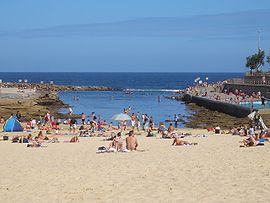
Clovelly BeachPopulation: 4,426 (2006) [1] Postcode: 2031 Location: 8 km (5 mi) south-east of Sydney CBD LGA: City of Randwick State District: Coogee Federal Division: Wentworth Suburbs around Clovelly: Queens Park Bronte Randwick Clovelly Tasman Sea Coogee Coogee Clovelly is a small beach-side suburb in Sydney's eastern suburbs, in the state of New South Wales, Australia. Clovelly is located 8 kilometres south-east of the Sydney central business district, in the local government area of the City of Randwick, within the Federal Division of Wentworth.
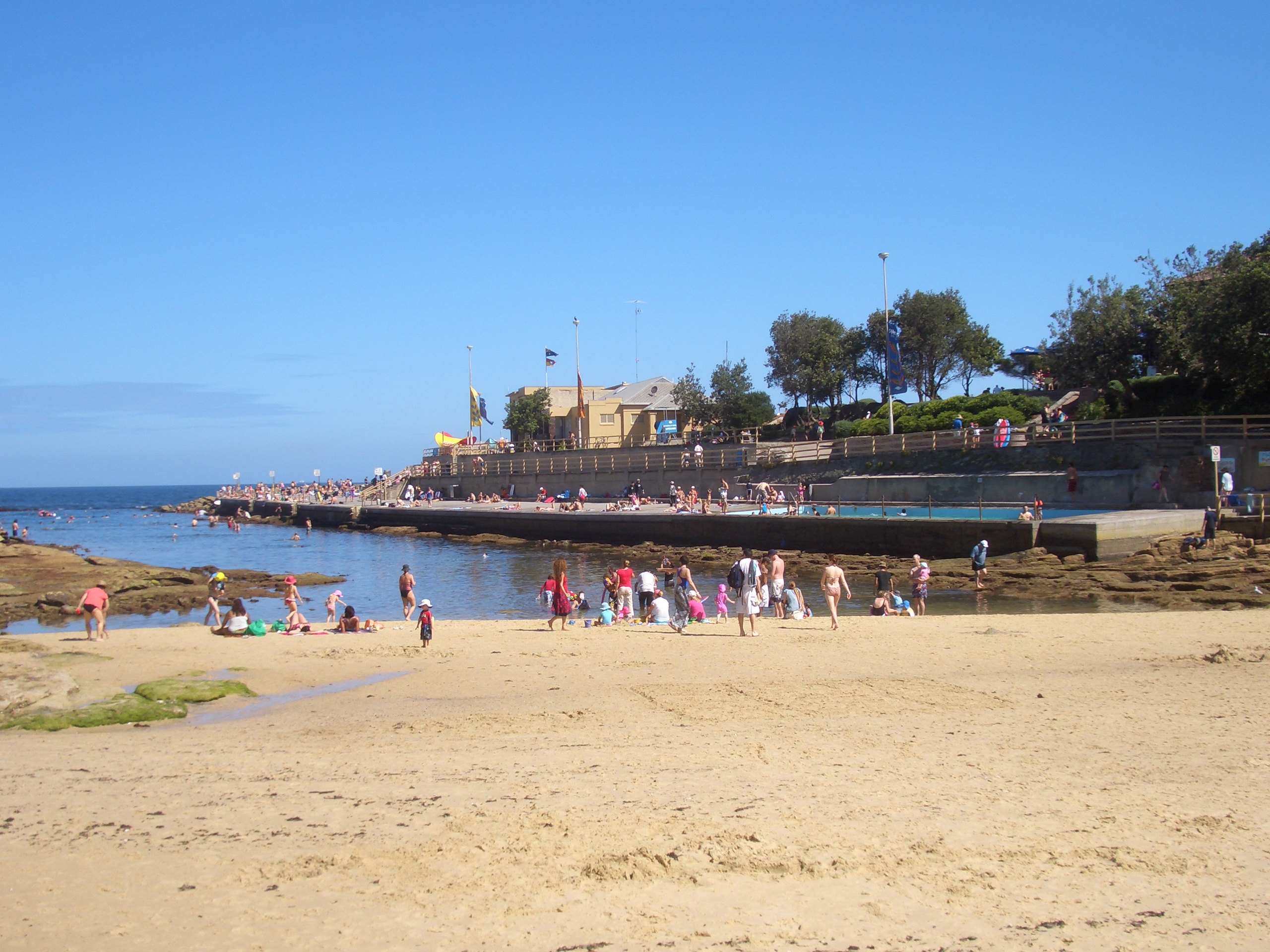
Clovelly is a mainly residential suburb on Clovelly Bay. Clovelly Beach is a small beach that sits on the end of the narrow bay. The bay is popular with swimmers. The bay is home to one of the first surf lifesaving clubs in the world, Clovelly Surf Life Saving Club, which was founded in 1906.[2] Clovelly is surrounded by the suburbs of Bronte in the north, Randwick in the west and Coogee in the south.
Contents
History
Originally known as Little Coogee, the name was changed to Clovelly in 1913. When the search for a new name began, Eastbourne, an English seaside town was suggested. The president of the local progress association suggested Clovelly, the name of a local estate owned by Sir John Robertson, which was named for the village of Clovelly on the north Devon coast, England.[3]
William C. Greville bought 20 acres (81,000 m2), which included the whole bay frontage, for 40 pounds in 1834. Early Clovelly houses were modest and built in a simple style. Some survived around Northumberland, Campbell and Boundary Streets near Waverley Cemetery and also further west. Massive subdivision began in 1909 into residential blocks, forming the basis of today's suburb.
Trams
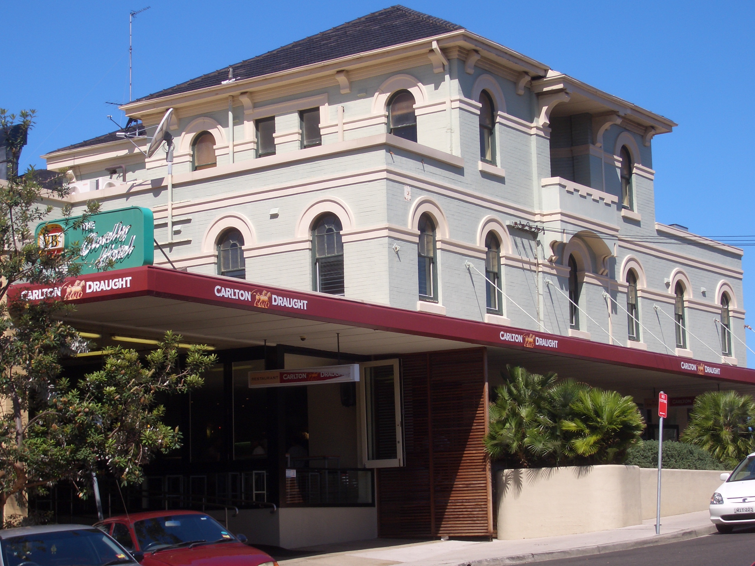
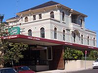 Clovelly Hotel
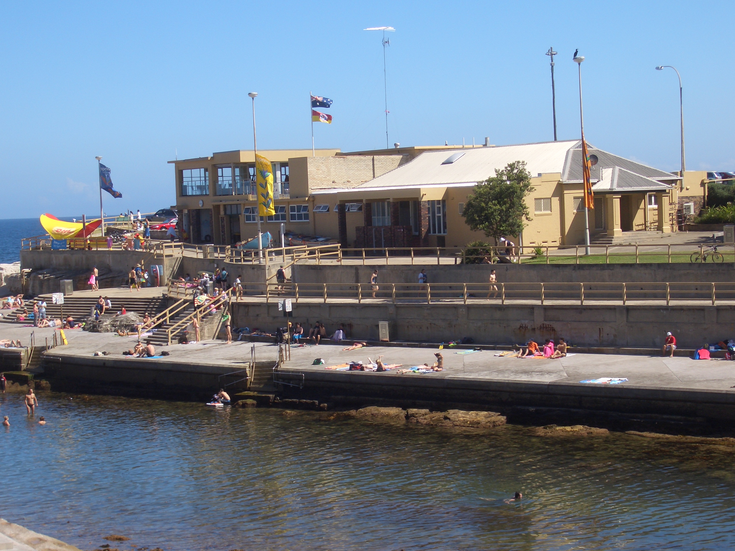
 Clovelly Surf Life Saving Club
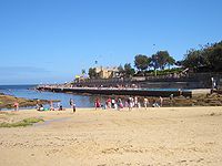 Clovelly BeachMain article: Trams in Sydney
The Clovelly tram line began at Alison Road to the intersection of Clovelly and Carrington Roads in 1912, then extending to Clovelly in 1913 helping to popularise the area. This line branched from Anzac Parade at Alison Road, and ran on its own tram reservation beside Centennial Park as far as Darley Road. Here it diverged from services to Coogee, to run north along Darley Road, then turned right into Clovelly Road to run down to its terminus at Clovelly Beach. Though services ran from Circular Quay and from Railway Square (from 1923). the line closed in 1957. [4] The tram line followed the current route of bus 339.
Commercial area
Clovelly has a small shopping precinct based around Clovelly Road, one beachside hotel, a Returned Services Club and a bowling club on leased public land with coastal views.
Schools
Sport and recreation
In summer, Clovelly Beach is a centre of community activity patrolled by council lifeguards on weekdays and Surf Club members on weekends/public holidays. In 2006 there were over 200 proficient club members rostered into 13 active patrols.[7]
In winter, the Clovelly Crocodiles field over 20 junior Rugby League sides in the Sydney Roosters junior competition. The Clovelly Eagles in 2006 fielded 18 junior Rugby Union sides in the Randwick/Easts Junior division.
Demographics
In the 2001 census Clovelly returned a population of 4,419 people.[8] It had notably less residents in the 5 to 24 age bracket and notably more residents in the 24 to 44 bracket than the broader Sydney standard deviation.
Notable residents
- Greig Pickhaver, comedian HG Nelson of Roy and HG
- Brad Fittler and Luke Ricketson former rugby league players
- John Howard (Australian actor)
- Kim Lewis, 80s soapie actress
- Steve Abbott, comedian/TV Personality (the Sandman)
- Paul Barry, author and journalist
- David Gallop, CEO of the National Rugby League [9]
- Tony Squires, National TV and Sydney radio personality.
- Jonathan Holmes ABC journalist, producer and Media Watch presenter.
- Clare Dennis,(1916-1971) gold medallist in the 200m breaststroke at the 1932 Summer Olympics grew up in the suburb
- The late Peter Ruehl, (1947 - 2011) Australian Financial Review columnist
References
- ^ Australian Bureau of Statistics (25 October 2007). "Clovelly (State Suburb)". 2006 Census QuickStats. http://www.censusdata.abs.gov.au/ABSNavigation/prenav/LocationSearch?collection=Census&period=2006&areacode=SSC11237&producttype=QuickStats&breadcrumb=PL&action=401. Retrieved 2009-03-03.
- ^ Clovelly Surf Life Saving Club > Home
- ^ The Book of Sydney Suburbs, Compiled by Frances Pollon, Angus & Robertson Publishers, 1990, Published in Australia ISBN 0-207-14495-8, page 64
- ^ Pictorial History of Randwick, Lawrence J, Kingsclear Books, Alexandria, 2001, pp.36-39
- ^ http://clovellybythesea.com.au/index.html
- ^ St Anthony's, Clovelly
- ^ http://www.clovellysurfclub.com.au/ Clovelly Surf Club
- ^ (Aust Census 2001, Basic Community Profile B03 Age by Sex)
- ^ A man on top of his game - League - Sport - smh.com.au
- Guide to Sydney Beaches
- "Sand in our Souls - the Beach in Australian History" Leone Huntsman, MUP, 2001
External links
- Clovelly, New South Wales is at coordinates 33°54′44″S 151°15′47″E / 33.91210°S 151.26292°ECoordinates: 33°54′44″S 151°15′47″E / 33.91210°S 151.26292°E
- Clovelly Beach
Suburbs and localities within the City of Randwick · Eastern Suburbs · Sydney Centennial Park · Chifley · Clovelly · Coogee · Hillsdale · Kensington · Kingsford · La Perouse · Little Bay · Malabar · Maroubra · Maroubra Junction · Matraville · Phillip Bay · Port Botany · Randwick · South Coogee
List of Sydney suburbs Categories:- Suburbs of Sydney
- Beaches of New South Wales

Wikimedia Foundation. 2010.