- Bahawalpur District
Infobox Pakistan district
district = Bahawalpur District
area = 24830
population = 2433091
pop_year = 1998
density =
caption = Location of Bahawalpur District (highlighted in red) within Punjab.
region = Punjab
established =
nazim = Tariq Bashir Cheema
naib_nazim = Syed Irfan Ahmad Gardazi [ [http://www.nrb.gov.pk/lg_election/results.asp?state=1 Zila Nazims & Naib Zila Nazims in the Province of Punjab] ]
seats =
tehsils = 5
languages =Saraiki , Punjabi andUrdu
website = www.bahawalpur.gov.pk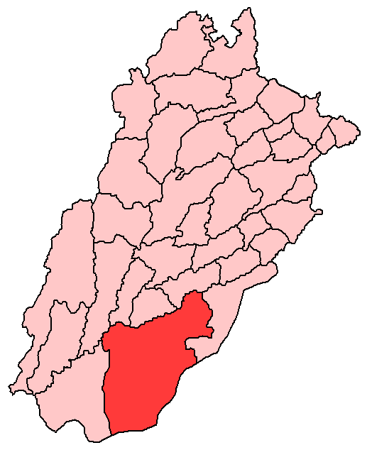
Bahawalpur District (
Urdu : بہاول پور) is one of the districts of Punjab,Pakistan . According to the 1998 Census of Pakistan it had a population of 2,433,091 of which 27.01% were urban [ [http://www.urckarachi.org/Population%20Table-5.htm Urban Resource Centre] ] Bahawalpur district covers 24,830 km². Approximately two-thirds of the district (16,000 km²) is covered by theCholistan Desert , which extends into theThar Desert ofIndia . The district is a major producer of cotton.History
The district capital
Bahawalpur , which lies just south of the Sutlej River, was founded in 1748 by Muhammad Bahawal Khan and was incorporated as a municipality in 1874. Bahawalpur became a vassal of the great Sikh empire built by MaharajahRanjit Singh . In 1836 Bahawalpur stopped paying tribute and openly declared independence. In the Anglo Sikh wars Bahawalpur supported the British and this guaranteed its survival. The founder of the State of Bahawalpur was Nawab Bahawal Khan Abbasi I. The Abbasi family ruled over the State for more than 200 years (1748 to 1954). During the rule of the last Nawab Sir Sadiq Muhammad Khan Abbasi V, Bahawalpur State was merged with Pakistan. During the 1960's (1954) the Nawab agreed (Agreement Dated 3rd October, 1947) for Bahawalpur to be absorbed into modern Pakistan. He was however given special privileges including the right to import several cars duty free each year. Bahawalpur was formerly the capital of the state and now is the District and Divisional Headquarters of Bahawalpur Division.The Nawabs of Bahawalpur originally came from Sindh; they formed a princely state and assumed independence in 1802.Administration
The district is administratively divided into five
tehsil s and 107 Union Councils: [ [http://www.nrb.gov.pk/lg_election/union.asp?district=3&dn=Bahawalpur Tehsils & Unions in the District of Bahawalpur - Government of Pakistan] ]Language
Saraiki and Punjabi is the local language of the area.Urdu and English are also spoken and understood by most of the people.Location
Bahawalpur is located in the southeast of Punjab province, the capital, Bahawalpur city, is 889km from Karachi. The region surrounding Bahawalpur to the west, called the Sindh, is a fertile alluvial tract in the Sutlej River valley that is irrigated by floodwaters, planted with groves of date palms, and thickly populated. The chief crops are wheat, gram, cotton, sugarcane, and dates. Sheep and cattle are raised for export of wool and hides. East of Bahawalpur is the Pat, or Bar, a tract of land considerably higher than the adjoining valley. It is chiefly desert irrigated by the Sutlej inundation canals and yields crops of wheat, cotton, and sugarcane. Farther east, the Rohi, or Cholistan, is a barren desert tract, bounded on the north and west by the Hakra depression with mound ruins of old settlements along its high banks; it is still inhabited by nomads. The principal inhabitants of the region surrounding Bahawalpur are Jat and Baluchi peoples. There are many historical sites in the area, including Uch, southwest of Bahawalpur, an ancient town dating from Indo-Scythian (Yüeh-chih) settlement (c. 128 BC to AD 450). Pop. (1981) City, 180,263; (1981 prelim.) metropolitan area, 695,000.
Bahawalpur is also an important agricultural training and educational center. Soapmaking and cotton ginning are important enterprises; cotton, silk, embroidery, carpets, and extraordinarily delicate pottery are produced. Factories producing cottonseed oil and cottonseed cake were built in the 1970s. It is an important marketing centre for the surrounding areas and is located on the crossroads between Peshawar, Lahore, Quetta and Karachi. Bahawalpur is also known for its distinctly embroidered slippers and shoes and the filigree pottery which is made here.
The City is located favourably for commerce, lying at the junction of trade routes from the east, south-east, and south. It is a centre for trade in wheat, cotton, millet, and rice grown in the surrounding region. Dates and mangoes are also grown here. Canals supply water for irrigation. The principal industries are cotton ginning, rice and flour milling, and the handweaving of textiles.
The Biges and Oldes Ghala Mandi are located in the Yazman Mandi tehsil.
References
Wikimedia Foundation. 2010.