- Devil's Dyke, Hertfordshire
-
Devil's Dyke is the remains of a defensive ditch around an ancient settlement of the Catuvellauni tribe of Ancient Britain. It lies at the east side of the current village of Wheathampstead, Hertfordshire, England. It has possible associations with Julius Caesar's second invasion of Britain (54 BC).
Contents
History
The area was excavated by Sir Mortimer Wheeler in 1932, and according to a plaque at one entrance to the dyke, presented by Lord Brocket in 1937 on the occasion of the coronation of King George VI.
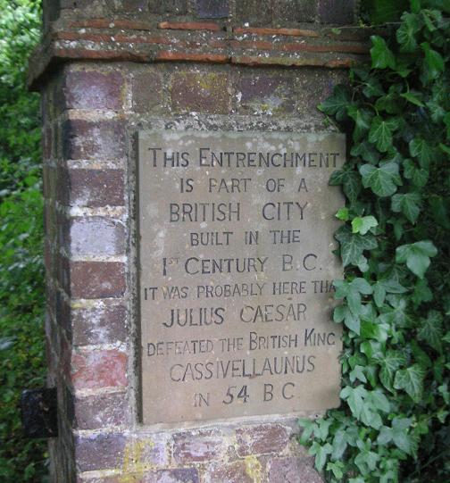
The site is said to be where Julius Caesar defeated Cassivellaunus in 54 BC. Although the historical evidence neither supports nor disproves this, the sign at the entrance to the Dyke states this (based on the assertions of Sir Mortimer), which has led to the claim often being repeated as an established fact.
It is believed to have been originally settled by Belgae invaders, and nearby archaeological finds of Belgic and pre-Belgic pottery, in excavations during the 1970s, appear to confirm this.
Description
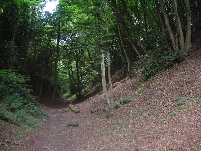
Today two sections of the ditch remain. The western section, adjacent to the village, is named Devil's Dyke. It is around 30 m wide and 12 m deep at its largest. A smaller ditch to the east is known as "The Slad". A moat continues the line of the ditch to the south of The Slad.
Some archaeologists[who?] believe that the ditch was connected with other local earthworks, particularly The Slad and Beech Bottom Dyke, located a kilometer away to the south east, to create a large enclosed settlement, using a single defensive earthwork running from the River Lea to the River Ver, which, if correct, would mean that it was one of the largest Iron Age settlements in Britain. The fortifications were probably erected by King Cunobelinus to define areas of land around their tribal centre at Verlamion – the predecessor of the later Roman city of Verulamium.
The site is marked as a "Belgic Oppidum" on Ordnance Survey maps.
Images
-

Part of the Devil's Dyke, Hertfordshire
-

Another part of the Devil's Dyke
-

Sign at the entrance to the Dyke
References
- grid reference TL183134
- Hertfordshire.com: Devil's Dyke
- mysteriousbritain - The Mysterious Sites of Hertfordshire
- The Modern Antiquarian: Devil's Dyke and the Slad
- Plaque at the entrance
- Second plaque at the entrance
- Wheathampstead History
- Devil's Dyke project
External links
- Beech Bottom Dyke and Devil's Dyke at The Celtic Planet website
Categories:- History of Hertfordshire
- Iron Age sites in England
- Scheduled Ancient Monuments in Hertfordshire
- Archaeological sites in Hertfordshire
- Former populated places in England
- Ancient dykes
-

Wikimedia Foundation. 2010.