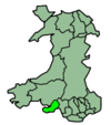
- Mynyddbach (electoral ward)
-
Mynydd-Bach Ward 
Ordnance Survey OS grid reference: Maps for SS6598 Geography Principal locality Mynydd-Bach Total population 8,756 (2001 census) Land area (km²) 3.57 (2001 census) Administration Local council: City and County of Swansea Number of councillors: 3 Nation: Wales Post office and telephone Postcode(s): SA6 Dialling code: +44-1792 Politics Welsh Assembly: Swansea East UK Parliament: Swansea East European Parliament: Wales Mynyddbach (Welsh: Mynydd-bach) is the name of an electoral ward, a community and a suburb in the City and County of Swansea, Wales. It does not have its own community council.
Mynydd-Bach is bounded by the wards of Morriston and Landore to the east, Cwmbwrla to the south, and Llangyfelach and Penderry to the west.
The electoral ward consists of some or all of the following areas: Clase, Clasemont, Mynydd-Bach, Park View Estate, Penfillia Estate, Treboeth, Tirdeunaw, Pinewood, Mynydd Garnlywd and Bryn Rock, in the parliamentary constituency of Swansea East.
For electoral purposes, Mynydd-Bach is broken down in to the polling districts of: Mynydd Garnlwyd, Bryn Rock, Treboeth, Penfilia, Tirdeunaw, Clasemont and Clase. Mynydd-Bach returns 3 councillors to the City and County of Swansea council.
2008 local council elections
Voter turnout for Mynydd-Bach in the 2008 local council elections was 36.49%. The results of the election were:
Candidate Party Votes Status Ceinwen Thomas Labour 1077 Labour hold Byron George Owen Labour 930 Labour gain Audrey Clement Independent 911 Independent hold Austin Raymond Welsby Independent 861 Charles Glyndwr White Labour 855 John Evans Independent 626 Oswyn Clement Independent 589 Karan Cheryl Sivertsen Conservative 362 Glyndwr Jones Conservative 281 Martha Jones Conservative 258 Categories:- Swansea electoral wards
- Communities of Swansea
Wikimedia Foundation. 2010.

