- Northwood, New South Wales
-
Northwood
Sydney, New South Wales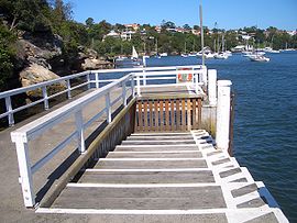
Northwood WharfPopulation: 905 (2006 census) Postcode: 2066 Location: 8 km (5 mi) north-west of Sydney CBD LGA: Municipality of Lane Cove State District: Lane Cove Federal Division: North Sydney Suburbs around Northwood: Lane Cove Osborne Park Gore Hill Longueville Northwood Greenwich Longueville Woolwich Greenwich Northwood is a suburb on the lower North Shore of Sydney, in the state of New South Wales, Australia. Northwood is located 8 kilometres north-west of the Sydney central business district, in the local government area of the Municipality of Lane Cove. Northwood sits on the northern side of the Lane Cove River between Woodford Bay and Gore Creek.
Contents
History
Northwood is named after Northwood House, designed by Edmund Blacket (1817-1883) and built by Mrs Jane Davey in 1878. The name was chosen because it is descriptive of its location, a woodland area in the north. Mrs Davey also built a ferry at her own expense, so that her family could travel to the city by ferry. [1]
Transport
The nearest railway station is St. Leonards and buses run frequently through the area. Northwood ferry wharf provides access to the Inner Harbour ferry services, which is popular for workers who commute to the CBD by ferry to Circular Quay.
Houses
Property consists entirely of free standing houses. The 2005 Sydney Morning Herald Homes guide found Northwood to be the 19th most expensive suburb in Sydney.
Population
Demographics
In the 2006 Australian Bureau of Statistics Census of Population and Housing, the population of Northwood stood at 905 people, 52.3% females and 47.7% males, with a median age of 42 years. 21% of the population was born overseas with England (5.4%), New Zealand (2.5%) and Scotland (1.3%) the most common. The five strongest religious affiliations in the area were in descending order: Catholic (30.9%), Anglican (30.3%), no religion (17%), Uniting Church (4.2%) and Buddhism (1.9%).[2]
Northwood's population is typically wealthy, with a median weekly household income of $2,831, compared with $1,027 in Australia. The most common types of occupation for employed persons were Professionals (41.6%), Managers (21.7%), and Clerical and Administrative Workers (15.2%). 81.5% of the suburbs occupied private dwellings were family households, 12.2% were lone person households and 1% were group households.[2]
Notable residents
Northwood was the home of landscape artist Lloyd Rees for many years before his death in 1988.[3] Many of his later paintings are of the area.
References
- ^ The Book of Sydney Suburbs, Compiled by Frances Pollen, Angus & Robertson Publishers, 1990, Published in Australia ISBN 0-207-14495-8
- ^ a b Australian Bureau of Statistics (25 October 2007). "Northwood (State Suburb)". 2006 Census QuickStats. http://www.censusdata.abs.gov.au/ABSNavigation/prenav/LocationSearch?collection=Census&period=2006&areacode=SSC11753&producttype=QuickStats&breadcrumb=PL&action=401. Retrieved 2007-12-20.
- ^ Commonwealth of Australia, It's an Honour: AC, 1987. Retrieved 24 March 2010.
External links
- Northwood, New South Wales is at coordinates 33°49′41″S 151°10′34″E / 33.82813°S 151.17619°ECoordinates: 33°49′41″S 151°10′34″E / 33.82813°S 151.17619°E
Suburbs and localities of the Municipality of Lane Cove · Lower North Shore · Sydney Suburbs Greenwich · Lane Cove · Lane Cove North · Lane Cove West · Linley Point · Longueville · Northwood · Riverview · St LeonardsLocalities List of Sydney suburbs Categories:- Suburbs of Sydney
- Sydney geography stubs

Wikimedia Foundation. 2010.