- Dartmouth, Nova Scotia
-
Dartmouth — Metropolitan Area — Dartmouth waterfront, showing pier, ferry and boats
Nickname(s): City of Lakes Location of Dartmouth, Nova Scotia Location of Dartmouth, Nova Scotia
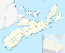
 Dartmouth
Coordinates: 44°40′0″N 63°34′0″W / 44.666667°N 63.566667°W Country  Canada
Province  Nova Scotia
Municipality Halifax Regional Municipality Neighbourhoods Albro Lake, Bell Ayr Park, Brightwood, Burnside, Commodore Park, Crichton Park, Crystal Heights, Downtown Dartmouth, Ellenvale, Grahams Corner, Greenough Settlement, Harbourview, Highfield Park, Imperoyal, Manor Park, Nantucket, Port Wallace, Portland Estates, Portland Hills, Shannon Park, Southdale, Tam O'Shanter Ridge, Tuft's Cove, Wallace Heights, Woodlawn, Woodside Founded 1750 Incorporated City January 1, 1961 Dissolved April 1, 1996 Government – Governing Body Halifax Regional Council – Community Council Harbour East Community Council Area – Total 58.57 km2 (22.6 sq mi) Elevation 0 - 113 m (-371 ft) Population (2001)[1] – Total 65,741 – Density 1,122.4/km2 (2,907/sq mi) Time zone AST (UTC-4) – Summer (DST) ADT (UTC-3) Postal code span B2V to B2Z, B3A-B Area code(s) 902 Telephone Exchanges 433-5 ,460-6, 468-9, 481 GNBC Code CAIYJ NTS Map 011D12 Part of a series about
Places in Nova Scotia Ferry running between Halifax and Dartmouth, docked at Dartmouth Ferry Terminal.
Dartmouth (2001 pop.: 65,741[1]) founded in 1750, is a community and planning area of the Halifax Regional Municipality, Nova Scotia. Located on the eastern shore of Halifax Harbour, Dartmouth has been nicknamed the City of Lakes after the large number of lakes located in the city.
On April 1, 1996, the provincial government amalgamated all the municipalities within the boundaries of Halifax County into a single-tier regional government named Halifax Regional Municipality (HRM). While Dartmouth and its neighbouring city of Halifax, the town of Bedford and the Municipality of the County of Halifax were dissolved at this time, the former city forms part of the urban core of the larger regional municipality and is officially labelled the "capital district" by the HRM government. At the time that the City of Dartmouth was dissolved, the provincial government altered its status to a separate community to Halifax however its status as part of the metropolitan "Halifax" urban core existed prior to municipal reorganisation in 1996. Dartmouth is still the geographic name that is used by all levels of government for mapping, 9-1-1, planning, and is recognised by the Halifax Regional Municipality as a place-name for civic addressing. The official place name did not change due to the confusion with similar street names and planning set out by the "City of Dartmouth" and public pressure. Today the same development planning for Downtown Dartmouth and the rest of the community is still in force as well as specific bylaws created prior to April 1, 1996.
Contents
History
Main article: History of Dartmouth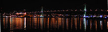 Angus A MacDonald Bridge (the 'old Bridge') Halifax, Nova Scotia.
Father Le Loutre's War began when Edward Cornwallis arrived to establish Halifax with 13 transports on June 21, 1749.[2] By unilaterally establishing Halifax, the British were violating earlier treaties with the Mi'kmaq (1726), which were signed after Dummer's War.[3] The British quickly began to build other settlements. To guard against Mi'kmaq, Acadian and French attacks on the new Protestant settlements, British fortifications were erected in Halifax (1749), Dartmouth (1750), Bedford (Fort Sackville) (1751), Lunenburg (1753) and Lawrencetown (1754).
In 1750, the sailing ship Alderney arrived with 151 immigrants. Municipal officials at Halifax decided that these new arrivals should be settled on the eastern side of Halifax Harbour. During the early years, there were 8 Acadian and Mi'kmaq raids on the new British settlement, such as the Raid on Dartmouth (1751).
The original settlement was made in an area known to the Mi'kmaq as "Boonamoogwaddy" or "Tomcod Ground". The community was later given the English name of Dartmouth in honour of William Legge, 1st Earl of Dartmouth who was a former Secretary of State. By 1752, 53 families consisting of 193 people lived in the community.
In 1873, Dartmouth was incorporated as a town and a Town Hall was established in 1877. In 1955, the town was permanently linked to Halifax by the Angus L. Macdonald Bridge which led to rapid suburban growth. The Town of Dartmouth amalgamated with several neighbouring villages into the City of Dartmouth in 1961. The A. Murray MacKay Bridge opened in 1970, furthering commercial and residential growth.
The city was dissolved on April 1, 1996, when its government was amalgamated into the Halifax Regional Municipality.
Municipal government
 Alderney Landing, Dartmouth, Nova Scotia.
Dartmouth is represented municipally in Halifax Regional Council by the following districts:
- District 5 - Dartmouth Centre
- District 6 - East Dartmouth - The Lakes
- District 7 - Portland - Woodlawn
- District 8 - Woodside - Eastern Passage
- District 9 - Albro Lake - Harbourview
The HRM community council for Dartmouth is the Harbour East Community Council and community council meetings are held in the council chamber of the Halifax Regional School Board building (formerly the Dartmouth City Hall) on the first Thursday of every month.
Residents of Dartmouth are known as Dartmouthians. As a community, Dartmouth has often tended to distinguish itself from the community and former city of Halifax, even under the present municipal amalgamation. Dartmouth is also the Halifax Regional Municipality's Public Works Eastern Region.
Economy
The city was not only a bedroom community for Halifax but also had commerce and industries of its own, including the Volvo Halifax Assembly plant and a molasses plant dating back to the days of the "triangular trade" with the West Indies.
Transportation and communications
Transportation
Dartmouth is linked to Halifax by the oldest continuously operating salt water ferry service in North America with the first crossing having taken place in 1752. Early ferries were powered by horses, which were replaced with steam engines in 1830. During the early 20th century, ferries shuttled pedestrians and vehicles between the downtown areas of Halifax and Dartmouth. A railway trestle was built across Halifax Harbour in the late 19th century to bring rail service to Dartmouth however it was destroyed by a storm, requiring the present railway connection built around Bedford Basin.
During the early 1950s, construction began on the Angus L. Macdonald Bridge, a suspension bridge crossing Halifax Harbour. It opened in 1955, ushering in an unprecedented development boom in Dartmouth. New subdivisions, shopping centres, office buildings and industrial parks have been built in recent decades. A second bridge, the A. Murray MacKay Bridge was opened in 1970 and the Highway 111 Circumferential Highway was built around Dartmouth to Woodside at this time.
Communications
 Halifax skyline from Dartmouth, NS.
- The first three digits of the postal codes are B2V, B2W, B2X, B2Y, B3A, B3B
- The telephone exchanges are 902: 462, 463, 433, 434, 435, 461, 464, 465, 466, 468, 469 - Aliant; 404, 407, 431, 444, 446, 478, 497, 225, 229 - Eastlink; 401, 402, 405, 406, 412, 441, 449 - Rogers Wireless; 209, 802, 830, 877 - Telus
Natal Day
- Dartmouthians have celebrated a civic holiday known as "Natal Day" since August 1895. The concept originated as a means to celebrate the arrival of the railway, but construction of the railway tracks was incomplete on the appointed day. Since all the preparations for the festivities were ready, organisers decided to go ahead with a celebration of the municipality's birthday instead.
- In 1941, the Dartmouth Natal Committee decided to erect a cairn in honour of the spirit and courage of the first settlers to Dartmouth's shore. It is situated in Leighton Dillman Park, part of the common lands left to the community by the Quakers, and it overlooks the harbour where the first settlers built their homes. The monument stands three meters high and is constructed from rocks gathered on Martinique Beach. A plaque in front of the cairn is inscribed and describes the arrival of the Alderney "on August 12, 1750 with 353 settlers."
Geography
 Display on Dartmouth waterfront, Dartmouth, Nova Scotia.
 Map of Burnside Park.
Neighbourhoods of Dartmouth include:
- Albro Lake
- Bel Ayr Park
- Brightwood
- Burnside
- Commodore Park
- Cranberry
- Crichton Park
- Crystal Heights
- Dartmouth Crossing
- Downtown Dartmouth
- Ellenvale
- Grahams Corner
- Greenough Settlement
- Harbourview
- Highfield Park
- Imperoyal
- Manor Park
- Montebello
- Nantucket
- Notting Park
- Port Wallace
- Portland Estates
- Portland Hills
- Russell Lake West
- Shannon Park
- Southdale
- Sunnyvale Trailer Park
- Tam O'Shanter Ridge
- Tuft's Cove
- Wallace Heights
- Westphal
- Wildwood Lake
- Woodlawn
- Woodside
The oldest structure in Dartmouth is the house of William Ray, one of the whalers. It is located at 59 Ochterloney Street and is believed to have been built around 1785 or 1786. Today it is a museum, furnished as a typical modest dwelling of a merchant of that time.
Dartmouth's first city hall was built in the early 1960s on land with the Dartmouth Common. On May 4, 2007, a Halifax Regional Municipality news releases stated that the building was to be demolished. The land has since been restored to parkland. [1]
Military
Dartmouth has been home to several Canadian Forces installations:
- CFB Shearwater, located on the southern border of Dartmouth is an air force base, formerly known as Naval Air Station Halifax, RCAF Station Dartmouth, RCAF Station Shearwater, HMCS Shearwater, and RCNAS Shearwater.
- HMC Naval Radio Station Albro Lake, a radio transmitter/receiver facility.
- CFB Halifax adjunct, an area on the Dartmouth waterfront opposite HMC Dockyard.
- Wallace Heights, a former military housing area in north-end Dartmouth
- Shannon Park, unused military housing area in north-end Dartmouth.
- Canadian Forces Ammunition Depot Bedford, a munitions magazine for Maritime Forces Atlantic, located on the border between Dartmouth and Bedford.
Famous Dartmouthians
- 1930s Hollywood starlet Ruby Keeler was born in Dartmouth.
- Acclaimed playwright Wendy Lill represented Dartmouth as a two-term New Democratic Party Member of Parliament in the House of Commons in Ottawa.
- Matt Mays, a Canadian singer, is from Cole Harbour and wrote the song "City of Lakes" as a tribute to Dartmouth.
- Joel Plaskett, a Canadian indie rock musician, lives in Dartmouth. Has a recording studio located in Dartmouth.
- National Hockey League (NHL) referee Don Koharski is a Dartmouth native.
- Former NHL bruiser Hilliard Graves (California Golden Seals) hails from Dartmouth.
- Former Major League Baseball pitcher Vince Horsman (Oakland A's) is from Dartmouth.
- NHL goaltender Olaf Kolzig (Washington Capitals) played his midget league minor hockey in Dartmouth.
- Cutting Crew guitarist Kevin Macmichael attended Dartmouth High School and called Dartmouth home
- Robb Wells and several other Trailer Park Boys performers.
- Jason Eisener director of Hobo With A Shotgun was born in Dartmouth
- Andrew Russell Olympic sprint canoeist
Symbols
 The City of Dartmouth Seal, located on a police badge.
 Flag of the former City of Dartmouth
- Dartmouth is nicknamed "The City of Lakes". Boasting 23 lakes within its boundaries, Dartmouthians take special pride in the chain of lakes within its boundaries that form part of the Shubenacadie Canal. Most famous amongst these is Lake Banook, which provides an excellent location for recreation as well as attractive vistas. Dartmouth's most historic body of water is the artificial Sullivan's Pond, located north-east of the downtown area on Ochterloney Street. It was dug in the 1830s as part of the Shubenacadie Canal to connect Halifax Harbour with Cobequid Bay on the Bay of Fundy.
- Dartmouth was Halifax's sister city. Halifax's city flower is the broad-chested rose. Dartmouth's city flower is the orchid.
Culture
- The television show Trailer Park Boys is set in a fictional Dartmouth trailer park and filmed in Dartmouth and its environs. The show features actors (such as Robb Wells) and writers from Dartmouth. A documentary film about the creation and production of the Trailer Park Boys series is entitled Hearts of Dartmouth.
- The community hosted to the ICF Canoe Sprint World Championships in 1997 and 2009..
References
- ^ a b "2001 Community Profiles". Statistics Canada. http://www12.statcan.ca/english/profil01/CP01/Details/Page.cfm?Lang=E&Geo1=CSD&Code1=1209022&Geo2=PR&Code2=12&Data=Count&SearchText=Dartmouth&SearchType=Begins&SearchPR=01&B1=All&GeoLevel=&GeoCode=1209022. Retrieved 2010-12-13.
- ^ Grenier, John. The Far Reaches of Empire. War in Nova Scotia, 1710-1760. Norman: U of Oklahoma P, 2008; Thomas Beamish Akins. History of Halifax, Brookhouse Press. 1895. (2002 edition). p 7
- ^ Wicken, p. 181; Griffith, p. 390; Also see http://www.northeastarch.com/vieux_logis.html
External links
Coordinates: 44°40′52″N 63°31′48″W / 44.6812°N 63.53°W
- Halifax Regional Municipality (HRM)
- Former Dartmouth City Flag
- The Miracle of Woodside 4 June 1965
- Forest Hills Fellowship Baptist Church of Dartmouth, Nova Scotia
Halifax Regional Municipality Government Services and agencies Articles of interest History • Metropolitan Halifax • Geography • Halifax Harbour • Education • Economy • Culture • Sports • Media • Transportation • Buildings and infrastructure • Communities • Halifax Explosion • Capital District • Port Authority • School Board • Halifax Harbour SolutionsCommunity areas Bedford • Chebucto Peninsula • Cole Harbour & Westphal • Cow Bay & Eastern Passage • Dartmouth • Eastern Shore East • Eastern Shore West • Mainland Halifax • Halifax Peninsula • Hammonds Plains, Upper Sackville & Beaver Bank • Lake Echo & Porters Lake • Lawrencetown • Musquodoboit Valley & Dutch Settlement • Preston & Cherrybrook • Prospect • St. Margaret's Bay • Timberlea, Lakeside, BeechvilleCategories:- Former cities in Canada
- Populated places established in 1750
- Populated places disestablished in 1996
- Communities in the Halifax Regional Municipality
- General Service Areas in Nova Scotia


Wikimedia Foundation. 2010.